The Cherokee Path Photos


More like The Cherokee Path
Recommended Reviews - The Cherokee Path
Start your review...

The somewhat aged marker is located near an intersection but the road is quiet enough here to be able to stop without getting in the way of other drivers. Do look out for poison ivy in the undergrowth if you're planning to get a good photo of the marker. The front reads, "The main trading path to the Cherokee Nation paralleled the route of Highway 11 for several miles at this point. This section of the path was used by travelers going from Keowee, the main Lower Town of the Cherokees, across the mountains to the Middle and Overhill Towns. The botanist William Bartram left a written account of his journey in 1776." And on the reverse, "In addition to its importance in the indian trade, the path played a military role in the Cherokee War and the Revolution. It linked Fort Prince George (1753) on the Keowee River with Fort Loundon (1756) on the Little Tennessee. Expeditions against the Cherokees were led by Archibald Montgomery in 1760, James Grant in 1761, and Andrew Williamson in 1776." It is marker number 37-3 and it was erected in 1973 by the South Carolina Society, Daughters of the American Colonists. [Review 1242 of 2025 - 1299 in South Carolina - 24794 overall] read more


More info about The Cherokee Path


The Cherokee Path - landmarks - Updated June 2026
Best of Salem
People found The Cherokee Path by searching for…
Things to Do in Salem, South Carolina
Scenic Overlook in Salem, South Carolina
Photo Spots in Salem, South Carolina
Hiking Trails in Salem, South Carolina
Scenic Views in Salem, South Carolina
Excursions in Salem, South Carolina
Historical Sites in Salem, South Carolina
Stairs Workout in Salem, South Carolina
Places to Take Pictures in Salem, South Carolina
View Points in Salem, South Carolina
Waterfalls and Swimming Holes in Salem, South Carolina
Observation Deck in Salem, South Carolina
Things to See in Salem, South Carolina
Waterfall in Salem, South Carolina
Field Trips in Salem, South Carolina
Attractions in Salem, South Carolina
Day Trips in Salem, South Carolina
Trending Searches in Salem, SC
Black Owned Nail Salons near The Cherokee Path
Boat Rental near The Cherokee Path
Cliff Jumping near The Cherokee Path
Day Trips near The Cherokee Path
Fireworks near The Cherokee Path
Fishing Spots near The Cherokee Path
Jet Ski Rental near The Cherokee Path
Kayak Rental near The Cherokee Path
Landmarks & Historical Buildings near The Cherokee Path
Peach Picking near The Cherokee Path
River Swimming near The Cherokee Path
Scenic Drive near The Cherokee Path
Strawberry Picking near The Cherokee Path
Swimming Holes near The Cherokee Path
Swimming Lakes near The Cherokee Path
U Pick Farms near The Cherokee Path
Browse Articles
Browse Nearby
BEST of Salem, South Carolina Restaurants near The Cherokee Path
BEST of Salem, South Carolina Things to Do near The Cherokee Path
BEST of Salem, South Carolina Coffee near The Cherokee Path
BEST of Salem, South Carolina Museums near The Cherokee Path
BEST of Salem, South Carolina Hotels near The Cherokee Path
BEST of Salem, South Carolina Photo Spots near The Cherokee Path
BEST of Salem, South Carolina Day Trips near The Cherokee Path
BEST of Salem, South Carolina Breakfast near The Cherokee Path
BEST of Salem, South Carolina Campgrounds near The Cherokee Path
Browse Brands
Related Searches in Salem, SC
Best Fishing Locations and Guides in Salem, South Carolina
Best Lookout Points to Visit in Salem, South Carolina
Best Places for Stunning Views in Salem, South Carolina
Best Spots for Star Gazing in Salem, South Carolina
Best Waterfalls and Swimming Holes in Salem, South Carolina
Book Engaging Historical Tours in Salem, South Carolina
Check Out Off Road Trails in Salem, South Carolina
Discover Popular Photo Spots in Salem, South Carolina
Discover Romantic Views in Salem, South Carolina
Discover Stunning Skyline View Spots in Salem, South Carolina
Discover Top Nature Parks to Visit in Salem, South Carolina
Discover the Best Beaches in Salem, South Carolina
Discover the Best Caves to Explore in Salem, South Carolina
Discover the Best Night Hike Trails in Salem, South Carolina
Effective Stairs Workout Spots in Salem, South Carolina
Enjoy Hiking Adventures in Salem, South Carolina
Enjoy Scenic Night View Experiences in Salem, South Carolina
Enjoy the Best Night View Spots in Salem, South Carolina
Enjoy the Best Walking Trails in Salem, South Carolina
Experience Stunning Sunset Views in Salem, South Carolina
Explore Beautiful Parks and Green Spaces in Salem, South Carolina
Explore Easy Hikes Perfect for All in Salem, South Carolina
Explore Free Picnic Areas Around Salem, South Carolina
Explore Nature Spots Around Salem, South Carolina
Explore Popular Scenic Overlook Points in Salem, South Carolina
Explore Popular Scenic Views Near Salem, South Carolina
Explore Popular View Points Around Salem, South Carolina
Explore Scenic National Park Locations in Salem, South Carolina
Explore Secret Spots Worth Visiting in Salem, South Carolina
Explore Top Art Galleries Located in Salem, South Carolina
Explore Venues & Event Spaces in Salem, South Carolina
Find Beautiful Views in Salem, South Carolina
Find Exciting Tours to Take in Salem, South Carolina
Find Top-Rated Waterfalls in Salem, South Carolina Now
Find the Best Playgrounds to Visit in Salem, South Carolina
Get Your City Pass for Attractions in Salem, South Carolina
Hiking Trails With Waterfalls in Salem, South Carolina
Off Leash Dog Hiking Trails in Salem, South Carolina
Popular Kids Activities in Salem, South Carolina
Popular Things to Do in Salem, South Carolina
Relax at Natural Hot Springs Near Salem, South Carolina
See Top Fireworks Events in Salem, South Carolina
Stair Climbing Activities and Gyms in Salem, South Carolina
Top Hiking Trails to Explore in Salem, South Carolina
Top Historic Restaurants to Try in Salem, South Carolina
Top Things to Do With Teenagers in Salem, South Carolina
Uncover the Best Secluded Spots Around Salem, South Carolina
Visit Beautiful Gardens in Salem, South Carolina
Visit Popular Museums in Salem, South Carolina Now
Where to Catch the Best Sunrise View in Salem, South Carolina
People who viewed The Cherokee Path also viewed
Thomas Harbison
1 review
Cherokee Defeat Historical Marker
1 review
Lynching of Allen Green Historical Marker
1 review
Andre Michaux Historical Marker
1 review
Rabun Gap-Nacoochee School Historical Marker
1 review
Seconee Town Historical Marker
1 review
Cobb Iron Bridge
1 review
Silas McDowell Historical Marker
1 review
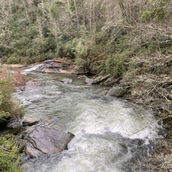
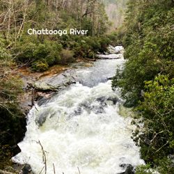
Chattooga River
1 review
Tanneries Historical Marker
1 review