1. Hagood Mill Historic Site

0

Pickens, SC

Cancel

Open app

Search

Hagood Mill Historic Site

4.8 (9 reviews)
Closed • Closed

Hagood Mill Historic Site Photos

More like Hagood Mill Historic Site

Recommended Reviews - Hagood Mill Historic Site

Your trust is our priority, so businesses can't pay to alter or remove their reviews. Learn more about reviews.
Yelp app icon
Browse more easily on the app
Review Feed Illustration

Reviews With Photos

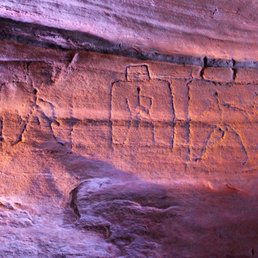
Prehistoric rock drawing at Haygood Mill
Sally L.

Always something fun happening at Haygood Mill on the weekends. In the past few years they found prehistoric rock carvings.

Storyteller and Humorist Mike Miller spinning a true lie at Hagood Mill Storytelling Festival
Mike M.

A really neat place to visit in Pickens County. I had the privilege of performing here at one of their annual storytelling festival. And thousands of folks turned out! Also me and my family attended one of their third sat fun days. Fun is the word! Blacksmiths, really cool folk music, storytelling and all kinds of crafts, My children bought wooden birds and homemade honey and books. The old mill still works and of course we watched it grind up some grits and of course we bought some grits! Fresh ground! Couldn't buy enough boiled peanuts for the family! The mill area isn't too spread out and it is easy to walk around. the rest rooms are family friendly and very clean. You wouldn't think so but they are. There is a very short nature trail you can walk on also. Very historic and the folks that work there are very friendly. If you want more info go to this website http://www.visitpickenscounty.com/vendor/61/hagood-mill/

Old Mill in Pickens

See all

1 month ago

Beautiful place and amazing staff! The cabins on site will take you back in time. Great place for a family outing or picnic.

Helpful 0
Thanks 0
Love this 0
Oh no 0

5 years ago

Helpful 0
Thanks 0
Love this 1
Oh no 0

6 years ago

Helpful 1
Thanks 0
Love this 2
Oh no 0

7 years ago

Helpful 0
Thanks 0
Love this 1
Oh no 0

3 years ago

Helpful 0
Thanks 0
Love this 0
Oh no 0

3 years ago

Wonderful place, great family place. Would recommend to anyone. Great photo locations as well

Helpful 0
Thanks 0
Love this 0
Oh no 0

4 years ago

Helpful 0
Thanks 0
Love this 0
Oh no 0
Photo of Mike M.
750
349
1885

11 years ago

Helpful 2
Thanks 0
Love this 4
Oh no 0
Photo of Amos M.
34
13
36

12 years ago

Helpful 2
Thanks 0
Love this 1
Oh no 0

Ask the Community - Hagood Mill Historic Site

Verify this business for free
Get access to customer & competitor insights.

Verify this business

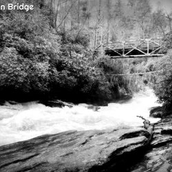
Old Iron Bridge

Old Iron Bridge

4.5(2 reviews)
23.7 mi

First off the Old Iron Bridge is not a business but rather a scenic stop on the Chattooga river…read more The bridge crosses the river between Cashiers and Highlands and is located on a dirt forestry road. It is certainly worth the visit. The original poster here offers a great deal of information about this bridge.

Do you ever see a landmark on Google Maps and wonder what it looks like in person? I do! I actually…read morespend hours when I'm bored traveling the world via Google Earth. It's how I find interesting things to do when I plan to be in a specific area either hiking or on vacation. ~~~ What makes this Old Iron Bridge special is its location over the mighty Chattooga River very early in the rivers journey. My guess is it's about 8 miles from where its headwaters begin @ Cashiers Lake. The Chattooga eventually becomes a much larger, wider and wild river as well as the defining squiggly boundary line between northeast Georgia and western South Carolina. This same river eventually bleeds into Lake Hartwell and soon after becomes the Savannah River, dumping all this fresh water into the Atlantic ocean. So, almost its entire journey defines South Carolina from Georgia, and it all begins very near this Old Iron Bridge. Call me a nerd if you want, but it simply fascinates me that I could possibly drop a note in a bottle from this bridge, and it has the potential of reaching Savannah, Georgia on a long journey 300+ miles away. Of course the bottle would have to survive the Class V crushing rapids + overcome multiple dams on the way to Savannah, but a fun thought nonetheless. Or what if you could drop a gallon of dye into the water that doesn't dissolve and track how long it takes to make it to the Atlantic? As a kid, I always has a fascination of how things work... like how far up does a helium filled party balloon travel and how many miles away will it be found? Coordinates: 35°00'57.5"N 83°07'34.8"W ~~~ [ WATERFALLS ] The most interesting highlight of this bridge is the waterfall below it! It's not a huge one (more of a large rapid in high water), but a thunderous spot in the river nonetheless as the southbound river takes a sharp turn east just past the bridge! I didn't know it until after I got home, but there was a spot on the other side of the river where I could have gotten a great pic of the falls, like this pic I found on pinterest: https://i.pinimg.com/originals/31/f6/fa/31f6fa1c47cfb5c0b57bc8417bea56aa.jpg My photos are from the opposite side of the bridge, which by the way, has a trail and a small parking area good for two cars. The trail leads down to the river and in a rainy period, you may also spot a LARGE 100'+ waterfall in the distance coming off the Chattooga Cliff on Bullpen Mountain. I only took the trail a short way to get a better pic of the distant waterfall, but it seems to follow the river north. ~~~ [ HISTORY ] Style: Pony truss bridge Status: Open to traffic Built: 1934 Length of largest span: 79.7 ft. Total length: 81.7 ft. Deck width: 11.8 ft. Also called Chattooga River Bridge Bull Pen Bridge Ammons Branch Bridge ~~~ [ FINAL THOUGHTS ] If you are a fan of bridges, this is a great one to add to your photo collection. Bull Pen Road is a nice wooded drive from Burrell's Ford Campground to Highlands, North Carolina. IF you are a fan of waterfalls, Kings Creek Fall and Spoonauger Falls are near the campground, and Secret Falls, Dry Falls as well as a high concentration of other named waterfalls are all near the Highlands! Enjoy 2020 / 8
Photos
Old Iron Bridge - Ye' Old Iron Bridge

Ye' Old Iron Bridge

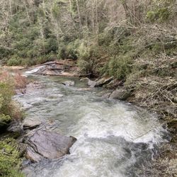
Old Iron Bridge - View of the bend in the river from Old Iron Bridge on a high volume day!

View of the bend in the river from Old Iron Bridge on a high volume day!

Old Iron Bridge - View of the 2nd waterfall from near Old Iron Bridge on a high volume day!

See all

View of the 2nd waterfall from near Old Iron Bridge on a high volume day!

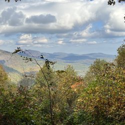
Sunset Rock - Sunset Rock trail - views from the sunrise side at 4:45pm

Sunset Rock

4.0(6 reviews)
27.6 mi

In less than 2 months I leave for my first ever missions trip to the continent of Africa. I…read morerecently experienced a mission trip to Haiti this past July (as detailed in my 410 Bridge review) and I was asked to join the Kenya team shortly after. I've had a great deal of time to reflect on that trip, because it honestly didn't meet my expectations. So this time I've decided to begin preparing myself mentally & spiritually well in advance of departing. I want this trip to be ALL that God intends for it to be and I don't want any of ME in the way. I purposely plan to use my time these coming weeks reflecting on all aspects of life. Daily areas where I miss simple truths that could teach me small valuable lessons. I know this may sound corny to some, but I would feel irresponsible if I didn't begin building my mental strength now, knowing that my last trip was probably not as fruitful as it could have been had I done the same prior. So, until I depart for my "big trip" I wanted to take the opportunity to use some of my reviews to reflect on the experience of places I visit. A mental way for me to decompress and prepare. First up, Sunset Rock. --- THE SCENE It was my first visit to Highlands, North Carolina. Admittedly I drove through the town a few years prior as my wife and I took a long detour home from a weekend in Asheville, but we paid little to no attention to the charm of this tiny mountain hamlet. I'd completed my mission of visiting nearby Dry Falls and Bridal Veil Falls, so my only goal at the time was dinner @ the Dillard House before hitting the road for our final 2 hour leg home. It could have been an amazing parade going on in the middle of town and it would not have deterred me from my plans. * REFLECTION - What is is about some of us that completing the goal is more important than experiencing the journey? I think in my life, and especially in my last mission trip, my desire to complete certain goals often outweighs the journey that I was sent to be on. During my visit to Highlands THIS time, I had no plans to actually walk around the city. There was a mountain I wanted to climb, a shadow in a valley I wanted to experience, a covered bridge I needed to photograph and a waterfall I missed on my last pass through town. I can be very scheduled and regimented, especially when it comes to travel because I don't know when/if I will be back that way again. So as I drove through this beautiful village, the thought occurred to me to slow down and enjoy the journey. I decided to park my car and walk. I had several wonderful conversations with locals. One lead me to an amazing burger at a local grocery store. While I was sitting enjoying my burger, another conversation lead me to Sunset Rock. I honestly didn't have time to visit, but what really peak my interest was the fact it seems to be more of a local secret than common visitor knowledge. So, instead of hiking to the waterfall I originally planned to visit, I drove directly here. --- THE EXPERIENCE I was told by locals I could take my car up the gravel driveway to the top, and apparently others were told the same as there were three other cars at the top. However, after returning home I discovered several sites saying the trail is meant to be for hiking only. One site mentioned signage at the beginning of the driveway, but was so focused on the goal that IF there was signage saying don't drive, I didn't notice. I called local authorities and it is indeed okay to drive to the top, but in retrospect I wouldn't advise it. The road is EXTREMELY narrow most of the way up and there is no room for error! Also, hikers have to really hug the roadside to allow you to pass as you kick up gravel dust in your wake. I'm sure that can be uncomfortable and unnerving, especially for those with small animals and children. * REFLECTION - Others truths are not always your reality. Even when something is okay, it's not always advisable. At the top is a small gravel turn around where I parked. A small stone with 'Ravenel Park' sits off to the right. Take the short trail near the information board. As you walk, an opening in the trees comes into view. Once you reach the granite outcrop and begin up the slight incline, the glory of sunset rock unfolds! The granite surface, although extremely bumpy and other worldly, is expansive and open like a stone dome. It is said to be thee spot you want to experience a sunset in the Highlands and I believe it! Hopefully my next visit will give me opportunity to experience it with my wife and kids. --- FINAL THOUGHTS Undoubtedly a gorgeous hidden gem! Yes, you are allowed to drive to the top, but honestly it is a short hike and the trail barely has room enough for one car, let alone if two cars are passing. My advice - enjoy the journey and walk. The hike is short and the view is sweet, plus the exercise is good for you! What more could you ask for :-) 2016/122

Dangerous road to the top of Sunset Rock by vehicle but only a ten minute walking hike with a few…read morespaces to the right of the road to park your car. Single lane dirt road with huge wet rocks blocking the way up and we got stuck mid-way. Met some hikers on the road and chatted briefly. No bears found but hikers be on the lookout. Sunset Rock is also known as Ravenel Park. I DO NOT RECOMMEND DRIVING ON THIS ROAD...EVER.

Photos
Sunset Rock - Sunset Rock - views from the sunset side (around 4:45pm)

Sunset Rock - views from the sunset side (around 4:45pm)

Sunset Rock - Instagram: @telephonesmoothie

Instagram: @telephonesmoothie

Sunset Rock - Instagram: @telephonesmoothie

See all

Instagram: @telephonesmoothie

High Falls Covered Bridge - High Falls Covered Bridge, Cedar Mountain

High Falls Covered Bridge

5.0(2 reviews)
19.4 mi

Big thanks to Richard R. for adding this one that did not come up in the usual searches and yet, it…read morewas the main reason I passed through the DuPont Forest. I love bridges and I love covered bridges even more! And wow, thanks for the amazing writeup of all the drama on this property that was an eye-opener. I parked the van at the High Falls Trailhead (there are restrooms and even a wifi here!) and made my way along the trail to the bridge. It's about 0.75 of a mile on a path through the woods. I am apparently not as delicious as usual as I earned zero mosquito bites despite sweating a lot in the humidity. I'd call this walk "easy plus." The bridge itself is impressive and quite modern. And I would suggest not missing the nearby Falls though I was simply too tired and it was getting too late for me. I'll need to plan better next time! The walk back was much easier as I opted to take the gravel road that is easy and smooth, but only open for emergency vehicles and the forest rangers. I would rate the hike as "easy" for 0.6 miles though not wheelchairable. You can ask the rangers for access by vehicle for handicapped but they're only open regular hours. [Review 20030 overall - 3463 in North Carolina - 1005 of 2023.]

High Falls Covered Bridge (also known as Buck Forest Covered Bridge) is one of my favorite bridges…read morein the Southern United States. It is a modern structure that has an interesting history. It is an example of the power of the people versus the dollar power of a developer. HISTORY In 1999, Sterling Diagnostic Imaging decided to sell their interest in the land that holds Triple Falls and High Falls, two of the most gorgeous waterfalls you will ever visit this side of the Mississippi. For reasons still unknown, the company decided to use an unusual bidding method by choosing to keep the bidding private and secretive. The State offered up a bid in efforts to save the land for public use, but Sterling announced a developer by the name of Jim Anthony won with a bid of 6.35 million. The developer initially announced in the Hendersonville Times News that he had no plans to develop the land, but instead wanted to use it as a private retreat. However, it soon became apparent Anthony was indeed planning a massive upscale gated community. The fact that the deed he purchased from Sterling Diagnostics stating the land could not be used for residential purposes at the Transylvania Courthouse did not seem to matter. It was later discovered the complex legal agreement between the two was unenforceable and the battle began between the state and Anthony. Anthony proceeded to begin building the roads and this gorgeous covered bridge as part of his planned community, but thankfully he was ultimately defeated. On October 23, 2000 Governor Jim Hunt and the Council of State unanimously voted to invoke eminent domain on the tract of land owned by developer Anthony. In many ways Anthony still won big, because the State paid him 24.5 million dollars in an out of court settlement. WOW! The Falls opened to the public on December 17, 2000. Since then, the entire 2200 acres has been integrated into Dupont State Forest. [History Reference: Romantic Asheville - "How Dupont State Forest was saved"] FINAL THOUGHTS Aside from being one of the most beautiful covered bridges you will ever see, it also is part of a trail system that includes arguably the most beautiful waterfalls in the South. If that is not enough of a reason to come here, let me give you movie fans one more reason. Many scenes from the 1st Hunger Games were filmed right here in this forest. The scene were Katniss finds Peeta camouflaged in the ground at the waterfall is located on the second tier of Triple Falls... just a half mile downstream of High Falls Covered Bridge. Movie scene: https://www.youtube.com/watch?v=UxvyMiwhJWw Year Built: 2000 Obvious materials: Wood, stone, concrete Spans over: Little River at the top of High Falls Location: Dupont State Forest @ Buck Forest Road

Photos
High Falls Covered Bridge - High Falls Covered Bridge, Cedar Mountain

High Falls Covered Bridge, Cedar Mountain

High Falls Covered Bridge - High Falls Covered Bridge, Cedar Mountain

High Falls Covered Bridge, Cedar Mountain

High Falls Covered Bridge - Lots of riders use the trails, so your chances of seeing a group on horseback is pretty good!

See all

Lots of riders use the trails, so your chances of seeing a group on horseback is pretty good!

Eugenia Duke Bridge - Eugenia Duke Bridge (a walking bridge)

Eugenia Duke Bridge

5.0(3 reviews)
19.0 mi

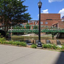
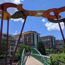
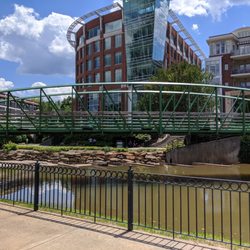
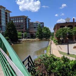
I will admit that I did not know the "name" of this bridge despite having walked across it…read morecountless times, although it has only been known by this name for the past couple of years. It's not the expansive Liberty Bridge that is most commonly associated with the Reedy River downtown, but it is a convenient and heavily foot-trafficked crossing just up the river that many people recognize. It's located parallel to Main Street and can be accessed by stairs on either side. The bright green bridge connects with the Swamp Rabbit Trail on one side and the sidewalks that go through the Wyche Pavilion and Peace Center amphitheater on the other. The bridge crosses over the Reedy right where there are concrete structures, looking somewhat like a dam, that are part of an old railroad trestle. The water spills over here providing lots of white noise, especially in combination with the other nearby water features and wall fountains.

This bridge was an educational experience for me. But not until the first time I finally paused to…read moretake in the signage. Eugenia Duke began her path to fame in 1917 by making sandwiches in her home kitchen to sell to the army during WWI. Her sandwiches were good but it was all about the Mayo. Years later at the urging the of those soldiers, she began bottling it in 1923. Knowing this makes me an even bigger fan of Duke's mayonnaise. Oh, wait. The icon bridge is pretty cool, too.

Photos
Eugenia Duke Bridge - Eugenia Duke Bridge

Eugenia Duke Bridge

Eugenia Duke Bridge - Eugenia Duke Bridge (a walking bridge)

Eugenia Duke Bridge (a walking bridge)

Eugenia Duke Bridge - Eugenia Duke Bridge

See all

Eugenia Duke Bridge

Bridal Veil Falls - 7/24

Bridal Veil Falls

3.9(24 reviews)
30.4 mi

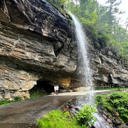
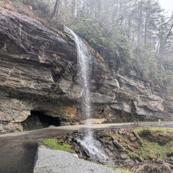
One of my favorite falls from my Childhood…read more I grew up in Brevard NC and my Grandmother lived between Silva and Franklin. Not the preferred route to visit because of the winding mountain roads but a good alternate and actually my favorite because of the scenery. Two main falls on the route. One was Dry Falls and the other Bridal Veil Falls. Bridal Veil was my favorite because you could drive under the fall. You could either drive behind the falls of if the took the other lane, the falls cascaded onto your vehicle. When I was in college, the biology club which I was part of camped out on the meadows behind my parents house and the next day, went plant collecting in the higher elevations. I had my father's pickup truck and we had a number of people in the back when we came to Bridal Veil Falls. Needless to say, I chose to drive on the side where the Cascade fell directly onto the truck. Dr. Crutchfield said, they are going to kill you. They did not but it did establish I am not a nice guy. Sadly they have recently erected barriers to prevent you from going under the falls. When I was growing up and in college, you had no option but at sometime they did upgrade the road and made a bypass that skirted the falls but left the option of still going under the falls. For one reason or another, they have erected temporary barriers to discourage this type of behavior. It is still, one of the most beautiful and interesting sites in this area and highly recommend stopping and enjoying the experience

On 64 No longer able to drive under the falls but you can…read morestill walk behind it. Although it has been and was lightly raining, the waterfall was very light. Parking is small unmarked side of the road and could accommodate several cars. Perhaps after a big rainstorm, BVF maybe impressive, but this was rather an unremarkable visit.

Photos
Bridal Veil Falls
Bridal Veil Falls - A beautiful waterfall that requires absolutely no hiking!!!

A beautiful waterfall that requires absolutely no hiking!!!

Bridal Veil Falls - Instagram: @telephonesmoothie

See all

Instagram: @telephonesmoothie

Hagood Mill Historic Site - landmarks - Updated October 2026

Loading...
Loading...
Loading...