Cancel

Open app

Search

Cherokee Defeat Historical Marker

3.0 (1 review)

Cherokee Defeat Historical Marker Photos

Recommended Reviews - Cherokee Defeat Historical Marker
Your trust is our priority, so businesses can't pay to alter or remove their reviews. Learn more about reviews.
Yelp app icon
Browse more easily on the app
Review Feed Illustration

3 years ago

Helpful 7
Thanks 2
Love this 3
Oh no 0

Verify this business for free

Get access to customer & competitor insights.

Verify this business

Rabun Gap-Nacoochee School Historical Marker - Rabun Gap-Nacoochee School Historical Marker

Rabun Gap-Nacoochee School Historical Marker

3.0(1 review)
4.1 mi

This marker stands on the property in front of the Rabun Gap - Nacoochee School which is secured…read morewhen there are no classes or events or games underway. The entrance is easy enough to access and that's where you can stop your car to view the marker as I did. The marker has the same text on both sides. It reads, "One of Rabun County's first college graduates, Andrew Jackson Ritchie received his B.A. and M.A. degrees from Harvard University before returning to his native county to devote his life to the education of the mountain people. "In 1903 he founded the Rabun Gap Industrial School and in 1917 originated the "Farm Plan," by which entire families work their way through school. The school operated independently until 1926, when it merged with the Nacoochee Institute, a school owned and supported by the Presbyterian Synod of Georgia. Under Dr. Ritchie's presidency, the new school, chartered in 1927 and named Rabun Gap-Nacoochee, acquired more land, larger dormitories and classrooms, and began new educational programs. "Dr. Ritchie, whose unique approach to education has attracted strong financial support, served as President of the school until his retirement in 1939. In 1948, the year of his death, his "Sketches of Rabun County History" was published. "Dr. Ritchie, educator, scholar, and historian, is buried on the hill overlooking this school which his complete devotion created." This is marker number 119-3 and it was erected in 1967 by the Georgia Historical Commission. [Review 469 of 2024 - 703 in Georgia - 21501 overall]

Will Henry Stevens Covered Bridge - Classic Carolina design

Will Henry Stevens Covered Bridge

4.5(2 reviews)
10.5 mi

No "shadows of a bear" for me, I passed through Highlands in order to see this famed covered…read morebridge. There really aren't many of them left in the US and very few remain in North Carolina! The bridge is the entrance to the Bascom Center, a six-acre campus of indoor and outdoor artworks. It was named for artist Will Henry Stevens (1881-1949) who lived and painted and taught here in Highlands. The bridge dates back about 200 years when it was originally build in New Hampshire over the Warner River. Disassembled rather than destroyed, it was put into storage in 1966. And then purchased and moved here to Highlands forty years later. Now it's been recreated as an Ithiel Town lattice using traditional techniques and materials including 1100 tree-nails, towels and trunnels with no metal fasteners! Unfortunately, when I arrived it was closed for reconstruction and repair. Blocked off on both sides and surrounded by piles of rough-hewn beams and planks. I'll need to come back when it's all fixed up. [Review 20018 overall - 3458 in North Carolina - 993 of 2023.]

I came to Highlands, NC in search of a bear, or more accurately the "shadow of a bear". A natural…read morephenomenon that happens from mid-October through early November when the setting sun casts a shadow onto the valley below Whiteside Mountain. The shadow takes on the appearance of a bear and I simply could not not miss this one-of-a kind opportunity. The shadow begins at 5:30 p.m. I arrived in town super early (around 1pm) so I decided to do a little exploring. There was a waterfall here I wanted to visit, but I discovered The Bascom Visual Arts Center and decided to make that my first stop. To know me is to know I have a profoundly deep love for old structures, particularly covered bridges. So to discover a covered bridge I was not aware of (that was also historic) in a gorgeous mountain setting was almost orgasmic... and I mean that literally. When I get super excited about something, it makes me wanna go poop! TMI right?, but it's true. There is no greater laxative for me than showing me a picture of someplace gorgeous that I've never been. It's why I keep travel magazines in a woven basket in our bathroom. The excitement for new adventures twists my stomach into knots. So, actually realizing I'm live on location of a place I would have seen in the pages of a magazine brings on a different excitement! LOL --- THE BRIDGE You simply can't get more picturesque than Will Henry Stevens Covered Bridge. A little research revealed this bridge was once considered the oldest covered bridge in New Hampshire. It was named Bagley Covered Bridge and it crossed the Warner River, until it was considered a hazard from its aging condition. The bridge was scheduled to be destroy until Milton & Arnold Graton, lovers of historic bridges, purchased it in 1966 and placed it in storage for the next 42 years. The bridge was built in approximately 1807 out of old growth pine. It is around 14 feet wide and almost 88 feet long. In February of 2008 it was gifted to the Bascom Art Center as a perfect entrance to their facility and reconstruction completed in 2009. This bridge looks like a totally new structure, but in fact is now over 200 years old. The design is Town lattice and uses over 1,100 wooden fasteners in keeping with the original 1800's bridge building traditions. I'm guessing the flares at the bottom were not original to the bridge, but are characteristic of Carolina-style covered bridges. SIDE NOTE: Famous people said to have once crossed this bridge are General Lafayette, President Theodore Roosevelt & President Franklin Pierce. --- FINAL THOUGHTS I am in awe of the dedication to conservation that led this bridge from New Hampshire to the Mountains of North Carolina. What love and genuine concern for the preservation of such an important artifact from a dying era! It truly brings a mist to my eyes to know that someone loved this bridge so much that they saved it, carefully dismantled it, stored it, nurtured it for 4 decades, and rebuilt it once they found it the perfect home. In Georgia, there were once over 600 covered bridges, but only 15 historic ones remain. Most met their end by arson or neglect. So I am very proud to see one of these beauties survived by being blanketed with a great deal of love. I wish we all honored such important structures & relationships in our lives and were less quick to deem things that were once important as antiquated and useless. I read an article about the father and son who saved the bridge, the Grafton's. It highlighted a quote which stated: "To me, to write-off the remaining usefulness of so faithful an old bridge... is like sentencing [someone] without hearing [their] witness. Should not this old bridge have a chance to be heard even through an interpreter?" AMEN 2016/119

Photos
Will Henry Stevens Covered Bridge - Will Henry Stevens Covered Bridge, Highlands

Will Henry Stevens Covered Bridge, Highlands

Will Henry Stevens Covered Bridge - Will Henry Stevens Covered Bridge, Highlands

Will Henry Stevens Covered Bridge, Highlands

Will Henry Stevens Covered Bridge - Will Henry Stevens Covered Bridge, Highlands

See all

Will Henry Stevens Covered Bridge, Highlands

Becky Branch Falls - Bonus waterfalls if you follow the trail an additional 1.8 miles.

Becky Branch Falls

4.0(2 reviews)
9.6 mi

Those looking for a short waterfall hike will appreciate Becky Branch Falls. It is approximately a…read morehalf mile hike round trip from the Warwoman Dell parking area to the falls via Bartram Trail. It can be easily viewed from a small bridge that crosses directly in front of the 20' waterfall. If you are feeling more adventurous, you can continue along Bartram Trail another 1.8 miles to Martin Creek Falls. It is mostly downhill, so the hike there is easy until you must return along the same path. Still, for the most part the trail is not terribly strenuous in any area. I walked this trail with a father and his 6 year old daughter that I met in the Warwoman Dell parking area. This tiny little lady easily conquered the trail, although I'm not sure how she handled the return trip since they stayed to swim in the pool of water at the base of Martin Creek Falls. The trail passes another waterfall that I don't believe has a name. It is a beautiful 8 foot multitiered waterfall, but it's not the big show! Travel approximately 1/3rd of a mile further past this fall to reach Martin Creek Falls. Believe me, it is worth the extra hike. THE AREA However, if you choose to only visit Becky Branch Falls, then be sure to check out the interactive trail through Warwoman Dell. Lots of informative signs will tell you about the area and the woman for whom it is named, Nancy Ward. Pronounced Nanye-hi, this Chreokee woman (whom belonged to the Wolf Clan) fought against the Creek Indians with her Cherokee husband. He was killed in battle, yet Nanye-hi rallied to lead her fellow Cherokees and defeated the Creeks. She was given the prestigious title of Ghighau (Beloved Woman) by her clan, which in turn gave her a council voice regarding decisions of war and peace. She eventually met and married an English trader by the name of Bryant Ward and spent the rest of her days trying to make peace between the Cherokee Nation and the Settlers. SOURCE: Scenic USA - Georgia The trail is a 1.5 mile loop that highlights the variety of plants such as the vast array of ferns, wildflowers and rhododendrons. This I believe is a nod to John Bartram (considered America's first botanist), Father of William Bartram of whom Bartram Trail is named. The trail is also said to have a beautiful scenic overlook, but I was honestly too tired to fully walk the loop trail to discover the view after my waterfall hike. Also along the trail is evidence of 18th century plans to build a railroad through this area. The bed for the railroad can still be seen in Warwoman Dell. FINAL THOUGHTS Family friendly hike that encompasses a lot of the things I love about being out in nature: Waterfalls, scenic views, beautiful plants and historic sites. I can only imagine what this trail looks like in the Spring when the rhododendrons are in bloom. 2018/53

This was a fun trail! I don't know much about hiking but this seemed like a fairly easy hike with a…read moregreat payoff in the form of a very pretty waterfall. We went in early November and saw a handful of other people. There We did not do the loop, instead continuing up on the Martin Creek Falls trail. I highly recommend, if you're up looking for a 4+ mile hike. If I had to make one criticism, it'd be that the trail doesn't go far from the road so you're hearing traffic for the duration of the hike. Not that it's a heavily trafficked road but you can definitely hear passing cars. There is parking just east of the trailhead at Warwoman Dell. Lastly, I had zero cell service on this trail! I got one tiny pulse of 3G at the trailhead, which enabled me to send a text I'd been trying to send since we parked, but nothing other than that. Lack of service aside, I would gladly hike this trail again!

Photos
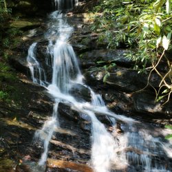
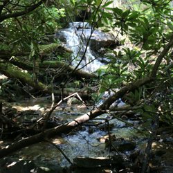
Becky Branch Falls - 20 foot tall Becky Branch Falls, approximately 200 yards from Warwoman Road on Bartram Trail.

20 foot tall Becky Branch Falls, approximately 200 yards from Warwoman Road on Bartram Trail.

Becky Branch Falls - Small waterfall from the culvert under Warwoman Road.

Small waterfall from the culvert under Warwoman Road.

Becky Branch Falls

See all

Elkmont Ghost Town - Elkmont Club Cabin #7A - Levi Trentham

Elkmont Ghost Town

4.5(2 reviews)
45.3 mi

Thanks to Google Maps (and my thorough trip itinerary planning), I had discovered the historic…read more(once a) "ghost town" of Elkmont. For America's most visited national park, it can be difficult to escape the crowds within the Great Smoky Mountains--yet Elkmont is one place to do just that! This Little River Valley was once home to a pioneer Appalachian community, a logging town, and later a resort community. To this day, old relics and abandoned buildings from the past remain--awaiting to be explored. The area was settled in the 1840s as the town of Little River when a logging company was formed. A railroad was later constructed to transport timber for the Little River Lumber Company. This eventually allowed the wealthy from Knoxville to visit what eventually became a resort town. When the Great Smoky Mountains National Park was was established in 1934, residents were given the option to sell their homes at full price and relocate, or sell to the National Park Service (NPS) for a discounted price allowing them to live there until they become deceased. By 1992, most of the homes remained vacant or with expired leases leading 70+ historic buildings into a state of deterioration. Thankfully the NPS decided to renovate and preserve 19 buildings in Elkmont for public visitation. You can now find the Elkmont Historic District with cabins along Jakes Creek Road that were completed around 1997. They attempted to keep the buildings in the closest original condition--even their exterior paint colors! Each cabin has information about the tenants and any unique features. Unfortunately, the cabins cannot be brought up to code for renting or staying inside. However, the largest lodge known as the Appalachian Club is available as an event venue. Continue to explore the Old Elkmont Cemetery up a rocky road near the beginning of Elkmont Road, or choose to hike the Jakes Creek or Little River Trails where you will venture past less discovered old chimneys, walls and tractors that still remain. Directions: Coming from Gatlinburg/Pigeon Forge or Cherokee, turn to go west on Fighting Creek Gap Road toward Cade's Cove (turn off near the Sugarlands Visitor Center). After the Laurel Falls trailhead, watch for signs to Elkmont Campground. Follow Elkmont Road all the way til it becomes a loop drive at Jakes Creek Trail Trailhead.

Pretty neat location. Reminded us of a place back home that is still a resort for the wealthy…read more Warning to others who visit, make sure to stop at Sugarlands Visitor Center and get your park tag before going. We were hoping to hike more of the area but didn't know we needed a park tag for our vehicle

Photos
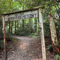
Elkmont Ghost Town - The Old Elkmont Cemetery signage

The Old Elkmont Cemetery signage

Elkmont Ghost Town - Appalachian Clubhouse

Appalachian Clubhouse

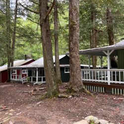
Elkmont Ghost Town - Elkmont Historic District Cabins along Jakes Creek Road

See all

Elkmont Historic District Cabins along Jakes Creek Road

Cherokee Defeat Historical Marker - landmarks - Updated May 2026

Loading...
Loading...
Loading...