Silas McDowell Historical Marker Photos

More like Silas McDowell Historical Marker
Recommended Reviews - Silas McDowell Historical Marker
Start your review...

My Yelp friend Carol S. (Virginia Beach, VA) will appreciate this one. The marker is along US-64 deep in the North Carolina mountains and points out a local citizen who contributed scientific knowledge. Silas McDowell rose from an orphaned childhood to become a well‑connected figure in the intellectual and political circles of western North Carolina. Though trained as a tailor, he built a life as a farmer, correspondent, and source of regional knowledge for writers and public figures. His scientific curiosity led him to make lasting contributions to botany, horticulture, and especially the idea of the mountain "thermal belt," which shaped agricultural understanding in the region. In his later years he turned to preserving local history, and his papers now reside at the University of North Carolina at Chapel Hill. The marker reads, "Silas McDowell 1795-1879. Botanical and historical writer; horticulturist. Originated concept of a temperate "thermal belt." Home stood 1/5 mi. west." It is marker number Q-50 and it was erected in 1990 by the Division of Archives and History. There is more information in the online essay. [Round number review 500 of 2026 - 4595 in North Carolina - 25682 overall] read more


More info about Silas McDowell Historical Marker


Silas McDowell Historical Marker - landmarks - Updated July 2026
Best of Franklin
People found Silas McDowell Historical Marker by searching for…
Churches in Franklin, North Carolina
Public Services & Government in Franklin, North Carolina
Free Things to Do in Franklin, North Carolina
Tourist Attractions in Franklin, North Carolina
Scenic Views in Franklin, North Carolina
Places to Take Pictures in Franklin, North Carolina
Photo Spots in Franklin, North Carolina
Urban Exploration in Franklin, North Carolina
Points of Interest in Franklin, North Carolina
Train in Franklin, North Carolina
Trending Searches in Franklin, NC
Boat Rental near Silas McDowell Historical Marker
Caves near Silas McDowell Historical Marker
Cliff Jumping near Silas McDowell Historical Marker
Day Trips near Silas McDowell Historical Marker
Fireworks near Silas McDowell Historical Marker
Historical Sites near Silas McDowell Historical Marker
Jet Ski Rental near Silas McDowell Historical Marker
Kayak Rental near Silas McDowell Historical Marker
Landmarks & Historical Buildings near Silas McDowell Historical Marker
Lookout Points near Silas McDowell Historical Marker
Picnic Areas near Silas McDowell Historical Marker
Places To Swim near Silas McDowell Historical Marker
River Swimming near Silas McDowell Historical Marker
River Tubing near Silas McDowell Historical Marker
Scenic Restaurants near Silas McDowell Historical Marker
Secluded Spots near Silas McDowell Historical Marker
Strawberry Picking near Silas McDowell Historical Marker
Swimming Holes near Silas McDowell Historical Marker
Swimming Lakes near Silas McDowell Historical Marker
Swimming Pools near Silas McDowell Historical Marker
Things To See near Silas McDowell Historical Marker
U Pick Farms near Silas McDowell Historical Marker
Browse Articles
Browse Nearby
BEST of Franklin, North Carolina Restaurants near Silas McDowell Historical Marker
BEST of Franklin, North Carolina Coffee near Silas McDowell Historical Marker
BEST of Franklin, North Carolina Things to Do near Silas McDowell Historical Marker
BEST of Franklin, North Carolina Shopping near Silas McDowell Historical Marker
BEST of Franklin, North Carolina Breakfast near Silas McDowell Historical Marker
Browse Brands
Related Searches in Franklin, NC
Best Fun Things to Do in Franklin, North Carolina
Best Things to Do on a Rainy Day in Franklin, North Carolina
Best Waterfalls and Swimming Holes in Franklin, North Carolina
Book Engaging Historical Tours in Franklin, North Carolina
Discover Charming Historic Homes in Franklin, North Carolina
Discover Family-Friendly Aquariums in Franklin, North Carolina
Discover Famous Monuments in Franklin, North Carolina
Discover Historic Sites and Places in Franklin, North Carolina
Discover Popular Landmarks in Franklin, North Carolina
Discover Popular Photo Spots in Franklin, North Carolina
Discover the Best Caves to Explore in Franklin, North Carolina
Discover the Best Planetarium Shows in Franklin, North Carolina
Enjoy Arts & Entertainment in Franklin, North Carolina
Enjoy Hiking Adventures in Franklin, North Carolina
Enjoy the Best Family Activities in Franklin, North Carolina
Enjoy the Best Walking Trails in Franklin, North Carolina
Experience Stunning Sunset Views in Franklin, North Carolina
Explore Beautiful Botanical Gardens in Franklin, North Carolina
Explore Beautiful Parks and Green Spaces in Franklin, North Carolina
Explore Easy Hikes Perfect for All in Franklin, North Carolina
Explore Family-Friendly Zoos and Wildlife in Franklin, North Carolina
Explore Free Things to Do Around Franklin, North Carolina
Explore Fun Activities to Do in Franklin, North Carolina
Explore Fun Field Trips in Franklin, North Carolina
Explore Popular Scenic Overlook Points in Franklin, North Carolina
Explore Popular Scenic Views Near Franklin, North Carolina
Explore Popular View Points Around Franklin, North Carolina
Explore Secret Spots Worth Visiting in Franklin, North Carolina
Explore Top Art Galleries Located in Franklin, North Carolina
Explore Venues & Event Spaces in Franklin, North Carolina
Explore the Top Car Museum in Franklin, North Carolina
Find Exciting Tours to Take in Franklin, North Carolina
Find Top-Rated Waterfalls in Franklin, North Carolina Now
Find Visitor Centers to Explore in Franklin, North Carolina
Find the Best Bridge Spots in Franklin, North Carolina
Find the Best Playgrounds to Visit in Franklin, North Carolina
Fun Things for Kids in Franklin, North Carolina
Hiking Trails With Waterfalls in Franklin, North Carolina
Perfect Spots to Watch Sunset in Franklin, North Carolina
Popular Picnic Spots to Visit in Franklin, North Carolina
Popular Places to Take Pictures in Franklin, North Carolina
Popular Things to Do in Franklin, North Carolina
Top Hiking Trails to Explore in Franklin, North Carolina
Top Museums for Kids to Visit in Franklin, North Carolina
Top Things to Do With Kids in Franklin, North Carolina
Tour Famous Lighthouses Located in Franklin, North Carolina
Uncover the Best Secluded Spots Around Franklin, North Carolina
Visit Cultural Centers in Franklin, North Carolina
People who viewed Silas McDowell Historical Marker also viewed
Macon County Courthouse
1 review
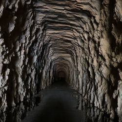
Stumphouse Tunnel
10 reviews
Looking Glass Rock Overlook
6 reviews
Rabun Gap-Nacoochee School Historical Marker
1 review
The Cherokee Path
1 review
Will Henry Stevens Covered Bridge
2 reviews
Sky Valley Overlook
7 reviews
Blue Valley Overlook
3 reviews
Old Iron Bridge
1 review
King Creek Falls
7 reviews