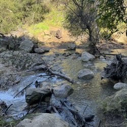
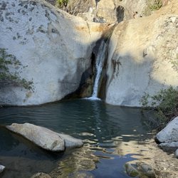
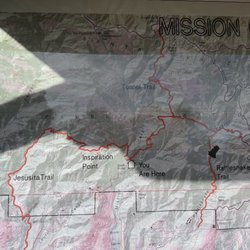
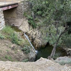
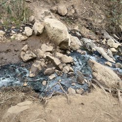
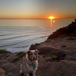
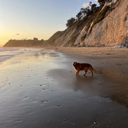
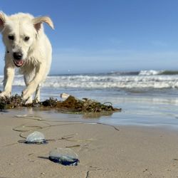
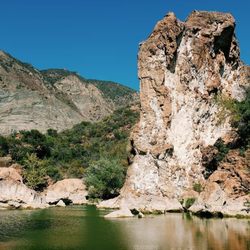
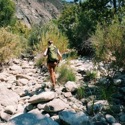
Tequepis Trail Photos


You might also consider
More like Tequepis Trail
Recommended Reviews - Tequepis Trail
Start your review...

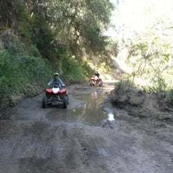
Better than you'd expect. From the road, the Mtns across the way look more enticing, but this trail was well-maintained, yet rugged. We mostly saw bikers, but didn't see a whole lot of people overall. Once you pull off of the highway, stay to the dirt road to the left; it will eventually become pavement again shortly before you hit the trail head. When you get to the creek, look for the trail to the left that goes across a wooden branch bridge, before it gets too deep. Most of the elevation gain is on the upper half and you will pretty much know immediately when that is going to start. We started on the trail about 7am and got down at 12:15pm. Broadcast Peak was our destination and we ended up with 12 miles hiking and probably approx. 2800' elevation gain. You don't really need to do the peak to see the best views, as that is right at the end of the trail near the lone tree, where you can see the Pacific Ocean on one side and lake Cachuma on the other; The peak of Broadcast doesn't really have any better views. read more


2 years ago
I embarked on this trail with a group of younglings on a cool day. I'd never been on this trail, the view was spectacular! It wasn't as difficult as I'd expected, though a couple of the youngsters grumbled halfway. We all pushed through and encouraged each other to keep going. When we reached the top it was not clear towards the ocean side, but the Lake Cachuma view looked like a painting! So beautiful, no words to describe the feeling. We also ran into some brave souls biking down the trail! read more


This review is for Tequepis Trail in Goleta, near Solvang and Santa Barbara. This is a ~7.8 mile round trip hike that takes about ~4 hours to complete. You will drive about a mile on dirt road to a camp filled with kids (St Vincent de Paul Ranch Camp). The road becomes accessible to one car as you get closer to the camp. Limited parking spots as well. From the parking, you will continue to walk through the camp for a little bit until you find the start of the trail. From there, you are surrounded by a nice and serene forest. Once you exit the forest, is where it's an incline all the way to the top. Plenty of views of Lake Cachuma as you climb up the mountain. Furthermore, you'll get the view of the Pacific Ocean at the top. Short video of the hike: https://youtu.be/8CZUppkofF0 read more


More info about Tequepis Trail
Santa Barbara, CA 93111
Directions
Hours
Outdoor Amenities
You might also consider


Tequepis Trail - hiking - Updated July 2026
Best of Santa Barbara
People found Tequepis Trail by searching for…
Campgrounds in Santa Barbara, California
Hiking Trails in Santa Barbara, California
Walking Trails in Santa Barbara, California
Off Road Trails in Santa Barbara, California
Things to Do in Santa Barbara, California
Easy Hikes in Santa Barbara, California
Scenic View in Santa Barbara, California
Camping Sites in Santa Barbara, California
Lakes & Ponds in Santa Barbara, California
Trails in Santa Barbara, California
Things to Do at Night in Santa Barbara, California
Running Trails in Santa Barbara, California
Mountain Biking in Santa Barbara, California
Camping Cabins in Santa Barbara, California
Tent Camping in Santa Barbara, California
Beautiful Views in Santa Barbara, California
To Do in Santa Barbara, California
Forest in Santa Barbara, California
Off Leash Dog Hikes in Santa Barbara, California
Views in Santa Barbara, California
Waterfall in Santa Barbara, California
Hiking Groups in Santa Barbara, California
Trending Searches in Santa Barbara, CA
4th Of July Fireworks in Santa Barbara, CA
Black Owned Nail Salons in Santa Barbara, CA
Boat Rental in Santa Barbara, CA
Cliff Jumping in Santa Barbara, CA
Day Trips in Santa Barbara, CA
Fireworks in Santa Barbara, CA
Jet Ski Rental in Santa Barbara, CA
Kayak Rental in Santa Barbara, CA
Lakes & Ponds in Santa Barbara, CA
Off Road Trails in Santa Barbara, CA
Outdoor Activities in Santa Barbara, CA
Places To Walk Around in Santa Barbara, CA
Public Pools in Santa Barbara, CA
Public Shower in Santa Barbara, CA
River Swimming in Santa Barbara, CA
Rock Quarry in Santa Barbara, CA
Running Trails in Santa Barbara, CA
Scenic Night View in Santa Barbara, CA
Scenic Overlook in Santa Barbara, CA
Secluded Spots in Santa Barbara, CA
Soccer Store in Santa Barbara, CA
Splash Pad in Santa Barbara, CA
Strawberry Picking in Santa Barbara, CA
Sunrise View in Santa Barbara, CA
Swimming Holes in Santa Barbara, CA
Swimming Lakes in Santa Barbara, CA
Watch Sunset in Santa Barbara, CA
Browse Articles
Browse Nearby
BEST of Santa Barbara, California Restaurants near Tequepis Trail
BEST of Santa Barbara, California Coffee near Tequepis Trail
BEST of Santa Barbara, California Things to Do near Tequepis Trail
BEST of Santa Barbara, California Breakfast near Tequepis Trail
BEST of Santa Barbara, California Horseback Riding near Tequepis Trail
BEST of Santa Barbara, California Museums near Tequepis Trail
Browse Brands
Related Searches in Santa Barbara, CA
Affordable Kayak Rental Services in Santa Barbara, California
Best Fishing Locations and Guides in Santa Barbara, California
Best Places for Horseback Riding in Santa Barbara, California
Best Waterfalls and Swimming Holes in Santa Barbara, California
Check Out Off Road Trails in Santa Barbara, California
Discover Dog Friendly Trails to Explore in Santa Barbara, California
Discover Kid Friendly Hiking Trails in Santa Barbara, California
Discover Scenic Waterfall Spots in Santa Barbara, California
Discover a Hiking Trail in Santa Barbara, California
Discover the Best Night Hike Trails in Santa Barbara, California
Dog-Friendly Hikes With Dogs in Santa Barbara, California
Enjoy Camping Adventures Around Santa Barbara, California
Enjoy Exciting Mountain Biking Adventures in Santa Barbara, California
Enjoy Kayaking Adventures in Santa Barbara, California
Enjoy Tent Camping Spots Around Santa Barbara, California
Enjoy a Beautiful Waterfall Hike in Santa Barbara, California
Enjoy a Peaceful Nature Walk in Santa Barbara, California
Enjoy the Best Picnic Spots and Ideas in Santa Barbara, California
Enjoy the Best Walking Path in Santa Barbara, California
Enjoy the Best Walking Trails in Santa Barbara, California
Exciting Cliff Jumping Spots in Santa Barbara, California
Explore Beautiful Parks and Green Spaces in Santa Barbara, California
Explore Easy Hikes Perfect for All in Santa Barbara, California
Explore Fun Activities to Do in Santa Barbara, California
Explore Popular Campgrounds Near Santa Barbara, California
Explore the Best Beach Spots in Santa Barbara, California
Explore the Best Swimming Holes Around Santa Barbara, California
Explore the Best Trail Options in Santa Barbara, California
Family Friendly Hiking With Kids in Santa Barbara, California
Find Beautiful Views in Santa Barbara, California
Find Popular Ziplining Spots Around Santa Barbara, California
Find the Best Parks for Picnics in Santa Barbara, California
Find the Best Scenic View Locations in Santa Barbara, California
Great Places to Walk in Santa Barbara, California
Hike the Popular Waterfall Trail in Santa Barbara, California
Hiking Trails With Waterfalls in Santa Barbara, California
Off Leash Dog Hiking Trails in Santa Barbara, California
Plan a Scenic Drive Route Near Santa Barbara, California
Play at a Splash Pad Park in Santa Barbara, California
Popular Outdoor Activities to Try in Santa Barbara, California
Popular Picnic Spots to Visit in Santa Barbara, California
Popular Things to Do in Santa Barbara, California
Safe River Swimming Areas in Santa Barbara, California
Safe and Fun Parks for Kids in Santa Barbara, California
Top Climbing Spots and Gyms in Santa Barbara, California
Top Places for Snorkeling in Santa Barbara, California
Top Playgrounds for Kids to Enjoy in Santa Barbara, California
Top Running Trails to Explore in Santa Barbara, California
Top Swimming Spots and Pools in Santa Barbara, California
Walk Dog Friendly Hiking Trails in Santa Barbara, California