Jesusita Trail Photos


You might also consider


More like Jesusita Trail
Recommended Reviews - Jesusita Trail
Start your review...


Reviews With Photos


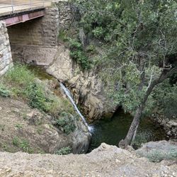
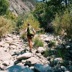
If you're looking for an easy hike but one that still gives you a good workout and has your legs feeling sore the next day, then you must check out Jesusita Trail. Apparently this trail takes you as far up to Inspiration Point if you want to make it more challenging but we didn't venture that far. Right now is the time to go since we've had so much rain this year; it's brought out so many beautiful colorful flowers. I haven't seen so much green in our mountains in over a decade! Our creeks have running water again, and the sound of it is so peaceful. It's the simple things like this that make me feel very blessed to live in such a beautiful place. Directions are simple, just head towards the mountains on San Roque Rd. until you see the Cater water treatment plant. If you get there early enough parking will be easy. This hike is 7 miles round trip, and a little steep at times with some rocky trails. I don't have hiking shoes yet but I was still comfortable wearing my running shoes, but if I hiked up to Inspiration Point then that definitely requires hiking shoes. Most of the trail is shady so you won't be exposed for long periods of time if your hiking on a clear warm day. Bring plenty of water, snacks, sunscreen, and other hiking essentials to get you through. There is one picnic table in the midst of the trail for those that wish to take a break and have a bite to eat. On our hike we came across a lot of dogs so this is a very dog friendly hike. They especially love jumping into the creeks just like little kids. It was great to see how happy they were splashing in the water. Some of the creeks require crossing the water to get back on the path so be prepared to use your balancing skills while using the rocks to get across. Overall a must do hike for those that are looking for a fun outdoor adventure! Looking forward to going back soon to trek up Inspiration Point.


An A1 hiking trail- picturesque views and clear trail markings along the way apart from where it veers off to become Inspiration Point. Good thing there was service up there otherwise we wouldn't have known we reached the peak! - Parking was simple. Near the water plant facility, there was a small lot right next to the trailhead, but be careful of the raised edge if your car is low to the floor! You can also park across the street in the dirt. - Be prepared for rocks, tree roots, puddles, small stream crossings, elevation, and inclines! There was also some poison oak along the trail so be sure to wear some high socks. Bring plenty of water! - 3-4 hour round trip - Everyone was really friendly (bikers, dogs and dog walkers)
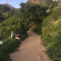

Always a great hike, 4.1 miles. Go as far as you want; you can always stop and turn back. Going up the trail or coming back it's picturesque and a great workout. Right now it is a real treat because you can hear the creek water running and bubbling over the rocks at least half of the way up. You will see lots of green and some flowers right now as well. Have good hiking shoes you do have to cross the creek a few times and the rocks can be slippery. If you go all the way to top the view if Santa Barbara is outstanding. Today we were pressed for time to beat the dark and went around 2 miles up and turned back. A little to many roots and rocks for me to hike this trail in the dark. Starting early in morning is best. See you on the trails
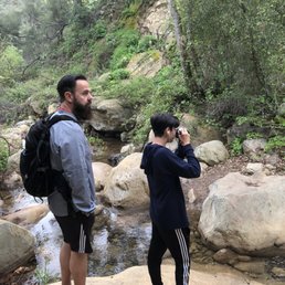

It was my first time hiking in the Santa Barbara area and I really liked this hike. I think it could have been a 5 start hike if I had hiked it on a clear day. Parking- we easily found parking along the side of the road on the right side near the trailhead...which is on the left side of the road Trail- the sign at the start states that the trail is 4.2 miles with 641 ft of elevation gain...not sure what that is based on, but if you are like me and wish to take this trail to Inspiration Point and back it was 7.1 miles for me with an elevation gain of 1,600 ft...so quite a bit of difference there; the trail is easy to follow and the first 1.5 goes north and sticks close to the creek and the water was running with some recent rain; the trail then leaves the trees and heads in a NE direction through a more open sort of grassland area and you will cross a road and some private property nearby and then the incline kicks in for the final mile or so with some switchbacks up to Inspiration Point...which I didn't see any signs but I had my All Trails app to verify we had made it there and there were some other hikers there already but sadly there was no view to enjoy since it was an extremely overcast and foggy morning (4/2/18) and visibility was maybe 200 yards so there was no view of the ocean or island sadly; the hike was green, with the sound of running water for most of the time, and great views of the mountains to the northeast...I just wished we could have seen the ocean...FYI dogs are allowed on this trail off leash which doesn't bother me but might bother some *the second half of the hike we really worked up a sweat not only because it was steeper but it was very humid and there was a light mist/drizzle Of course bring plenty of water and hiking shoes or shoes with good traction, trekking poles are not needed for this hike. Plan on this hike taking about 3-4 hours. I would rate this as moderately difficult.


My hiking partner and I hiked the Jesusita Trail to Inspiration Point. It was a Friday about 11:00 a.m. Finding the trail head was fairly easy, following the trail was fairly easy once you got into it, but we did get off the path a few times and had to ask some other hikers. Even though the trail to inspiration point via Jususita Trail is about 7 miles up and back it seemed a lot longer. A lot of going back and forth to reach the top. We must of only passed a handfull people each time concerned that we had enough water. When you hit the ending of the Jususita trail it is like what reviews say, you go through a private property gate and continue to Inspiration Point. Jususita Trail is definitely a hike worth doing. The day we went, hardly any other hikers were to be seen, the hikers we saw had dogs but not bothersome as some reviewers say. No mountain bikers at all during our entire hike. Do bring wear proper shoes, and bring water.


Multiple ways to get up here. It gets hot, so bring water and snacks, its kind of a long hike, with mixed open/shade, and lots of switchbacks with uneven ground and quasi-steep grade. *Someone should really make a zipline happen, that shoots back to Santa Barbara. Refresher on trail etiquette: http://blog.rei.com/hike/trail-etiquette-who-has-the-right-of-way/


Partly shaded trail (key in this heatwave) with several different ecosystems along the way. Nice ascent and what should be a great payoff at the top with ocean views, however not always a guarantee with smog/cloudcover. Alas, the view did not come out for us, but we did have a great time and great workout on the way to the top. Good for dog-walkers and beginner hikers seeking a 3-4 hour hike. My main complaint is the trailhead and path weren't that well marked and there are several offshoot paths that fooled us in the first 2 miles and had us taking several unanticipated detours and wandering onto private property. It is nice though that one of the farms it tramps through has decided to provide a little shade and water to those who wander. Drought is clearly present here too - no sign of a creek or stream at all in early September.


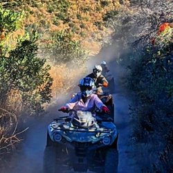
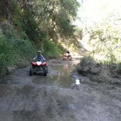
I just discovered this trail last year. I love hiking here. The trail follows the creek most of the way and is pretty secluded once you get far enough back. The first mile or so of the trail is relatively flat and easy to hike. The trail meets up with a paved road after a bit and cuts through someone's ranch before heading uphill. The majority of the trail is shaded until you meet up with a dirt/gravel utility road just before Inspiration Point. This trail is much less crowded than Cold Springs (my favorite) so it makes for a nice alternative. A little way into the trail is a fork that is the beginning of the Arroyo Burro trail. I usually stick to the Jesusita Trail, I think it's more fun. Beware of the large number of mountain bikers on this one.


This is a local well kept trail! Once we got closer to "Inspiration Point", we were definitely feeling the burn having passed all the switch backs. There is enough shade in the beginning of the trail, but towards the end, it can be treacherous. Be sure to stay hydrated and be prepared for this to take about 4-5 hours. Happy Trails!


The hike is easy the first half. Some small inclines but nothing hard. You pass by an avocado farm, grass field and a stream. Then you enter a nice stream which supports a cool wooded forest. Finally, you get to the private property and this is where the fun moderate second part begins. Make sure to fill your bottle. As you go in an s- shaped trail up, you will have plenty of opportunities to see the coast line. Unfortunately my girlfriend and I, were only able to reach the narrow trail before turning back because sunset was coming soon. Love this trail.


4 months ago


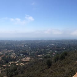
We hiked from the trailhead just north of the Cater Water Treatment Plant up to Inspiration Point and back. Total mileage was about 7.4 miles, and it was a great hike. A good amount of trees and shade. The trail was very pleasant on the eyes most of the way, and you start to see the views of the city and ocean on some of the switchbacks at 2.5mi and 3mi. The turn around point is Inspiration Point, and what a great place to have that sandwich you packed with you: Inspiration Point has expensive views, and the area is nice and flat. We got two hikes in, while in SB; this one and Romero Canyon. We both greatly preferred Jesusita (pronounced "Hay Sue See Ta" ) over Romero Canyon. read more


Jesusita Trail is a solid hike, about 3-4 miles round trip up to Inspiration Point depending on where you start. It's a good enough distance mile wise for beginners & enough of an incline climb for seasoned hikers to get a good workout depending on how hard they push it. We started our hike a little on the late side around 11am during the weekend so we had to park on the side of the road about a half mile from where the road to the trail starts. The start of this trail also leads to the Tunnel Trail, for the Jesusita Route you'll want to stay to the left once the concrete road ends about a half mile into the hike. There are a few other directions the trail leads to, we took it up to inspiration point, I'll continue the experience of this hike with my review of that site next. read more


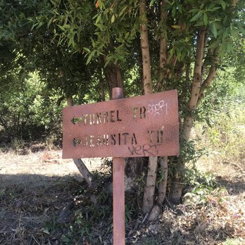


If you're looking for an easy hike but one that still gives you a good workout and has your legs feeling sore the next day, then you must check out Jesusita Trail. Apparently this trail takes you as far up to Inspiration Point if you want to make it more challenging but we didn't venture that far. Right now is the time to go since we've had so much rain this year; it's brought out so many beautiful colorful flowers. I haven't seen so much green in our mountains in over a decade! Our creeks have running water again, and the sound of it is so peaceful. It's the simple things like this that make me feel very blessed to live in such a beautiful place. Directions are simple, just head towards the mountains on San Roque Rd. until you see the Cater water treatment plant. If you get there early enough parking will be easy. This hike is 7 miles round trip, and a little steep at times with some rocky trails. I don't have hiking shoes yet but I was still comfortable wearing my running shoes, but if I hiked up to Inspiration Point then that definitely requires hiking shoes. Most of the trail is shady so you won't be exposed for long periods of time if your hiking on a clear warm day. Bring plenty of water, snacks, sunscreen, and other hiking essentials to get you through. There is one picnic table in the midst of the trail for those that wish to take a break and have a bite to eat. On our hike we came across a lot of dogs so this is a very dog friendly hike. They especially love jumping into the creeks just like little kids. It was great to see how happy they were splashing in the water. Some of the creeks require crossing the water to get back on the path so be prepared to use your balancing skills while using the rocks to get across. Overall a must do hike for those that are looking for a fun outdoor adventure! Looking forward to going back soon to trek up Inspiration Point. read more


6 years ago
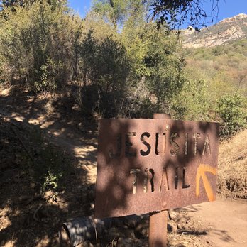
This trail was nice. Some good incline but nothing too crazy. Follow the trail because there are some private property that could mislead you in the wrong direction. read more



7 years ago
An A1 hiking trail- picturesque views and clear trail markings along the way apart from where it veers off to become Inspiration Point. Good thing there was service up there otherwise we wouldn't have known we reached the peak! - Parking was simple. Near the water plant facility, there was a small lot right next to the trailhead, but be careful of the raised edge if your car is low to the floor! You can also park across the street in the dirt. - Be prepared for rocks, tree roots, puddles, small stream crossings, elevation, and inclines! There was also some poison oak along the trail so be sure to wear some high socks. Bring plenty of water! - 3-4 hour round trip - Everyone was really friendly (bikers, dogs and dog walkers) read more


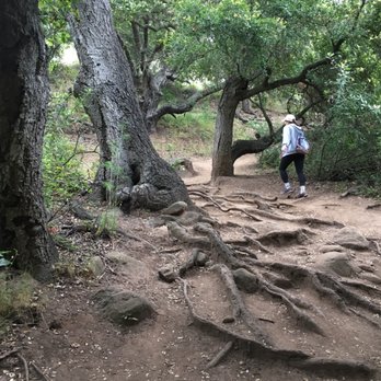


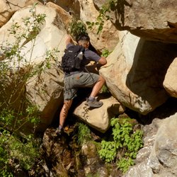
Always a great hike, 4.1 miles. Go as far as you want; you can always stop and turn back. Going up the trail or coming back it's picturesque and a great workout. Right now it is a real treat because you can hear the creek water running and bubbling over the rocks at least half of the way up. You will see lots of green and some flowers right now as well. Have good hiking shoes you do have to cross the creek a few times and the rocks can be slippery. If you go all the way to top the view if Santa Barbara is outstanding. Today we were pressed for time to beat the dark and went around 2 miles up and turned back. A little to many roots and rocks for me to hike this trail in the dark. Starting early in morning is best. See you on the trails read more
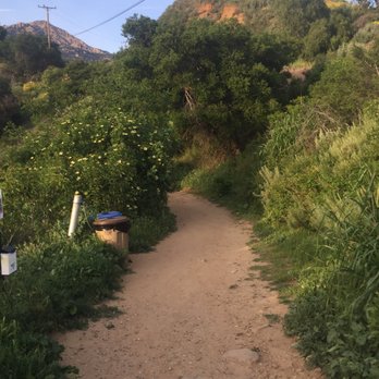


It was my first time hiking in the Santa Barbara area and I really liked this hike. I think it could have been a 5 start hike if I had hiked it on a clear day. Parking- we easily found parking along the side of the road on the right side near the trailhead...which is on the left side of the road Trail- the sign at the start states that the trail is 4.2 miles with 641 ft of elevation gain...not sure what that is based on, but if you are like me and wish to take this trail to Inspiration Point and back it was 7.1 miles for me with an elevation gain of 1,600 ft...so quite a bit of difference there; the trail is easy to follow and the first 1.5 goes north and sticks close to the creek and the water was running with some recent rain; the trail then leaves the trees and heads in a NE direction through a more open sort of grassland area and you will cross a road and some private property nearby and then the incline kicks in for the final mile or so with some switchbacks up to Inspiration Point...which I didn't see any signs but I had my All Trails app to verify we had made it there and there were some other hikers there already but sadly there was no view to enjoy since it was an extremely overcast and foggy morning (4/2/18) and visibility was maybe 200 yards so there was no view of the ocean or island sadly; the hike was green, with the sound of running water for most of the time, and great views of the mountains to the northeast...I just wished we could have seen the ocean...FYI dogs are allowed on this trail off leash which doesn't bother me but might bother some *the second half of the hike we really worked up a sweat not only because it was steeper but it was very humid and there was a light mist/drizzle Of course bring plenty of water and hiking shoes or shoes with good traction, trekking poles are not needed for this hike. Plan on this hike taking about 3-4 hours. I would rate this as moderately difficult. read more
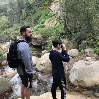


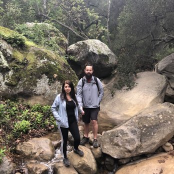

My hiking partner and I hiked the Jesusita Trail to Inspiration Point. It was a Friday about 11:00 a.m. Finding the trail head was fairly easy, following the trail was fairly easy once you got into it, but we did get off the path a few times and had to ask some other hikers. Even though the trail to inspiration point via Jususita Trail is about 7 miles up and back it seemed a lot longer. A lot of going back and forth to reach the top. We must of only passed a handfull people each time concerned that we had enough water. When you hit the ending of the Jususita trail it is like what reviews say, you go through a private property gate and continue to Inspiration Point. Jususita Trail is definitely a hike worth doing. The day we went, hardly any other hikers were to be seen, the hikers we saw had dogs but not bothersome as some reviewers say. No mountain bikers at all during our entire hike. Do bring wear proper shoes, and bring water. read more

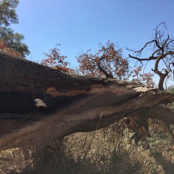


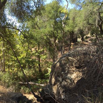


Multiple ways to get up here. It gets hot, so bring water and snacks, its kind of a long hike, with mixed open/shade, and lots of switchbacks with uneven ground and quasi-steep grade. *Someone should really make a zipline happen, that shoots back to Santa Barbara. Refresher on trail etiquette: http://blog.rei.com/hike/trail-etiquette-who-has-the-right-of-way/ read more


11 years ago
Partly shaded trail (key in this heatwave) with several different ecosystems along the way. Nice ascent and what should be a great payoff at the top with ocean views, however not always a guarantee with smog/cloudcover. Alas, the view did not come out for us, but we did have a great time and great workout on the way to the top. Good for dog-walkers and beginner hikers seeking a 3-4 hour hike. My main complaint is the trailhead and path weren't that well marked and there are several offshoot paths that fooled us in the first 2 miles and had us taking several unanticipated detours and wandering onto private property. It is nice though that one of the farms it tramps through has decided to provide a little shade and water to those who wander. Drought is clearly present here too - no sign of a creek or stream at all in early September. read more


16 years ago
I just discovered this trail last year. I love hiking here. The trail follows the creek most of the way and is pretty secluded once you get far enough back. The first mile or so of the trail is relatively flat and easy to hike. The trail meets up with a paved road after a bit and cuts through someone's ranch before heading uphill. The majority of the trail is shaded until you meet up with a dirt/gravel utility road just before Inspiration Point. This trail is much less crowded than Cold Springs (my favorite) so it makes for a nice alternative. A little way into the trail is a fork that is the beginning of the Arroyo Burro trail. I usually stick to the Jesusita Trail, I think it's more fun. Beware of the large number of mountain bikers on this one. read more


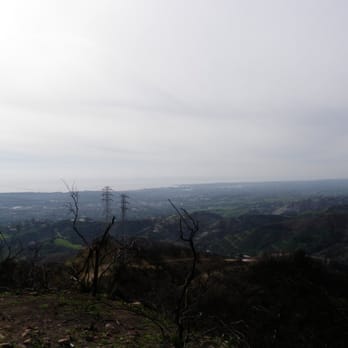


9 years ago

This is a local well kept trail! Once we got closer to "Inspiration Point", we were definitely feeling the burn having passed all the switch backs. There is enough shade in the beginning of the trail, but towards the end, it can be treacherous. Be sure to stay hydrated and be prepared for this to take about 4-5 hours. Happy Trails! read more


15 years ago


12 years ago
The hike is easy the first half. Some small inclines but nothing hard. You pass by an avocado farm, grass field and a stream. Then you enter a nice stream which supports a cool wooded forest. Finally, you get to the private property and this is where the fun moderate second part begins. Make sure to fill your bottle. As you go in an s- shaped trail up, you will have plenty of opportunities to see the coast line. Unfortunately my girlfriend and I, were only able to reach the narrow trail before turning back because sunset was coming soon. Love this trail. read more


11 years ago

11 years ago

13 years ago
10 years ago
It was a relatively easy hike to the halfway point (water fountain) but then it got a little more challenging as it became steeper. Only one wrong turn but was able to meet up with the correct trail. It is a 4 mile hike to the top. Once we got to inspiration point we were so glad to have continued on as it was truly a gorgeous sight. However no markers so it was hard to know how much further since we did not know it was 4 miles up. Glad we went. Loved the trail. read more


12 years ago
10 years ago

More info about Jesusita Trail
Ask the Community - Jesusita Trail
Review Highlights - Jesusita Trail
You might also consider






















Why does Yelp recommend reviews?
1 review that is not currently recommended
The reviews below are not factored into the business's overall star rating.

7 years ago
Jesusita Trail - hiking - Updated May 2026
Best of Santa Barbara
People found Jesusita Trail by searching for…
Hiking Trails in Santa Barbara, California
Easy Hikes in Santa Barbara, California
Cliff Jumping in Santa Barbara, California
Parks in Santa Barbara, California
Flower Fields in Santa Barbara, California
Sunset View in Santa Barbara, California
Off Road Trails in Santa Barbara, California
Running Trails in Santa Barbara, California
Dog Friendly Hiking Trails in Santa Barbara, California
Walking Trails in Santa Barbara, California
Scenic Night View in Santa Barbara, California
Natural Hot Springs in Santa Barbara, California
Picnic Spots in Santa Barbara, California
Off Leash Dog Hiking Trails in Santa Barbara, California
Hikes With Dogs in Santa Barbara, California
Dog Friendly Things to Do in Santa Barbara, California
Lookout Points in Santa Barbara, California
Secluded Spots in Santa Barbara, California
Waterfall Hike in Santa Barbara, California
Beautiful Views in Santa Barbara, California
Trail in Santa Barbara, California
Dog Friendly Parks in Santa Barbara, California
Trending Searches in Santa Barbara, CA
Boat Rental near Jesusita Trail
Botanical Gardens near Jesusita Trail
Bounce House Rentals near Jesusita Trail
Campgrounds near Jesusita Trail
Cliff Jumping near Jesusita Trail
Dog Friendly Things To Do near Jesusita Trail
Flower Fields near Jesusita Trail
Flower Shop near Jesusita Trail
Lakes & Ponds near Jesusita Trail
Movie Theatre near Jesusita Trail
Nurseries & Gardening near Jesusita Trail
Outdoor Activities near Jesusita Trail
Outdoor Furniture Stores near Jesusita Trail
Party Equipment Rentals near Jesusita Trail
Pick Your Own Farms near Jesusita Trail
Picnic Areas near Jesusita Trail
Places To Walk Around near Jesusita Trail
Rainy Day Activities near Jesusita Trail
Rock Quarry near Jesusita Trail
Running Trails near Jesusita Trail
Scenic Drive near Jesusita Trail
Secret Spots near Jesusita Trail
Strawberry Picking near Jesusita Trail
Sunrise View near Jesusita Trail
Swimming Holes near Jesusita Trail
Things To Do On A Rainy Day near Jesusita Trail
Browse Articles
Browse Nearby
BEST of Santa Barbara, California Coffee near Jesusita Trail
BEST of Santa Barbara, California Things to Do near Jesusita Trail
BEST of Santa Barbara, California Restaurants near Jesusita Trail
BEST of Santa Barbara, California Breakfast near Jesusita Trail
BEST of Santa Barbara, California Walking Trails near Jesusita Trail
BEST of Santa Barbara, California Parks near Jesusita Trail
BEST of Santa Barbara, California Caves near Jesusita Trail
BEST of Santa Barbara, California Campgrounds near Jesusita Trail
BEST of Santa Barbara, California Sightseeing near Jesusita Trail
Browse Brands
Related Searches in Santa Barbara, CA
Affordable Kayak Rental Services in Santa Barbara, California
Best Fishing Locations and Guides in Santa Barbara, California
Best Places for Horseback Riding in Santa Barbara, California
Best Waterfalls and Swimming Holes in Santa Barbara, California
Check Out Off Road Trails in Santa Barbara, California
Discover Dog Friendly Trails to Explore in Santa Barbara, California
Discover Kid Friendly Hiking Trails in Santa Barbara, California
Discover Scenic Waterfall Spots in Santa Barbara, California
Discover a Hiking Trail in Santa Barbara, California
Discover the Best Night Hike Trails in Santa Barbara, California
Dog-Friendly Hikes With Dogs in Santa Barbara, California
Enjoy Camping Adventures Around Santa Barbara, California
Enjoy Exciting Mountain Biking Adventures in Santa Barbara, California
Enjoy Kayaking Adventures in Santa Barbara, California
Enjoy Tent Camping Spots Around Santa Barbara, California
Enjoy a Beautiful Waterfall Hike in Santa Barbara, California
Enjoy a Peaceful Nature Walk in Santa Barbara, California
Enjoy the Best Picnic Spots and Ideas in Santa Barbara, California
Enjoy the Best Walking Path in Santa Barbara, California
Enjoy the Best Walking Trails in Santa Barbara, California
Exciting Cliff Jumping Spots in Santa Barbara, California
Explore Beautiful Parks and Green Spaces in Santa Barbara, California
Explore Easy Hikes Perfect for All in Santa Barbara, California
Explore Fun Activities to Do in Santa Barbara, California
Explore Popular Campgrounds Near Santa Barbara, California
Explore the Best Beach Spots in Santa Barbara, California
Explore the Best Swimming Holes Around Santa Barbara, California
Explore the Best Trail Options in Santa Barbara, California
Family Friendly Hiking With Kids in Santa Barbara, California
Find Beautiful Views in Santa Barbara, California
Find Popular Ziplining Spots Around Santa Barbara, California
Find the Best Parks for Picnics in Santa Barbara, California
Find the Best Scenic View Locations in Santa Barbara, California
Great Places to Walk in Santa Barbara, California
Hike the Popular Waterfall Trail in Santa Barbara, California
Hiking Trails With Waterfalls in Santa Barbara, California
Off Leash Dog Hiking Trails in Santa Barbara, California
Plan a Scenic Drive Route Near Santa Barbara, California
Play at a Splash Pad Park in Santa Barbara, California
Popular Outdoor Activities to Try in Santa Barbara, California
Popular Picnic Spots to Visit in Santa Barbara, California
Popular Things to Do in Santa Barbara, California
Safe River Swimming Areas in Santa Barbara, California
Safe and Fun Parks for Kids in Santa Barbara, California
Top Climbing Spots and Gyms in Santa Barbara, California
Top Places for Snorkeling in Santa Barbara, California
Top Playgrounds for Kids to Enjoy in Santa Barbara, California
Top Running Trails to Explore in Santa Barbara, California
Top Swimming Spots and Pools in Santa Barbara, California
Walk Dog Friendly Hiking Trails in Santa Barbara, California


