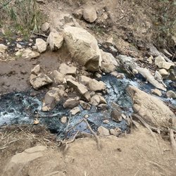
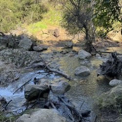
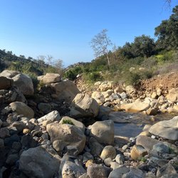
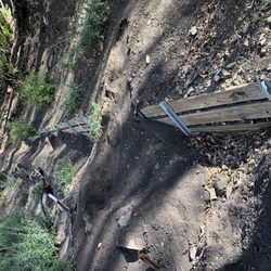
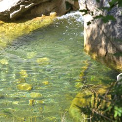
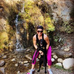
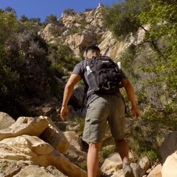
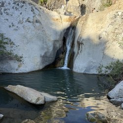
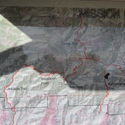
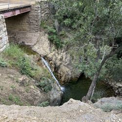
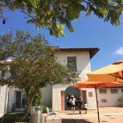
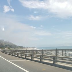
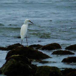
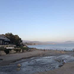
McMenemy Trail Photos


You might also consider
More like McMenemy Trail
Recommended Reviews - McMenemy Trail


More info about McMenemy Trail
East Mountain Rd
Montecito, CA 93150
Directions
(805) 564-5418
Call Now
Hours
Outdoor Amenities
You might also consider


McMenemy Trail - hiking - Updated June 2026
Best of Montecito
People found McMenemy Trail by searching for…
Scenic View in Montecito, California
Hiking Trails With Waterfalls in Montecito, California
Easy Hikes in Montecito, California
Scenic Drive in Montecito, California
Running Trails in Montecito, California
Waterfalls and Swimming Holes in Montecito, California
Waterfalls in Montecito, California
Shaded Hike in Montecito, California
Off Road Trails in Montecito, California
Walking Trails in Montecito, California
Bike Paths in Montecito, California
Running Routes in Montecito, California
Trail in Montecito, California
Photo Spots in Montecito, California
Things to Do in Montecito, California
Creeks in Montecito, California
Hot Yoga in Montecito, California
Beautiful Views in Montecito, California
Walking Path in Montecito, California
View Points in Montecito, California
Things to Do at Night in Montecito, California
Off Leash Dog Hikes in Montecito, California
Trending Searches in Montecito, CA
Bait And Tackle Shop near McMenemy Trail
Black Owned Nail Salons near McMenemy Trail
Boat Rental near McMenemy Trail
Cliff Jumping near McMenemy Trail
Dog Friendly Trails near McMenemy Trail
Fishing Spots near McMenemy Trail
Jet Ski Rental near McMenemy Trail
Kayak Rental near McMenemy Trail
Lakes & Ponds near McMenemy Trail
Outdoor Activities near McMenemy Trail
Pick Your Own Farms near McMenemy Trail
Places To Walk Around near McMenemy Trail
Public Shower near McMenemy Trail
River Swimming near McMenemy Trail
Rock Quarry near McMenemy Trail
Scenic Night View near McMenemy Trail
Scenic Overlook near McMenemy Trail
Secluded Spots near McMenemy Trail
Soccer Store near McMenemy Trail
Splash Pad near McMenemy Trail
Strawberry Picking near McMenemy Trail
Sunrise View near McMenemy Trail
Swimming Holes near McMenemy Trail
Swimming Lakes near McMenemy Trail
Swimming Pools near McMenemy Trail
Watch Sunset near McMenemy Trail
Browse Articles
Browse Nearby
BEST of Montecito, California Restaurants near McMenemy Trail
BEST of Montecito, California Coffee near McMenemy Trail
BEST of Montecito, California Things to Do near McMenemy Trail
BEST of Montecito, California Parks near McMenemy Trail
BEST of Montecito, California Walking Trails near McMenemy Trail
BEST of Montecito, California Breakfast near McMenemy Trail
BEST of Montecito, California Hot Springs near McMenemy Trail
BEST of Montecito, California Campgrounds near McMenemy Trail
BEST of Montecito, California Sightseeing near McMenemy Trail
Browse Brands
Related Searches in Montecito, CA
Affordable Kayak Rental Services in Montecito, California
Best Fishing Locations and Guides in Montecito, California
Best Places for Horseback Riding in Montecito, California
Best Waterfalls and Swimming Holes in Montecito, California
Check Out Off Road Trails in Montecito, California
Discover Dog Friendly Trails to Explore in Montecito, California
Discover Kid Friendly Hiking Trails in Montecito, California
Discover Scenic Waterfall Spots in Montecito, California
Discover a Hiking Trail in Montecito, California
Discover the Best Night Hike Trails in Montecito, California
Discover the Best Running Track in Montecito, California
Dog-Friendly Hikes With Dogs in Montecito, California
Enjoy Camping Adventures Around Montecito, California
Enjoy Exciting Mountain Biking Adventures in Montecito, California
Enjoy Kayaking Adventures in Montecito, California
Enjoy Tent Camping Spots Around Montecito, California
Enjoy a Beautiful Waterfall Hike in Montecito, California
Enjoy the Best Picnic Spots and Ideas in Montecito, California
Enjoy the Best Walking Path in Montecito, California
Enjoy the Best Walking Trails in Montecito, California
Exciting Cliff Jumping Spots in Montecito, California
Explore Beautiful Parks and Green Spaces in Montecito, California
Explore Easy Hikes Perfect for All in Montecito, California
Explore Fun Activities to Do in Montecito, California
Explore Popular Campgrounds Near Montecito, California
Explore Top Dog Parks in Montecito, California Near You
Explore the Best Beach Spots in Montecito, California
Explore the Best Swimming Holes Around Montecito, California
Explore the Best Trail Options in Montecito, California
Family Friendly Hiking With Kids in Montecito, California
Find Beautiful Views in Montecito, California
Find Popular Ziplining Spots Around Montecito, California
Find the Best Parks for Picnics in Montecito, California
Find the Best Scenic View Locations in Montecito, California
Great Places to Walk in Montecito, California
Hiking Trails With Waterfalls in Montecito, California
Off Leash Dog Hiking Trails in Montecito, California
Plan a Scenic Drive Route Near Montecito, California
Popular Outdoor Activities to Try in Montecito, California
Popular Picnic Spots to Visit in Montecito, California
Popular Things to Do in Montecito, California
Safe River Swimming Areas in Montecito, California
Safe and Fun Parks for Kids in Montecito, California
Top Climbing Spots and Gyms in Montecito, California
Top Paddleboarding Activities in Montecito, California
Top Places for Snorkeling in Montecito, California
Top Running Trails to Explore in Montecito, California
Top Swimming Spots and Pools in Montecito, California