Rattlesnake Canyon Photos







You might also consider


More like Rattlesnake Canyon
Recommended Reviews - Rattlesnake Canyon
Start your review...


Reviews With Photos


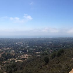
Since I tend to hike a fair amount of long and challenging hikes I tend to forget this 4+ mile out and back trail can be a little challenging too however it's definitely doable. The trail starts near Skofield Park, sometimes you can actually park in the Skofiled lot or right along the road leading to the trail. The trail is fairly easy to follow with some decent elevation gains along the way. While the views might now be as nice as inspiration point there are a few spots where you can get a nice view of the ocean and the surrounding mountains that you're in. The actual trail itself is only about 2.2 miles with 1,600 of elevation gains, where the trail ends you find a sign point in the direction of other trails and roads so you can add on to make your hike in the area around 6-8 plus miles round trip incase you feel the 4.4 miles isn't enough for you. *side not to get to the top of the trail, one you get to the meadow there will be a fork toward the right. Stay left to go up the trail to reach the end of rattlesnake trail.


Great hike with great views! Best part of it all is that it's dog friendly! Parking is terrible. You definitely want to be parked inside the white line to avoid a ticket. If you're ON the line, you're at risk for a ticket. The roads can be a little narrow so I understand the strictness around this. You get a little everything: streaming water, great views of the mountains, lots of shade, tons of picture opportunities, and a meadow of flowers! We didn't quite make it up to the meadows because we were short on time. Great place and easy to find. There's no signal up here so plan accordingly.


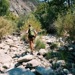
As a non-avid hiker, this was a pretty challenging hike. I've only done inspiration point in town, so I was excited to try a new trail. Parking wasn't too bad on a Saturday late afternoon in the winter. Most of the parking is parallel on the street along a drop off with no curb so be prepared for that. The trail was pretty easy to find and most of it runs along the creek and under the tree cover so the shade was nice. I appreciated the peaceful sounds of the creek along the way. The incline itself was substantially steep. Lots of rocks and uneven footing. I would recommend this hike for someone with at least an average level of physical fitness. It took about an hour to get to the meadow with the fork, and then you can choose to turn back, go left for Tunnel Trail, or right for Gibraltar. Since we heard of the stunning views at the top, we decided to go right. This took about another hour to get to the top and it was much steeper than the first part of the hike. Not to mention the end of this trail connects to an actual road so you COULD drive up if you just wanted the view (we considered taking a Lyft back down since the sun was setting). The view at the top is gorgeous, so worth it for sure, and heading down was much faster. Be careful if you're heading down around sunset. Once it gets dark, it's easy to get lost off the trail under the tree cover. I might do this hike again once I've tried some other local ones.


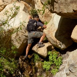
Rattlesnake Canyon was my favorite hike during my trip to Santa Barbara. From the trailhead, the hike is around 3 miles one way for a total of 6 miles round trip. On the way up, you get gorgeous views of the mountains and the ocean below. The incline is pretty mild the majority of the way, but it does get a little steeper as you are approaching the end. There were a few calm creeks to cross over and a few boulders to climb up, but nothing that was too scary or dangerous. When you finally reach the top of Rattlesnake Canyon, you are surrounded by beautiful views everywhere. Despite its name, I saw no rattlesnakes for the course of the entire hike. The hike is pretty family friendly with dogs being allowed on the trail.
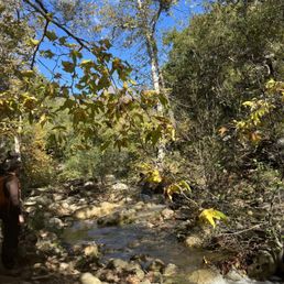
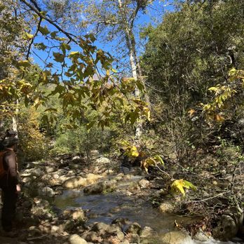
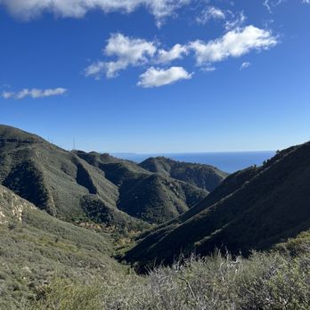
Scenic and beautiful trail! I was able to take advantage of today's random sunny weather sandwiched between two rainstorms. As such, I knew I was in for a wet trail. Wet, check. Muddy, check. Slippery, double check! The trailhead is maybe 100 feet away from the front of Skofield Park in Mission Canyon. It's a peaceful and hidden part on the outskirts of town. While there's no private parking, I was able to find a parallel street spot close by. The trail is mostly shaded and meanders through four separate creek beds. On a typical Santa Barbara day, this would be a non-issue as our city is notoriously dry. However, all beds today were teeming with rushing water. I must admit that it was kind of exciting balancing from stone to stone in an effort to make it across. One of the creeks didn't have equally spaced stepping stones and one of my shoes had to step in the water. The sun dried it out during my trek so I didn't mind all that much. One mistake I made was bringing my AirPods. I was afraid they'd fall out of my ears not only when crossing the creeks, but also during instances where I'd accidentally slide in the muddy terrain. Not only that, but there was pretty much zero Verizon cell reception. The sound of rushing water was peaceful and provided a wonderful natural soundtrack during my trek. The trail itself is wide and mostly clear. As you get past the first half, it gets exponentially steeper and rockier. I didn't make it up to the very top but am pretty sure I made it the majority of the way. My Strava app clocked 5.5 miles round trip. This hike was not strenuous and while there were a good amount of others out there, still felt very secluded and peaceful. I'm no expert hiker and will say that this trail was not intimidating. The only iffy part was the muddy terrain but I don't imagine that this would be the case the majority of the year. Definitely worth checking out if you're looking for a nice way to spend a few hours.


The only way to describe this hike is: magical! I loved every minute of trekking through this trail full of trees, a stream, boulders, and the fresh mountain air. My friends and I stopped by here after being in Santa Barbara for a work event. Since it's such a long drive back to SD, we decided to get in some exercise first. I'm sooo glad we did. Hiking in SD is very much sub-par when you grew up in the PNW. I didn't think Santa Barbara would be much better, but it totally was. Felt like I was in another state lol. I could describe it more, but I'll let you see for yourself in the pics. PS- it's roughly 4 miles round trip, and dog friendly :)


I did a nice 6.8 mile loop going up the shaded side of the canyon in the morning and coming down the partially shaded canyon in the afternoon. October weather was fine, but still a little warm for this walk, so bring at least a liter of water. This walk is unique for the desert plants you will see on the way. Coming from Northern California where there is lots more water, the trail has an interesting collection of plants and variations of the Northern oaks that have adapted to the dry environment. The leaves are smaller and the acorns are also tiny. I met another hiker on my way who hikes the canyon 6 days a week with his three standard poodles. He pointed out a known rattlesnake den that is on the trail. "I often see them out sunning or with their heads peeking out the den when we go by.", he said. So, be alert and you may see one of those reptiles for which the canyon gets its name. My trail friend also showed me how high the water can get during the rainy season in the canyon - VERY high and swift - so if there are rains much of the trail is impassible and dangerous. The trails are well enough marked, but you can use your phone to see exactly where you are using various maps. Reception was outstanding for me! ( Project Fi ). My Runkeeper app kept me updated as to where I was on the trail and how slow I was going. The trail is quite steep at the 5 mile point of my loop. I was glad I took my cane!


Rattlesnake canyon has always been one of my favorite places to visit to observe all kinds of reptiles/amphibians and other wildlife. Newts mate heavily in the larger pools during the spring and it's always a treat to see them at work. The only thing that bothers me is that I often saw people letting their dogs run around in the pools. These pools are essential to the survival of this species, so I hope by seeing this review hikers will keep their dogs on leashes and keep them on the path so that the wildlife will continue to be able to breed without disturbance.


Loved it. Its a gradual moderate steep short hike. Water and Trail shoes as must, loose rock, so good shoe support helps. Wear pants or leggings, some paths are more narrow than others and I noticed there is a lot of Poison Ivy or Oak, not sure which but I do know they are either one. We hiked it when the weather temps were about 80, nice cool breezes throughout the hike. Vegetation and rock formations gorgeous. There are some very nice streams. We only walked to the Meadows due to the limited time we had. We will be back next time to go to the top and spend more time and have a picnic.


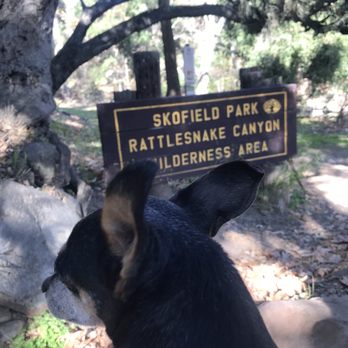
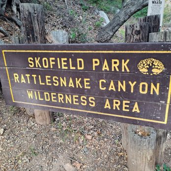
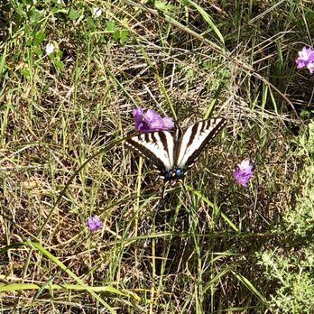
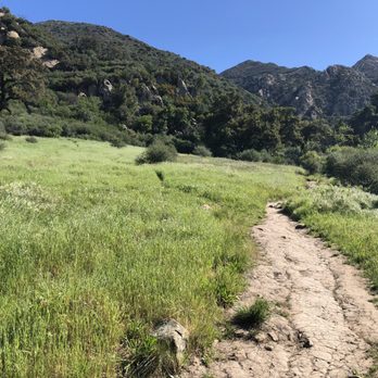
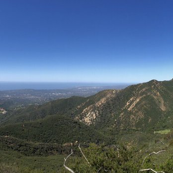
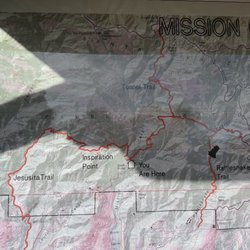
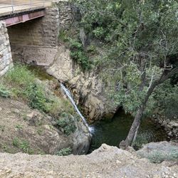
All it takes to witness the natural wonders of Santa Barbara is this one hike. Walk along butterflies who glide past you through the air. Follow the sound of crystal water creeks all while meandering up the mountains. Chew on some sour grass like the local kids do. Hop in a refreshing 'poza' or pool to cool yourself down. Observe paragliders dive from peaks and mountain climbers escalate cliffs. Welcome to Rattlesnake Canyon! Get Here: Drive up Mission Canyon Road and turn onto Las Canoas near the botanical gardens. Follow it until you reach Skofield Park and a stone bridge built by a mason in 1919. You can't miss the sign for Rattlesnake Canyon & Skofield Park that looks like this (https://www.yelp.com/biz_photos/rattlesnake-canyon-mission-canyon?select=UdZte62iVm6ih1c4KNOEhg). Find Your Route: The trail is pretty well paved by humans. When in doubt, follow the creek. The GPS on my phone's Google Maps app was helpful too since the entire trail is mapped out from beginning to end; service is decent (with T-Mobile) but can be sketchy in spots. (See here: https://www.yelp.com/biz_photos/rattlesnake-canyon-mission-canyon?select=8T8_Vwyfa1Hs6-U4gKsLdw) Look for these key points: Remain creekside initially. If you're observant, you may find pieces of the old dam and aqueduct built in the early 1800s by the Chumash along the creek that once brought water to the Mission. Cross over the creek twice. You'll eventually find yourself in a beautiful grassy meadow known as Tin Can Meadow (image here: https://www.yelp.com/biz_photos/rattlesnake-canyon-mission-canyon?select=sHNBj-8JY6EvzZAVE11fVw)--named after squatter William O'Connor who once called this plot of land home until it burned down in the 1925 wildfire. You'll eventually reach a split in the trail with a sign leading to either Tunnel Trail to East Camino Cielo (more difficult) and Gibraltar (less difficult yet still steep). The half mile hike with multiple switchbacks to Gibraltar has a pay off of spectacular downtown Santa Barbara and ocean views, in addition to paragliders and rock climbers. Take some tips: -This is one of the few trails not impacted by the Thomas fire and also very shaded, so get here early to avoid crowds. Thankfully parking is plentiful. -Even though the trail is very shaded, you will still need plenty of cold water to drink along the way. -Be aware of Poison Oak along the route--stay on the trail! -Take your antihistamine allergy pills before starting the trek. Pollen blows every which way. -There is a lot of walking on wet, uneven stones and rocks so wear steady hiking shoes with decent tread. Thanks to the Santa Barbara Independent news for the history tips and lesson!


2 years ago
I brought my mother and little siblings on this hike. They all enjoyed it, and even though we didn't make it all the way up to the top we loved crossing the creeks. My youngest sibling is 4 years old and he kept up! We brought my 13 year old little dog on the hike, she ran up the trail. I'd definitely recommend this hike during early morning or afternoon. There are many gorgeous sights, sounds and smells to savor. There were so many kind people and lovely flowers along the trail. read more


Since I tend to hike a fair amount of long and challenging hikes I tend to forget this 4+ mile out and back trail can be a little challenging too however it's definitely doable. The trail starts near Skofield Park, sometimes you can actually park in the Skofiled lot or right along the road leading to the trail. The trail is fairly easy to follow with some decent elevation gains along the way. While the views might now be as nice as inspiration point there are a few spots where you can get a nice view of the ocean and the surrounding mountains that you're in. The actual trail itself is only about 2.2 miles with 1,600 of elevation gains, where the trail ends you find a sign point in the direction of other trails and roads so you can add on to make your hike in the area around 6-8 plus miles round trip incase you feel the 4.4 miles isn't enough for you. *side not to get to the top of the trail, one you get to the meadow there will be a fork toward the right. Stay left to go up the trail to reach the end of rattlesnake trail. read more


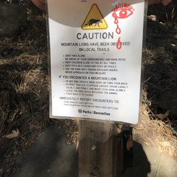


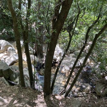


Great hike with great views! Best part of it all is that it's dog friendly! Parking is terrible. You definitely want to be parked inside the white line to avoid a ticket. If you're ON the line, you're at risk for a ticket. The roads can be a little narrow so I understand the strictness around this. You get a little everything: streaming water, great views of the mountains, lots of shade, tons of picture opportunities, and a meadow of flowers! We didn't quite make it up to the meadows because we were short on time. Great place and easy to find. There's no signal up here so plan accordingly. read more



6 years ago
As a non-avid hiker, this was a pretty challenging hike. I've only done inspiration point in town, so I was excited to try a new trail. Parking wasn't too bad on a Saturday late afternoon in the winter. Most of the parking is parallel on the street along a drop off with no curb so be prepared for that. The trail was pretty easy to find and most of it runs along the creek and under the tree cover so the shade was nice. I appreciated the peaceful sounds of the creek along the way. The incline itself was substantially steep. Lots of rocks and uneven footing. I would recommend this hike for someone with at least an average level of physical fitness. It took about an hour to get to the meadow with the fork, and then you can choose to turn back, go left for Tunnel Trail, or right for Gibraltar. Since we heard of the stunning views at the top, we decided to go right. This took about another hour to get to the top and it was much steeper than the first part of the hike. Not to mention the end of this trail connects to an actual road so you COULD drive up if you just wanted the view (we considered taking a Lyft back down since the sun was setting). The view at the top is gorgeous, so worth it for sure, and heading down was much faster. Be careful if you're heading down around sunset. Once it gets dark, it's easy to get lost off the trail under the tree cover. I might do this hike again once I've tried some other local ones. read more


Rattlesnake Canyon was my favorite hike during my trip to Santa Barbara. From the trailhead, the hike is around 3 miles one way for a total of 6 miles round trip. On the way up, you get gorgeous views of the mountains and the ocean below. The incline is pretty mild the majority of the way, but it does get a little steeper as you are approaching the end. There were a few calm creeks to cross over and a few boulders to climb up, but nothing that was too scary or dangerous. When you finally reach the top of Rattlesnake Canyon, you are surrounded by beautiful views everywhere. Despite its name, I saw no rattlesnakes for the course of the entire hike. The hike is pretty family friendly with dogs being allowed on the trail. read more

Scenic and beautiful trail! I was able to take advantage of today's random sunny weather sandwiched between two rainstorms. As such, I knew I was in for a wet trail. Wet, check. Muddy, check. Slippery, double check! The trailhead is maybe 100 feet away from the front of Skofield Park in Mission Canyon. It's a peaceful and hidden part on the outskirts of town. While there's no private parking, I was able to find a parallel street spot close by. The trail is mostly shaded and meanders through four separate creek beds. On a typical Santa Barbara day, this would be a non-issue as our city is notoriously dry. However, all beds today were teeming with rushing water. I must admit that it was kind of exciting balancing from stone to stone in an effort to make it across. One of the creeks didn't have equally spaced stepping stones and one of my shoes had to step in the water. The sun dried it out during my trek so I didn't mind all that much. One mistake I made was bringing my AirPods. I was afraid they'd fall out of my ears not only when crossing the creeks, but also during instances where I'd accidentally slide in the muddy terrain. Not only that, but there was pretty much zero Verizon cell reception. The sound of rushing water was peaceful and provided a wonderful natural soundtrack during my trek. The trail itself is wide and mostly clear. As you get past the first half, it gets exponentially steeper and rockier. I didn't make it up to the very top but am pretty sure I made it the majority of the way. My Strava app clocked 5.5 miles round trip. This hike was not strenuous and while there were a good amount of others out there, still felt very secluded and peaceful. I'm no expert hiker and will say that this trail was not intimidating. The only iffy part was the muddy terrain but I don't imagine that this would be the case the majority of the year. Definitely worth checking out if you're looking for a nice way to spend a few hours. read more


3 years ago

6 years ago
The only way to describe this hike is: magical! I loved every minute of trekking through this trail full of trees, a stream, boulders, and the fresh mountain air. My friends and I stopped by here after being in Santa Barbara for a work event. Since it's such a long drive back to SD, we decided to get in some exercise first. I'm sooo glad we did. Hiking in SD is very much sub-par when you grew up in the PNW. I didn't think Santa Barbara would be much better, but it totally was. Felt like I was in another state lol. I could describe it more, but I'll let you see for yourself in the pics. PS- it's roughly 4 miles round trip, and dog friendly :) read more


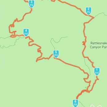
I did a nice 6.8 mile loop going up the shaded side of the canyon in the morning and coming down the partially shaded canyon in the afternoon. October weather was fine, but still a little warm for this walk, so bring at least a liter of water. This walk is unique for the desert plants you will see on the way. Coming from Northern California where there is lots more water, the trail has an interesting collection of plants and variations of the Northern oaks that have adapted to the dry environment. The leaves are smaller and the acorns are also tiny. I met another hiker on my way who hikes the canyon 6 days a week with his three standard poodles. He pointed out a known rattlesnake den that is on the trail. "I often see them out sunning or with their heads peeking out the den when we go by.", he said. So, be alert and you may see one of those reptiles for which the canyon gets its name. My trail friend also showed me how high the water can get during the rainy season in the canyon - VERY high and swift - so if there are rains much of the trail is impassible and dangerous. The trails are well enough marked, but you can use your phone to see exactly where you are using various maps. Reception was outstanding for me! ( Project Fi ). My Runkeeper app kept me updated as to where I was on the trail and how slow I was going. The trail is quite steep at the 5 mile point of my loop. I was glad I took my cane! read more



6 years ago
Rattlesnake canyon has always been one of my favorite places to visit to observe all kinds of reptiles/amphibians and other wildlife. Newts mate heavily in the larger pools during the spring and it's always a treat to see them at work. The only thing that bothers me is that I often saw people letting their dogs run around in the pools. These pools are essential to the survival of this species, so I hope by seeing this review hikers will keep their dogs on leashes and keep them on the path so that the wildlife will continue to be able to breed without disturbance. read more


Loved it. Its a gradual moderate steep short hike. Water and Trail shoes as must, loose rock, so good shoe support helps. Wear pants or leggings, some paths are more narrow than others and I noticed there is a lot of Poison Ivy or Oak, not sure which but I do know they are either one. We hiked it when the weather temps were about 80, nice cool breezes throughout the hike. Vegetation and rock formations gorgeous. There are some very nice streams. We only walked to the Meadows due to the limited time we had. We will be back next time to go to the top and spend more time and have a picnic. read more


7 years ago

All it takes to witness the natural wonders of Santa Barbara is this one hike. Walk along butterflies who glide past you through the air. Follow the sound of crystal water creeks all while meandering up the mountains. Chew on some sour grass like the local kids do. Hop in a refreshing 'poza' or pool to cool yourself down. Observe paragliders dive from peaks and mountain climbers escalate cliffs. Welcome to Rattlesnake Canyon! Get Here: Drive up Mission Canyon Road and turn onto Las Canoas near the botanical gardens. Follow it until you reach Skofield Park and a stone bridge built by a mason in 1919. You can't miss the sign for Rattlesnake Canyon & Skofield Park that looks like this (https://www.yelp.com/biz_photos/rattlesnake-canyon-mission-canyon?select=UdZte62iVm6ih1c4KNOEhg). Find Your Route: The trail is pretty well paved by humans. When in doubt, follow the creek. The GPS on my phone's Google Maps app was helpful too since the entire trail is mapped out from beginning to end; service is decent (with T-Mobile) but can be sketchy in spots. (See here: https://www.yelp.com/biz_photos/rattlesnake-canyon-mission-canyon?select=8T8_Vwyfa1Hs6-U4gKsLdw) Look for these key points: Remain creekside initially. If you're observant, you may find pieces of the old dam and aqueduct built in the early 1800s by the Chumash along the creek that once brought water to the Mission. Cross over the creek twice. You'll eventually find yourself in a beautiful grassy meadow known as Tin Can Meadow (image here: https://www.yelp.com/biz_photos/rattlesnake-canyon-mission-canyon?select=sHNBj-8JY6EvzZAVE11fVw)--named after squatter William O'Connor who once called this plot of land home until it burned down in the 1925 wildfire. You'll eventually reach a split in the trail with a sign leading to either Tunnel Trail to East Camino Cielo (more difficult) and Gibraltar (less difficult yet still steep). The half mile hike with multiple switchbacks to Gibraltar has a pay off of spectacular downtown Santa Barbara and ocean views, in addition to paragliders and rock climbers. Take some tips: -This is one of the few trails not impacted by the Thomas fire and also very shaded, so get here early to avoid crowds. Thankfully parking is plentiful. -Even though the trail is very shaded, you will still need plenty of cold water to drink along the way. -Be aware of Poison Oak along the route--stay on the trail! -Take your antihistamine allergy pills before starting the trek. Pollen blows every which way. -There is a lot of walking on wet, uneven stones and rocks so wear steady hiking shoes with decent tread. Thanks to the Santa Barbara Independent news for the history tips and lesson! read more







8 years ago

12 years ago

9 years ago
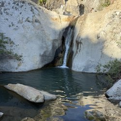
WATER WATER WATER! Thank god for the rain it has blessed our mountains with beautiful waterfalls and wells that u can hear all throughout this trail! It was amazing did a little bit of bouldering here as well. And I saw families taking a swim in the deeper areas. Definitely bringing my son here for an adventure next time! read more


13 years ago

9 years ago

15 years ago
More info about Rattlesnake Canyon
2325 Gibraltar Rd
Santa Barbara, CA 93105
Directions
(805) 564-5418
Call Now
Visit Website
https://sbparksandrec.santabarbaraca.gov
Hours
Indoor Amenities
Outdoor Amenities
Ask the Community - Rattlesnake Canyon
Review Highlights - Rattlesnake Canyon
You might also consider

























Why does Yelp recommend reviews?
2 reviews that are not currently recommended
The reviews below are not factored into the business's overall star rating.

11 years ago

15 years ago
Rattlesnake Canyon - hiking - Updated May 2026
Best of Santa Barbara
People found Rattlesnake Canyon by searching for…
Swimming Holes in Santa Barbara, CA
Hiking Trails With Waterfalls in Santa Barbara, CA
Cliff Jumping in Santa Barbara, CA
Easy Hikes in Santa Barbara, CA
Sunrise View in Santa Barbara, CA
River Swimming in Santa Barbara, CA
Sunset View in Santa Barbara, CA
Flower Fields in Santa Barbara, CA
Scenic Drive in Santa Barbara, CA
Off Road Trails in Santa Barbara, CA
Free Campgrounds in Santa Barbara, CA
Swimming Lakes in Santa Barbara, CA
Secluded Spots in Santa Barbara, CA
Running Trails in Santa Barbara, CA
Beautiful Views in Santa Barbara, CA
Scenic Night View in Santa Barbara, CA
Dog Friendly Hikes in Santa Barbara, CA
Things to Do With Kids in Santa Barbara, CA
Waterfalls in Santa Barbara, CA
Things to Do With Teenagers in Santa Barbara, CA
Trending Searches in Santa Barbara, CA
Boat Rental near Rattlesnake Canyon
Botanical Gardens near Rattlesnake Canyon
Bounce House Rentals near Rattlesnake Canyon
Campgrounds near Rattlesnake Canyon
Cliff Jumping near Rattlesnake Canyon
Dog Friendly Things To Do near Rattlesnake Canyon
Flower Fields near Rattlesnake Canyon
Flower Shop near Rattlesnake Canyon
Lakes & Ponds near Rattlesnake Canyon
Movie Theatre near Rattlesnake Canyon
Nurseries & Gardening near Rattlesnake Canyon
Outdoor Activities near Rattlesnake Canyon
Outdoor Furniture Stores near Rattlesnake Canyon
Party Equipment Rentals near Rattlesnake Canyon
Pedicure near Rattlesnake Canyon
Pick Your Own Farms near Rattlesnake Canyon
Picnic Areas near Rattlesnake Canyon
Places To Walk Around near Rattlesnake Canyon
Rainy Day Activities near Rattlesnake Canyon
Rock Quarry near Rattlesnake Canyon
Running Trails near Rattlesnake Canyon
Scenic Drive near Rattlesnake Canyon
Secret Spots near Rattlesnake Canyon
Strawberry Picking near Rattlesnake Canyon
Sunrise View near Rattlesnake Canyon
Swimming Holes near Rattlesnake Canyon
Things To Do On A Rainy Day near Rattlesnake Canyon
Browse Articles
Browse Nearby
BEST of Santa Barbara, California Things to Do near Rattlesnake Canyon
BEST of Santa Barbara, California Restaurants near Rattlesnake Canyon
BEST of Santa Barbara, California Coffee near Rattlesnake Canyon
BEST of Santa Barbara, California Breakfast near Rattlesnake Canyon
BEST of Santa Barbara, California Horseback Riding near Rattlesnake Canyon
BEST of Santa Barbara, California Shopping near Rattlesnake Canyon
BEST of Santa Barbara, California Hotels near Rattlesnake Canyon
Browse Brands
Related Searches in Santa Barbara, CA
Affordable Kayak Rental Services in Santa Barbara, California
Best Fishing Locations and Guides in Santa Barbara, California
Best Places for Horseback Riding in Santa Barbara, California
Best Waterfalls and Swimming Holes in Santa Barbara, California
Check Out Off Road Trails in Santa Barbara, California
Discover Dog Friendly Trails to Explore in Santa Barbara, California
Discover Kid Friendly Hiking Trails in Santa Barbara, California
Discover Scenic Waterfall Spots in Santa Barbara, California
Discover a Hiking Trail in Santa Barbara, California
Discover the Best Night Hike Trails in Santa Barbara, California
Dog-Friendly Hikes With Dogs in Santa Barbara, California
Enjoy Camping Adventures Around Santa Barbara, California
Enjoy Exciting Mountain Biking Adventures in Santa Barbara, California
Enjoy Kayaking Adventures in Santa Barbara, California
Enjoy Tent Camping Spots Around Santa Barbara, California
Enjoy a Beautiful Waterfall Hike in Santa Barbara, California
Enjoy a Peaceful Nature Walk in Santa Barbara, California
Enjoy the Best Picnic Spots and Ideas in Santa Barbara, California
Enjoy the Best Walking Path in Santa Barbara, California
Enjoy the Best Walking Trails in Santa Barbara, California
Exciting Cliff Jumping Spots in Santa Barbara, California
Explore Beautiful Parks and Green Spaces in Santa Barbara, California
Explore Easy Hikes Perfect for All in Santa Barbara, California
Explore Fun Activities to Do in Santa Barbara, California
Explore Popular Campgrounds Near Santa Barbara, California
Explore the Best Beach Spots in Santa Barbara, California
Explore the Best Swimming Holes Around Santa Barbara, California
Explore the Best Trail Options in Santa Barbara, California
Family Friendly Hiking With Kids in Santa Barbara, California
Find Beautiful Views in Santa Barbara, California
Find Popular Ziplining Spots Around Santa Barbara, California
Find the Best Parks for Picnics in Santa Barbara, California
Find the Best Scenic View Locations in Santa Barbara, California
Great Places to Walk in Santa Barbara, California
Hike the Popular Waterfall Trail in Santa Barbara, California
Hiking Trails With Waterfalls in Santa Barbara, California
Off Leash Dog Hiking Trails in Santa Barbara, California
Plan a Scenic Drive Route Near Santa Barbara, California
Play at a Splash Pad Park in Santa Barbara, California
Popular Outdoor Activities to Try in Santa Barbara, California
Popular Picnic Spots to Visit in Santa Barbara, California
Popular Things to Do in Santa Barbara, California
Safe River Swimming Areas in Santa Barbara, California
Safe and Fun Parks for Kids in Santa Barbara, California
Top Climbing Spots and Gyms in Santa Barbara, California
Top Places for Snorkeling in Santa Barbara, California
Top Playgrounds for Kids to Enjoy in Santa Barbara, California
Top Running Trails to Explore in Santa Barbara, California
Top Swimming Spots and Pools in Santa Barbara, California
Walk Dog Friendly Hiking Trails in Santa Barbara, California


