Snow Mountain Ranch Photos


 - Hiking Near Me - Cowiche, Washington")

More like Snow Mountain Ranch
Recommended Reviews - Snow Mountain Ranch
Start your review...

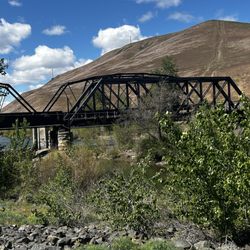
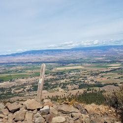
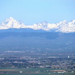
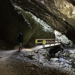
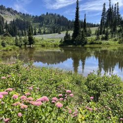
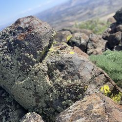
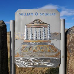
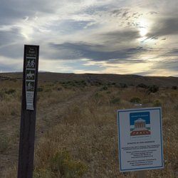
Snow Mountain Ranch is the next in a long list of hiking spots in the area that we have been excited to check out! Just sits on the backside of the rocky top trail system and actually connects up at the top of the hill. It is accessed via Cowiche / Highland and has a very large parking lot from which you start. There are probably a dozen or so trails that range from small short lives all the way to longer hikes that take you up the hill and connect you with the William O Douglas trail system of Rocky Top. We took one of the intermediate trails that took us up a little over a mile and then came back after the kiddos had decided that they had had enough for the afternoon. Along the way, the trails were nicely groomed, they had fun stuff to look at including a number of bathtubs for whatever reason, and lots of rocks, sticks, bushes and dirt to playing. For the three little dudes, all under seven, it was a good afternoon! The trails are well marked and even the longer, steeper trails are not bad. I judge this largely by the fact that I was able to carry a three-year-old and a five-year-old (separately) on my shoulders whilst going down and not having a lot of trouble. We are very excited to continue to explore this area and at some point in the near future want to do the hike up and over, it looks to be about 6 miles. Up top are some spectacular views of Mount Adams and most of the Yakima Valley. If you've got the time, it's well worth the trip! read more


6 years ago
Finally hiked this trail! It has been on my list for a long time and I'm so glad we did it. My husband and I started around 10am and did the whole trail (roughly 6 miles) in a couple hours. We took a lunch and ate at the top and enjoyed the views of mnt Adams, Rainier and the valley. It is a pretty steady incline to the top...I would say this is not for beginners or younger children. Did not see any snakes. Would do this hike again! read more


More info about Snow Mountain Ranch
2648 Cowiche Mill Rd
Cowiche, WA 98923
Directions
Hours
Outdoor Amenities


Snow Mountain Ranch - hiking - Updated July 2026
Best of Cowiche
People found Snow Mountain Ranch by searching for…
Scenic View in Cowiche, Washington
Hiking Trails in Cowiche, Washington
View Points in Cowiche, Washington
Waterfalls in Cowiche, Washington
Walking Trails in Cowiche, Washington
Things to Do With Kids in Cowiche, Washington
Things to Do at Night in Cowiche, Washington
Running Trails in Cowiche, Washington
Photo Spots in Cowiche, Washington
Easy Hikes in Cowiche, Washington
Fun Things to Do in Cowiche, Washington
Free Things to Do in Cowiche, Washington
Swimming Holes in Cowiche, Washington
Sunset View in Cowiche, Washington
River Swimming in Cowiche, Washington
Water Parks for Kids in Cowiche, Washington
Off Leash Dog Hikes in Cowiche, Washington
Places to Run in Cowiche, Washington
Beautiful Views in Cowiche, Washington
Fishing Spots in Cowiche, Washington
Tennis Courts in Cowiche, Washington