Tipsoo Lake Photos


More like Tipsoo Lake
Recommended Reviews - Tipsoo Lake
Start your review...

Reviews With Photos

Helllo 2019 wild flower season!! Always a beautiful place to go any time of year (well, when it's not covered in snow :-p), but it's lovely to have a splash of colour. This is an easy trail right off of 410. Pretty small parking lot, lookout point, and some parallel street parking further up. The trail that goes directly around the lake is about 1 mile and very flat - perfect for grandma! In fact, mine used to paint here while grandpa did some hiking. This area, once you've enjoyed the little trip around the lake, meets up with both the PCT and Naches Peak Loop. If you go across the highway you'll find Little Tipsoo Lake. This is somewhere people definitely don't come over to much. What limited trail that's there is overgrowing nicely - which makes this place a great "sit and think" place. PS - if you're in this area for the Naches Peak Loop -- walk clockwise for the best views!!


Good and easy to find place. Pretty much parking spots. There are 2 toilets on the parking area. But one of them has broken door... We've been here 1st June and there are lot of melted snow. Lake also was covered by ice and snow in some places. We've made a hike around the lake and drove to the Yakima. We've spent great day there!


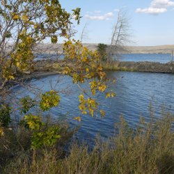
This lake has an amazing view of Mount Rainier if you are not looking to go directly to the mountain. We came during the end of July (around 4PM) which is the best time to see all the beautiful wildflowers. It was really hot and there's so many bugs but this area is such a pretty place to take photos. We did leave with at least five mosquito bites so make sure to come prepared with bug spray and sunscreen! This is also right across from Naches Loop Trailhead and has parking as well; can only get down to the lake by staircase so this may be a struggle for those who are disabled. The view of the mountain is so pretty and totally worth it to stop by. The trail is also not hard so very kid friendly! read more


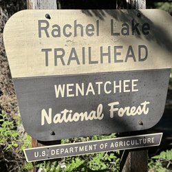
Tipsoo Lake is a beautiful location full of wildflowers, evergreens, various hiking trails, and a gorgeous view of Mount Rainier on a clear day. The day we went it was really foggy outside early in the day and it was just starting to clear when we were ready to leave. But check out those Rainier photos from other hikers who were fortunate to have visited on a bright day. Spectacular! Tipsoo Lake is quite small and has a walking path around it that is flat and easy to walk for hikers of all abilities. Along that path you can find a variety of flowers (including those cool Lorax kind) as well as paths leading to other trails such as Naches Peak Loop. If you head up that trail a bit from the lake, you'll come to a bridge that goes over highway 410 and that can be a nice viewing point for kids. There are a small number of parking spaces (10 to 12) in a tiny lot right off of the freeway and you may be fortunate enough to snag a spot if you arrive early. Friendly reminder to mind the signs and stay on the trail to protect the surrounding land and flowers. read more


Helllo 2019 wild flower season!! Always a beautiful place to go any time of year (well, when it's not covered in snow :-p), but it's lovely to have a splash of colour. This is an easy trail right off of 410. Pretty small parking lot, lookout point, and some parallel street parking further up. The trail that goes directly around the lake is about 1 mile and very flat - perfect for grandma! In fact, mine used to paint here while grandpa did some hiking. This area, once you've enjoyed the little trip around the lake, meets up with both the PCT and Naches Peak Loop. If you go across the highway you'll find Little Tipsoo Lake. This is somewhere people definitely don't come over to much. What limited trail that's there is overgrowing nicely - which makes this place a great "sit and think" place. PS - if you're in this area for the Naches Peak Loop -- walk clockwise for the best views!! read more


7 years ago
Good and easy to find place. Pretty much parking spots. There are 2 toilets on the parking area. But one of them has broken door... We've been here 1st June and there are lot of melted snow. Lake also was covered by ice and snow in some places. We've made a hike around the lake and drove to the Yakima. We've spent great day there! read more


5 years ago
Beautiful stop while riding through to eastern Washington. Along hi-way 410, you can see it fr the Parking spot just before you pass into the Wenatchee forest fr Mount Rainer. read more

7 years ago
An easy hike around the lake. Lots of wildflowers in bloom. Nearby parking and other trail access is close by. No swimming or fishing at this lake but it is a nice and clear. A great view of all the surrounding mountains. read more


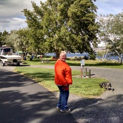
Awesome area to hike and explore! Easy parking and restrooms are here and you can hop on the Naches Peak Loop and the PCT. There are signs and info about the trails so you know what to expect. It started to get crowded in the early afternoon so I suggest getting here in the morning but there is ample parking but still I can see it filling up later in the day. Super easy to find, it's right off of hwy 410 past Crystal MT. Took us about 45 mins once you get to Enumclaw so nothing crazy. Also no charge to park in this area! No pass required it was so nice. read more


More info about Tipsoo Lake
Ask the Community - Tipsoo Lake


Tipsoo Lake - hiking - Updated July 2026
Best of Naches
People found Tipsoo Lake by searching for…
Swimming Lakes in Naches, Washington
Hiking Trails in Naches, Washington
Photo Spots in Naches, Washington
Things to Do in Naches, Washington
View Points in Naches, Washington
Easy Hikes in Naches, Washington
Lookout Points in Naches, Washington
Sunrise View in Naches, Washington
Fishing Lake in Naches, Washington
Sunrise Hike in Naches, Washington
Off Road Trails in Naches, Washington
Waterfall Hike in Naches, Washington
Attractions in Naches, Washington
Scenic Overlook in Naches, Washington
Secret Spots in Naches, Washington
Tent Camping in Naches, Washington
Scenic Views in Naches, Washington
Running Trails in Naches, Washington
Places to Take Pictures in Naches, Washington
Walking Trails in Naches, Washington
Trending Searches in Naches, WA
Blueberry Picking near Tipsoo Lake
Cliff Jumping near Tipsoo Lake
Dog Friendly Trails near Tipsoo Lake
Fishing Spots near Tipsoo Lake
Peach Picking near Tipsoo Lake
Places To Swim near Tipsoo Lake
Public Shower near Tipsoo Lake
River Swimming near Tipsoo Lake
Strawberry Picking near Tipsoo Lake
Swimming Holes near Tipsoo Lake
Browse Articles
Browse Nearby
BEST of Naches, Washington Restaurants near Tipsoo Lake
BEST of Naches, Washington Horseback Riding near Tipsoo Lake
BEST of Naches, Washington Coffee near Tipsoo Lake
BEST of Naches, Washington Breakfast near Tipsoo Lake
BEST of Naches, Washington Shopping near Tipsoo Lake
Browse Brands
Related Searches in Naches, WA
Best Fishing Locations and Guides in Naches, Washington
Best Nature Trails for Hiking in Naches, Washington
Best Off Leash Dog Parks in Naches, Washington
Best Parks for Parties and Events in Naches, Washington
Best Places for Horseback Riding in Naches, Washington
Best Sledding Spots and Fun in Naches, Washington
Best Spots for Star Gazing in Naches, Washington
Best Water Parks for Kids in Naches, Washington
Check Out Off Road Trails in Naches, Washington
Discover Baseball Fields Around Naches, Washington
Discover Popular Bike Trails in Naches, Washington
Discover Popular Photo Spots in Naches, Washington
Discover Top Nature Parks to Visit in Naches, Washington
Discover the Best Running Track in Naches, Washington
Effective Stairs Workout Spots in Naches, Washington
Enjoy Camping Adventures Around Naches, Washington
Enjoy Scenic Night View Experiences in Naches, Washington
Enjoy Tent Camping Spots Around Naches, Washington
Enjoy the Best Night View Spots in Naches, Washington
Enjoy the Best Picnic Spots and Ideas in Naches, Washington
Enjoy the Best Walking Trails in Naches, Washington
Exciting Cliff Jumping Spots in Naches, Washington
Explore Beautiful Parks and Green Spaces in Naches, Washington
Explore Easy Hikes Perfect for All in Naches, Washington
Explore Popular Campgrounds Near Naches, Washington
Explore Popular RV Parks Around Naches, Washington
Explore Popular Scenic Overlook Points in Naches, Washington
Explore Scenic Lakes to Visit in Naches, Washington
Explore Secret Spots Worth Visiting in Naches, Washington
Explore Top Dog Parks in Naches, Washington Near You
Explore the Best Swimming Holes Around Naches, Washington
Explore the Best Trail Options in Naches, Washington
Family Friendly Hiking With Kids in Naches, Washington
Find Cozy Camping Cabins in Naches, Washington
Find Fun Kids Activities Outdoor in Naches, Washington
Find Parks and Recreation Activities in Naches, Washington
Find Top Dog Swimming Spots in Naches, Washington
Find the Best Playgrounds to Visit in Naches, Washington
Find the Best Scenic View Locations in Naches, Washington
Find the Best Swimming Pools in Naches, Washington Today
Hiking Trails With Waterfalls in Naches, Washington
Perfect Spots to Watch Sunset in Naches, Washington
Plan Nature Center Visits in Naches, Washington
Popular Fishing Spots to Explore in Naches, Washington
Popular Kids Activities in Naches, Washington
Popular Places to Take Pictures in Naches, Washington
Popular Things to Do in Naches, Washington
Relax at Natural Hot Springs Near Naches, Washington