Cancel

    Open app

    Search

    Box Canyon Overlook

    4.3 (3 reviews)

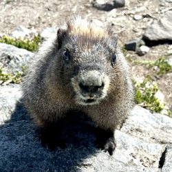
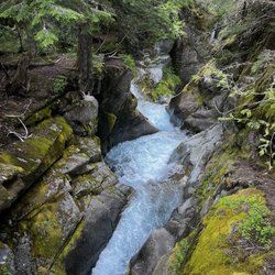
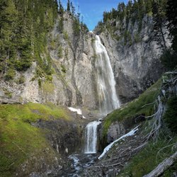
    Box Canyon Overlook Photos
    You might also consider

    Recommended Reviews - Box Canyon Overlook

    Your trust is our priority, so businesses can't pay to alter or remove their reviews. Learn more about reviews.
    Yelp app icon
    Browse more easily on the app
    Review Feed Illustration

    1 year ago

    Helpful 6
    Thanks 2
    Love this 8
    Oh no 0

    2 years ago

    Helpful 0
    Thanks 0
    Love this 1
    Oh no 0

    8 years ago

    Helpful 8
    Thanks 1
    Love this 7
    Oh no 0

    Verify this business for free

    Get access to customer & competitor insights.

    Verify this business

    Snowgrass Flat Trail

    Snowgrass Flat Trail

    5.0(2 reviews)
    21.2 mi

    Amazing backpacking weekend here. Lots of campsites, but the wildflowers were outstanding as…read morewell!! Gorgeous place and the weather was just perfect! Goat Lake was amazing to get to as well. This place has amazing views too. The mosquitos were definitely around, but manageable. Bring bug wipes though!! Highly recommend this place!

    CGI can't create THIS. Poets are inspired by THIS…read more Painter's canvases are made for THIS. Singers muse about THIS. My legs gravitate to THIS. THIS.....is Snowgrass Flat in the Goat Rocks Wilderness. When it comes to hiking the Cascades, sadly, I'm a creature of habit. I have favorite hikes which I rinse and repeat annually. This is a bad thing when you have miles and miles of lands full of the most beautiful color, scenery, experiences to be had. Snowgrass Flat is now added to my repetoire of go-to places for Cascadian hikes. With a trailhead located south of Packwood, one must venture for about 45min along a dusty gravel road (it's about a 15-17mile trek; while in your car, you will feel like a sock in a washing machine due to the washboarded road). And I'm not kidding about the dust, it's a dustgasm. But it's all worth it. The trailhead was fairly filled with many a hiker's vehicle (but on the trail, we didn't see too many). The trail starts with a quickstep along the side of a pine-filled mountain---every once in a while you'll be afforded views of Mt. Adams to your right. There is water on this trail, and you may cover a bog or two, streams, and at mile 1-2 a torrent which is handled by a nicely-built bridge. Due to the water, there are some boggy-ness, and with this there can be some mosquitoes, but we didn't come across much on our way up (perhaps the bug spray helped...or maybe I just wasn't tasty enough). If you want a workout, you will have one. It doesn't slap you upside the head, but it's a nice, slow, long burn---so it's nice. After about 2-3hrs (around Mile 5-6 for us), the horizon starts to open up and you feel like you are reaching the top. This is the Flat That Is Snowgrass. You are in meadows galore. For some reason the sky is bluer, the waters are clearer, the craggy snow-covered peaks are breath-takers....it's everything a hike should be. There are many options for camping. Here you can see St. Helens in hazy distance, and Mt. Adams is there to taunt. Other sights are Goat Lake to the north---it's captured in what appears to be an eternal winter. The biggest feature would have to be Old Snowy and his mountain homies. If you have the time, my friends told me that Goat Lake and Old Snowy are excellent additional trips one can take from Snowgrass Flat. **mental note made** I can't wait to come here again. This is why I love Washington state. This is why I hike. THIS is brought to you by the YELP-1200.

    Photos
    Snowgrass Flat Trail - Stream In Snowgrass

    Stream In Snowgrass

    Snowgrass Flat Trail
    Snowgrass Flat Trail - Looking Toward Old Snowy

    See all

    Looking Toward Old Snowy

    Reflection Lakes Loop Hike - Great reflection of mt Reinier

    Reflection Lakes Loop Hike

    4.7(9 reviews)
    4.2 mi

    This is a great hike for photographers if you want to get both a nice view of Mount Rainier and of…read moreits reflection in the lake. The best time to come here is on a clear day and when the water is calm. You get stunning views of the alpine lakes and of the mountain peaks in the background. I made two stops here during my trip because the wind had caused ripples on the water and I wasn't able to get a clear shot with my camera. The reflection was much more clearer the second stop. Reflection Lakes is located off of Stevens Canyon Road just south of Paradise in Mount Rainier National Park. After parking, head down to the lake to find the hiking trail. The parking lot can fill up during the busier part of the day. The Lakes Trail is a three mile loop trail that goes around the lake and starts from either end of the parking lot. Wildflowers border the lakes in summer which adds some nice color to your photographs. The park asks that you stay on the trail to protect the meadow around the lake. Pinnacle Peak Trail is another popular trail that starts south of the Reflection Lakes parking lot. I really enjoyed making a stop here. It is one of the best places to get an iconic picture of Mount Rainier. There is no swimming, fishing, or boating in Reflection Lakes. But nearby Louise Lake allows wading and fishing. You can only visit Reflection Lakes in the summer as Stevens Canyon Road closes up during the winter season.

    Made a quick stop here to see the reflection of Mt Rainier…read more Heard it's supposed to be beautiful at sunrise, but it was rainy during our visit so we forewent the early morning visit. Came around 9am-ish on a cloudy day and were able to see a decent reflection - can only imagine how beautiful it would be on a nice, sunny day. We did a bit of the walk around the lakes, and while the walk was nice, the best views come from the overlooks where you park. Definitely worth a quick stop while driving by. If the weather is good, consider sunrise - you might be in for a wonderful surprise.

    Photos
    Reflection Lakes Loop Hike - 9/21/24

    9/21/24

    Reflection Lakes Loop Hike
    Reflection Lakes Loop Hike - 9/21/24

    See all

    9/21/24

    Shoe Lake Hike Via Pacific Crest Trail - Old Snowy

    Shoe Lake Hike Via Pacific Crest Trail

    5.0(1 review)
    14.8 mi

    Had been stalking the White Pass/Shoe Lake area for windows of good weather the last month or two…read more(every weekend, it would conveniently be rainy/snowy up there!). Recently I saw the forecast open up for some sunny conditions---during the work week. I decided to make the trip---isn't that what vacation days are for?? I drove up to White Pass, from the east side, with clear blue skies the entire way. I parked on the highway (across from the Kracker Barrel at the base of the White Pass slopes). I slapped on my 35lb pack, grabbed my dogs, and we scrambled up the slopes. I like going this route (vs. starting at the Trailhead) because there are nice views and it cuts down on distance. It's a bear of a workout though! Once on the PCT, it's a nice, fairly flat, and scenic hike---y'know, the usual. Near the new ski run up on top, I heard/saw workers cutting/burning trees to clear way for the ski run (sometimes I wish I could make them turn the ski lift ON, so I could be taken all the way up to the Miriam Lake Basin....but what fun would that be?? I had seen evidence of recent snow every here and there (1-4" patches of snow). Once at the Miriam Lake Basin/Hogback Ridge, I made my way to Shoe Lake. There's one stretch of this big open piece of trail where there was quite a bit of hard icy snow. Camped above the beautiful Shoe Lake. I heard an elk bugling at around 7pm---it must have been south down the hill. Such a cool sound to hear! But it was also scary, because within seconds I also heard something very big plodding around nearby--definitely an elk. It was so close I could hear it breathing. A wee bit scary! (and cool) Oh, I did spy some huckleberries along the way, amazingly enough---but they weren't as good as the ones I picked 3weeks ago. Such a late season! The night yielded beautiful views of the Milky Way, constellations, Jupiter, satellites, and the like. The hike back was nice for most of the way. I saw a herd of mountain goats in the Miriam Lake Basin. The snow/ice mentioned earlier was pretty scary in the morning. The first clouds of the trip rolled in around 1pm...but I was pretty much done. While unloading at my car, an employee from the Kracker Barrel rode his bike to me. He was wondering where I was and if I was ok. Apparently, I forgot to roll my driver's side window up---so it was open for 24hrs!! Everything was fine, but I sure felt dumb. Anyway, probably my last backpacking trip of 2011. A great way to end the season!

    Photos
    Shoe Lake Hike Via Pacific Crest Trail - Reflection

    Reflection

    Shoe Lake Hike Via Pacific Crest Trail - From Nearby Peak

    From Nearby Peak

    Shoe Lake Hike Via Pacific Crest Trail - At Dusk

    See all

    At Dusk

    Melmont Ghost Town - Recked car

    Melmont Ghost Town

    4.5(4 reviews)
    26.4 mi

    The best kept secret in pierce county. Finding parking will be difficult on a nice day. We parked…read morenear the bridge but others will park near Fairfax trail. It is about A 2 to 5 mile loop. So if you were to do a round-trip it could be up to 4 to 10. Well you walk around you'll see beautiful foliage, rivers, trees, and scary abandoned ghost town relics of buildings. There are some who criticize this nonexistent town but if you have some patience you will see a lot of the structures. Or even the foundations of them. It is very dog friendly. However there is no water for them so please bring your own. The ground is not very smooth so be careful of their paws. There are no garbage cans so pack it out. There are many locals hiking and walking. They are very friendly.

    The bestie and I decided to take a hike with my two dogs. This place popped up on a search. We're…read morein no way professional hikers and this hike made us both nervous a few times. We drove over a one lane bridge and then parked on the side where we saw other cars. Once we got out the car we couldn't tell where the actual hike started. Then we see a small sign that says it's north over the bridge. The one lane bridge? Yes. Yes this bridge. So off we go to walk across this high bridge with two dogs, also my youngest dog is a nut ball. Cars are driving past us but they're going slowly and we're staying all the way to the side. Once you cross the bridge there's a metal guardrail that you cross over. Then the trippy part starts. The actual hike is starts below the bridge. There's these crazy stones that I know they want to say are rock stairs but they are not. They are instead pieces of Earth that love to trip me. There is a metal guardrail to grab onto for balance and honestly there was a time when it held my entire body weight. And we have dogs on a leash to take down with us! What an adventure! I go down and have to convince the bestie to follow. She's convinced this is a bad idea now lol. It's not though, we toggle down and come to a nice hiking trail. We took a left and hiked for four miles before we turned around. I believe there's a town to hike to but we never found it. Sometimes the trail was too narrow and to high for my tastes but courage prevailed! It was all so beautiful! The trees, the water, the sky. I would go again...

    Photos
    Melmont Ghost Town - Old building

    Old building

    Melmont Ghost Town - River

    River

    Melmont Ghost Town - River down below

    See all

    River down below

    Comet Falls and Trail

    Comet Falls and Trail

    5.0(2 reviews)
    8.2 mi

    Hiked Comet Falls with my fiancé and a couple of our best friends and absolutely loved the trail!…read moreI've only done a couple trails in MRNP but even if I had done more, I could see this still ranking as a favorite. We had a reservation for entry into the park before 9am and hit the trail early in the day to make sure we wouldn't have to deal with any lines. No issues! The trail is almost four miles roundtrip with a little over 1,200 feet in elevation gain. I wouldn't exactly call it a beginner hike because there's several steep and challenging parts, but it's nothing too bad. My legs were a little sore the next day but all in all it was a great workout. The falls at the end are absolutely gorgeous and hard to comprehend how tall they really are until you're standing right next to it! There's a ton of smaller falls along the way and glimpses of the mountains through the trees too which makes this a gorgeous hike pretty much the entire way. Like most people do, we made ourselves a lunch and enjoyed it at the end and watched the falls for a little while. 10/10 would do this trail again!
    Oh wow...how has no one on Yelp written about Comet Falls??? Without a doubt, this trail and hiking…read moretowards majestic Comet Falls was one of THE BEST ACTIVITIES AND ATTRACTIONS I WITNESSED at Mount Rainier National Park! What a truly remarkable experience this was for me. I know most people, visitors and tourists would say the main attraction of Mount Rainier is Mount Rainier itself. But this hike to Comet Falls ABSOLUTELY WON ME OVER! I was simply thrilled with the 462 foot plunge of Comet Falls....which then cascaded into another small waterfall. Holy Smokes, when I visited...I was able to photograph both waterfalls (with Comet Falls being the main attraction) all within one entire picture. Seriously, it made for one truly humbling moment! Just some background information I can provide... First off, Comet Falls Trailhead was located literally right off the side of the road as I made my way from outside the entrance towards Mt. Rainier in the small town of Ashford, Washington. From the entrance station, it was about a 10 mile drive heading towards the Paradise Section of Mt. Rainier. Keep this in mind because there ARE NONE, ZERO SIGNS FOR COMET FALLS! Yes, I passed Comet Falls while heading towards the Henry Jackson Visitor Center. But while driving, there were a bunch of cars parked off the side of the road and this got my attention that something cool could be offered here. Along with using the park map, I did recognize the trailhead. In all, I'd say maybe there were only 10 parking spots available. That's how small the area was with limited parking availability. Also, this is VERY IMPORTANT. I hiked to Comet Falls in early afternoon around 1pm in the month of August. When I arrived at the falls in mid-late day....I had the sun at my back going with me. THIS WAS VITAL! Because as you'd expect for taking pictures, this was the perfect moment to grab photos! Absolutely perfect! Yeah it also helped that I hiked the trail on a beautifully sunny day. But coming here in the afternoon time made for the sun to be going with me and I thought my pictures came out stunningly well! Lol, this was so important to me...to not be facing against the sun and dealing with shadows. VISIT IN THE AFTERNOON! More info...Comet Falls Trail is a 3.8 mile round trip hike gaining about 900 feet in elevation. It's not really a hard hike...nothing out of the ordinary...but just so people know it wasn't the easiest hike. Along the way there's not much to view while hiking, just plenty of switchbacks. Right before I arrived at Comet Falls, there was a smaller waterfall area combined with crossing a bridge that some folks may believe is Comet Falls, but it's not. There'll be a clear sign saying - "Comet Falls 200 feet ahead". Still, some people did stop for a picture at these unnamed falls, but they paled in comparison to actual Comet Falls. And yeah when I arrived at Comet Falls, I was completely stunned how statuesque they appeared! For summer time there were still patches of snow on the ground which actually enhanced the surroundings. It wasn't too crowded during my time here and I was able to snap some terrific photos. Also, I easily climbed and got myself right underneath the falls...absolutely as good of an up close view as I could have asked for. I'd say it took me about 3 hours in total to hike Comet Falls. And I spent about 1 hour photographing and just hanging out in and among the falls. Comet Falls was truly special. To be able to get a thrilling introduction to this 462 foot waterfall, the highest waterfall at Mount Rainier, truly gave me the chills I felt quite lucky. And hiking here and spending a portion of the day was certainly worthwhile and one of the best memories I've had since visiting Mt. Rainier National Park. Hiking to Comet Falls is an absolute must!!!

    Photos
    Comet Falls and Trail
    Comet Falls and Trail
    Comet Falls and Trail

    See all

    Box Canyon Overlook - hiking - Updated July 2026

    Loading...
    Loading...
    Loading...