Twin Firs Trailhead Parks Photos


You might also consider
More like Twin Firs Trailhead
Recommended Reviews - Twin Firs Trailhead
Start your review...

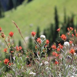
As I was wrapping up my trip to Mount Rainier National Park, I made a quick stop to hike this 0.4 mile loop trail. Twin Firs Trailhead is a short trail that allows you to explore some of the park's lowland old-growth forest. This short nature walk is easy for all ages. On this trail you will see giant evergreens, shrubs, wildflowers and huge nurse-logs. There is also lots of trees covered in moss. The nice thing about this hike is that you can get close enough to touch some of the trees that have fallen. Many of these old-growth trees on this trail are very old and have not been disturbed by human activity. Douglas-fir, western red cedar and western hemlock are some examples of the Northwest's "big three" evergreens that are present here. Twin Firs Trailhead is located two miles west of Longmire on the road to the Nisqually Entrance. There is not a lot of parking here. The trail is a loop that starts at a fallen tree. You can start your nature hike in either direction. The original "twin firs" that gave the trail its name no longer exist. read more