Cancel

    Open app

    Search

    Oldgrowth Loop Trail

    4.0 (1 review)

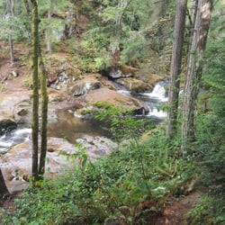
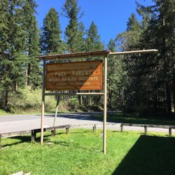
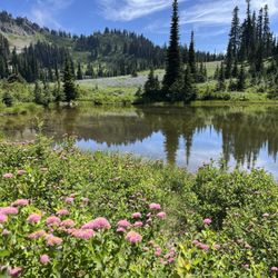
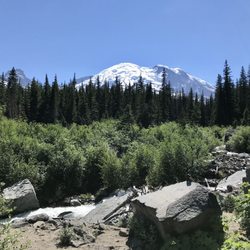
    Oldgrowth Loop Trail Photos

    You might also consider

    More like Oldgrowth Loop Trail

    Recommended Reviews - Oldgrowth Loop Trail

    Your trust is our priority, so businesses can't pay to alter or remove their reviews. Learn more about reviews.
    Yelp app icon
    Browse more easily on the app
    Review Feed Illustration

    5 years ago

    Helpful 1
    Thanks 0
    Love this 1
    Oh no 0

    Verify this business for free

    Get access to customer & competitor insights.

    Verify this business

    Shoe Lake Hike Via Pacific Crest Trail - Old Snowy

    Shoe Lake Hike Via Pacific Crest Trail

    5.0(1 review)
    27.6 mi

    Had been stalking the White Pass/Shoe Lake area for windows of good weather the last month or two…read more(every weekend, it would conveniently be rainy/snowy up there!). Recently I saw the forecast open up for some sunny conditions---during the work week. I decided to make the trip---isn't that what vacation days are for?? I drove up to White Pass, from the east side, with clear blue skies the entire way. I parked on the highway (across from the Kracker Barrel at the base of the White Pass slopes). I slapped on my 35lb pack, grabbed my dogs, and we scrambled up the slopes. I like going this route (vs. starting at the Trailhead) because there are nice views and it cuts down on distance. It's a bear of a workout though! Once on the PCT, it's a nice, fairly flat, and scenic hike---y'know, the usual. Near the new ski run up on top, I heard/saw workers cutting/burning trees to clear way for the ski run (sometimes I wish I could make them turn the ski lift ON, so I could be taken all the way up to the Miriam Lake Basin....but what fun would that be?? I had seen evidence of recent snow every here and there (1-4" patches of snow). Once at the Miriam Lake Basin/Hogback Ridge, I made my way to Shoe Lake. There's one stretch of this big open piece of trail where there was quite a bit of hard icy snow. Camped above the beautiful Shoe Lake. I heard an elk bugling at around 7pm---it must have been south down the hill. Such a cool sound to hear! But it was also scary, because within seconds I also heard something very big plodding around nearby--definitely an elk. It was so close I could hear it breathing. A wee bit scary! (and cool) Oh, I did spy some huckleberries along the way, amazingly enough---but they weren't as good as the ones I picked 3weeks ago. Such a late season! The night yielded beautiful views of the Milky Way, constellations, Jupiter, satellites, and the like. The hike back was nice for most of the way. I saw a herd of mountain goats in the Miriam Lake Basin. The snow/ice mentioned earlier was pretty scary in the morning. The first clouds of the trip rolled in around 1pm...but I was pretty much done. While unloading at my car, an employee from the Kracker Barrel rode his bike to me. He was wondering where I was and if I was ok. Apparently, I forgot to roll my driver's side window up---so it was open for 24hrs!! Everything was fine, but I sure felt dumb. Anyway, probably my last backpacking trip of 2011. A great way to end the season!

    Photos
    Shoe Lake Hike Via Pacific Crest Trail - Reflection

    Reflection

    Shoe Lake Hike Via Pacific Crest Trail - From Nearby Peak

    From Nearby Peak

    Shoe Lake Hike Via Pacific Crest Trail - At Dusk

    See all

    At Dusk

    Tipsoo Lake

    Tipsoo Lake

    4.4(9 reviews)
    36.4 mi

    This lake has an amazing view of Mount Rainier if you are not looking to go directly to the…read moremountain. We came during the end of July (around 4PM) which is the best time to see all the beautiful wildflowers. It was really hot and there's so many bugs but this area is such a pretty place to take photos. We did leave with at least five mosquito bites so make sure to come prepared with bug spray and sunscreen! This is also right across from Naches Loop Trailhead and has parking as well; can only get down to the lake by staircase so this may be a struggle for those who are disabled. The view of the mountain is so pretty and totally worth it to stop by. The trail is also not hard so very kid friendly!

    Tipsoo Lake is a beautiful location full of wildflowers, evergreens, various hiking trails, and a…read moregorgeous view of Mount Rainier on a clear day. The day we went it was really foggy outside early in the day and it was just starting to clear when we were ready to leave. But check out those Rainier photos from other hikers who were fortunate to have visited on a bright day. Spectacular! Tipsoo Lake is quite small and has a walking path around it that is flat and easy to walk for hikers of all abilities. Along that path you can find a variety of flowers (including those cool Lorax kind) as well as paths leading to other trails such as Naches Peak Loop. If you head up that trail a bit from the lake, you'll come to a bridge that goes over highway 410 and that can be a nice viewing point for kids. There are a small number of parking spaces (10 to 12) in a tiny lot right off of the freeway and you may be fortunate enough to snag a spot if you arrive early. Friendly reminder to mind the signs and stay on the trail to protect the surrounding land and flowers.

    Photos
    Tipsoo Lake
    Tipsoo Lake
    Tipsoo Lake

    See all

    Glacier Basin Trail - Cute little fella

    Glacier Basin Trail

    5.0(2 reviews)
    46.2 mi

    The Glacier Basin Trail is utterly magical in every sense of the word. I must have taken hundreds…read moreof pictures and several videos while hiking this trail. This hike has everything that your little heart could ever desire! A forest full of giant trees. Vibrantly green shrubs. Waterfalls at practically each turn. Majestic views of not only the snow covered mountains, but the gorgeous aqua hues of the White River down below. The rushing river running parallel. Rampant wildlife. Colorful wildflowers. Inclines and elevation galore. I mean, shall I go on?! Just stunning. Glacier Basin is located near the White River entrance of Mount Rainier National Park. The trail begins just behind the White River Campgrounds. It's starts off mildly inclining through a lush forest, but the incline picks up speed and continues to incline until you reach the camp. It's about roughly 9 miles and 2,000 feet of elevation in total if you add in the the detour to the Emmons Lorraine Trail. Do it! It will add another 1.5/2miles to the hike, BUT... this is where you'll find that incredible view of the Inter Fork White River. It's funny that it's called the "white river" because it's stunningly aqua from the top of Emmons Lorraine. The Emmons Lorraine trail is a turn off that's about a mile into the Glacier Basin Trail and includes a river crossing and a steep incline up a narrow hill. It looks a bit intimidating, but it's really not. Just sit on your bum for the really gnarly parts coming down (at least that's what I did). Continuing on the Glacier Basin Trail, it's basically a straight shot up the hill for another 3 miles until you reach the top. There are a few spots with some switchbacks, but it's mostly a ridge-like trail. AllTrails has rated this hike as moderate, but it's definitely on the harder side of moderate if not difficult. What makes this hike so enjoyable though is the fact that there's so much scenery. Every time I took a break, I was either greeted by a beautiful mini waterfall or vibrant wildflowers. The views are very motivating and it keeps you going. Once you reach Glacier Basin Camp, you'll be met with the most stunning views of snow covered Mount Rainier and the rushing waters of the White River right next to it. This hike took me about 5 hours in total to complete (including breaks, lunch, and detours). It's definitely a day hike, so bring enough food and water to keep yourself nourished. Also, make sure you have some really comfortable hiking shoes/boots and hiking poles for the way down if you have bad knees. Coming down can be just as tough as hiking up because of the steepish downhill for 3 miles straight. This one is definitely going in the books as one of my favorite National Park hikes and my favorite Washington state hike thus far. If you're looking for a challenge and a great way to see the beauty of Mount Rainier National Park, Glacier Basin Trail is a great option.

    As a Seattle native, I can say that this is my favorite hike I've ever been on. The hike has a fork…read moreabout a mile in. If you fork left, there is a relatively short (~30 min) but steep trail that leads to the glacier basin. The water is a bright teal with mountains in the background, one of the best views I've ever seen. My friends and I went swimming in the basin, which was very cold but also very fun. If you stay on the main trail, it is an additional 6 miles that is moderate-difficult and took about 3 hours to get up. At the top, there is a really pretty meadow and campground. You will need a Mt. Ranier National Park pass ($50 annual or $30/week) to enter. I went on a weekday in the morning and had no trouble finding parking. The main trail was quite empty, but the left fork had a couple other groups. However, we more or less had the place to ourselves. Overall, 10/10 would reccomend!

    Photos
    Glacier Basin Trail
    Glacier Basin Trail - Stunning

    Stunning

    Glacier Basin Trail - Beautiful

    See all

    Beautiful

    Snowgrass Flat Trail

    Snowgrass Flat Trail

    5.0(2 reviews)
    20.6 mi

    Amazing backpacking weekend here. Lots of campsites, but the wildflowers were outstanding as…read morewell!! Gorgeous place and the weather was just perfect! Goat Lake was amazing to get to as well. This place has amazing views too. The mosquitos were definitely around, but manageable. Bring bug wipes though!! Highly recommend this place!

    CGI can't create THIS. Poets are inspired by THIS…read more Painter's canvases are made for THIS. Singers muse about THIS. My legs gravitate to THIS. THIS.....is Snowgrass Flat in the Goat Rocks Wilderness. When it comes to hiking the Cascades, sadly, I'm a creature of habit. I have favorite hikes which I rinse and repeat annually. This is a bad thing when you have miles and miles of lands full of the most beautiful color, scenery, experiences to be had. Snowgrass Flat is now added to my repetoire of go-to places for Cascadian hikes. With a trailhead located south of Packwood, one must venture for about 45min along a dusty gravel road (it's about a 15-17mile trek; while in your car, you will feel like a sock in a washing machine due to the washboarded road). And I'm not kidding about the dust, it's a dustgasm. But it's all worth it. The trailhead was fairly filled with many a hiker's vehicle (but on the trail, we didn't see too many). The trail starts with a quickstep along the side of a pine-filled mountain---every once in a while you'll be afforded views of Mt. Adams to your right. There is water on this trail, and you may cover a bog or two, streams, and at mile 1-2 a torrent which is handled by a nicely-built bridge. Due to the water, there are some boggy-ness, and with this there can be some mosquitoes, but we didn't come across much on our way up (perhaps the bug spray helped...or maybe I just wasn't tasty enough). If you want a workout, you will have one. It doesn't slap you upside the head, but it's a nice, slow, long burn---so it's nice. After about 2-3hrs (around Mile 5-6 for us), the horizon starts to open up and you feel like you are reaching the top. This is the Flat That Is Snowgrass. You are in meadows galore. For some reason the sky is bluer, the waters are clearer, the craggy snow-covered peaks are breath-takers....it's everything a hike should be. There are many options for camping. Here you can see St. Helens in hazy distance, and Mt. Adams is there to taunt. Other sights are Goat Lake to the north---it's captured in what appears to be an eternal winter. The biggest feature would have to be Old Snowy and his mountain homies. If you have the time, my friends told me that Goat Lake and Old Snowy are excellent additional trips one can take from Snowgrass Flat. **mental note made** I can't wait to come here again. This is why I love Washington state. This is why I hike. THIS is brought to you by the YELP-1200.

    Photos
    Snowgrass Flat Trail - Stream In Snowgrass

    Stream In Snowgrass

    Snowgrass Flat Trail
    Snowgrass Flat Trail - Looking Toward Old Snowy

    See all

    Looking Toward Old Snowy

    Panther Creek Falls - This is Panther Creek Falls

    Panther Creek Falls

    4.8(16 reviews)
    47.9 mi

    Located just off the Columbia River Gorge lies this beautiful, unique waterfall that flows…read morebeautifully down the rocky moss. Getting here on the side road can be a little risky, so please drive safe, drive slow, and share the road. Parking is right after the crossing signal in an open dirt lot across from the falls. There's two paths, the upper view point which will no give you the view you see in Al the pictures, but it's easy for a quick teaser. Stay to the left and up to go down to the falls and there you'll see this beautiful fall. The path can get muddy from the cliffs and water running on the sides. The multiple fall streams on the moss is what makes this fall so eye pleasing. The rocks are slippery so mind to the paths and enjoy beautiful fall!

    Well what can I say besides this is one of the most beautiful hikes I have ever been on. The hike…read moreto get to the waterfall is short enough and once you get there, you could literally watch the water fall for hours. It looks like something out of a movie, a fantasy movie with fairies and goddesses. The path to get there can be a little bit narrow, so I recommend wearing shoes with good grip and don't take too much with you, it's best to pack light for this one. You could truly sit there for hours with nothing but the water entertaining you. It's so pure and cleansing and definitely something you will think about the rest of your day, if not week. I highly recommend this beautiful aspect of nature.

    Photos
    Panther Creek Falls - Panther Creek Falls

    Panther Creek Falls

    Panther Creek Falls - At the bottom of Panther Creek Falls.

    At the bottom of Panther Creek Falls.

    Panther Creek Falls

    See all

    Ingalls Lake

    Ingalls Lake

    5.0(6 reviews)
    74.7 mi

    I am in love the the Lake Ingalls hike! My friend and I arrived at the trailhead Sunday morning…read morejust before 8 a.m. and already counted 120 cars at the trailhead. We parked about 0.3 miles from the trailhead. Cars lined both sides of the narrow road, despite a sign indicating for folks to only park on one side. There were some very questionable parking jobs on edges and cliffs. There was a small line waiting for the one toilet, which was not stocked with toilet paper (don't forget to bring your own + hand sanitizer). There were a couple surprises I had after reading other trip reports. The first one was that the road up to the trailhead was not bad at all. Sure, it was a little bumpy and there were a few potholes to watch out for, but it was seriously nothing compared to other trailheads I've been on. A sedan can easily make it up to the top with no problem. The second thing I found different than the trip reports was the level of difficulty. WTA rates this hike as expert, and I thought it was nowhere near expert. It really was a nice gradual incline with some rock scrambling at the top. Plus, there's beautiful sights to see the entire way up, so it was very pleasant. The trail was packed, but once my friend and I started hiking, we slowly spaced out from the others. Everyone we encountered was super kind and courteous. The only downside we had from the people was that this is a trail that does not allow dogs, and there were several we encountered (including one off leash who ran up to my friend and was a little nippy). There was also fresh dog poop right on the trail an owner had left behind. The lake at the top wasn't too busy. There were plenty of spots to sit to grab a bite to eat and admire the view. After the initial descent from the lake where there's a lot of rock scrambling and questioning if you're still on the trail (there's multiple ways up through the rocks, so just keep going and look for cairns), it's a steady decline that's easy on the knees. I will definitely be back!

    This is about a 10 mile total hike. I'm not a very experienced hiker, so it too me a while to get…read moreup there. My boyfriend and I camped up at the top too. Up to the top, it's quite easy as in the trail and the incline should be fine if you have hiked a lot. At some point up the trail, it gets a little narrow and steep way down if you're not careful. Bless my boyfriend for carrying my camping bag too. At the top, there's a camp ground. It's near a river if you want to get water. There's also a toilet! It's a wooden box and it's a great view to take a dump at. From the campsite, it's about 1 mile to the lake at the top. There are cairn stacks along the way to reach the lake. Without following it, I'm sure you can still find it, but with it, it shows you an easy route to climb. The lake itself is very clear and very cold! I went in August and there was still some snow! There are also mountain goats! I found the best time to see them is in the morning. They come near the camp site too! I heard a baby mountain goat crying for it's mom too. It was so cool seeing them so close! You can see where they have even around since their fur gets caught on the branches.

    Photos
    Ingalls Lake
    Ingalls Lake
    Ingalls Lake

    See all

    Melmont Ghost Town - Recked car

    Melmont Ghost Town

    4.5(4 reviews)
    34.4 mi

    The best kept secret in pierce county. Finding parking will be difficult on a nice day. We parked…read morenear the bridge but others will park near Fairfax trail. It is about A 2 to 5 mile loop. So if you were to do a round-trip it could be up to 4 to 10. Well you walk around you'll see beautiful foliage, rivers, trees, and scary abandoned ghost town relics of buildings. There are some who criticize this nonexistent town but if you have some patience you will see a lot of the structures. Or even the foundations of them. It is very dog friendly. However there is no water for them so please bring your own. The ground is not very smooth so be careful of their paws. There are no garbage cans so pack it out. There are many locals hiking and walking. They are very friendly.

    The bestie and I decided to take a hike with my two dogs. This place popped up on a search. We're…read morein no way professional hikers and this hike made us both nervous a few times. We drove over a one lane bridge and then parked on the side where we saw other cars. Once we got out the car we couldn't tell where the actual hike started. Then we see a small sign that says it's north over the bridge. The one lane bridge? Yes. Yes this bridge. So off we go to walk across this high bridge with two dogs, also my youngest dog is a nut ball. Cars are driving past us but they're going slowly and we're staying all the way to the side. Once you cross the bridge there's a metal guardrail that you cross over. Then the trippy part starts. The actual hike is starts below the bridge. There's these crazy stones that I know they want to say are rock stairs but they are not. They are instead pieces of Earth that love to trip me. There is a metal guardrail to grab onto for balance and honestly there was a time when it held my entire body weight. And we have dogs on a leash to take down with us! What an adventure! I go down and have to convince the bestie to follow. She's convinced this is a bad idea now lol. It's not though, we toggle down and come to a nice hiking trail. We took a left and hiked for four miles before we turned around. I believe there's a town to hike to but we never found it. Sometimes the trail was too narrow and to high for my tastes but courage prevailed! It was all so beautiful! The trees, the water, the sky. I would go again...

    Photos
    Melmont Ghost Town - Old building

    Old building

    Melmont Ghost Town - River

    River

    Melmont Ghost Town - River down below

    See all

    River down below

    Oldgrowth Loop Trail - hiking - Updated May 2026

    Loading...
    Loading...
    Loading...