
Cle Elum Riverfront Park Photos


More like Cle Elum Riverfront Park
Recommended Reviews - Cle Elum Riverfront Park
Start your review...

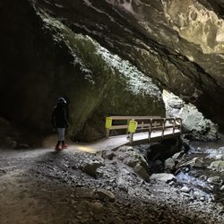
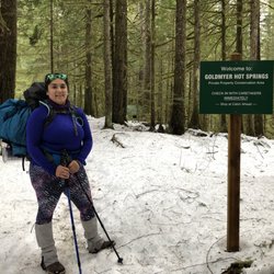
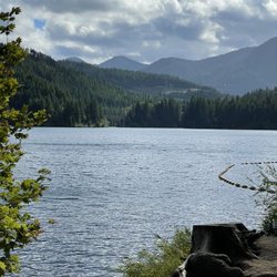
Hello, river fun!! Wenatchee river is long, winded and strong!!! And we got to see the park right from cel elum/ suncadia resort! It's gorgeous! Green! Crazy strong! So pretty! So refreshing. So scary! All at once. In short, it was perfect. The hotel does guided activities here. Fly fishing, river rafting etc! Since Baci wasn't allow on most/ if not all, we ended up hiking a lot!! Hiking down 50 flights of stairs this river! Crazy windy up above, calm down here. I wish I can let Baci swim but pretty sure I'll never see him again if I did. So we did a little soak! And stand! It was still fun! Beautiful hike. A ton of lethal mosquitos!! Bring a lot of repellent! read more
5 years ago
More info about Cle Elum Riverfront Park
3600 Suncadia Trl
Cle Elum, WA 98922
Directions
Hours
Outdoor Amenities


Cle Elum Riverfront Park - hiking - Updated July 2026
Best of Cle Elum
People found Cle Elum Riverfront Park by searching for…
Trending Searches in Cle Elum, WA
Blueberry Picking near Cle Elum Riverfront Park
Boat Tours near Cle Elum Riverfront Park
Cliff Jumping near Cle Elum Riverfront Park
Day Trips near Cle Elum Riverfront Park
Dog Friendly Things To Do near Cle Elum Riverfront Park
Dog Swimming near Cle Elum Riverfront Park
Jet Ski Rental near Cle Elum Riverfront Park
Kayak Rental near Cle Elum Riverfront Park
Lakes near Cle Elum Riverfront Park
Outdoor Activities near Cle Elum Riverfront Park
Peach Picking near Cle Elum Riverfront Park
Public Shower near Cle Elum Riverfront Park
River Swimming near Cle Elum Riverfront Park
Rock Quarry near Cle Elum Riverfront Park
Scenic Night View near Cle Elum Riverfront Park
Swimming Holes near Cle Elum Riverfront Park
Swimming Lakes near Cle Elum Riverfront Park
Things To Do On A Rainy Day near Cle Elum Riverfront Park
Tubing near Cle Elum Riverfront Park
U Pick Farms near Cle Elum Riverfront Park
View Points near Cle Elum Riverfront Park
Browse Articles
Browse Nearby
BEST of Cle Elum, Washington Coffee near Cle Elum Riverfront Park
BEST of Cle Elum, Washington Restaurants near Cle Elum Riverfront Park
BEST of Cle Elum, Washington Things to Do near Cle Elum Riverfront Park
BEST of Cle Elum, Washington Parks near Cle Elum Riverfront Park
BEST of Cle Elum, Washington Lakes near Cle Elum Riverfront Park
BEST of Cle Elum, Washington Breakfast near Cle Elum Riverfront Park
BEST of Cle Elum, Washington Campgrounds near Cle Elum Riverfront Park
BEST of Cle Elum, Washington Ski Resorts near Cle Elum Riverfront Park
BEST of Cle Elum, Washington Sledding near Cle Elum Riverfront Park
Browse Brands
Related Searches in Cle Elum, WA
Affordable Kayak Rental Services in Cle Elum, Washington
Best Dog Hiking Trails Around Cle Elum, Washington
Best Fishing Locations and Guides in Cle Elum, Washington
Best Places for Horseback Riding in Cle Elum, Washington
Check Out Off Road Trails in Cle Elum, Washington
Discover Dog Friendly Trails to Explore in Cle Elum, Washington
Discover Easy Hiking Trails Near Cle Elum, Washington
Discover Popular Bike Trails in Cle Elum, Washington
Discover a Hiking Trail in Cle Elum, Washington
Discover the Best Night Hike Trails in Cle Elum, Washington
Dog-Friendly Hikes With Dogs in Cle Elum, Washington
Enjoy Camping Adventures Around Cle Elum, Washington
Enjoy Exciting Mountain Biking Adventures in Cle Elum, Washington
Enjoy Off Leash Dog Hikes in Cle Elum, Washington
Enjoy Tent Camping Spots Around Cle Elum, Washington
Enjoy the Best Walking Trails in Cle Elum, Washington
Experience Stunning Sunset Views in Cle Elum, Washington
Explore Beautiful Parks and Green Spaces in Cle Elum, Washington
Explore Easy Hikes Perfect for All in Cle Elum, Washington
Explore Fun Activities to Do in Cle Elum, Washington
Explore Popular Campgrounds Near Cle Elum, Washington
Explore Popular RV Parks Around Cle Elum, Washington
Explore Popular Scenic Overlook Points in Cle Elum, Washington
Explore Scenic Lakes to Visit in Cle Elum, Washington
Explore Top Dog Parks in Cle Elum, Washington Near You
Explore the Best Swimming Holes Around Cle Elum, Washington
Family Friendly Hiking With Kids in Cle Elum, Washington
Find Beautiful Views in Cle Elum, Washington
Find Cozy Camping Cabins in Cle Elum, Washington
Find Popular Ziplining Spots Around Cle Elum, Washington
Find the Best Playgrounds to Visit in Cle Elum, Washington
Hiking Trails With Waterfalls in Cle Elum, Washington
Off Leash Dog Hiking Trails in Cle Elum, Washington
Plan a Scenic Drive Route Near Cle Elum, Washington
Popular Fishing Spots to Explore in Cle Elum, Washington
Popular Kids Activities in Cle Elum, Washington
Popular Outdoor Activities to Try in Cle Elum, Washington
Popular Picnic Spots to Visit in Cle Elum, Washington
Safe River Swimming Areas in Cle Elum, Washington
Safe and Fun Parks for Kids in Cle Elum, Washington
Top Hiking Trails to Explore in Cle Elum, Washington
Top Playgrounds for Kids to Enjoy in Cle Elum, Washington
Top Running Trails to Explore in Cle Elum, Washington
Top Swimming Lakes to Enjoy in Cle Elum, Washington
Top Swimming Spots and Pools in Cle Elum, Washington
Top Things to Do With Kids in Cle Elum, Washington


