Cancel

    Open app

    Search

    Peshastin Pinnacles State Park

    4.5 (6 reviews)

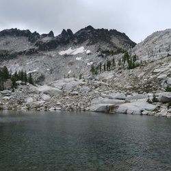
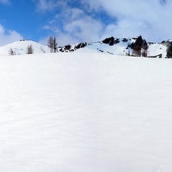
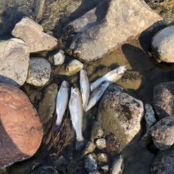
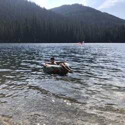
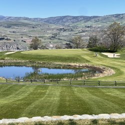
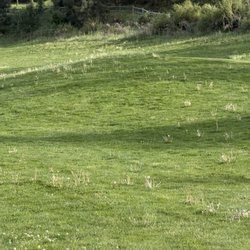
    Peshastin Pinnacles State Park Photos

    You might also consider

    More like Peshastin Pinnacles State Park

    Recommended Reviews - Peshastin Pinnacles State Park

    Your trust is our priority, so businesses can't pay to alter or remove their reviews. Learn more about reviews.
    Yelp app icon
    Browse more easily on the app
    Review Feed Illustration

    1 year ago

    Helpful 4
    Thanks 0
    Love this 4
    Oh no 0
    Photo of Tanis L.
    283
    1056
    6355

    4 years ago

    Helpful 3
    Thanks 0
    Love this 3
    Oh no 0
    Photo of Sky T.
    1
    17
    5

    6 years ago

    Helpful 0
    Thanks 0
    Love this 0
    Oh no 0

    7 years ago

    Helpful 0
    Thanks 0
    Love this 0
    Oh no 0
    Photo of Thomas K.
    10
    50
    152

    12 years ago

    Helpful 0
    Thanks 0
    Love this 0
    Oh no 0
    Photo of Tina S.
    0
    52
    17

    11 years ago

    Helpful 0
    Thanks 0
    Love this 0
    Oh no 0

    Ask the Community - Peshastin Pinnacles State Park

    Verify this business for free

    People searched for Hiking 162 times last month within 15 miles of this business.

    Verify this business

    The Enchantments

    The Enchantments

    5.0(11 reviews)
    14.5 mi

    Indeed very enchanting place. We did backpacking 3 nights 4…read moredays to experience the core zone as much as possible including off-trail scrambles for Little Annapurna and Enchantment Peak. We went Colchuck to Viviane and traced back since not much to see beyond Viviane. Really nice backpacking. My detailed mileage etc is below blog post. https://himebackpacker.blogspot.com/2024/10/the-enchantments-washington.html

    I've done this a couple of times so I'll give you the different perspectives…read more The first time I did it as a one-day hike because I did not have a permit. The second time I did it as a three night hike because it was after October 15th and I still didn't have a permit. Since that time, the permit season has been extended to October 30th. Either way, I suggest that hiking in the fall is the prettiest time due to the larch trees colors. Both times we started at the Stuart Lake trailhead (recommended due to reduced overall elevation gain) and ended at the Snow Lake trailhead. Now at the risk of offending someone I will say that hiking through the Enchantments in one day is like watching a porn movie on fast forward. You miss most of the scenery. My suggestion is to either get a permit, or hike outside of season, preferably in the fall, but stay at least two nights. Given that the hike up Aasgard Pass has an elevation gain of 1900 feet in about a mile, I can attest that it can be quite dangerous when raining. On the East side there will be mud & rock slides and in our case we had to duck out of the way of several large, (18 or so inch diameter) Rocks that came bouncing down the boulders with unpredictable direction at a very high rate of speed. Risks early in the season are snow slides and avalanches, so be very aware of the conditions when you are there. All that said, anyone who does not give this a five and tell you that it's absolutely one of the most beautiful hikes you'll ever take on must know something I don't, and I've hiked the Himalayas. Remember that goats are dangerous. Pee on rocks, not soil because the goats will dig it up for the salt. Try not to let a goat see you peeing or it will run towards you. Try fishing in the lakes; the trout are great for dinner up there. You should also know that when coming down toward the Snow Lake trailhead there are a large number of switchbacks and when you see the cars just down the hill, it will likely be another hour before you get there, and if you did it as a day hike, your feet may not be happy when you finally arrive. If you are a hiker, you must find a way to get this one done before you hang up your boots.

    Photos
    The Enchantments
    The Enchantments - Lo mejor

    Lo mejor

    The Enchantments - Bonking

    See all

    Bonking

    Colchuck Lake - Colchuck Lake | Instagram: @telephonesmoothie

    Colchuck Lake

    4.8(18 reviews)
    13.4 mi

    Colchuck Lake has been on my list for YEARS and one I definitely considered a bucket list trail. I…read morefinally got the chance to do it this past weekend and it was 100% warranted as as bucket list destination. Doing some research before the hike we learned that the parking lot is pretty much full before 7am. We reached there by around 6:45am and it was entirely full and people were parking down the road. We were even as far as at least half a mile away from the actual trailhead when we actually parked, but luckily the walk is pretty flat. The beginning of the trailhead has a bathroom that will have a lengthy line in the morning, and it is gross. Just be prepared! In total, we clocked almost 9 miles round trip and it took us just shy of 7 hours. That said, we did spend about an hour at the top to take in all of the views and the experience as a whole. I knew this trail would be challenging and I'd say it was probably the second hardest I've ever done (maybe the third), with the first being Mailbox Peak. There are some incredibly tough stretches with steep rock stairs and areas where it feels like you're scrambling a ton. There are moderate breaks where the trail flattens, but it's pretty challenging the entire length of the hike. The end point, the actual lake, is entirely worth the pain and "I don't know if I can do this" moments along the way. Absolutely STUNNING. Probably the most unreal colored water I've ever seen with the shade of blue that it was. The mountains encompassing the lake look fake - literally like AI in real life or something. Truly is a great spot to find a nice rock to sit and relax to enjoy lunch and reenergize for the trek down the trail. After hitting the bottom, it was a loooong walk back to the car with us being so wiped. Much to our disappoint we also discovered that ALL of the cars parked along the road received $100 tickets from the Chelan PD, despite there being no signs that said we couldn't park along the road (just on the bridge, which we weren't on). Overall Colchuck Lake was worth the wait and I'm so glad to have seen it finally - I just don't think I'll ever do it again LOL.

    Colchuck Lake is one of the most beautiful, if not the most beautiful alpine lake I've seen. It is…read moreabsolutely worth a hike to get there, and many others would agree, given the often full trailheads early in the morning during nice weather, even on weekdays. You just cannot beat the views and the stunning blue water of the lake. We did an out/back hike, but plenty of others were planning to hike a lot more of the Enchantment Trail. Bring plenty of water, snacks, take breaks as you need it, and enjoy the view (and possibly a dip) at the lake when you get there!

    Photos
    Colchuck Lake - Colchuck Lake | Instagram: @telephonesmoothie

    Colchuck Lake | Instagram: @telephonesmoothie

    Colchuck Lake - Totally worth the trek!

    Totally worth the trek!

    Colchuck Lake

    See all

    Ingalls Lake

    Ingalls Lake

    5.0(6 reviews)
    21.7 mi

    I am in love the the Lake Ingalls hike! My friend and I arrived at the trailhead Sunday morning…read morejust before 8 a.m. and already counted 120 cars at the trailhead. We parked about 0.3 miles from the trailhead. Cars lined both sides of the narrow road, despite a sign indicating for folks to only park on one side. There were some very questionable parking jobs on edges and cliffs. There was a small line waiting for the one toilet, which was not stocked with toilet paper (don't forget to bring your own + hand sanitizer). There were a couple surprises I had after reading other trip reports. The first one was that the road up to the trailhead was not bad at all. Sure, it was a little bumpy and there were a few potholes to watch out for, but it was seriously nothing compared to other trailheads I've been on. A sedan can easily make it up to the top with no problem. The second thing I found different than the trip reports was the level of difficulty. WTA rates this hike as expert, and I thought it was nowhere near expert. It really was a nice gradual incline with some rock scrambling at the top. Plus, there's beautiful sights to see the entire way up, so it was very pleasant. The trail was packed, but once my friend and I started hiking, we slowly spaced out from the others. Everyone we encountered was super kind and courteous. The only downside we had from the people was that this is a trail that does not allow dogs, and there were several we encountered (including one off leash who ran up to my friend and was a little nippy). There was also fresh dog poop right on the trail an owner had left behind. The lake at the top wasn't too busy. There were plenty of spots to sit to grab a bite to eat and admire the view. After the initial descent from the lake where there's a lot of rock scrambling and questioning if you're still on the trail (there's multiple ways up through the rocks, so just keep going and look for cairns), it's a steady decline that's easy on the knees. I will definitely be back!

    This is about a 10 mile total hike. I'm not a very experienced hiker, so it too me a while to get…read moreup there. My boyfriend and I camped up at the top too. Up to the top, it's quite easy as in the trail and the incline should be fine if you have hiked a lot. At some point up the trail, it gets a little narrow and steep way down if you're not careful. Bless my boyfriend for carrying my camping bag too. At the top, there's a camp ground. It's near a river if you want to get water. There's also a toilet! It's a wooden box and it's a great view to take a dump at. From the campsite, it's about 1 mile to the lake at the top. There are cairn stacks along the way to reach the lake. Without following it, I'm sure you can still find it, but with it, it shows you an easy route to climb. The lake itself is very clear and very cold! I went in August and there was still some snow! There are also mountain goats! I found the best time to see them is in the morning. They come near the camp site too! I heard a baby mountain goat crying for it's mom too. It was so cool seeing them so close! You can see where they have even around since their fur gets caught on the branches.

    Photos
    Ingalls Lake
    Ingalls Lake
    Ingalls Lake

    See all

    Rachel Lake Trailhead - Flowers

    Rachel Lake Trailhead

    3.6(11 reviews)
    37.3 mi

    The views on this hike warrant a five star review for sure! Loads of waterfalls, mountains, and of…read morecourse trees and flowers to see on this route up to Rachel Lake. The problem? Not a clear trail at all. My hiking group and I found ourselves asking, "Is this trail?", numerous times on this extremely strenuous seemingly endless uphill trek to the lake. Now, granted, some of our group was in better shape than others and managed the physicality of the trail better than others but still we all agreed it was extremely hard. First you drive up a gravel road approximately 6 miles to get to the parking lot. One bathroom is available there which wasn't too gross. Once you enter the trail it starts heading up. And up and up and up. It is seemingly endless. I believe it about 4 plus miles up. The trail starts out fairly marked and easy to follow. Then it doesn't. Unfortunately I got separated from my group for a good portion of this hike due to my attempt to stay with the "faster" ladies, lol. I just kept going up. Thank goodness a few other people passed me to let me know I was on the right track. No trail at all really for a good portion and I merely followed a dry creek trail. Extremely rocky and loads of bushwhacking. I had to stop every five to ten feet to catch my breath. The steepness reminded me of a hike in Big Sur called Garrapata which after I competed that one I said I would never do again, lol. Now to the good parts of the hike. Gorgeous scenery beyond words! Loads of amazing waterfalls as you are following a creek flowing from a lake high above. The lake was outstandingly beautiful. I took a quick dip in the icy water at the top! Quickly it changed my outlook on the hike and cooled me off. Will I do it again? Maybe, but next time. I will bring more snacks for the hike that give me energy. I will start out slower and take more frequent deliberate breaks. And please please don't forget your mosquito repellent! Also, long pants as a large portion of this hike you go through tall grasses and overgrowth. I consider myself an experienced hiker when I was in CA, but here in WA, I am a beginner for sure. Stay hydrated and go at your own pace. This is worth it at least once. SYOY and No FOMO for me here! Lol.

    Lake Rachel is a great hike if you're looking for a beautiful end view and lots of fun sights along…read morethe way. Unfortunately, the trail is not marked well and we went off path and up towards different falls a couple times but going off trail was worth it for the extra couple views we saw! Be prepared to get your feet wet and be careful climbing over the slippery rocks.

    Photos
    Rachel Lake Trailhead - One of the many gorgeous views.

    One of the many gorgeous views.

    Rachel Lake Trailhead - The trail

    The trail

    Rachel Lake Trailhead - Here.

    See all

    Here.

    Peshastin Pinnacles State Park - hiking - Updated May 2026

    Loading...
    Loading...
    Loading...