Signal Knob Hike Photos


More like Signal Knob Hike
Recommended Reviews - Signal Knob Hike
Start your review...

4 years ago
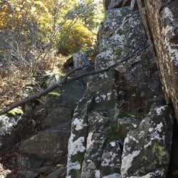
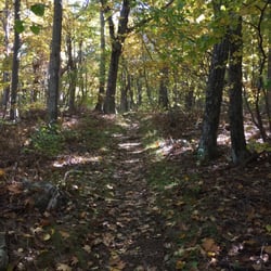
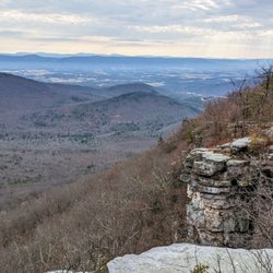
11 years later, Saturday June 25th I finally came back to finish what I started. . Let me say, I hike a lot! I don't mind 10 miles flat or up and down. This trail however, was brutal! Rocks, boulders and more rocks. That was my trail path. It takes more time and more energy. Know this* My foot hit the path at 1pm. I got in my car for home at 7:39pm. Not bad considering the situation, but tbh, I didn't think I was going to make it. It was exhausting but great part is, it's a round trip. Not one way, turn around and go back. Start out on Massanutten trail to reach the TV station (hence Signal knob) then return to parking on the Tuscarora trail. So silent, unlike the A.T and NPS in the area. The Tuscarora is more wild and silent. How I feel about it, anyway. . I need a badge for hiking this for real. You know how you get tired and you don't pick your feet up high enough you stub your feet on the rocks? Well with the trail being nothing but rocks, my toe is feeling it. Check my toe pic. I literally started cursing the trail everytime I stubbed my toe. Such an adventure!!! I love to hate it. read more


11 years ago
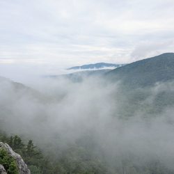
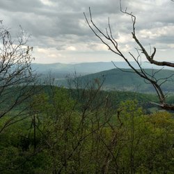
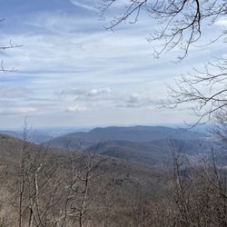
A challenging hike especially for our 7 year old. Our 10 year old did well. Wear good shoes, preferably ones that can support your ankles because of the very rocky terrain. Our hike had some added difficulty since some parts of the trail still had ice when we hiked in February. We printed out a map before leaving and took a picture of the map at the base of the trail. We wanted to make it to Signal Knob, but had to stop at the Shenandoah Valley Overlook. We had read it took someone 4 1/2 hours to hike into Signal Knob and back out the same way. It took us a total of 5 hours to get to the Shenandoah Valley Overlook, due to the ice, little feat and one of my kids not feeling well halfway through the hike. We will all go again and hopefully make it all the way! read more

11 years ago
13 years ago
More info about Signal Knob Hike


Signal Knob Hike - hiking - Updated May 2026
Best of Warren
People found Signal Knob Hike by searching for…
Things to Do in Warren, Virginia
Hiking Trails in Warren, Virginia
Star Gazing in Warren, Virginia
Lookout Points in Warren, Virginia
Sunset View in Warren, Virginia
Waterfalls and Swimming Holes in Warren, Virginia
Places to Take Pictures in Warren, Virginia
Running Trails in Warren, Virginia
Walking Trails in Warren, Virginia
Secret Spots in Warren, Virginia
Sunrise View in Warren, Virginia
Easy Hikes in Warren, Virginia
Scenic Overlook in Warren, Virginia
View Points in Warren, Virginia
Basketball Courts in Warren, Virginia
Off Road Trails in Warren, Virginia
Dog Friendly Hiking Trails in Warren, Virginia
Scenic View in Warren, Virginia
State Park in Warren, Virginia
Photo Spots in Warren, Virginia
Waterfalls in Warren, Virginia
Browse Nearby
Browse Brands
Browse Articles
People who viewed Signal Knob Hike also viewed
Peters Mill Run
3 reviews
Tibbet Knob Hiking Trail
2 reviews
Buzzard Hill
1 review
Eagle Rock / Tuscarora Trail
3 reviews
Raven Rocks Hike
35 reviews
Shenandoah River State Park
55 reviews
Trumbo Hollow Hike
1 review
Mount Marshall Trailhead
1 review
Sky Meadows State Park
62 reviews
Jim and Molly Denton Shelter
1 review