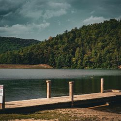
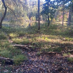
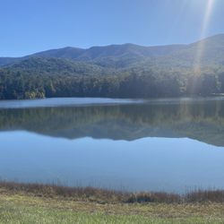
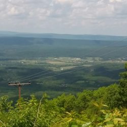
Sherando Park Photos

You might also consider
More like Sherando Park
Recommended Reviews - Sherando Park
Start your review...

10 years ago


7 years ago
It was a nice park! We counted at least 3 playgrounds when we went exploring. A lot of the playgrounds/ picnic areas are in the woods so bring bug spray! It's very spacious and there is lots to do, we had a nice experience. read more
More info about Sherando Park


Sherando Park - parks - Updated June 2026
Best of Stephens City
People found Sherando Park by searching for…
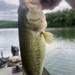
Fishing in Stephens City, Virginia
Lakes in Stephens City, Virginia
Things to Do in Stephens City, Virginia
Playgrounds in Stephens City, Virginia
Picnic Areas in Stephens City, Virginia
Places to Take Pictures in Stephens City, Virginia
Volleyball Courts in Stephens City, Virginia
Fishing Lake in Stephens City, Virginia
Parks for Kids in Stephens City, Virginia
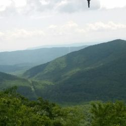
Scenic View in Stephens City, Virginia
Lakes & Ponds in Stephens City, Virginia
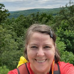
Hiking Trails in Stephens City, Virginia
Running Trails in Stephens City, Virginia
Scenic Drive in Stephens City, Virginia
Fishing Spots in Stephens City, Virginia
Hiking With Kids in Stephens City, Virginia
Walking Trails in Stephens City, Virginia
Parks for Picnics in Stephens City, Virginia
Photo Spots in Stephens City, Virginia
Attractions in Stephens City, Virginia
Tourist Attractions in Stephens City, Virginia
Sand Volleyball in Stephens City, Virginia
Trending Searches in Stephens City, VA
4th Of July Fireworks near Sherando Park
Baseball Fields near Sherando Park
Black Owned Nail Salons near Sherando Park
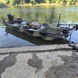
Boat Rental near Sherando Park
Cliff Jumping near Sherando Park
Dog Friendly Beaches near Sherando Park
Fishing Spots near Sherando Park
Kayak Rental near Sherando Park
Public Pools near Sherando Park
River Swimming near Sherando Park
Strawberry Picking near Sherando Park
Swimming Holes near Sherando Park
Swimming Lakes near Sherando Park
Browse Articles
Browse Nearby
BEST of Stephens City, Virginia Restaurants near Sherando Park
BEST of Stephens City, Virginia Things to Do near Sherando Park
BEST of Stephens City, Virginia Coffee near Sherando Park
BEST of Stephens City, Virginia Basketball Courts near Sherando Park
BEST of Stephens City, Virginia Hiking near Sherando Park
BEST of Stephens City, Virginia Breakfast near Sherando Park
BEST of Stephens City, Virginia Campgrounds near Sherando Park
Browse Brands
Related Searches in Stephens City, VA
Best Parks for Parties and Events in Stephens City, Virginia
Check Out Great Playgrounds in Stephens City, Virginia
Check Out Off Road Trails in Stephens City, Virginia
Discover Baseball Fields Around Stephens City, Virginia
Discover Fun Activities to Do in Stephens City, Virginia
Discover Lakes & Ponds to Explore in Stephens City, Virginia
Discover Popular Photo Spots in Stephens City, Virginia
Discover Top Nature Parks to Visit in Stephens City, Virginia
Discover the Best Beaches in Stephens City, Virginia
Enjoy the Best Picnic Spots and Ideas in Stephens City, Virginia
Enjoy the Best Walking Trails in Stephens City, Virginia
Explore Easy Hikes Perfect for All in Stephens City, Virginia
Explore Family-Friendly Zoos and Wildlife in Stephens City, Virginia
Explore Free Kids Activities Near Stephens City, Virginia
Explore Free Picnic Areas Around Stephens City, Virginia
Explore Landmarks & Historical Buildings in Stephens City, Virginia
Explore Parks With Pull Up Bars in Stephens City, Virginia
Explore Popular Campgrounds Near Stephens City, Virginia
Explore Popular Picnic Areas Around Stephens City, Virginia
Explore Popular RV Parks Around Stephens City, Virginia
Explore Popular Recreation Centers Around Stephens City, Virginia
Explore Popular Scenic Views Near Stephens City, Virginia
Explore Scenic Lakes to Visit in Stephens City, Virginia
Explore Secret Spots Worth Visiting in Stephens City, Virginia
Explore Top Dog Parks in Stephens City, Virginia Near You
Explore Top Gyms in Stephens City, Virginia Now
Explore Top Water Parks in Stephens City, Virginia Today
Explore the Best Swimming Holes Around Stephens City, Virginia
Find Beautiful Views in Stephens City, Virginia
Find Top Skating Rinks in Stephens City, Virginia for All Ages
Find Top-Rated Waterfalls in Stephens City, Virginia Now
Find a Park With BBQ Pits in Stephens City, Virginia
Find the Best Parks BBQ Grills in Stephens City, Virginia
Find the Best Parks for Picnics in Stephens City, Virginia
Find the Best Swimming Pools in Stephens City, Virginia Today
Fun Things for Kids in Stephens City, Virginia
Have Fun at a Splash Pad in Stephens City, Virginia
Hiking Trails With Waterfalls in Stephens City, Virginia
Indoor Playgrounds to Explore in Stephens City, Virginia
Parks With Basketball Courts for Games in Stephens City, Virginia
Picnic Areas With BBQ Pits Available in Stephens City, Virginia
Popular Fishing Spots to Explore in Stephens City, Virginia
Popular Kids Activities in Stephens City, Virginia
Popular Outdoor Activities to Try in Stephens City, Virginia
Popular Places to Take Pictures in Stephens City, Virginia
Top Hiking Trails to Explore in Stephens City, Virginia
Top Swimming Lakes to Enjoy in Stephens City, Virginia
Top-Rated Basketball Courts to Play at in Stephens City, Virginia