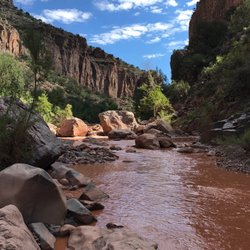
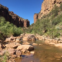
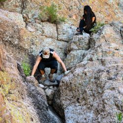
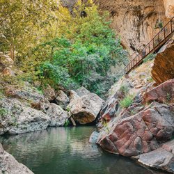
Round Mountain Park Photos


You might also consider
More like Round Mountain Park
Recommended Reviews - Round Mountain Park
Start your review...

1 month ago
Great hiking, lots to see. I went off trail a couple of times and found some really neat things. read more


1 year ago
Neat easy trail with plenty of offshoot trails to explore. Most of the main trail is paved. Bathrooms available, close location, and beautiful views from the top. 2 years ago it was filled with wildflowers but none this year!! read more


An easier hike for those who don't like to go up a steep mountain. The trails are fairly newer. Some are a nice walk while others are longer and more of a challenge, but not too hard. Trails like the boulder trail have some spray paint on the ground to help guide you. There are multiple trails that can intersect one another. I will be going back again! read more

More info about Round Mountain Park
Globe, AZ 85501
Directions
Hours
Outdoor Amenities


Round Mountain Park - hiking - Updated June 2026
Best of Globe
People found Round Mountain Park by searching for…
Trending Searches in Globe, AZ
Black Owned Nail Salons near Round Mountain Park
Dog Friendly Trails near Round Mountain Park
Lakes near Round Mountain Park
Pick Your Own Farms near Round Mountain Park
River Swimming near Round Mountain Park
Scenic Drive near Round Mountain Park
Splash Pad near Round Mountain Park
Swimming Holes near Round Mountain Park
Browse Articles
Browse Nearby
BEST of Globe, Arizona Things to Do near Round Mountain Park
BEST of Globe, Arizona Coffee near Round Mountain Park
BEST of Globe, Arizona Photo Spots near Round Mountain Park
BEST of Globe, Arizona Restaurants near Round Mountain Park
BEST of Globe, Arizona Hot Springs near Round Mountain Park
BEST of Globe, Arizona Parks near Round Mountain Park
BEST of Globe, Arizona Breakfast near Round Mountain Park
Browse Brands
Related Searches in Globe, AZ
Best Fishing Locations and Guides in Globe, Arizona
Best Fun Things to Do in Globe, Arizona
Best Nature Trails for Hiking in Globe, Arizona
Best Places for Horseback Riding in Globe, Arizona
Best Waterfalls and Swimming Holes in Globe, Arizona
Check Out Off Road Trails in Globe, Arizona
Discover Dog Friendly Trails to Explore in Globe, Arizona
Discover Popular Bike Trails in Globe, Arizona
Discover Popular Photo Spots in Globe, Arizona
Discover Top Nature Parks to Visit in Globe, Arizona
Discover a Hiking Trail in Globe, Arizona
Discover the Best Night Hike Trails in Globe, Arizona
Dog-Friendly Hikes With Dogs in Globe, Arizona
Enjoy Camping Adventures Around Globe, Arizona
Enjoy Exciting Mountain Biking Adventures in Globe, Arizona
Enjoy a Beautiful Waterfall Hike in Globe, Arizona
Enjoy the Best Walking Trails in Globe, Arizona
Exciting Cliff Jumping Spots in Globe, Arizona
Experience Stunning Sunset Views in Globe, Arizona
Explore Beautiful Parks and Green Spaces in Globe, Arizona
Explore Easy Hikes Perfect for All in Globe, Arizona
Explore Free Things to Do Around Globe, Arizona
Explore Jet Skis for Sale or Rent in Globe, Arizona
Explore Popular Boat Charters Near Globe, Arizona
Explore Popular Campgrounds Near Globe, Arizona
Explore Popular RV Parks Around Globe, Arizona
Explore Popular View Points Around Globe, Arizona
Explore Scenic Lakes to Visit in Globe, Arizona
Explore Top Dog Parks in Globe, Arizona Near You
Explore the Best Boating Spots in Globe, Arizona
Family Friendly Hiking With Kids in Globe, Arizona
Find Beautiful Views in Globe, Arizona
Find Fun Things to Do With Kids in Globe, Arizona
Find Popular Ziplining Spots Around Globe, Arizona
Find Top Skate Parks in Globe, Arizona for All Skill Levels
Find the Best Parks for Picnics in Globe, Arizona
Find the Best Scenic View Locations in Globe, Arizona
Find the Best Swimming Pools in Globe, Arizona Today
Hiking Trails With Waterfalls in Globe, Arizona
Must-See Tourist Attractions Around Globe, Arizona
Perfect Spots to Watch Sunset in Globe, Arizona
Plan a Scenic Drive Route Near Globe, Arizona
Popular Kids Activities in Globe, Arizona
Popular Picnic Spots to Visit in Globe, Arizona
Popular Places to Take Pictures in Globe, Arizona
Popular Things to Do in Globe, Arizona
Relax at Natural Hot Springs Near Globe, Arizona
Top Paddleboarding Activities in Globe, Arizona
People who viewed Round Mountain Park also viewed
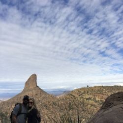
Picketpost Trail
14 reviews
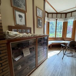
Besh-Ba-Gowah Archaeological Park
35 reviews
Globe Community Center Park
1 review
Gila County Fairgrounds
3 reviews
Coolidge Dam and San Carlos Reservoir
2 reviews
Superior UTV Rentals
17 reviews
Gila County Miniature Golf
1 review
Kearny Golf Club
1 review
Cobre Valley Recreation Center
1 review