Robbers Roost Trail Photos


You might also consider
More like Robbers Roost Trail
Recommended Reviews - Robbers Roost Trail
Start your review...

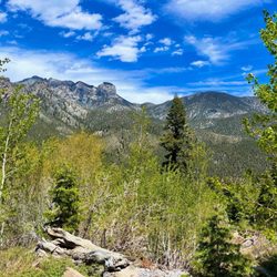
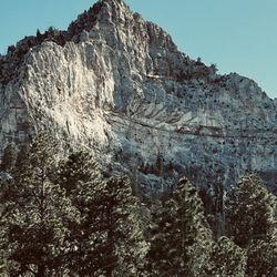
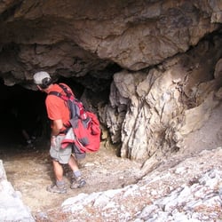
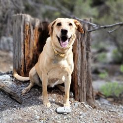
After hiking at Cathedral Rock Trail, we decided to hike Robber's Roost Trail. It is a 0.5 mile heavily trafficked loop trail located in Mt. Charleston. Directions from Las Vegas: Travel north on U.S. Highway 95, then take State Route 157 west., then transfer onto State Route 158. Travel 3.2 miles north on State Route 158 (Deer Creek Road) from State Route 157 (Kyle Canyon Road). On the right is a parking area and the trailhead is on the left. This hiking is best from March until September. The trail is a short loop trail that climbs up a canyon to a couple of caves. It then winds through a forest of pinion pines and mountain mahogany before returning back to the main trail. It has an interesting history. Legend has it that Robber's Roost was a hideout for bandits during the days of the old Mormon Trail. The caves not only offered shelter, but also an excellent vantage point for spotting would-be attackers. We saw rock climbers. The hike ends at a cliffhanger and caves but if you're experienced you can go on and up over the caves. read more


More info about Robbers Roost Trail
You might also consider


Robbers Roost Trail - hiking - Updated May 2026
Best of Mt Charleston
People found Robbers Roost Trail by searching for…
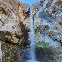
Hiking Trails With Waterfalls in Mt Charleston, NV
Places to Take Pictures in Mt Charleston, NV
Things to Do in Mt Charleston, NV
Cliff Jumping in Mt Charleston, NV
Visitor Centers in Mt Charleston, NV
Rock Climbing in Mt Charleston, NV
Off Road Trails in Mt Charleston, NV
Scenic View in Mt Charleston, NV
Scenic Restaurants in Mt Charleston, NV
Scenic Drive in Mt Charleston, NV
Canyoneering in Mt Charleston, NV
Running Trails in Mt Charleston, NV
Romantic Views in Mt Charleston, NV
Scenic Overlook in Mt Charleston, NV
Easy Hikes in Mt Charleston, NV
Walking Trails in Mt Charleston, NV
Cliff Diving in Mt Charleston, NV
Running Routes in Mt Charleston, NV
Waterfalls in Mt Charleston, NV
Browse Nearby
BEST of Mt Charleston, Nevada Restaurants near Robbers Roost Trail
BEST of Mt Charleston, Nevada Things to Do near Robbers Roost Trail
BEST of Mt Charleston, Nevada Coffee near Robbers Roost Trail
BEST of Mt Charleston, Nevada Picnic Areas near Robbers Roost Trail
BEST of Mt Charleston, Nevada Campgrounds near Robbers Roost Trail
BEST of Mt Charleston, Nevada Breakfast near Robbers Roost Trail
BEST of Mt Charleston, Nevada Shopping near Robbers Roost Trail
BEST of Mt Charleston, Nevada Hotels near Robbers Roost Trail
BEST of Mt Charleston, Nevada Glamping near Robbers Roost Trail