Potrero County Park Campground Photos


You might also consider
More like Potrero County Park Campground
Recommended Reviews - Potrero County Park Campground
Start your review...


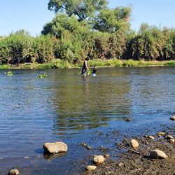
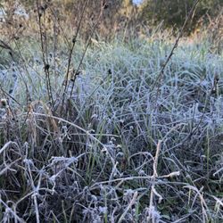
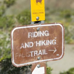
I love it when I can bring my dogs camping! Potrero County Park Campground is located on the East Side of San Diego. The surrounding areas are mountains and small towns. We went at the beginning of October. The weather in the daytime was cool, it rained for one day at night, and it got chilly. At night you can hear frogs and crickets. Dogs are welcome, but they must be leased at all times. There are hot showers available in the park bathrooms. Make sure to bring quarters to feed the machine. There are unruly campers at night. They blast the music up during quiet hours and drink. The best time to camp here is during the weekdays, and it's tranquil. The nature trail is easy to hike. It was a nice getaway! You can find more information about Potrero at - https://reservations.sdparks.org/reservation/camping/ read more


7 years ago
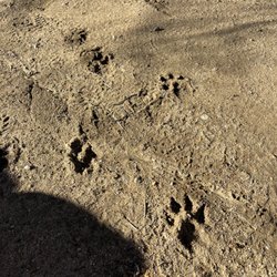
Quiet well maintained county park. Bathrooms were clean. Showers were rust stained so I'm glad we were in an RV. We had space 15 which had lots of shade and room for our slide out. 31' class C RV. No real path to the bathroom so you have to cross across others campsites if you are in a, ah, hurry. Lots of ground squirrels, blue jays, vultures, crows and woodpeckers. ***COYOTES at night **** we had our dogs wear their coyote vests any time we went out. Serious sticker burr challenge for our dogs. Will bring a rake next time. Super friendly ranger. They have a little free library. We will come again in winter read more


3 years ago
2 years ago
6 years ago
So quiet when its 104° outside. Beautifully kept campgrounds. Friendly Rangers, strict with their rules but thats ok. Bathrooms and showers are accommodateing. We will return in the fall. Only negative is you can only get wifi by the rangers station. read more


2 years ago
4 years ago
4 years ago
9 years ago
Went to the campground for one of our annual family camping trips. This location was by far the best one we've gone to and plan on coming back next year. We purchased a tent site for a weekend, and the areas are very spacious. Could easily fit multiple tents on one site. Was able to park our cars right in front of our site so the transfer of our belongings was short and easy. Each tent site had a spacious picnic table. Some tent site were "nature" sites that had running water available There are restroom and bathroom facilities. Showers are nothing special and are $0.50 for 4 minutes, max 15 quarters. Have a cleaning area to clean dishes and a designated area for trash.. Cabins are available for stay as well, some members of the family rented a few and look into doing the same for next year. They have their own restroom and only bunk/bed frames. Few others rented rv sites which are also very spacious. Only $5 extra for water and electric hook ups. Nights are very chilly and a bit windy. We stayed in October 2017, so during the day was a bit warm. read more


3 years ago
9 years ago
5 years ago
16 years ago
10 years ago
Enjoyed the weekend. It Felt safe, it was clean and there is a store about a mile and a half away give or take a few miles, should you arrive and realize you forgot little ends and outs. The Rangers office offers wood for 5 bucks which was great because the rules says you can't bring your own wood. read more


5 years ago
8 years ago
14 years ago
7 years ago
14 years ago
12 years ago
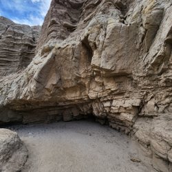
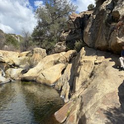
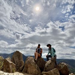
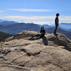
Wow, what a perfect campground! We arrived early afternoon on a Saturday, disconnected the trailer, and was greeted by a nice young hip ranger, not the old stogy ones of years past. He explained the rules, told us about a great hike to take, and then let us be for the night. After disconnecting our trailer we headed to the nearby Tecate border crossing, paid 5 bucks to park on the U.S. side and enjoyed a nice lunch at Pollo Feliz, shopping at the Calimex market, enjoyed a frozen fruit paleta on the plaza, and then headed back to the campground for the night. There is an easy hike to the top of a small hill where you can enjoy some incredible sunsets, and sunrises if you're an early riser. We enjoyed our campfire that evening, and the peaceful surroundings. On Easter Sunday we drove back to Tecate for a delicious breakfast at Los Pinos just across the street from the plaza. Two ladies make and serve the best authentic Mexican breakfast plates, and chiles rellenos to die for! After we gorged ourselves, we returned to the campground to fetch the trailer and head back into the city. Even the guys at the Border Patrol checkpoint along highway 94 west were pretty cool and friendly. Potrero County Park Campground is a true hidden gem. read more

10 years ago
8 years ago
10 years ago
11 years ago
10 years ago
13 years ago
11 years ago
15 years ago
11 years ago
More info about Potrero County Park Campground
Ask the Community - Potrero County Park Campground
How many vehicles per site? How much for extra vehicles?
One. Extra fee for more cars
Review Highlights - Potrero County Park Campground
You might also consider


Why does Yelp recommend reviews?
4 reviews that are not currently recommended
The reviews below are not factored into the business's overall star rating.
15 years ago
15 years ago
15 years ago
15 years ago
Potrero County Park Campground - hiking - Updated May 2026
Best of Potrero
People found Potrero County Park Campground by searching for…
Trending Searches in Potrero, CA
Botanical Gardens near Potrero County Park Campground
Bounce House Rentals near Potrero County Park Campground
Campgrounds near Potrero County Park Campground
Cheap Plants near Potrero County Park Campground
Flower Fields near Potrero County Park Campground
Flower Shop near Potrero County Park Campground
Garage Sales near Potrero County Park Campground
Garden Center near Potrero County Park Campground
Graduation Leis near Potrero County Park Campground
Lakes & Ponds near Potrero County Park Campground
Nurseries & Gardening near Potrero County Park Campground
Outdoor Activities near Potrero County Park Campground
Outdoor Furniture Stores near Potrero County Park Campground
Parks near Potrero County Park Campground
Party Equipment Rentals near Potrero County Park Campground
Pedicure near Potrero County Park Campground
Photo Spots near Potrero County Park Campground
Picnic Areas near Potrero County Park Campground
Places To Take Pictures near Potrero County Park Campground
Rock Quarry near Potrero County Park Campground
Running Trails near Potrero County Park Campground
Rv Rental near Potrero County Park Campground
Spray Tanning near Potrero County Park Campground
Sunrise View near Potrero County Park Campground
Swimming Holes near Potrero County Park Campground
Table And Chair Rentals near Potrero County Park Campground
Browse Articles
Browse Nearby
BEST of Potrero, California Things to Do near Potrero County Park Campground
BEST of Potrero, California Coffee near Potrero County Park Campground
BEST of Potrero, California Breakfast near Potrero County Park Campground
BEST of Potrero, California Restaurants near Potrero County Park Campground
BEST of Potrero, California Shopping near Potrero County Park Campground
BEST of Potrero, California Campgrounds near Potrero County Park Campground
BEST of Potrero, California Hotels near Potrero County Park Campground
BEST of Potrero, California Museums near Potrero County Park Campground
BEST of Potrero, California Taxis near Potrero County Park Campground
Browse Brands
Related Searches in Potrero, CA
Access Computer Lab Facilities in Potrero, California
Access DMV Kiosk Services Conveniently in Potrero, California
Access Public Library Services in Potrero, California
Affordable Jet Ski Rental Options in Potrero, California
Affordable Kayak Rental Services in Potrero, California
Affordable Passport Photos Available in Potrero, California
Best Fishing Locations and Guides in Potrero, California
Best Fun Things to Do in Potrero, California
Best Parks for Parties and Events in Potrero, California
Best Places for Horseback Riding in Potrero, California
Best Places to Study in Potrero, California
Complete DMV Services Available in Potrero, California
Comprehensive Mail Services Offered in Potrero, California
Convenient Usps Drop Off Locations in Potrero, California
Discover Free Parking Options in Potrero, California
Discover Popular Landmarks in Potrero, California
Discover a Hiking Trail in Potrero, California
Discover the Best Night Hike Trails in Potrero, California
Dog-Friendly Hikes With Dogs in Potrero, California
Easy Drivers License Renewal in Potrero, California
Easy Vehicle Registration Process in Potrero, California
Enjoy Camping Adventures Around Potrero, California
Enjoy Free Wifi Connections Across Potrero, California
Enjoy a Dog Beach Day in Potrero, California
Enjoy the Best Family Activities in Potrero, California
Enjoy the Best Walking Trails in Potrero, California
Exciting Cliff Jumping Spots in Potrero, California
Experience Stunning Sunset Views in Potrero, California
Explore All Usps Locations Near Potrero, California
Explore Beautiful Parks and Green Spaces in Potrero, California
Explore Bike Rentals Throughout Potrero, California
Explore Community Centers Available in Potrero, California
Explore Courthouses Available in Potrero, California
Explore Free Things to Do Around Potrero, California
Explore Fun Activities to Do in Potrero, California
Explore Indoor Public Spaces in Potrero, California
Explore Jet Skis for Sale or Rent in Potrero, California
Explore Landmarks & Historical Buildings in Potrero, California
Explore Nature Spots Around Potrero, California
Explore Police Departments in Potrero, California
Explore Popular Campgrounds Near Potrero, California
Explore Popular RV Parks Around Potrero, California
Explore Popular View Points Around Potrero, California
Explore Scenic Lakes to Visit in Potrero, California
Explore Top Dog Parks in Potrero, California Near You
Explore Top Things to Do at Night in Potrero, California
Explore Top Water Parks in Potrero, California Today
Explore Vibrant Public Art Displays in Potrero, California
People who viewed Potrero County Park Campground also viewed
Lake Morena County Park
71 reviews
Lake Jennings
191 reviews
Blossom Valley
Burnt Rancheria Campground
81 reviews
Indian Hills Camp
28 reviews
Mount San Miguel Park
74 reviews
Rock House Trail
52 reviews
Merigan Trail
3 reviews
Boulevard / Cleveland National Forest KOA Holiday
30 reviews
Proctor Valley Nature Resource Area
1 review
The Walking Trail
2 reviews