Rock House Trail Photos


You might also consider


More like Rock House Trail
Recommended Reviews - Rock House Trail
Start your review...




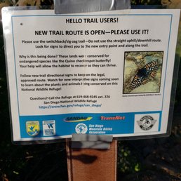

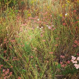


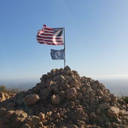


Beautiful view from the top! This trail is a good workout and definitely gets the blood pumping. It's 4.4 miles round trip, no shade, and has a rapid elevation change. There are multiple switchbacks and loose gravel. Wear good shoes, otherwise you might roll an ankle on the way down. The trail is open and marked, and easy to follow. There is plenty of free parking and restrooms at the park. It's a good hike for all ages and pet friendly. The trail tends to get busy during the summer, but I haven't seen it too crowded. Make sure to bring water, especially in the hot months. I prefer going in the morning to beat the heat and crowds. There are plenty nice views and an aerial view from the top. Nice photo opportunity from the top of the mountain. Great trail for all levels of experience, easy to get to, and not too crowded. A must try. read more


According to a hiking app, Rock House Trail is approximately a 4.3 mile round trip journey. With the numerous switchbacks and ascent to the top of Mother Miguel Mountain, the distance felt longer. You can park at the lot of Mount San Miguel Community Park and walk over to the trailhead. The other option is to park curbside at the corner of Paseo Veracruz and Paseo Los Gatos which was what I and most others did. There was no shade on the entire trek so I was fortunate to pick a cloudy day. You head north for about 1/10 of a mile and then cross a major path before winding up a slope which was where all the switchbacks began. Signage kept popping up to discourage hikers from going off the main thoroughfare. This was done to minimize the amount of erosion from taking shortcuts. I liked the idea, but there were many too points in which you could walk an alternate route. It was nearly impossible to stay strictly on the preferred trail. About halfway up, the path straightened out, and it was nearly a direct line to the peak. A couple of flags were planted at the summit which made for a good photo opportunity. The summit views to the east and west were very nice minus the power lines. The app encouraged you to go about 1/3 mile further which led to a rather steep descent. It ended up at an electrical tower overlooking Sweetwater Reservoir to the west. From that point, it was a little over two miles to get back to the start. The duration was right around two hours for me to complete the out and back. Moderate was a fair way to describe the difficulty mainly because of the elevation gain of almost 1200 feet. In a way, this hike felt like the Chula Vista version of Cowles Mountain but slightly lengthier with less steep switchbacks. I enjoyed the experience to give it four stars. read more




6 years ago
Well this trail has definitely changed since I've last been here! As of 6/5/2020, there are a lot more switchbacks, information polls, and trail signs to lead you to the top. Before, you kinda had to figure out a way to the top (there were no signs whatsoever) but now it's a lot more easier and doesn't feel as strenuous since the path is marked out. However, going down is still a little tricky. Although there are some signs that have directed you upward, when you get toward the middle going down you really can't tell where to go. Although you can visibly see the park and the end of the trail, there is no clear cut view of where to go. Luckily I ran into some people who pointed me in the direction of how to get down. For an experienced hiker, this is easy to moderate. For the new/inexperienced hiker, this is more on the moderate side. read more


One of my favorite trails/ hikes ! I highly highly recommend coming early especially during summer ! By 9-10 am the sun in blazing and there is NO shade , I made that mistake once! And bring lots of water !! Also wouldn't recommend bringing any small pups after 10 am either , their paws can be damaged as well as become dehydrated from the hike ! The view from the top is incredible ! Highly recommend ! read more


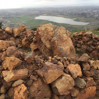
Did this hike this morning (1/27/19) on a nice clear day. Parking- arrived a bit before 7 am and there was plenty of free street parking by the trailhead at the corner of Paseo Veracruz and Paseo Los Gatos Trail- the hardest part is the first mile is it is pretty much straight up to Mother Miguel Mountain which is how this hike is listed on All Trails; there is no tree cover so this could be a miserable hike in the wrong conditions; it is about 1.2 miles to the peak where there is a collection of rocks and a couple flags; I decided to go down the opposite side of the mountain toward the Sweetwater Reservoir instead of going down the same way and added more mileage to make it 5.8 miles total; I only saw a handful of people during the first half of the hike but as I was finishing just before 9 am the trails were getting quite busy (not Cowles Mtn busy but far from the solitude you might be seeking) *the biggest thing I didn't like about the trail is there are so many connecting/intersecting trails and I did not see one sign anywhere on the trail; there are also so many power lines and towers taking away from the great views read more




Rock House Trail is the path that leads to the top of Mother Miguel Mountain. It is a great experience for those of all ages. Rock House Trail is conveniently located near the 125 freeway. The address you should type into your GPS is: 2335 Paseo Veracruz. You can park in Mount Miguel Park or along the curb in the neighborhood. There is not much shade so I would recommend you come in the evening or early morning if you visit when its sunny. I began at 6:00 pm on a June night and finished before it was too dark. I was also smart to have wet wipes in my car and these were great because I was very dusty at the end. There is a little shopping center across the way that has a Starbucks, taco shop, sushi restaurant and more. If you are looking to get outdoors for an hour or two I highly recommend you check out Rock House Trail. read more


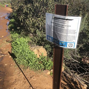
This was a nice workout. I know some people mention the path that goes straight up, but they have a lot of signs now that tell people to stay off that trail, so just use the switchbacks. You can get to the trailhead in two different ways: either park at the dog park (if you MSP to the Mount San Miguel community park) or you can park on the paseo Veracruz and there's a path that takes you to the trailhead too. The first little bit was somewhat difficult to navigate because there weren't really that many signs, but you're pretty much staring at the mountain as you go, so as long as you're going toward the mountain you're good. I had a 9 year old and a 13 year old with me, and the hike took us just over two hours to complete, and that's including time at the top and time to rest. I can't imagine doing this hike during the day during the summer because there's no shade, but right now it's a pretty good way to get he heart pumping! read more


4 years ago
Love this trail. A bit crowded, but tolerable. Started at 7 am. It was cold, luckily I was dressed in layers. Lots of loose gravel and rocks. The incline was okay, would have loved for a steeper climb. Long switchbacks. Stay on the trail, please. read more



3 years ago

6 years ago
Haven't hike in couple years so this was pretty tough for me but I must say is a lot easier than Cowles Mountain went with my husband and 11 year old daughter took us about 1 1/2 to get to the top did stop a couple times the beginning of the trail pretty easy towards the end more incline but manage make it to the top beautiful hike couple people on the trail very friendly look like there's different ways to get to the top meet a couple that took a different route I do advise bring backpack and plenty water it was a good stress reliever since we all been dealing with pandemic will definitely do it again read more


5 years ago

Attempted to hike Mother Miguel Mountain hike that I found on AllTrails app. Per app it's supposed to be an out and back hike measuring 10.9 miles. There was no mention of Rock House Trail, but that's eventually where we ended up. I parked at Sweetwater Summit park/campground. By the time we arrived in the morning the campground entrance building was closed. Didn't see any signs about a parking fee or fee drop box, so parking was free? Trekked down past the fishing area to the start of the actual trailhead about 3 miles from parking lot. Whoops. Good thing there were gorgeous views of the lake along the way which were enhanced by the overcast and rainy weather this morning. Didn't feel like we were in San Diego at all. After summiting the mountain and reaching the flags, you can see views including the reservoir, Bonita city, mountains, and the Salt Creek Golf course. We continued straight down instead of turning back around into the rainy part of the hike. Trail isn't really well-marked in some areas or maybe overcast weather played a factor. Overall hike was a little over 9 miles in 2.5 hours. Not too steep, but definitely slippery/muddy today. Saw trail runners, mountain bikers, and fellow hikers along the way. Pretty easy-moderate trail. read more


8 years ago
Fun little hike! Will make it a regular! This was my first trip up! I parked at the end of the dog park but will prob park at the end of the street next time. Took about 28 minutes up. I took the steepest path I could find. Apple Watch said 1.2miles and 1072 feet. I really want to hike to the Towers but I Hear it is now closed Pros: short , secluded (only saw about 5-7 people on the trail! Cons: had to pay the I125 Toll( $2 each way) Anyone know a different way around? read more


9 years ago
TIP: Plug in San Miguel Park (2335 Paseo Veracruz, Chula Vista, CA 91914 (b/t Calle La Quinta & Corte Ventura)for address to get to this trail and save yourself from running around trying to find this awesome trail. Once you get to the park, look for the dog park and right around there you will see the path to the trail. Next, make sure you read the bulletin board that has the map of the trail so as not to make the same mistake me and friends did by following the trail where the houses are. THAT IS A DEAD END and is not the path you are looking for. The trail starts in a dirt road thats blocked by some type of metal gate and the uphill path is visible. Didnt get to finish this hike coz we ran out of time and light... but will def come back to finish my post! :) goodluck and happy hiking!!! read more


This was a great hike that really got the blood pumping and ended with an awesome view. Overall the trail is in pretty good condition. I recommend getting some hiking boots to ensure you are getting the best grip possible when going up/down the steepest parts. Parking is easy since this hike starts at a residential neighborhood. For the most part this hike just goes up and not too many flat areas that will allow for you to relax. I frequently hike and was able to do this no problem, even followed a lady carrying her 3 yr old up it! Although I will admit, it looked extremely challenging. Just make sure to take your time and go during a cool parts of the day as there is no shade. Make sure to bring plenty of water and enjoy the views form the top! read more

8 years ago
First time hiking this trail ... I have been wanting to hike it for a long time now and I finally made it with my good friend ... she picked the steep side and their is no signs. We parked right next to a park. I would like to go back and try the switchback side. It is a work out if you are not an expert like myself. If you have a trekking pole I recommended it and some hiking shoes the steep side is very slippery. Fun trail ! Happy Hiking! read more


We decided to spend our afternoon off hiking and we found this awesome trail. It's is a little hard to find so I recommend that you read previous reviews to help you find it. I especially liked the one that tells you to look for Mount San Miguel Park in google maps. That's the most accurate way to find the trail. Once you are in the park, look for the dog park and park near there. Just follow the path that leads to the mountain. I think there are several ways to get to the top. If you want to make it kind of fast and are up for the challenge, take the step path, it'll take you like 30minutes to get to the top if you are in pretty decent shape. Otherwise, there's another path that kinda goes around the mountain, not sure how long will that take to make it to the top. The view along the way is very pretty and once you are on the top, you can see the ocean and downtown San Diego, -stunning view! The whole thing is a good workout and a great way to spend time with family or friends or even for a nice alone walk. Bring lots of water and some confortable shoes, hiking shoes if you are going to take the steep route. read more


9 years ago

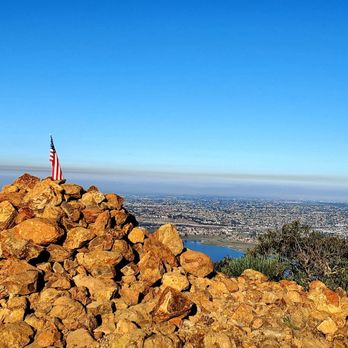
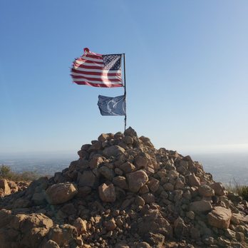
Rock House Trail Stats (according to alltrails.com): -Distance: 4.5 miles RT -Elevation Gain: 1,213 Feet -Route Type: Out & Back My Stats: -Total Steps: 9,247 -Total Calories Burned: 945 -Total Time: 75 minutes (3.7 mph pace) My Review: If I had the rate this hike, I would say it's about moderate. I found it easy, but I'm sure that it's a lot tougher during the summer since there's absolutely no shade on the trail. Within minutes of starting this hike, I noticed a full-grown coyote on the trail as well as two ravens circling above me. The coyote was easily scared off, but the ravens continued to make their presence known by dropping a few bombs on the trail. At first, I thought the ravens were flying above me as guides up to the peak. I eventually realized that they probably looked at me as lunch. Instead of helping me, these birds were Yelping me. I didn't allow these birds to ruin my hike and eventually they circled someone else. At the halfway point, a ranger asked us to stay on the trail. I assume that he was talking to the group ahead of me because I stayed on the trail the entire time. The group ahead of me took a lot of shortcuts and instead of following the switchbacks, they climbed straight up. It's neat to be elite. But I guess for them, it's neater to be a cheater. Making it to top wasn't difficult and I still passed the group that was taking all them shortcuts. They were huffin' and puffin'. I almost felt bad for them. An American and POW flag is at the top. Rocks support both flags and is sturdy enough to be used as a bench to sit on. Sights include a 345-degree view San Diego, including the Pacific Ocean, downtown, Spring Valley, PH, and Southside. The peak is high enough that the airlines flying to and from the San Diego International Airport looked so close that you can see them at "plane" sight. The trek down was even easier than the climb up. I saw another coyote on the way down but assumed that it was the same one that I saw on the way up. Overall, nice hike. It's quick, it has its challenges, it's rewarding at the top, and it's very close to my parents' home. read more




9 years ago
This was a great workout. Beautiful views at the top. What we wore and brought along: This was a hike that we completed on April 17, 2107. We started at 10:30 am and the high temp that day was about 74 degrees. We wore tanks and shorts. That was perfect. One bottle of water would've been sufficient had we not gotten lost on the back side of hill on the way down. Parking: We followed the directions to '2335 Paseo Veracruz, Chula Vista, 91914'. It was a nice little park at the end of the road with plenty of parking. The north side of the park bordered open space. We parked in the northwest corner of the lot. read more


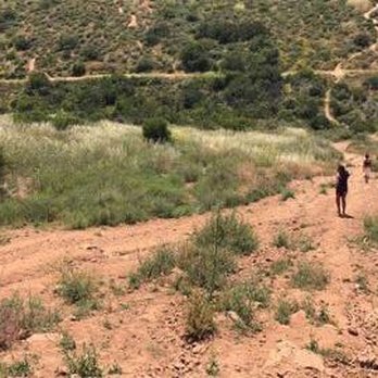

One of my favorite hikes in San Diego! The first time I went I used the AllTrails app so I didn't get lost. This hike is beautiful and the top of the mountain offers beautiful sights! It is approximately 4.5 miles long. Parking can easily be found at the San Miguel Community Park. I considered this a moderate level hike-- the constant incline is killer if you aren't used to that kind of activity! read more


9 years ago
In fathers day hiked the trail with my wife and my two kids super Sunny day .......hot!!!!!!!!!! The trail gets a bit stip but we made it to the top where the flags are...... Loved the trail it's beautiful the views are awesome. Highly recommend to hike it with friends and family.... bring lots of water read more


7 years ago
I really enjoyed the hike. Perfect for me and the pup. There is plenty of parking and not a ton of people hogging up the mountain. I will definitely be back with the pup. Maybe my wife will join us next time read more


It's a short hike, with amazing views. It's steep at first but eases up after the first half mile. On a clear day the view is hard to beat. You can easily see Coronado, downtown, and Mexico. This is a great hike if you don't have all day and want to get outside and do something. Lots of people bring dogs and some have picnics at the top. For the most part the trail is not crowded. You may see a snake, so be prepared for that possibility. It seems like you'll get to the top really fast but it keeps going around corners! No need to call it a day when you get to the Rock House flag, plenty more trails await just keep going! read more


7 years ago


8 years ago

9 years ago
This was a good hike, got lost trying to find the beginning until I read another person's review and parked where she suggested. You get a nice view at the top of a lake and you can see downtown. we kept going up the trail instead of doing the zigzags which made it a little difficult but worth the challenge. read more


9 years ago
Great hike! First time up there took me 45min to the flag. It was a little difficult because we took shortcuts straight up, i say twice as hard as cowls. Bring good shoes because you will slide on your way down. i used google maps app to find and semi follow the trail. Theirs parking next to the park 2335 paseo Veracruz Chula vista 91914. Not crowded good views. read more


8 years ago
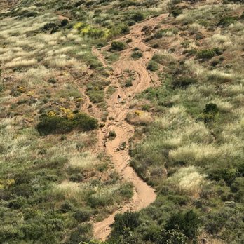
There's 2 ways up. The obvious is going straight up the visible steep trail. Too steep and slippery for me. Over to the left is another trail that leads you to switch backs which make the climb longer but easier. I read people's comments about getting lost in this section, but that's impossible as the switch backs meet up with the main trail. What many hikers don't realize is you can hike back another way via the lake. When you get to the top of the mountain you keep going (north?) and follow the trail down the backside of the mountain. On this route you can get lost so I don't recommend it unless you have gps to help you get back. read more


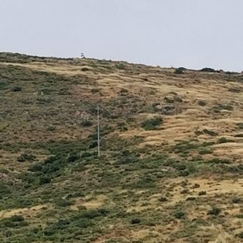
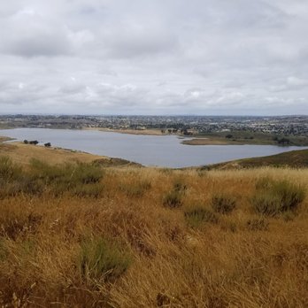
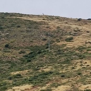
Probably the longest hike I have been on in a minute. This is a pretty challenging one. The first trail goes straight up toward the summit and is basically do or die at the start. There is another trail that zig zags up the side. It's "slightly" less challenigng then tackling the trail that goes straight up. But it will take you longer. Upon hitting the summit there is the famous rock formation with the American flag and the POW flag. It's quite a sight. After today, my personal recommendation is to go back down the trail you came up. I made the mistake of going down the other side of the summit. There is a fork in that trail. Take the wrong one and you will go towards a dead end where there are no more trails (off towards the power lines). You would need to double back to find the other trail head that takes you down. That trail leads towards the lake. Head back toward the power lines and it's sort of another dead end on to a gate that reads private property. From this point you should be able to see the lights toward the park where everyone parks. Head towards that area. You think you hit another dead end when there is a white cinder block but just behind that is the pavement leading back to the park and civilization. It took 4 hours total (probably should have been 3 if we just took the path down that we took up) to finish this and probably ended up being 4-5 miles IMO. But there are great sights of the lake and Chula Vista here as you go up the summit. read more




8 years ago
Head out around 5:40pm and you will make it to the top to catch and amazing sunset. Great place to get a look at the super moons also. The planes landing in downtown San Diego fly around here to you get a nice over head view of them coming around. Trail is clean and challenging. Perfect for a beginner or experienced hiker. read more


9 years ago
We hiked this yesterday.. It was a short easy hike.. The view was great and it's not crowded.. The only drawbacks are that the main trail (if any) doesn't really go anywhere and there isn't a designated parking lot.. Otherwise, it a nice short hike read more

9 years ago
Beginner hiker here. We did this trail with a recommendation from Yelp and I was pleasantly surprised. We took the shortcut and went straight up...a little challenging for a beginner but a good challenging. We made it up in 40 minutes and when we reached the top, we were rewarded with great views...although it was cloudy. Great for beginners that want a small challenge but don't want crowds as with other trails. During the whole hike, we only saw one other person. Just be careful going down cause it does get slippery since there are a lot of rocks. Nonetheless, we will definitely be doing this trail again soon! read more


10 years ago

9 years ago
Just a great hike allowing you to pace yourself or compete against yourself. Seldom crowded and great views. My only issue is recently people leaving their crap throughout the trail. Specifically water bottle caps, dog crap on the trail, and energy bar wrappers!!! If you plan on doing the 1:45 minute hike take your stuff back with you. read more


7 years ago

10 years ago
Good hike with amazing views! Take the switchbacks as it is very steep at the beginning! It's about 2.5 miles one way. Great workout. read more


Page 1 of 2
More info about Rock House Trail
2335 Paseo Veracruz
Chula Vista, CA 91914
Directions
Hours
Outdoor Amenities
Ask the Community - Rock House Trail
Where do you start the Rock House Mountain Bike Trail?
Behind the park, you'll see a trail that leads down to the main trail. You'll eventually find it once you go EAST on the first trail behind San Miguel Community Park.
Review Highlights - Rock House Trail
You might also consider














Rock House Trail - hiking - Updated May 2026
Best of Chula Vista
People found Rock House Trail by searching for…
Hiking Trails in Chula Vista, California
Things to Do in Chula Vista, California
Campgrounds in Chula Vista, California
Walking Trails in Chula Vista, California
Parks in Chula Vista, California
Fishing Spots in Chula Vista, California
Fishing in Chula Vista, California
Off Road Trails in Chula Vista, California
Running Trails in Chula Vista, California
Beautiful Views in Chula Vista, California
Easy Hikes in Chula Vista, California
Bike Paths in Chula Vista, California
Watch Sunset in Chula Vista, California
Scenic Overlook in Chula Vista, California
Night Hike in Chula Vista, California
Full Moon Hike in Chula Vista, California
Dog Friendly Hiking Trails in Chula Vista, California
Scenic View in Chula Vista, California
Lakes & Ponds in Chula Vista, California
Waterfall Hike in Chula Vista, California
Mountain Biking in Chula Vista, California
Sunrise View in Chula Vista, California
Trending Searches in Chula Vista, CA
Boat Rental near Rock House Trail
Botanical Gardens near Rock House Trail
Bounce House Rentals near Rock House Trail
Campgrounds near Rock House Trail
Cherry Picking near Rock House Trail
Cliff Jumping near Rock House Trail
Dog Friendly Things To Do near Rock House Trail
Flower Fields near Rock House Trail
Flower Shop near Rock House Trail
Garage Sales near Rock House Trail
Lakes & Ponds near Rock House Trail
Nurseries & Gardening near Rock House Trail
Outdoor Activities near Rock House Trail
Outdoor Furniture Stores near Rock House Trail
Party Equipment Rentals near Rock House Trail
Pedicure near Rock House Trail
Pick Your Own Farms near Rock House Trail
Picnic Areas near Rock House Trail
Places To Take Pictures near Rock House Trail
Plant Nursery near Rock House Trail
Rock Quarry near Rock House Trail
Running Trails near Rock House Trail
Scenic Drive near Rock House Trail
Secret Spots near Rock House Trail
Strawberry Picking near Rock House Trail
Sunrise View near Rock House Trail
Swimming Holes near Rock House Trail
Browse Articles
Browse Nearby
BEST of Chula Vista, California Coffee near Rock House Trail
BEST of Chula Vista, California Walking Trails near Rock House Trail
BEST of Chula Vista, California Restaurants near Rock House Trail
BEST of Chula Vista, California Things to Do near Rock House Trail
BEST of Chula Vista, California Parks near Rock House Trail
BEST of Chula Vista, California Breakfast near Rock House Trail
BEST of Chula Vista, California Campgrounds near Rock House Trail
BEST of Chula Vista, California Hotels near Rock House Trail
Browse Brands
Related Searches in Chula Vista, CA
Affordable Kayak Rental Services in Chula Vista, California
Best Fishing Locations and Guides in Chula Vista, California
Best Places for Horseback Riding in Chula Vista, California
Best Waterfalls and Swimming Holes in Chula Vista, California
Check Out Off Road Trails in Chula Vista, California
Discover Dog Friendly Trails to Explore in Chula Vista, California
Discover Scenic Mountain Bike Trails Near Chula Vista, California
Discover Walking Parks in Chula Vista, California Near You
Discover a Hiking Trail in Chula Vista, California
Discover the Best Night Hike Trails in Chula Vista, California
Dog-Friendly Hikes With Dogs in Chula Vista, California
Enjoy Camping Adventures Around Chula Vista, California
Enjoy Exciting Mountain Biking Adventures in Chula Vista, California
Enjoy Kayaking Adventures in Chula Vista, California
Enjoy Tent Camping Spots Around Chula Vista, California
Enjoy a Beautiful Waterfall Hike in Chula Vista, California
Enjoy a Peaceful Nature Walk in Chula Vista, California
Enjoy the Best Picnic Spots and Ideas in Chula Vista, California
Enjoy the Best Walking Path in Chula Vista, California
Enjoy the Best Walking Trails in Chula Vista, California
Exciting Cliff Jumping Spots in Chula Vista, California
Explore Beautiful Parks and Green Spaces in Chula Vista, California
Explore Easy Hikes Perfect for All in Chula Vista, California
Explore Fun Activities to Do in Chula Vista, California
Explore Popular Campgrounds Near Chula Vista, California
Explore the Best Beach Spots in Chula Vista, California
Explore the Best Swimming Holes Around Chula Vista, California
Explore the Best Trail Options in Chula Vista, California
Family Friendly Hiking With Kids in Chula Vista, California
Find Beautiful Views in Chula Vista, California
Find Popular Ziplining Spots Around Chula Vista, California
Find the Best Parks for Picnics in Chula Vista, California
Find the Best Scenic View Locations in Chula Vista, California
Great Places to Walk in Chula Vista, California
Hike the Popular Waterfall Trail in Chula Vista, California
Hiking Trails With Waterfalls in Chula Vista, California
Off Leash Dog Hiking Trails in Chula Vista, California
Plan a Scenic Drive Route Near Chula Vista, California
Popular Outdoor Activities to Try in Chula Vista, California
Popular Picnic Spots to Visit in Chula Vista, California
Safe River Swimming Areas in Chula Vista, California
Safe and Fun Parks for Kids in Chula Vista, California
Top Climbing Spots and Gyms in Chula Vista, California
Top Paddleboarding Activities in Chula Vista, California
Top Places for Snorkeling in Chula Vista, California
Top Running Trails to Explore in Chula Vista, California
Top Swimming Lakes to Enjoy in Chula Vista, California
Top Swimming Spots and Pools in Chula Vista, California
Walk Dog Friendly Hiking Trails in Chula Vista, California
Walk the Best Paved Walking Trails in Chula Vista, California
People who viewed Rock House Trail also viewed

Mother Miguel Mountain Trail
4 reviews

Rice Canyon Trail
14 reviews

Otay Valley Regional Park
21 reviews
Otay

Mount San Miguel Park
74 reviews

Sweetwater Park
16 reviews

J Street Marina Bayside Park
58 reviews

Sweetwater River Bridge
37 reviews

The Greg Cox Bike Park
5 reviews
Otay

Upper Otay Reservoir
2 reviews

Hilltop Park
21 reviews