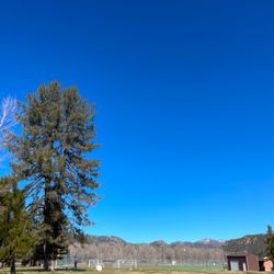
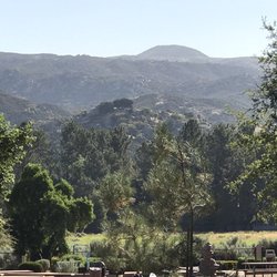
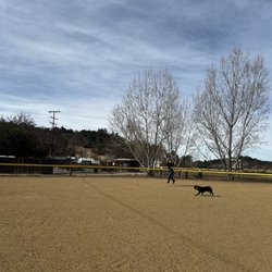
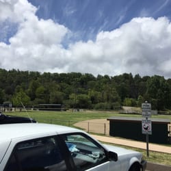
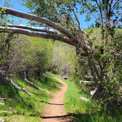
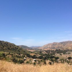
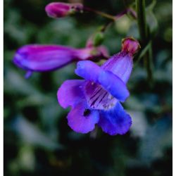
Dead Horse Falls Trail Photos


You might also consider
More like Dead Horse Falls Trail
Recommended Reviews - Dead Horse Falls Trail
Start your review...

3 months ago
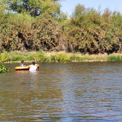
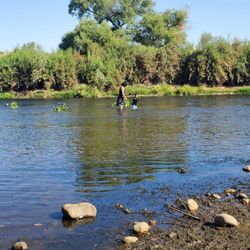
Nice little hike. $10 for parking. Has a bathrooms. Fire road over some rolling Hills until you make a left to go visit the "river". Trail ends up at a nice watering hole. Could definitely do some wading during the summer months if there's water. Even though you're not supposed to touch the water. . The fire road continues through the rolling Hills for several miles if you wanted. read more


3 years ago
Nice easy hike. Beautiful waterfall. Had this waterfall all to ourselves. Took a nice little dip in the swimming pool. Chilly but refreshing! read more
5 years ago
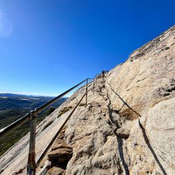
Loved the trail, very mellow but worth it. Pretty easy to find the falls with a beautiful little resting pool. Water is great. Head up the hill on a quick left-handed cut back for a higher climb up the mountain. read more

4 years ago
Loved hiking over here. Cleanest porta potty. I know weird thing to say but it's true. Bad cell reception but that's to be expected. Definitely will go again. read more
More info about Dead Horse Falls Trail
24916 Viejas Blvd
Descanso, CA 91916
Directions
Hours
Outdoor Amenities
You might also consider


Dead Horse Falls Trail - hiking - Updated May 2026
Best of Descanso
People found Dead Horse Falls Trail by searching for…
Waterfall Hike in Descanso, CA
Swimming Holes in Descanso, CA
Places to Swim in Descanso, CA
Running Trails in Descanso, CA
River Swimming in Descanso, CA
Swimming Lakes in Descanso, CA
Places to Take Pictures in Descanso, CA
Running Tracks Open to the Public in Descanso, CA
Tourist Attractions in Descanso, CA
Trending Searches in Descanso, CA
Baseball Fields near Dead Horse Falls Trail
Boat Rental near Dead Horse Falls Trail
Botanical Gardens near Dead Horse Falls Trail
Bounce House Rentals near Dead Horse Falls Trail
Campgrounds near Dead Horse Falls Trail
Cherry Picking near Dead Horse Falls Trail
Cliff Jumping near Dead Horse Falls Trail
Dog Friendly Things To Do near Dead Horse Falls Trail
Fishing Spots near Dead Horse Falls Trail
Flower Fields near Dead Horse Falls Trail
Flower Shop near Dead Horse Falls Trail
Garage Sales near Dead Horse Falls Trail
Hair near Dead Horse Falls Trail
Lakes & Ponds near Dead Horse Falls Trail
Nurseries & Gardening near Dead Horse Falls Trail
Outdoor Activities near Dead Horse Falls Trail
Outdoor Basketball Courts near Dead Horse Falls Trail
Outdoor Furniture Stores near Dead Horse Falls Trail
Parks near Dead Horse Falls Trail
Party Equipment Rentals near Dead Horse Falls Trail
Pedicure near Dead Horse Falls Trail
Pick Your Own Farms near Dead Horse Falls Trail
Picnic Areas near Dead Horse Falls Trail
Places To Take Pictures near Dead Horse Falls Trail
Public Running Track near Dead Horse Falls Trail
Rock Quarry near Dead Horse Falls Trail
Running Trails near Dead Horse Falls Trail
Scenic Drive near Dead Horse Falls Trail
Secret Spots near Dead Horse Falls Trail
Splash Pad near Dead Horse Falls Trail
Strawberry Picking near Dead Horse Falls Trail
Sunrise View near Dead Horse Falls Trail
Swimming Holes near Dead Horse Falls Trail
Table And Chair Rentals near Dead Horse Falls Trail
Tennis Courts near Dead Horse Falls Trail
Walking Trails near Dead Horse Falls Trail
Browse Nearby
BEST of Descanso, California Things to Do near Dead Horse Falls Trail
BEST of Descanso, California Parks near Dead Horse Falls Trail
BEST of Descanso, California Scenic View near Dead Horse Falls Trail
BEST of Descanso, California Restaurants near Dead Horse Falls Trail
BEST of Descanso, California Coffee near Dead Horse Falls Trail
BEST of Descanso, California Breakfast near Dead Horse Falls Trail
BEST of Descanso, California Hotels near Dead Horse Falls Trail
BEST of Descanso, California Campgrounds near Dead Horse Falls Trail
BEST of Descanso, California Taxis near Dead Horse Falls Trail
Browse Brands
Related Searches in Descanso, CA
Best Fishing Locations and Guides in Descanso, California
Best Off Leash Dog Parks in Descanso, California
Best Parks for Parties and Events in Descanso, California
Best Places for Horseback Riding in Descanso, California
Best Places for Stunning Views in Descanso, California
Best Water Parks for Kids in Descanso, California
Best Waterfalls and Swimming Holes in Descanso, California
Check Out Great Playgrounds in Descanso, California
Check Out Off Road Trails in Descanso, California
Discover Baseball Fields Around Descanso, California
Discover Beautiful Garden Spots in Descanso, California
Discover Fun Toddler Parks in Descanso, California for Your Little One
Discover Lakes & Ponds to Explore in Descanso, California
Discover Popular Photo Spots in Descanso, California
Discover Scenic Bike Paths in Descanso, California
Discover Scenic Hiking Trails in Descanso, California
Discover Scenic Mountain Bike Trails Near Descanso, California
Discover Soccer Fields in Descanso, California Near You
Discover Top Nature Parks to Visit in Descanso, California
Discover Top State Parks to Visit in Descanso, California
Discover Walking Parks in Descanso, California Near You
Discover a Hiking Trail in Descanso, California
Discover the Best Kids Park Spots in Descanso, California
Discover the Best Night Hike Trails in Descanso, California
Discover the Best Running Track in Descanso, California
Dog-Friendly Hikes With Dogs in Descanso, California
Effective Stairs Workout Spots in Descanso, California
Enjoy Kayaking Adventures in Descanso, California
Enjoy Scenic Places to Walk in Descanso, California
Enjoy a Beautiful Waterfall Hike in Descanso, California
Enjoy the Best Picnic Spots and Ideas in Descanso, California
Enjoy the Best Tubing Experiences in Descanso, California
Enjoy the Best Walking Path in Descanso, California
Enjoy the Best Walking Trails in Descanso, California
Exciting Cliff Jumping Spots in Descanso, California
Experience Thrilling White Water Rafting in Descanso, California
Explore Beautiful Parks and Green Spaces in Descanso, California
Explore Easy Hikes Perfect for All in Descanso, California
Explore Family-Friendly Zoos and Wildlife in Descanso, California
Explore Free Picnic Areas Around Descanso, California
Explore Outdoor Basketball Courts for All Skill Levels in Descanso, California
Explore Parks With Pull Up Bars in Descanso, California
Explore Popular Campgrounds Near Descanso, California
Explore Popular RV Parks Around Descanso, California
Explore Popular Scenic Overlook Points in Descanso, California
Explore Scenic Lakes to Visit in Descanso, California
Explore Top Dog Parks in Descanso, California Near You
Explore the Best Beach Spots in Descanso, California