Pine Valley County Park Photos


You might also consider
More like Pine Valley County Park
Recommended Reviews - Pine Valley County Park
Start your review...

10 months ago


What an awesome little park! It has lots of parking, it's clean and there are a ton of tables! They have two nice playgrounds close to the tables so it's perfect for Birthday parties. They have two clean bathroom facilities; one by the field and one by the picnic area. They have a beautiful field that looks untouched as well as basketball and tennis courts. The park rangers are very nice too. read more

5 years ago
3 years ago
3 years ago
9 years ago
6 years ago
7 years ago
9 years ago
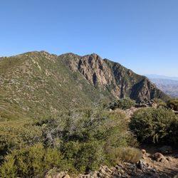
Came here for the first time during Pine Valley Days. Nice view, good amount of space. The baseball fields looked nice. Can't remember the condition of the bathrooms, but I don't recall being disgusted by them. read more


8 years ago
More info about Pine Valley County Park
28820-28824 Old Hwy 80
Pine Valley, CA 91962
Directions
(619) 473-8558
Call Now
Hours
Outdoor Amenities
Ask the Community - Pine Valley County Park
Review Highlights - Pine Valley County Park
You might also consider


Pine Valley County Park - parks - Updated July 2026
Best of Pine Valley
People found Pine Valley County Park by searching for…
Hiking in Pine Valley, California
Things to Do in Pine Valley, California
Turf Fields in Pine Valley, California
Basketball Courts in Pine Valley, California
Tennis in Pine Valley, California
Playgrounds in Pine Valley, California
Beaches in Pine Valley, California
Picnic Spots in Pine Valley, California
Baseball Fields in Pine Valley, California
Water Parks in Pine Valley, California
Beautiful Views in Pine Valley, California
Snow Park in Pine Valley, California
Parks for Kids in Pine Valley, California
Playgrounds for Kids in Pine Valley, California
Swimming Lakes in Pine Valley, California
Places to Take Pictures in Pine Valley, California
Fun Things to Do With Teens in Pine Valley, California
Gazebos in Pine Valley, California
Toddler Playground in Pine Valley, California
Fun Things to Do at Night in Pine Valley, California
Family Fun in Pine Valley, California
View Points in Pine Valley, California
Trending Searches in Pine Valley, CA
Boat Rental in Pine Valley, CA
Fishing Spots in Pine Valley, CA
Jet Ski Rental in Pine Valley, CA
Kayak Rental in Pine Valley, CA
Kids Activities Outdoor in Pine Valley, CA
Outdoor Basketball Courts in Pine Valley, CA
Places To Swim in Pine Valley, CA
Places To Walk Around in Pine Valley, CA
Pool Day Pass in Pine Valley, CA
Public Pools in Pine Valley, CA
River Swimming in Pine Valley, CA
Soccer Store in Pine Valley, CA
Strawberry Picking in Pine Valley, CA
Swimming Holes in Pine Valley, CA
Swimming Lakes in Pine Valley, CA
Things To Do With Kids in Pine Valley, CA
Browse Articles
Browse Nearby
BEST of Pine Valley, California Restaurants near Pine Valley County Park
BEST of Pine Valley, California Things to Do near Pine Valley County Park
BEST of Pine Valley, California Coffee near Pine Valley County Park
BEST of Pine Valley, California Hiking near Pine Valley County Park
BEST of Pine Valley, California Breakfast near Pine Valley County Park
BEST of Pine Valley, California Shopping near Pine Valley County Park
BEST of Pine Valley, California Campgrounds near Pine Valley County Park
Browse Brands
Related Searches in Pine Valley, CA
Best Off Leash Dog Parks in Pine Valley, California
Best Parks for Parties and Events in Pine Valley, California
Best Water Parks for Kids in Pine Valley, California
Check Out Great Playgrounds in Pine Valley, California
Discover Baseball Fields Around Pine Valley, California
Discover Fun Toddler Parks in Pine Valley, California for Your Little One
Discover Popular Photo Spots in Pine Valley, California
Discover Soccer Fields in Pine Valley, California Near You
Discover the Best Beaches in Pine Valley, California
Discover the Best Kids Park Spots in Pine Valley, California
Enjoy Scenic Places to Walk in Pine Valley, California
Enjoy the Best Picnic Spots and Ideas in Pine Valley, California
Enjoy the Best Walking Path in Pine Valley, California
Enjoy the Best Walking Trails in Pine Valley, California
Explore Beautiful Botanical Gardens in Pine Valley, California
Explore Free Picnic Areas Around Pine Valley, California
Explore Fun Activities to Do in Pine Valley, California
Explore Parks With Pull Up Bars in Pine Valley, California
Explore Pickleball Courts in Pine Valley, California
Explore Popular Campgrounds Near Pine Valley, California
Explore Popular Picnic Areas Around Pine Valley, California
Explore Popular RV Parks Around Pine Valley, California
Explore Popular Recreation Centers Around Pine Valley, California
Explore Popular View Points Around Pine Valley, California
Explore Scenic Lakes to Visit in Pine Valley, California
Explore Top Gyms in Pine Valley, California Now
Explore the Best Trail Options in Pine Valley, California
Find Parks and Recreation Activities in Pine Valley, California
Find Top Dog Friendly Parks to Visit in Pine Valley, California
Find Top Dog Swimming Spots in Pine Valley, California
Find Top Skate Parks in Pine Valley, California for All Skill Levels
Find a Park With BBQ Pits in Pine Valley, California
Find the Best Parks BBQ Grills in Pine Valley, California
Find the Best Parks for Picnics in Pine Valley, California
Find the Best Swimming Pools in Pine Valley, California Today
Great Places to Walk in Pine Valley, California
Have Fun at a Splash Pad in Pine Valley, California
Indoor Playgrounds to Explore in Pine Valley, California
Locate Tennis Courts Around Pine Valley, California
Parks With Basketball Courts for Games in Pine Valley, California
Picnic Areas With BBQ Pits Available in Pine Valley, California
Play at a Splash Pad Park in Pine Valley, California
Popular Fishing Spots to Explore in Pine Valley, California
Popular Places to Take Pictures in Pine Valley, California
Top Hiking Trails to Explore in Pine Valley, California
Top Running Trails to Explore in Pine Valley, California
Top Swimming Lakes to Enjoy in Pine Valley, California
Top Swimming Spots and Pools in Pine Valley, California
Top-Rated Basketball Courts to Play at in Pine Valley, California
People who viewed Pine Valley County Park also viewed
Big Rock Park
48 reviews
Mast Park
72 reviews
Lindo Lake County Park
46 reviews
Boulder Oaks Neighborhood Park
3 reviews
Mountain Empire Community Park
2 reviews
Prescott Promenade Park
6 reviews
Santee Lakes Recreation Preserve
374 reviews
Sunset Park
2 reviews
Dos Picos County Park
104 reviews
Wright's Field
2 reviews