Panoramic Point Photos


You might also consider


More like Panoramic Point
Recommended Reviews - Panoramic Point
Start your review...



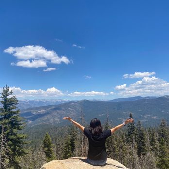
The panoramic point was closed in last April and finally we could check it out this time. My hubby has been there before so he wanted to take me there. This place is hidden gem! You can choose to hike start from the trailhead at the end of Panoramic Point Road, 2 miles up from the park visitor center and market at Grant Village. We chose to drive up to the parking lot instead. It was about a 10 minute drive up on a narrow road from the John Muir Lodge. Gorgeous overlook and amazing views from the top. Highly recommended! read more




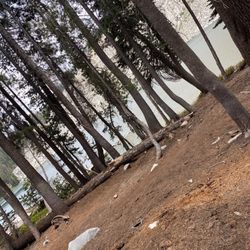
Panoramic Point maybe previously had the potential to be a worthwhile attraction right in the heart of Kings Canyon National Park. Before I discuss why I was a little frustrated with my experience, let me just give a few details and background about coming here. For my journey exploring Sequoia and Kings Canyon NP's...I stayed in this Grant Grove Village area right in between the border of both parks. I actually rented a tent cabin for a couple of evenings. Panoramic Point was situated just behind Grant Grove and the John Muir Lodge. It was relatively easy to find as there was a sign for it right along the road. If you have any difficulty locating it, the Kings Canyon Visitor Center is situated on the grounds of Grant Grove Village. Just go inside and ask a park ranger and they'll know exactly what you're talking about. Getting here....it was a straightforward drive of 1 - 2 miles up the mountain. Once I arrived, the parking lot was relatively empty around 9am as this was one of the first sights of the day I decided to uncover since it was in the vicinity of my cabin. Getting out of the car, I found the Panoramic Point Trailhead and a description of what the area was all about with what to expect along a short hike. Well, the hike was so quick....it was a 0.5 mile round trip walk. That's how short.... There were 2 main reasons why I was disappointed with Panoramic Point.... 1. Well, I could sense this area could have once been great for panoramic views of the Sierra Nevada Mountain Range.....now it looked like over due time the natural skyline appearance had been tainted by trees. To clarify....during my visit a lot of random protruding trees and forest shrubbery appeared in my sightline from the overlook, which ultimately disturbed the scenic aspects of the landscape and beyond. These "unannounced" trees sort of hindered the entire background. I was left puzzled as to what was so special about this spot? I thought in my head...."well, had these trees not been in the way...the potential was there for Panoramic Point to be memorable". Continuing with this idea.....the views were just okay at best. And...the reason I'm convinced Panoramic Point was mediocre was because.....later on in the day I drove fabled 30-mile Generals Highway throughout Kings Canyon which ended at Zumwalt Meadow. Along this parkway I discovered magnificent views and majestic terrain much more inspiring than the short walk up here. In comparison some people may say Panoramic Point is recommended, but for me it was an afterthought especially after stopping at the many beautiful roadside pullovers on Generals Highway like.....Junction View, Yucca Point and Hotel Creek Overlook. My 2nd letdown about Panoramic Point (but this can be easily remedied, lol) was I visited here first thing in the morning over the summer time and I had the sun facing directly into my eyes. Grrrr....this made for picture taking to be difficult especially with the mountainous setting in the distance appearing fuzzy and hazy. So....if you do decide to visit here, I'd certainly suggest stopping on by in the afternoon time with the sun at your back to enhance photographic opportunities. Overall, Panoramic Point could have been momentous back in the day, but with all the new growths of trees rising high into the skyline....it interfered with the whole ambiance and made for a deflating experience. But hey, it's a part of nature. I was in acceptance of it and better to see growth of the forest rather than any wildfires destroying the land.....even if it's at the expense of a place aptly named Panoramic Point. read more




7 years ago
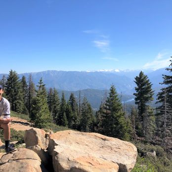
This is a quick stop close to the Grant Grove. It's about a 10 minute drive up a mountain. From the parking lot, you'll climb about 10 minutes to get to Panoramic Point. While it's uphill, it's not that steep. Once there, you'll get some pretty good views of the mountains in the area and a lake. It's not a long stop, but I think it's worth it for the view. read more


We tried to walk up the hill but it's best to drive up the narrow 1.2 miles up from John Muir lodge. Once up there, the outstanding overlook can be reached via a paved 0.5-mile round trip hike with one switchback. The views are amazing and worthy of the name. Look out to northeast over Kings Canyon and surrounding snowy peaks. The trailhead is just a couple miles from Grant Village in the Grant Grove Area of Kings Canyon National Park. Panoramic Point, is at a 7,520-foot overlooking stunning mountain peaks and valleys. I saw benches to relax or hike a trail that follows a mountain ridge to the Park Ridge Fire Lookout. You will pay a national park entrance fee to visit Kings Canyon National Park, but you don't need a permit to hike to Panoramic Point. read more