Pacific Crest Trail At Penny Pines Photos



You might also consider


More like Pacific Crest Trail At Penny Pines
Recommended Reviews - Pacific Crest Trail At Penny Pines
Start your review...


Reviews With Photos


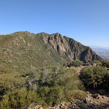
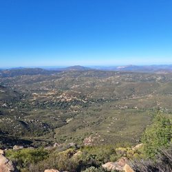
Beautiful hiking trail located in the Cleveland National Forest. This was my first time here and I'm already planning my next trip back (especially since the PCT runs through here). Despite the hot and dry weather the tail was a mix of beautiful fall colors mid-December. The trail was moderate and the views were beautiful. Tips for a successful trip: - wear long pants; shrubs are prickly -buy and adventure pass - parking at the trail head looks like a regular turn out but the trail name is stamped on a rail - bring water - bring snacks to eat at the top - read/leave encouraging notes at the GeoCache box at the top Enjoy!


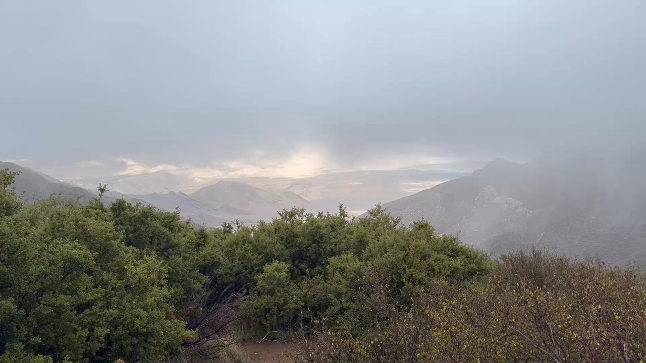
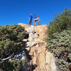
Maybe it's unusual to Yelp about nature, but everyone deserves to know about a little fresh air and natural scenery. Located near Mount Laguna, you can easily make this trek within 1 hour if coming from central San Diego. Parking consists of two turnouts on either side of the road which can fit maybe 5 cars each. You can hike the Noble Canyon Trail and Big Laguna Trail across the street or proceed to a portion of the famous PCT at Penny Pines. Hiking North leads you on the PCT towards Garnet Peak, while going South will eventually take you to Monument Peak. A hike to Garnet Peak is a happy distance at a very easy 4.2 miles roundtrip. The trek up beyond the base is a constant 0.5mi incline and a bit rocky, but definitely doable. I took my senior Lab on this hike and she finished it like a champ (although sore later). We went on a foggy day in the mountains, so we couldn't see much but still caught glimpses of the Anza Borrego and Salton Sea every now and then. Fantastic outing and will return!


Hiked Saturday August 15, 2015 Penny Pines to Garnet Peak Mileage: 4.4 miles Time: 2+ hours First off, there is no shade on this trail. NO SHADE AT ALL. Wear plenty of sunblock and bring water! We hiked it in 95 degree weather. It was hot, very hot. Directions: We camped at Laguna Campground, so this hike is just down the street from here. When you come out of Laguna Campground go left, you pass the lookout to the right and keep going. Watch out for the mile markers, once you pass mile 27.5, go a little further and Penny Pines will be on the right. If you go pas mile marker 27, you've gone too far. From what the ranger station told us, you don't need an adventure pass to park on the side of the street. I wasn't too sure, so I still put my year pass on display. Trail: So you do probably a little under 2 miles one way on the PCT and you will get to the Garnet Peak Trail on the right hand side. Once you get to that point, it's pretty much a straight shot up to the peak. It was so hot when we went, I was going so slow! Great views at the top though of Anza Borrego! Not a very long hike, but it's a nice one and it's part of the PCT!


Started at penny lane trail head and hiked to garnet peak and back . Some of the most amazing views and thousand feet drop offs :) We did this on a Sunday in October , weather was perfect and it took us 3 hours because we like to play around and investigate everything . Had a great snack break at the top of garnet peak , which is a little bit of a climb up at 5,000 ft elev. but nothing harsh. Get your pass at the Mt Laguna lodge before you hike $5


INDIAN CREEK LOOP REVIEW (8.8 miles) Let's begin with 100% of hikes in Mt. Laguna or that includes the PCT will be an ethereal experience. Many say you can create, shape and mold reality. Others will say manifest and it will come. And then there are some that are just bah humbug. I always revel in God's imagination and creativity when he created these mountains. And then gave the gift of ingenuity to humans to work to create pathways and trails for us to enjoy and simply relish in gratitude and awe the entire hike. I'm a real hiker. Real backpacker. Real camper. And real glamping. I hike 2x a week for more than a decade. This is only to give you perspective of this review. This is my first time doing the full loop that included Pacific Crest Trail,Pine Mountain Road,Indian Creek Trail,and Noble Canyon Trail AKA "Indian Creek Loop." And today was wonky. Some parts were hard, some parts were easy, same parts were as if my body never has done hiking before. It was a doozy. I would likely do this hike again within the next couple of weeks. Because in my imagination, I'm an amazing hiker and that did not show today when I was struggling. I love taking photos and there was about an hour where I was trying to manage my breathing and focus and trek poles that I took no photos. Yep, I let the mountain win, smh. On this day, spectacular hike with alternating elevation, endless greenery, and blooming plants. Walking the legendary PCT, passing the "Canada" sign, and glimpsing Anza Borrego's desert floor was unforgettable. From rocky paths to meadows and mountain views, every turn offered something new. No one on the trail until the final half mile where bikers were on trail. I started at Piney Pines. Next time I'll go counterclockwise. GOOD TO KNOW *Att network excellent reception the entire trail *I felt safe as a solo hiker but I still get the quesies. I carry a few safety thins. Shhh. Don't tell *Hike time: 3 hrs, 3 minutes *90% exposed hike. *At the 4 mile marker, shade, benches and toilets. The toilets are unsanitary. I don't want to vomit and make it worse so I do my thing in nature. *When you start there's a point where you just have to finish *You can break this up to build up your mileage over time THIS HIKE IS NOT FOR: *Newbies, there's elevation involved *Whiners, complainers, or scaredy cats *Those who I have only done Cowles Mountain and think this is the next level "Life can be limited and you miss out. But create your own unlimitedness and you must do this hike." read more


This review is for the Garnet Peak via Pacific Crest Trail which was a 4 mile round trip that took about 2 hours to complete. The trail for the most part was easy to follow and completely exposed to the sun. A good portion of the trail was rocky which could make your foot a bit uncomfortable. There were also a few instances where you could go off trail for a bit to check out the desert views! Short video of the hike for those interested: https://www.youtube.com/watch?v=htU3_t3cDMI read more
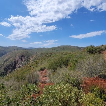


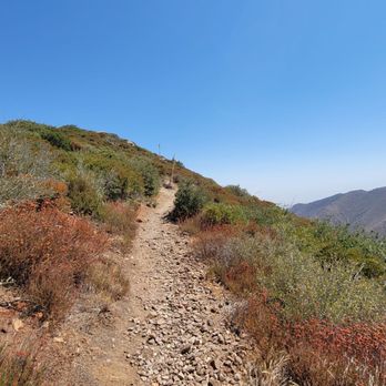


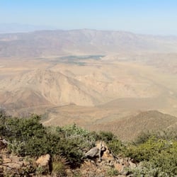
Garnet Peak was beautiful! The eastern most side of Cleveland National Forest meets the western edge of Anza Borrego Desert. It is a daily short hike at about 1.7 miles one way and only 500' elevation gain from the parking lot. You are amongst the highest peaks in San Diego County and can see the Salton sea from there. In the winter you even get snow! read more


8 years ago
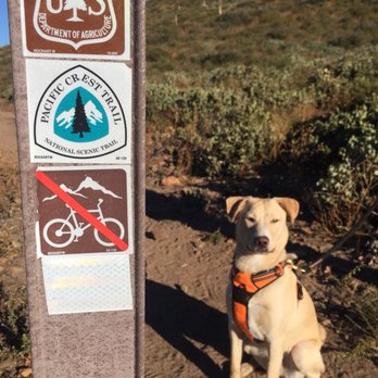
Beautiful hiking trail located in the Cleveland National Forest. This was my first time here and I'm already planning my next trip back (especially since the PCT runs through here). Despite the hot and dry weather the tail was a mix of beautiful fall colors mid-December. The trail was moderate and the views were beautiful. Tips for a successful trip: - wear long pants; shrubs are prickly -buy and adventure pass - parking at the trail head looks like a regular turn out but the trail name is stamped on a rail - bring water - bring snacks to eat at the top - read/leave encouraging notes at the GeoCache box at the top Enjoy! read more


9 years ago
Maybe it's unusual to Yelp about nature, but everyone deserves to know about a little fresh air and natural scenery. Located near Mount Laguna, you can easily make this trek within 1 hour if coming from central San Diego. Parking consists of two turnouts on either side of the road which can fit maybe 5 cars each. You can hike the Noble Canyon Trail and Big Laguna Trail across the street or proceed to a portion of the famous PCT at Penny Pines. Hiking North leads you on the PCT towards Garnet Peak, while going South will eventually take you to Monument Peak. A hike to Garnet Peak is a happy distance at a very easy 4.2 miles roundtrip. The trek up beyond the base is a constant 0.5mi incline and a bit rocky, but definitely doable. I took my senior Lab on this hike and she finished it like a champ (although sore later). We went on a foggy day in the mountains, so we couldn't see much but still caught glimpses of the Anza Borrego and Salton Sea every now and then. Fantastic outing and will return! read more


Hiked Saturday August 15, 2015 Penny Pines to Garnet Peak Mileage: 4.4 miles Time: 2+ hours First off, there is no shade on this trail. NO SHADE AT ALL. Wear plenty of sunblock and bring water! We hiked it in 95 degree weather. It was hot, very hot. Directions: We camped at Laguna Campground, so this hike is just down the street from here. When you come out of Laguna Campground go left, you pass the lookout to the right and keep going. Watch out for the mile markers, once you pass mile 27.5, go a little further and Penny Pines will be on the right. If you go pas mile marker 27, you've gone too far. From what the ranger station told us, you don't need an adventure pass to park on the side of the street. I wasn't too sure, so I still put my year pass on display. Trail: So you do probably a little under 2 miles one way on the PCT and you will get to the Garnet Peak Trail on the right hand side. Once you get to that point, it's pretty much a straight shot up to the peak. It was so hot when we went, I was going so slow! Great views at the top though of Anza Borrego! Not a very long hike, but it's a nice one and it's part of the PCT! read more


13 years ago

12 years ago
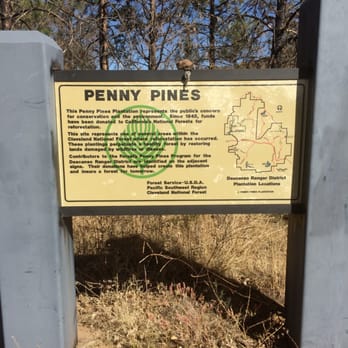
Started at penny lane trail head and hiked to garnet peak and back . Some of the most amazing views and thousand feet drop offs :) We did this on a Sunday in October , weather was perfect and it took us 3 hours because we like to play around and investigate everything . Had a great snack break at the top of garnet peak , which is a little bit of a climb up at 5,000 ft elev. but nothing harsh. Get your pass at the Mt Laguna lodge before you hike $5 read more



14 years ago

16 years ago

11 years ago
Amazing hike and unlike many in San Diego, there are not truckloads of people on the trail. You may run into one or two who are beginning the PCT journey which is super interesting. The trail meets them about 50 miles into their 1300 mi journey south to north. read more


12 years ago
Phenomenal hike, definitely go, it is a true hidden gem! Very manageable drive from San Diego or Orange County. Incredible views in every direction, and in particular of the desert floor below (few thousand foot drop offs). It is an "out and back" hike, so feel free to hike out as far as you'd like before returning. On the way in, it is easy to pass by the trailhead at Penny Pines. Get ready to pull over and park on the side of the road when you reach mile marker 27 on Sunrise Highway (note: it is a lot less than 27 miles once you get off the 8 at Sunrise Highway). Pick up your $5 adventure pass at the Laguna Mountain Lodge (will be on your left as you go through the mountain "village" of Mt. Laguna). Make sure to hydrate well, the altitude is around 5,000 feet, but did not bother us at all. The trail is fairly easy - gradual inclines and descents. Would highly recommend checking out Garnet Peak, it is a few hundred feet of elevation gain from the main Pacific Crest Trail. Great opportunity to take pictures up there. On a Saturday afternoon in early September it was not crowded whatsoever, we only saw five people the entire day. We will definitely go back again soon! read more


12 years ago


15 years ago
11 years ago

10 years ago

11 years ago
10 years ago
10 years ago
11 years ago
More info about Pacific Crest Trail At Penny Pines
12000 Sunrise Hwy
Pine Valley, CA 91962
Directions
Hours
Outdoor Amenities
Ask the Community - Pacific Crest Trail At Penny Pines
Review Highlights - Pacific Crest Trail At Penny Pines
You might also consider




















Pacific Crest Trail At Penny Pines - hiking - Updated May 2026
Best of Pine Valley
People found Pacific Crest Trail At Penny Pines by searching for…
Campgrounds in Pine Valley, California
Things to Do in Pine Valley, California
Parks in Pine Valley, California
Hiking Trails in Pine Valley, California
Beautiful Views in Pine Valley, California
Off Road Trails in Pine Valley, California
Forest in Pine Valley, California
Running Trails in Pine Valley, California
Lookout Points in Pine Valley, California
Picnic Spots in Pine Valley, California
Easy Hikes in Pine Valley, California
Fall Foliage in Pine Valley, California
Picnic Areas in Pine Valley, California
Photo Spots in Pine Valley, California
Waterfall Hike in Pine Valley, California
Visitor Centers in Pine Valley, California
Secret Spots in Pine Valley, California
Sunrise Hike in Pine Valley, California
Places to Take Pictures in Pine Valley, California
Lakes & Ponds in Pine Valley, California
Snow in Pine Valley, California
Playgrounds in Pine Valley, California
Trending Searches in Pine Valley, CA
Boat Rental near Pacific Crest Trail At Penny Pines
Botanical Gardens near Pacific Crest Trail At Penny Pines
Bounce House Rentals near Pacific Crest Trail At Penny Pines
Campgrounds near Pacific Crest Trail At Penny Pines
Dog Friendly Things To Do near Pacific Crest Trail At Penny Pines
Flower Fields near Pacific Crest Trail At Penny Pines
Flower Shop near Pacific Crest Trail At Penny Pines
Hair near Pacific Crest Trail At Penny Pines
Lakes & Ponds near Pacific Crest Trail At Penny Pines
Movie Theatre near Pacific Crest Trail At Penny Pines
Nurseries & Gardening near Pacific Crest Trail At Penny Pines
Outdoor Activities near Pacific Crest Trail At Penny Pines
Outdoor Furniture Stores near Pacific Crest Trail At Penny Pines
Party Equipment Rentals near Pacific Crest Trail At Penny Pines
Pedicure near Pacific Crest Trail At Penny Pines
Pick Your Own Farms near Pacific Crest Trail At Penny Pines
Picnic Areas near Pacific Crest Trail At Penny Pines
Places To Walk Around near Pacific Crest Trail At Penny Pines
Rainy Day Activities near Pacific Crest Trail At Penny Pines
Rock Quarry near Pacific Crest Trail At Penny Pines
Running Trails near Pacific Crest Trail At Penny Pines
Scenic Drive near Pacific Crest Trail At Penny Pines
Secret Spots near Pacific Crest Trail At Penny Pines
Strawberry Picking near Pacific Crest Trail At Penny Pines
Sunrise View near Pacific Crest Trail At Penny Pines
Swimming Holes near Pacific Crest Trail At Penny Pines
Things To Do On A Rainy Day near Pacific Crest Trail At Penny Pines
Browse Articles
Browse Nearby
Browse Brands
Related Searches in Pine Valley, CA
Best Fishing Locations and Guides in Pine Valley, California
Best Places for Horseback Riding in Pine Valley, California
Best Spots for Star Gazing in Pine Valley, California
Best Waterfalls and Swimming Holes in Pine Valley, California
Check Out Off Road Trails in Pine Valley, California
Discover Scenic Waterfall Spots in Pine Valley, California
Discover a Hiking Trail in Pine Valley, California
Discover the Best Night Hike Trails in Pine Valley, California
Discover the Best Running Track in Pine Valley, California
Dog-Friendly Hikes With Dogs in Pine Valley, California
Effective Stairs Workout Spots in Pine Valley, California
Enjoy Camping Adventures Around Pine Valley, California
Enjoy Exciting Mountain Biking Adventures in Pine Valley, California
Enjoy Tent Camping Spots Around Pine Valley, California
Enjoy a Beautiful Waterfall Hike in Pine Valley, California
Enjoy the Best Picnic Spots and Ideas in Pine Valley, California
Enjoy the Best Walking Path in Pine Valley, California
Enjoy the Best Walking Trails in Pine Valley, California
Experience Stunning Sunset Views in Pine Valley, California
Explore Beautiful Parks and Green Spaces in Pine Valley, California
Explore Bike Rentals Throughout Pine Valley, California
Explore Fun Activities to Do in Pine Valley, California
Explore Popular Campgrounds Near Pine Valley, California
Explore Popular View Points Around Pine Valley, California
Explore Scenic Lakes to Visit in Pine Valley, California
Explore the Best Swimming Holes Around Pine Valley, California
Explore the Best Trail Options in Pine Valley, California
Family Friendly Hiking With Kids in Pine Valley, California
Find Beautiful Views in Pine Valley, California
Find Fun Kids Activities Outdoor in Pine Valley, California
Find Popular Ziplining Spots Around Pine Valley, California
Find Top Dog Swimming Spots in Pine Valley, California
Find the Best Playgrounds to Visit in Pine Valley, California
Find the Best Scenic View Locations in Pine Valley, California
Great Places to Walk in Pine Valley, California
Off Leash Dog Hiking Trails in Pine Valley, California
Plan a Scenic Drive Route Near Pine Valley, California
Popular Fishing Spots to Explore in Pine Valley, California
Popular Outdoor Activities to Try in Pine Valley, California
Popular Picnic Spots to Visit in Pine Valley, California
Safe River Swimming Areas in Pine Valley, California
Safe and Fun Parks for Kids in Pine Valley, California
Top Climbing Spots and Gyms in Pine Valley, California
Top Playgrounds for Kids to Enjoy in Pine Valley, California
Top Running Trails to Explore in Pine Valley, California
Top Swimming Lakes to Enjoy in Pine Valley, California
Top Swimming Spots and Pools in Pine Valley, California
Top Things to Do With Kids in Pine Valley, California
People who viewed Pacific Crest Trail At Penny Pines also viewed

El Cajon Mountain Hiking Trail
140 reviews

Cedar Creek Falls
358 reviews

Merigan Trail
3 reviews

Santa Ysabel Open Space Preserve West
13 reviews

Potato Chip Rock
547 reviews

Secret Canyon Trail
6 reviews

Three Sisters Falls
369 reviews

Desert View Picnic Site
1 review

Historic Flume Trailhead
2 reviews
Blossom Valley

Hike Garnet Peak via PCT
2 reviews