Mt Rose Summit Photos


You might also consider
More like Mt Rose Summit
Recommended Reviews - Mt Rose Summit
Start your review...

Reviews With Photos


We didn't hike to the real mountain summit, that's for the Sierra Clubbers. We got to the summit of the Mt Rose Highway. There's a nice parking area here and trail starting spots for hiking. We had our pick up truck on the super hot day down in the valleys. Here at over 8900 feet, the temps were much cooler and pleasant. This makes for a great place for a picnic in the back of the truck on lounge chairs. Bust out the ice chest and the bucket of fried chicken and we're set! If you're not used to high altitude, it might be a little hard to breath. Living down in the Sac Valley in Red Bluff, I don't get much high altitude breathing practice. If you're driving over the pass here, stop and check out this stopping spot.

Decided to "trail run" up to Mt. Rose Summit on Labor Day weekend with a friend. We walked a couple miles of it a few nights before and thought we could handle it as the first 1.5 miles are a nice dirt path with minimal incline. We accidentally veered off trail around 2.5 miles in so we turned around to continue on the Mt. Rose path. Slowly hiking/jogging/trotting we made it to the top in well under 2 hours. We quickly enjoyed our view before dusk and jogged down. What an adventure and great view!

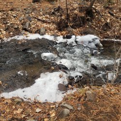
Not for the faint-hearted, and definitely not a trip you should consider lightly if you're going in mid-February. Mountain was still entirely covered in snow and it was actually mildly dangerous considering how easy it was to lose the trail. Would recommend coming here closer to March or when you're sure the snow has melted. Otherwise, if you're sure you want to get in that quad burn, make sure you have proper snow boots with ski shoes. We rented them at a local store and that place was packed with people! We must have waited about a good 45 minutes or so until we were all serviced (with a semi-large group of 6 of us). Make sure you have the essentials for preparing for the unexpected- apart from snow shoes and sturdy ski poles, you'll want the basics (water, snacks, snacks, did I say other snacks or sources of energy, some form of actual food (can't go wrong with peanut butter & banana sandwiches), unless your water bottle opens in your pack and gets all your sandwiches soggy). Consider having a battery pack if you're going to rely on your phone- and even then make sure you have a compass and at least a map. There was surprisingly good reception for most of the mountain but always be prepared is the only motto there is for hiking out this remotely. Huge safety public service announcement here that I can't seem to emphasize enough! Another rule is to ALWAYS have a buddy. We actually ran into a lone hiker who was having some combination of mild high altitude sickness or a type 1 diabetes hypoglycemic episode who we had to help call search & rescue for so make sure you know what you're doing but always with a buddy!

I'd you're looking for an awesome day outside, this is your spot. Starting from the Mt. Rose parking lot puts you a good 2.5 hours from the summit without snow. If you've got to contend with snow, make sure to get an early start. This hike has tons of views so don't forget a camera. But also don't forget sunscreen if you get tired of the weekend crowds on the main trail don't be afraid to check the less traveled side trails around the summit area. Dog friendly


OVERALL: Five stars! This is a great stop by the freeway that has a parking lot you can park your car. About a 40 min drive from Reno. Came on a Sunday before noon. More people started coming after 1pm. SNOW ACTIVITIES: Easily walk onto a vast flat area with semi soft snow perfect for gathering together for snow balls or making snowmen. We grabbed chunks of snow and played with our dog. A family made a snowman and took photos. Saw two other dogs a group brought who were off leash, but we kept our dog leashed the whole time especially with kids around I know some people get nervous about dogs near kids. If it's hills you seek, there are hills with nice clearings without trees and not too steep for sledding. I mention the trees because the last thing you want is to sled head first into a tree. There were a few families with children sledding down on sleds or circular discs. They were all laughing having fun and taking photos. Plus with the flat land at the bottom you have plenty of space to slow down and land in soft snow. Some freeway stops with snow are super icy and hurt when you fall because it's so hard, but this place has perfect snow! Not too soft where you sink down to your knees and not hard. Ski or snowboard? The group who brought the dogs had skiis and walked somewhere higher up the hills past the trees so I assume they went up to the top to then ski down, but I never saw them come back down by the time we left. BATHROOMS: had a sign that said they're closed. Trash can by the bathroom building.

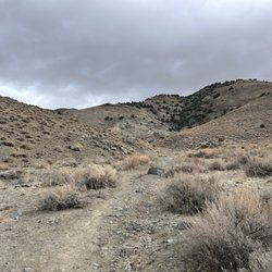
Today was my second time summiting mt rose after at least 5 years and I'm asking myself why it took me so long to revisit this beautiful hike. The trail itself it mostly sand or a mix between gravel and some areas with larger pieces of broken up granite but nothing too gnarly. The first 2.5 miles to the waterfall is mostly flat. The real incline doesn't happen till after the waterfall and it's really not that bad either. I think from there's it's approximately another 2.5+ or so miles to the top. There's still some wet areas on the trail because of the late snow melt but that's ok because the abundance of wildflowers is real right now!! I must have went super late in the year last time because I don't remember this. Anyways .. after the water fall the accent starts but it's not that bad. It is steep but it's do able and shouldn't scare anyone away. I would rate this trail as moderate-maybe hard for some. Take your time and rest on the way up if you have to! It's worth it - The last mile gets a bit steeper and close to the summit its rockier. If you weren't breathing heavy before, you will be now. Once your at the top you are rewarded with a beautiful view , 360° - so make sure you look all around you. And this hike is dog friendly :)

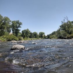
Amazing hike, and well worth the effort. I think you could actually break this hike in parts. The first to the waterfall and then if course to the summit. The first part is fairly easy hike. The views are nothing less than spectacular. Hiking past Tamarack Lake with it's clear mountain blue tint, amazing. There is plenty of shade along the first half as well. Obviously available of water is awful handy, as halfway on the hike are the waterfall. The second half of the hike is a lot more challenging, but so worth the effort. It's s extremely well maintained trail. The views are the continued to get my epic as I made my way all the way to the summit. Just a overall knock your socks off kinda day. Go for it, you won't regret it.


2 years ago
I love this Mt Rose hiking trail. It's about 11 mile loop trail located northeast of Incline Village in Nevada. The trail is considered moderately challenging with a steady climb. It took me about 6 hours to complete. Mount Rose Summit is the highest mountain pass in the Sierra Nevada, which remains open year-round. Gorgeous hiking trail! Enjoy! read more


2 years ago
Snowy find! We had an amazing time at Mt. Rose summit. Our doodle-Plumette had a blast running and frolicking in the snow and we loved the convenient location! We loved the breathtaking views of the surrounding landscapes -which-provided numerous photo opportunities. We wil Although-we were not prepared to hike in the snow-the panoramic vistas of the surrounding mountains and valleys convinced us to come back to take in a nature hike in the summer. Perk: Dog Friendly read more


Tahoe Rim Trail; TRT. Mt. Rose is the 2nd highest mountain in the Lake Tahoe Basin and the highest Tahoe Basin peak in Nevada. Quality/Quantity - Nice easy unpaved hike. Did only two miles today as I knew I had a gardening project later today... My goal is to come back tomorrow to Sky Tavern and hike 4-8 miles. Wish me luck. Update, day 2 - hiked to Tamarack Lake and back, 4 miles. Sky Tavern closed due to an event. 2.5 miles in, you get to the waterfall. Atmosphere - Beautiful views, clear sunny day. Perfect weather for a hike, not too hot or too cold. My pictures do NOT do it justice. Dog, bike, horse friendly. Different paths for differ types of hikes. Bathrooms under construction, remodel, repair. One outhouse availability which I did not use. Parking for approximately 50 cars, currently less due to construction. Roads can be closed due to snow or fire danger. Camping available, but you need a permit. Service - None, self service. Price - Free, please donate. Owner Suggestion - Thank you Mt. Rose for such beautiful trails. read more


We didn't hike to the real mountain summit, that's for the Sierra Clubbers. We got to the summit of the Mt Rose Highway. There's a nice parking area here and trail starting spots for hiking. We had our pick up truck on the super hot day down in the valleys. Here at over 8900 feet, the temps were much cooler and pleasant. This makes for a great place for a picnic in the back of the truck on lounge chairs. Bust out the ice chest and the bucket of fried chicken and we're set! If you're not used to high altitude, it might be a little hard to breath. Living down in the Sac Valley in Red Bluff, I don't get much high altitude breathing practice. If you're driving over the pass here, stop and check out this stopping spot. read more


Decided to "trail run" up to Mt. Rose Summit on Labor Day weekend with a friend. We walked a couple miles of it a few nights before and thought we could handle it as the first 1.5 miles are a nice dirt path with minimal incline. We accidentally veered off trail around 2.5 miles in so we turned around to continue on the Mt. Rose path. Slowly hiking/jogging/trotting we made it to the top in well under 2 hours. We quickly enjoyed our view before dusk and jogged down. What an adventure and great view! read more


6 years ago
Not for the faint-hearted, and definitely not a trip you should consider lightly if you're going in mid-February. Mountain was still entirely covered in snow and it was actually mildly dangerous considering how easy it was to lose the trail. Would recommend coming here closer to March or when you're sure the snow has melted. Otherwise, if you're sure you want to get in that quad burn, make sure you have proper snow boots with ski shoes. We rented them at a local store and that place was packed with people! We must have waited about a good 45 minutes or so until we were all serviced (with a semi-large group of 6 of us). Make sure you have the essentials for preparing for the unexpected- apart from snow shoes and sturdy ski poles, you'll want the basics (water, snacks, snacks, did I say other snacks or sources of energy, some form of actual food (can't go wrong with peanut butter & banana sandwiches), unless your water bottle opens in your pack and gets all your sandwiches soggy). Consider having a battery pack if you're going to rely on your phone- and even then make sure you have a compass and at least a map. There was surprisingly good reception for most of the mountain but always be prepared is the only motto there is for hiking out this remotely. Huge safety public service announcement here that I can't seem to emphasize enough! Another rule is to ALWAYS have a buddy. We actually ran into a lone hiker who was having some combination of mild high altitude sickness or a type 1 diabetes hypoglycemic episode who we had to help call search & rescue for so make sure you know what you're doing but always with a buddy! read more


I'd you're looking for an awesome day outside, this is your spot. Starting from the Mt. Rose parking lot puts you a good 2.5 hours from the summit without snow. If you've got to contend with snow, make sure to get an early start. This hike has tons of views so don't forget a camera. But also don't forget sunscreen if you get tired of the weekend crowds on the main trail don't be afraid to check the less traveled side trails around the summit area. Dog friendly read more

7 years ago
We came here in December, before all the snow started. Driving here is not too far from El Dorado hotel, where we stayed. I really enjoyed the view from up above and the little snow that kept us busy sledding. The view is phenomenal. We can't wait to come back for the ski season. read more

11 years ago
OVERALL: Five stars! This is a great stop by the freeway that has a parking lot you can park your car. About a 40 min drive from Reno. Came on a Sunday before noon. More people started coming after 1pm. SNOW ACTIVITIES: Easily walk onto a vast flat area with semi soft snow perfect for gathering together for snow balls or making snowmen. We grabbed chunks of snow and played with our dog. A family made a snowman and took photos. Saw two other dogs a group brought who were off leash, but we kept our dog leashed the whole time especially with kids around I know some people get nervous about dogs near kids. If it's hills you seek, there are hills with nice clearings without trees and not too steep for sledding. I mention the trees because the last thing you want is to sled head first into a tree. There were a few families with children sledding down on sleds or circular discs. They were all laughing having fun and taking photos. Plus with the flat land at the bottom you have plenty of space to slow down and land in soft snow. Some freeway stops with snow are super icy and hurt when you fall because it's so hard, but this place has perfect snow! Not too soft where you sink down to your knees and not hard. Ski or snowboard? The group who brought the dogs had skiis and walked somewhere higher up the hills past the trees so I assume they went up to the top to then ski down, but I never saw them come back down by the time we left. BATHROOMS: had a sign that said they're closed. Trash can by the bathroom building. read more


Today was my second time summiting mt rose after at least 5 years and I'm asking myself why it took me so long to revisit this beautiful hike. The trail itself it mostly sand or a mix between gravel and some areas with larger pieces of broken up granite but nothing too gnarly. The first 2.5 miles to the waterfall is mostly flat. The real incline doesn't happen till after the waterfall and it's really not that bad either. I think from there's it's approximately another 2.5+ or so miles to the top. There's still some wet areas on the trail because of the late snow melt but that's ok because the abundance of wildflowers is real right now!! I must have went super late in the year last time because I don't remember this. Anyways .. after the water fall the accent starts but it's not that bad. It is steep but it's do able and shouldn't scare anyone away. I would rate this trail as moderate-maybe hard for some. Take your time and rest on the way up if you have to! It's worth it - The last mile gets a bit steeper and close to the summit its rockier. If you weren't breathing heavy before, you will be now. Once your at the top you are rewarded with a beautiful view , 360° - so make sure you look all around you. And this hike is dog friendly :) read more


Amazing hike, and well worth the effort. I think you could actually break this hike in parts. The first to the waterfall and then if course to the summit. The first part is fairly easy hike. The views are nothing less than spectacular. Hiking past Tamarack Lake with it's clear mountain blue tint, amazing. There is plenty of shade along the first half as well. Obviously available of water is awful handy, as halfway on the hike are the waterfall. The second half of the hike is a lot more challenging, but so worth the effort. It's s extremely well maintained trail. The views are the continued to get my epic as I made my way all the way to the summit. Just a overall knock your socks off kinda day. Go for it, you won't regret it. read more

7 years ago
Great hiking spot. We did 2.6 miles total before 8am and it was nice and quiet. Got more busy when we left around 9ish so go early to beat the crowds. Beautiful trees and lots of little chipmunks read more


8 years ago
8 years ago
We had such a fun time at the summit and meadows. The best part is that we could have our dog sliding with us. read more

9 years ago
This really needs to be broken down into 2 portions. The first portion would be the 2.5 mile hike to the Galena Creek Falls. This was a relatively easy hike, I think the elevation change is only around 500 ft. The Falls are fantastic! The second portion would be the 2.5 miles to the summit. This is a much more difficult hike consisting of an increase of 2000 ft of elevation. Being from Houston, this increase of elevation made breathing very difficult. My wife and I had to stop numerous times to catch our breath and adjust to the lack of oxygen. Along the way, you will find numerous points in which the trail is only about 12-24" wide making it a bit challenging. But at the summit, it made it all worth it. I'd highly suggest the first portion to the Falls for everyone, but maybe the second portion might be best reserved for somewhat experienced hikers. read more

10 years ago
More info about Mt Rose Summit
Ask the Community - Mt Rose Summit
Review Highlights - Mt Rose Summit
You might also consider


Why does Yelp recommend reviews?
2 reviews that are not currently recommended
The reviews below are not factored into the business's overall star rating.
4 years ago
6 years ago
Mt Rose Summit - hiking - Updated July 2026
Best of Reno
People found Mt Rose Summit by searching for…
Trending Searches in Reno, NV
Browse Articles
Browse Nearby
BEST of Reno, Nevada Restaurants near Mt Rose Summit
BEST of Reno, Nevada Breakfast near Mt Rose Summit
BEST of Reno, Nevada Coffee near Mt Rose Summit
BEST of Reno, Nevada Things to Do near Mt Rose Summit
BEST of Reno, Nevada Shopping near Mt Rose Summit
BEST of Reno, Nevada Campgrounds near Mt Rose Summit
BEST of Reno, Nevada Thrift Stores near Mt Rose Summit
Browse Brands
Related Searches in Reno, NV
Affordable Kayak Rental Services in Reno, Nevada
Best Fishing Locations and Guides in Reno, Nevada
Best Places for Horseback Riding in Reno, Nevada
Best Sledding Spots and Fun in Reno, Nevada
Check Out Off Road Trails in Reno, Nevada
Discover Dog Friendly Trails to Explore in Reno, Nevada
Discover Scenic Bike Paths in Reno, Nevada
Discover Scenic Mountain Bike Trails Near Reno, Nevada
Discover Scenic Waterfall Spots in Reno, Nevada
Discover a Hiking Trail in Reno, Nevada
Discover the Best Night Hike Trails in Reno, Nevada
Dog-Friendly Hikes With Dogs in Reno, Nevada
Enjoy Camping Adventures Around Reno, Nevada
Enjoy Exciting Mountain Biking Adventures in Reno, Nevada
Enjoy Kayaking Adventures in Reno, Nevada
Enjoy Tent Camping Spots Around Reno, Nevada
Enjoy a Beautiful Waterfall Hike in Reno, Nevada
Enjoy the Best Picnic Spots and Ideas in Reno, Nevada
Enjoy the Best Tubing Experiences in Reno, Nevada
Enjoy the Best Walking Path in Reno, Nevada
Enjoy the Best Walking Trails in Reno, Nevada
Exciting Cliff Jumping Spots in Reno, Nevada
Experience Thrilling White Water Rafting in Reno, Nevada
Explore Beautiful Parks and Green Spaces in Reno, Nevada
Explore Easy Hikes Perfect for All in Reno, Nevada
Explore Fun Activities to Do in Reno, Nevada
Explore Popular Campgrounds Near Reno, Nevada
Explore the Best Beach Spots in Reno, Nevada
Explore the Best Boating Spots in Reno, Nevada
Explore the Best Swimming Holes Around Reno, Nevada
Explore the Best Trail Options in Reno, Nevada
Family Friendly Hiking With Kids in Reno, Nevada
Find Beautiful Views in Reno, Nevada
Find Popular Ziplining Spots Around Reno, Nevada
Find the Best Parks for Picnics in Reno, Nevada
Find the Best Scenic View Locations in Reno, Nevada
Great Places to Walk in Reno, Nevada
Hiking Trails With Waterfalls in Reno, Nevada
Off Leash Dog Hiking Trails in Reno, Nevada
Plan a Scenic Drive Route Near Reno, Nevada
Popular Outdoor Activities to Try in Reno, Nevada
Popular Picnic Spots to Visit in Reno, Nevada
Safe River Swimming Areas in Reno, Nevada
Safe and Fun Parks for Kids in Reno, Nevada
Top Running Trails to Explore in Reno, Nevada
Top Swimming Lakes to Enjoy in Reno, Nevada
Top Swimming Spots and Pools in Reno, Nevada
Top Things to Do With Kids in Reno, Nevada
People who viewed Mt Rose Summit also viewed
Lower Galena Creek Trail - Jones-Whites Loop - Church's Pond
19 reviews
Marlette lake trail
6 reviews
Cross Peak Hiking Trail
16 reviews
Galena Falls Trail
3 reviews
Upper Thomas Creek - Whites Creek - Dry Pond Trail
7 reviews
Galena Creek Trail
5 reviews
Tahoe Rim Trail to Picnic Rock Viewpoint
16 reviews
Mount Rose Wilderness
3 reviews
Ballardini Ranch Trailhead
14 reviews
East Keystone Canyon
10 reviews