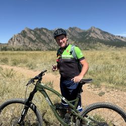
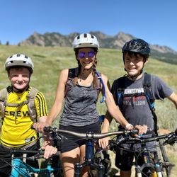
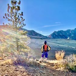
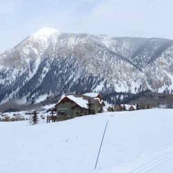
Mount Elbert Photos


More like Mount Elbert
Recommended Reviews - Mount Elbert
Start your review...

Reviews With Photos

This is the highest 14er in Colorado, which makes it feel like such a huge accomplishment to summit! Although that may sound daunting, this is a very doable 14er and one of my friends in my group did this as her first one (she did so well!). The road up is 2WD and there's lots of places to park even if the lot is full. They have restrooms at the trailhead and I found the trail easy to follow. We did the north trail, which is standard route. No bouldering needed, just keep hiking! There are a few false summits...why you got to tease us like that Elbert? But it makes the real summit that much more exciting! It's a pretty one, not the prettiest in my opinion, but very nice. Clocked the trip around 11miles and over 4K elevation!

Very steep very difficult climb, but a very fun challenge nonetheless. Lost my partner on the way up, the workers working on the mountain were very kind and help send up a message to me that my friend was alive and safe about halfway down the mountain. Beautiful views and literally being the highest person in the US in one way possibly two ways at one point.

Absolutely amazing hike! This was my first time hiking a 14nr, so I had no experience of what it would be like, and it was difficult to say the least! You gain over 4500 feet in elevation, and this is the highest peak in the rock mountains in North America. That constant incline was killer but not impossible! They are doing lots of construction on the trail, which will likely make it safer and / or easier to navigate. Im pretty scared of heights thankfully there was only a short section that was on a cliff edge, and the hiking poles helped me feel secure. There are 2 false summits, so don't feel let down when you reach them and have to keep going, the last false summit is very close to the top! The views at the top make it worthwhile, you can see for miles, including the beautiful twin lakes. This hike was overall 10.5 miles and took 8.5hrs to complete, I took lots of breaks for snacks and rest, but im a native so the altitude wasn't a problem for me but could be for others. Make sure to bring plenty of water and food! I recommend this hike, but maybe not for your first 14nr if you are not acclimated to this altitude.

So I generally shy away from 14ers as the tourists crap everywhere on the trail leaving toilet paper widely seen For those visiting please dig a cathole 6 inches deep and PACK your toilet paper out Elbert is a wonderful trail well maintained and easy to hike...compared to Capitol or Longs. Start early 5-6am Bring 2-3 liters of water, snacks,and proper layers of clothing 2nd highest peak in the continuous United States read more


10 months ago
4 years ago
Summiting the tallest mountain in Colorado. Second tallest mountain in the lower 48 states. This was a challenging hike. With spectacular views and a nice accomplishment to check off my bucket list. I did a few months of training in preparation. I am very glad I did. It made the hike much more enjoyable. The views of the alpine terrain, mountains and trees were breathtaking! The trail was very well maintained. My recipe for success: Train up prior, made it easier Planning according to weather reports Early start in order to be back to tree line by noon Carb load the night before, I ate pizza Canned iced coffee morning Water Energy gummies Sturdy boots read more


3 years ago
This is the highest 14er in Colorado, which makes it feel like such a huge accomplishment to summit! Although that may sound daunting, this is a very doable 14er and one of my friends in my group did this as her first one (she did so well!). The road up is 2WD and there's lots of places to park even if the lot is full. They have restrooms at the trailhead and I found the trail easy to follow. We did the north trail, which is standard route. No bouldering needed, just keep hiking! There are a few false summits...why you got to tease us like that Elbert? But it makes the real summit that much more exciting! It's a pretty one, not the prettiest in my opinion, but very nice. Clocked the trip around 11miles and over 4K elevation! read more


2 years ago
Very steep very difficult climb, but a very fun challenge nonetheless. Lost my partner on the way up, the workers working on the mountain were very kind and help send up a message to me that my friend was alive and safe about halfway down the mountain. Beautiful views and literally being the highest person in the US in one way possibly two ways at one point. read more


4 years ago
Absolutely amazing hike! This was my first time hiking a 14nr, so I had no experience of what it would be like, and it was difficult to say the least! You gain over 4500 feet in elevation, and this is the highest peak in the rock mountains in North America. That constant incline was killer but not impossible! They are doing lots of construction on the trail, which will likely make it safer and / or easier to navigate. Im pretty scared of heights thankfully there was only a short section that was on a cliff edge, and the hiking poles helped me feel secure. There are 2 false summits, so don't feel let down when you reach them and have to keep going, the last false summit is very close to the top! The views at the top make it worthwhile, you can see for miles, including the beautiful twin lakes. This hike was overall 10.5 miles and took 8.5hrs to complete, I took lots of breaks for snacks and rest, but im a native so the altitude wasn't a problem for me but could be for others. Make sure to bring plenty of water and food! I recommend this hike, but maybe not for your first 14nr if you are not acclimated to this altitude. read more


4 years ago
5 star experience to be sure! We started out from the trailhead in the middle of the night to make it to the top by sunrise. The trail is well maintained and easy to follow, even in the dark! The false peaks are always a bit of a letdown, but nothing could rain in my parade today! My fiancé and I said our vows at the top, and since you can self-solemnize in Colorado, now he's my husband! We had a fantastic day, everyone on the mountain was so nice, and we're excited to share this story for the rest of our lives together! read more


4 years ago
10 years ago
9 years ago
More info about Mount Elbert
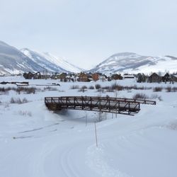
Leadville, CO 80461
Directions
Hours
Outdoor Amenities
Ask the Community - Mount Elbert
Review Highlights - Mount Elbert


Mount Elbert - hiking - Updated June 2026
Best of Leadville
People found Mount Elbert by searching for…
Beaches in Leadville, Colorado
Things to Do in Leadville, Colorado
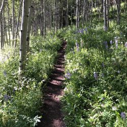
Hiking Trails in Leadville, Colorado
Scenic Views in Leadville, Colorado
Swimming Lakes in Leadville, Colorado
Sunrise View in Leadville, Colorado
Scenic Overlook in Leadville, Colorado
Campgrounds in Leadville, Colorado
Photo Spots in Leadville, Colorado
Easy Hikes in Leadville, Colorado
Tent Camping in Leadville, Colorado
Running Trails in Leadville, Colorado
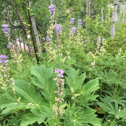
Flower Fields in Leadville, Colorado
Natural Hot Springs in Leadville, Colorado
Cliff Diving in Leadville, Colorado
Off Road Trails in Leadville, Colorado
Waterfalls in Leadville, Colorado
Lakes & Ponds in Leadville, Colorado
Free Campgrounds in Leadville, Colorado
Trending Searches in Leadville, CO
Amusement Parks near Mount Elbert
Cliff Jumping near Mount Elbert
Dog Friendly Trails near Mount Elbert
Dog Swimming near Mount Elbert
Kayak Rental near Mount Elbert
Outdoor Activities near Mount Elbert
Pick Your Own Farms near Mount Elbert
Picnic Areas near Mount Elbert
Public Shower near Mount Elbert
River Swimming near Mount Elbert
River Tubing near Mount Elbert
Running Trails near Mount Elbert
Scenic Drive near Mount Elbert
Sunrise View near Mount Elbert
Swimming Holes near Mount Elbert
Swimming Lakes near Mount Elbert
Swimming Pools near Mount Elbert
Browse Articles
Browse Nearby
BEST of Leadville, Colorado Coffee near Mount Elbert
BEST of Leadville, Colorado Restaurants near Mount Elbert
BEST of Leadville, Colorado Hot Springs near Mount Elbert
BEST of Leadville, Colorado Things to Do near Mount Elbert
BEST of Leadville, Colorado Parks near Mount Elbert
BEST of Leadville, Colorado Scenic View near Mount Elbert
BEST of Leadville, Colorado Campgrounds near Mount Elbert
BEST of Leadville, Colorado Breakfast near Mount Elbert
BEST of Leadville, Colorado Visitor Centers near Mount Elbert
Browse Brands
Related Searches in Leadville, CO
Affordable Bike Repair Services in Leadville, Colorado
Affordable Bike Tune Up Services in Leadville, Colorado
Affordable Kayak Rental Services in Leadville, Colorado
Affordable Mobile Bike Repair in Leadville, Colorado
Affordable Tandem Bike Rental in Leadville, Colorado
Best Dirt Bike Riding Spots in Leadville, Colorado
Best Dog Hiking Trails Around Leadville, Colorado
Best Electric Bike Rental Services in Leadville, Colorado
Best Fishing Locations and Guides in Leadville, Colorado
Best Fun Things to Do in Leadville, Colorado
Best Lookout Points to Visit in Leadville, Colorado
Best Nature Trails for Hiking in Leadville, Colorado
Best Places for Horseback Riding in Leadville, Colorado
Best Sledding Spots and Fun in Leadville, Colorado
Best Used Bikes for Sale Near Leadville, Colorado
Discover Dog Friendly Trails to Explore in Leadville, Colorado
Discover Free Parking Options in Leadville, Colorado
Discover Popular Bike Trails in Leadville, Colorado
Discover Popular Photo Spots in Leadville, Colorado
Discover Scenic Mountain Bike Trails Near Leadville, Colorado
Discover Top Nature Parks to Visit in Leadville, Colorado
Discover a Hiking Trail in Leadville, Colorado
Discover the Best Night Hike Trails in Leadville, Colorado
Dog-Friendly Hikes With Dogs in Leadville, Colorado
Enjoy Camping Adventures Around Leadville, Colorado
Enjoy Exciting Mountain Biking Adventures in Leadville, Colorado
Enjoy Hiking Adventures in Leadville, Colorado
Enjoy Tent Camping Spots Around Leadville, Colorado
Enjoy the Best Picnic Spots and Ideas in Leadville, Colorado
Enjoy the Best Tubing Experiences in Leadville, Colorado
Exciting Cliff Jumping Spots in Leadville, Colorado
Exciting Snow Tubing Experiences in Leadville, Colorado
Experience Stunning Sunset Views in Leadville, Colorado
Explore Beautiful Parks and Green Spaces in Leadville, Colorado
Explore Bike Rentals Throughout Leadville, Colorado
Explore Easy Hikes Perfect for All in Leadville, Colorado
Explore Family-Friendly Zoos and Wildlife in Leadville, Colorado
Explore Popular Campgrounds Near Leadville, Colorado
Explore Popular RV Parks Around Leadville, Colorado
Explore Popular Scenic Overlook Points in Leadville, Colorado
Explore Popular View Points Around Leadville, Colorado
Explore Scenic Lakes to Visit in Leadville, Colorado
Explore Secret Spots Worth Visiting in Leadville, Colorado
Explore Top Dog Parks in Leadville, Colorado Near You
Explore the Best Boating Spots in Leadville, Colorado
Explore the Best Swimming Holes Around Leadville, Colorado
Explore the Best Trail Options in Leadville, Colorado
Find Beautiful Views in Leadville, Colorado