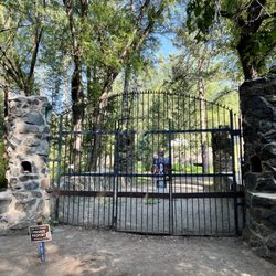
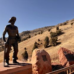
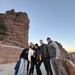
White Ranch Open Space Park Photos


You might also consider
More like White Ranch Open Space Park
Recommended Reviews - White Ranch Open Space Park
Start your review...

Reviews With Photos

Gets kinda treacherous with the mt. bikers on Upper Longhorn, be alert! Also the declines give little reaction time for hikers/bikers. Be sure not to use earbuds, although you rarely should while hiking, IMO. Two puddled areas and still some snow on Maverick Trail on 4/01/20 - if you decide to cut through Longhorn & Belcher. Maverick is easy to miss but it's behind you right at the marked Upper Longhorn sign (on the map). Really helped me to take a map from the lot because there's no cell reception up here (or at least a pic of it). Upper Longhorn is a rather steep downhill, so backtracking will get you breathing! (Again, bikers!) Saw some deer & birds wildlife, some very narrow paths, parts are more challenging than others. So, I wouldn't suggest taking the fam on Upper Longhorn or Maverick.


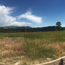
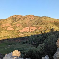
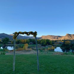
White Ranch Open Park is part of the Jefferson County Open Park system. The Jeffco Open Space system consists of 53,000 acres of open space in 29 regional parks and includes over 230 miles of hiking trails. The mountain scenery in these parks is incredibly beautiful. Having these parks so close to urban and suburban population centers makes it easy to access and enjoy them. Also included as part of the Jeffco Open Space system are a number of off-lease dog parks. Any of these parks are an awesome resource to the residents of Jefferson County.
We hiked here on the 4th of July and i really liked that it was close, and that this trailhead had an actual address so it was easy to find. There were plenty of parking, with a main lot and then an overflow lot that had its own entrance to the trail. The trails were very well marked, spots that were very shaded and spots that were all sun. I liked that you could make this a long hike, difficult hike, easy hike or short hike- it was all based on what trails you were taking. There was a bath which is always nice (i didn't use it so not sure how clean or unclean it was). Great views. Highly recommend!

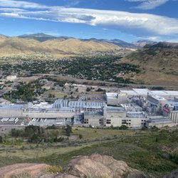
I happened upon White Ranch park yesterday while looking for a place to hike. This wasn't my original destination - I was headed in this direction to look for a plan b as my original locale didn't work out. I saw the sign on 93 and figured I'd check it out - so glad I did! I had no idea this place existed and from the parking lot, it's hard to tell exactly where the "open space" is. It weaves through some expansive (ridiculously massive and expansive) homes most with horses right along the trail. There's one trail in from the easy parking lot, and I wasn't entirely sure how far or where it would lead. I hiked up the Belcher Hill trail for about 90 minutes - I kept thinking I had to be getting close to the top but I finally stopped at a point I thought was "close" to the top. Good thing I did - after I picked up a trail map I realized I wasn't ever going to get to "the top." Turns out there are almost 20 miles of trails in this park and most are interconnected somehow. I'm glad I turned around when I did as I was getting close to the west side of the park and had I made it that far I wouldn't have had time to get back to my car before the sun started to set and it really cooled off. Anyway . . . this place was a find! It's close to town - just north of Golden, right past North Table Mountain park just west of 93. I was pleasantly surprised by the elevation gain on a moderately short hike up the mountain - it was a good workout and I'm feeling it today. As you wind your way up the Belcher Hill trail, the views are amazing - awesome views of Denver and then toward the back of the mountain some great views of the foothills. A word of advice though, don't forget to grab a trail map in the parking lot! You'll be glad you did. If you haven't been here, or didn't know it existed, what are you waiting for - it's a great day for a hike!

We hiked here last Saturday afternoon after worked half day. Didn't want to go too far from home, that's was a very good choice! We been here years ago with kids, but it's still very helpful to have a map with us. There are different trails in this open space, depends on the distance and difficulty of the trails. Hikers, bikers and horse back riders were very friendly, sharing the trails. Enjoy the beautiful mountains and great views of huge houses, table mountain and the metro Denver including downtown!

I have now been to this park three times as a hiker. Twice to the upper Western parking in the mountains a little bit, and once hiking from the bottom parking lot in Golden which would be the East parking lot. I am very happy with the selection of trails, the variety of the terrain, flora, and fauna. I don't know what else to say other than that it's a beautiful place. After walking this I can't wait to bring a mountain bike up here. Has plenty of very easy to mountain trails and some extremely technical Sprint's as well. Like the rest Colorado this place can be very easy or can kick your rear end depending on what you're looking for.

Came here for a nice quick hike with my hound and thoroughly enjoyed it. It wasn't that far removed but it was nice and peaceful. We only saw one other person on the trail, a female mountain biker, kudos to her, I was impressed. We took the rawhide trail which was a nice little five mile loop. You get some nice views of the city as well as a lot of forest space, and some open fields. We saw a couple of deer hiding in the bushes looking at us, and a lone coyote by the herd over cattle that is on private property bordering the end of the trail. They say coyotes are active in the area so beware of that. We will be back to try the other trails.
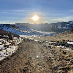
The plan was to backpack in and camp the night. It's a beautiful spot... We did our homework, dug around the website, mapped it out, etc... We got there, parked in the upper west lot and headed to the sawmill campgrounds. Nice hike, butt kicker hill to start, very well maintained camp ground.. then we realized we needed a permit! Lesson learned (not on the website): park in the lower west parking lot, sign up, get the permit, leave the pink slip in your car, and bring the yellow with you! Also, the trailhead from the lower west parking lot is a lot less steep (we took this on the way out) for hauling in gear (more beverages next time?? :)). Feeling defeated as we trudged uphill back to the car (hoping it wasn't about to pour rain on us), our consolation was spotting a black tailed deer! Very cool =)


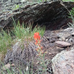
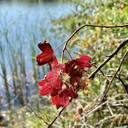
We did a 6 or so mile hike. The views were okay, but what I liked the most were the rocks on the trail (smaller ones that were red, orange, yellow, clear, and metallic). We did this in the snow, so wearing spikes helped. The trail was shaded a lot, which would be great in the summer. read more


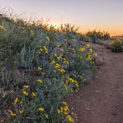
Beautiful space for hiking, biking - right outside Golden with a pretty scenic drive. Parking is ample, views are gorgeous, altitude isn't bad and I have to say that spring is a nice time to visit as everything is so green and the lack of tree cover isn't unbearable - yet! Perfect place to come for an easy hike or ride, with lots of spots for a picnic lunch. The history of this park is interesting and I love the random barns scattered throughout the space. read more


Gets kinda treacherous with the mt. bikers on Upper Longhorn, be alert! Also the declines give little reaction time for hikers/bikers. Be sure not to use earbuds, although you rarely should while hiking, IMO. Two puddled areas and still some snow on Maverick Trail on 4/01/20 - if you decide to cut through Longhorn & Belcher. Maverick is easy to miss but it's behind you right at the marked Upper Longhorn sign (on the map). Really helped me to take a map from the lot because there's no cell reception up here (or at least a pic of it). Upper Longhorn is a rather steep downhill, so backtracking will get you breathing! (Again, bikers!) Saw some deer & birds wildlife, some very narrow paths, parts are more challenging than others. So, I wouldn't suggest taking the fam on Upper Longhorn or Maverick. read more


White Ranch Open Park is part of the Jefferson County Open Park system. The Jeffco Open Space system consists of 53,000 acres of open space in 29 regional parks and includes over 230 miles of hiking trails. The mountain scenery in these parks is incredibly beautiful. Having these parks so close to urban and suburban population centers makes it easy to access and enjoy them. Also included as part of the Jeffco Open Space system are a number of off-lease dog parks. Any of these parks are an awesome resource to the residents of Jefferson County. read more


We hiked here on the 4th of July and i really liked that it was close, and that this trailhead had an actual address so it was easy to find. There were plenty of parking, with a main lot and then an overflow lot that had its own entrance to the trail. The trails were very well marked, spots that were very shaded and spots that were all sun. I liked that you could make this a long hike, difficult hike, easy hike or short hike- it was all based on what trails you were taking. There was a bath which is always nice (i didn't use it so not sure how clean or unclean it was). Great views. Highly recommend! read more

I happened upon White Ranch park yesterday while looking for a place to hike. This wasn't my original destination - I was headed in this direction to look for a plan b as my original locale didn't work out. I saw the sign on 93 and figured I'd check it out - so glad I did! I had no idea this place existed and from the parking lot, it's hard to tell exactly where the "open space" is. It weaves through some expansive (ridiculously massive and expansive) homes most with horses right along the trail. There's one trail in from the easy parking lot, and I wasn't entirely sure how far or where it would lead. I hiked up the Belcher Hill trail for about 90 minutes - I kept thinking I had to be getting close to the top but I finally stopped at a point I thought was "close" to the top. Good thing I did - after I picked up a trail map I realized I wasn't ever going to get to "the top." Turns out there are almost 20 miles of trails in this park and most are interconnected somehow. I'm glad I turned around when I did as I was getting close to the west side of the park and had I made it that far I wouldn't have had time to get back to my car before the sun started to set and it really cooled off. Anyway . . . this place was a find! It's close to town - just north of Golden, right past North Table Mountain park just west of 93. I was pleasantly surprised by the elevation gain on a moderately short hike up the mountain - it was a good workout and I'm feeling it today. As you wind your way up the Belcher Hill trail, the views are amazing - awesome views of Denver and then toward the back of the mountain some great views of the foothills. A word of advice though, don't forget to grab a trail map in the parking lot! You'll be glad you did. If you haven't been here, or didn't know it existed, what are you waiting for - it's a great day for a hike! read more


10 years ago
We hiked here last Saturday afternoon after worked half day. Didn't want to go too far from home, that's was a very good choice! We been here years ago with kids, but it's still very helpful to have a map with us. There are different trails in this open space, depends on the distance and difficulty of the trails. Hikers, bikers and horse back riders were very friendly, sharing the trails. Enjoy the beautiful mountains and great views of huge houses, table mountain and the metro Denver including downtown! read more


6 years ago
I have now been to this park three times as a hiker. Twice to the upper Western parking in the mountains a little bit, and once hiking from the bottom parking lot in Golden which would be the East parking lot. I am very happy with the selection of trails, the variety of the terrain, flora, and fauna. I don't know what else to say other than that it's a beautiful place. After walking this I can't wait to bring a mountain bike up here. Has plenty of very easy to mountain trails and some extremely technical Sprint's as well. Like the rest Colorado this place can be very easy or can kick your rear end depending on what you're looking for. read more


12 years ago
11 years ago
Came here for a nice quick hike with my hound and thoroughly enjoyed it. It wasn't that far removed but it was nice and peaceful. We only saw one other person on the trail, a female mountain biker, kudos to her, I was impressed. We took the rawhide trail which was a nice little five mile loop. You get some nice views of the city as well as a lot of forest space, and some open fields. We saw a couple of deer hiding in the bushes looking at us, and a lone coyote by the herd over cattle that is on private property bordering the end of the trail. They say coyotes are active in the area so beware of that. We will be back to try the other trails. read more


7 years ago
The plan was to backpack in and camp the night. It's a beautiful spot... We did our homework, dug around the website, mapped it out, etc... We got there, parked in the upper west lot and headed to the sawmill campgrounds. Nice hike, butt kicker hill to start, very well maintained camp ground.. then we realized we needed a permit! Lesson learned (not on the website): park in the lower west parking lot, sign up, get the permit, leave the pink slip in your car, and bring the yellow with you! Also, the trailhead from the lower west parking lot is a lot less steep (we took this on the way out) for hauling in gear (more beverages next time?? :)). Feeling defeated as we trudged uphill back to the car (hoping it wasn't about to pour rain on us), our consolation was spotting a black tailed deer! Very cool =) read more


10 years ago
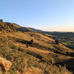
One of the largest JCOS sites with an extensive trail system and great views. Recommend using the west parking lots if you want to stay flexible on hike duration. read more


8 years ago
12 years ago
Always a great place to get away to. I usually go to the upper parking lots to catch a little cooler weather. You head up Golden Gate Canyon until you hit Crawford Gulch but it's all well marked with signs that will lead you there. I've done the Rawhide Loop many times now and it takes almost 2 hours. There's a few creeks to step over or let the dogs cool down. There's a bathroom a ways in at one of the campsites and the grass is tall enough in some places that if I ran through it I'd be thinking about that scene from Jurassic Park 2 where they get picked off one by one. I digress. Great spot and not too far from downtown Golden or Denver for that matter but it still feels like you're getting away. read more


7 years ago
9 years ago
12 years ago
First time at White Ranch Park and really liked the trail options. The group I was with did not want to travel far for from Denver for a hike. Someone recommended White Ranch Park and it was a great decision. The trails are well maintain and there are several options depending on your level which is great for a small group with people from all levels of experience. The trails weren't too busy although watch out for the bikers! read more

More info about White Ranch Open Space Park
Ask the Community - White Ranch Open Space Park
Review Highlights - White Ranch Open Space Park


Why does Yelp recommend reviews?
1 review that is not currently recommended
The reviews below are not factored into the business's overall star rating.
10 years ago
White Ranch Open Space Park - hiking - Updated July 2026
Best of Golden
People found White Ranch Open Space Park by searching for…
Trending Searches in Golden, CO
Beautiful Views near White Ranch Open Space Park
Blueberry Picking near White Ranch Open Space Park
Boardwalk near White Ranch Open Space Park
Boat Tours near White Ranch Open Space Park
Cliff Jumping near White Ranch Open Space Park
Cruising Spots near White Ranch Open Space Park
Day Trips near White Ranch Open Space Park
Dog Friendly Beaches near White Ranch Open Space Park
Dog Friendly Things To Do near White Ranch Open Space Park
Dog Friendly Trails near White Ranch Open Space Park
Flower Fields near White Ranch Open Space Park
Free Picnic Areas near White Ranch Open Space Park
Indoor Dog Park near White Ranch Open Space Park
Jet Ski Rental near White Ranch Open Space Park
Kayak Rental near White Ranch Open Space Park
Kids Activities Indoor near White Ranch Open Space Park
Lakes near White Ranch Open Space Park
Lookout Points near White Ranch Open Space Park
Night Hike near White Ranch Open Space Park
Off Road Trails near White Ranch Open Space Park
Outdoor Activities near White Ranch Open Space Park
Outdoor Basketball Courts near White Ranch Open Space Park
Parks near White Ranch Open Space Park
Picnic Spots near White Ranch Open Space Park
Places To Walk Around near White Ranch Open Space Park
Playgrounds near White Ranch Open Space Park
Public Shower near White Ranch Open Space Park
Rainy Day Activities near White Ranch Open Space Park
River Swimming near White Ranch Open Space Park
Rock Quarry near White Ranch Open Space Park
Scenic Night View near White Ranch Open Space Park
Scenic Overlook near White Ranch Open Space Park
Splash Pad near White Ranch Open Space Park
State Parks near White Ranch Open Space Park
Surf Shop near White Ranch Open Space Park
Swimming Holes near White Ranch Open Space Park
Swimming Lakes near White Ranch Open Space Park
Things To Do On A Rainy Day near White Ranch Open Space Park
Things To Do With Kids near White Ranch Open Space Park
Tubing near White Ranch Open Space Park
Watch Sunset near White Ranch Open Space Park
Water Parks near White Ranch Open Space Park
Water Parks For Kids near White Ranch Open Space Park
Waterfalls near White Ranch Open Space Park
Waterfalls And Swimming Holes near White Ranch Open Space Park
Browse Nearby
Browse Brands
Related Searches in Golden, CO
Affordable Bike Repair Services in Golden, Colorado
Affordable Bike Tune Up Services in Golden, Colorado
Affordable Cheap Bike Tune Up Services in Golden, Colorado
Affordable Kayak Rental Services in Golden, Colorado
Affordable Road Bike Rental in Golden, Colorado
Best Dirt Bike Riding Spots in Golden, Colorado
Best Dog Hiking Trails Around Golden, Colorado
Best Electric Bike Rental Services in Golden, Colorado
Best Fishing Locations and Guides in Golden, Colorado
Best Nature Trails for Hiking in Golden, Colorado
Best Off Leash Dog Parks in Golden, Colorado
Best Parks for Parties and Events in Golden, Colorado
Best Places for Horseback Riding in Golden, Colorado
Best Sightseeing Experiences Available in Golden, Colorado
Best Sledding Spots and Fun in Golden, Colorado
Best Water Parks for Kids in Golden, Colorado
Check Out Great Playgrounds in Golden, Colorado
Check Out Off Road Trails in Golden, Colorado
Convenient Bike Sharing Programs in Golden, Colorado
Discover Baseball Fields Around Golden, Colorado
Discover Dog Friendly Trails to Explore in Golden, Colorado
Discover Easy Hiking Trails Near Golden, Colorado
Discover Fun Toddler Parks in Golden, Colorado for Your Little One
Discover Kid Friendly Hiking Trails in Golden, Colorado
Discover Lakes & Ponds to Explore in Golden, Colorado
Discover Popular Bike Tours in Golden, Colorado
Discover Popular Bike Trails in Golden, Colorado
Discover Scenic Bike Paths in Golden, Colorado
Discover Scenic Mountain Bike Trails Near Golden, Colorado
Discover Soccer Fields in Golden, Colorado Near You
Discover Top Nature Parks to Visit in Golden, Colorado
Discover Top State Parks to Visit in Golden, Colorado
Discover a Hiking Trail in Golden, Colorado
Discover the Best Beaches in Golden, Colorado
Discover the Best Kids Park Spots in Golden, Colorado
Discover the Best Night Hike Trails in Golden, Colorado
Dog-Friendly Hikes With Dogs in Golden, Colorado
Enjoy Camping Adventures Around Golden, Colorado
Enjoy Hiking Adventures in Golden, Colorado
Enjoy Kayaking Adventures in Golden, Colorado
Enjoy Off Leash Dog Hikes in Golden, Colorado
Enjoy Tent Camping Spots Around Golden, Colorado
Enjoy a Beautiful Waterfall Hike in Golden, Colorado
Enjoy the Best Picnic Spots and Ideas in Golden, Colorado
Enjoy the Best Walking Path in Golden, Colorado
Enjoy the Best Walking Trails in Golden, Colorado
Exciting Snow Tubing Experiences in Golden, Colorado
Experience Thrilling White Water Rafting in Golden, Colorado


