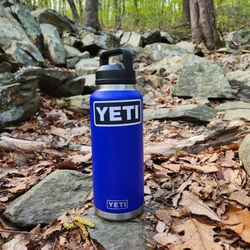
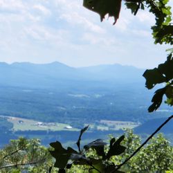
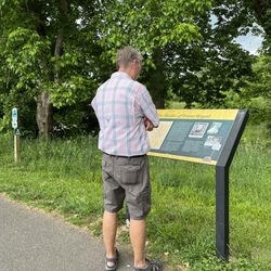
Cancel

    Open app

    Search

    Linden Park

    4.0 (1 review)

    Linden Park Photos

    You might also consider

    Recommended Reviews - Linden Park

    Your trust is our priority, so businesses can't pay to alter or remove their reviews. Learn more about reviews.
    Yelp app icon
    Browse more easily on the app
    Review Feed Illustration

    3 years ago

    Helpful 1
    Thanks 0
    Love this 0
    Oh no 0

    Verify this business for free

    People searched for Parks 252 times last month within 15 miles of this business.

    Verify this business

    Woodstock Tower

    Woodstock Tower

    4.9(15 reviews)
    17.8 mi

    Great place with great views!…read more Pop "Woodstock Tower" into Google Maps, and it will take you to the right spot (Apple Maps only took me to the trailhead a distance away). This will put you near a little overlook off the dirt road or if you keep going, a small gravel parking lot. Be prepared to drive on dirt and gravel roads for over a mile to get here; you are going the right way! This end of the trail has a clearly marked sign saying it is the Woodstock Tower. From either of those parking lots it's only about ¼ mile walk to get to the tower. The path varies from rocky to flat dirt. Loads of hickory nuts line the path. You could also come from the other end of the trail, which is over a mile away in the other direction. The climb up is steep but manageable (I'd recommend being more careful descending!) with metal steps. Considering she's still standing 90 years after her construction, I'd say the tower is stable. Hats off to the Civilian Conservation Corps for building this lasting landmark! The views from the top are great and worth the short walk and short climb. I met a local man at the top who shoots a lot of videos from up there. He did warn that sometimes there are black bears in the area; I never saw one my whole time, but just keep alert. It was a little cold on the mid-October day we were there and the top of the mountain did mean lots of cross wind, so dress appropriately. Unless you're weird about heights (apologies to my wife; thanks for walking out to it with us, Baby), this is a worthwhile visit. Definitely recommend!

    What a pleasant surprise! We drove up the mountain on Christmas Eve and simply enjoyed the views…read more Our goal of finding the tower wasn't easy being that my bf hadn't been up there since he was a kid. Nevertheless we found it :-) I was a bit apprehensive of climbing it at first but took baby steps lol. What a beautiful scenery once you reach the top. Great experience!

    Photos
    Woodstock Tower - It's quite a way down - don't fall!

    It's quite a way down - don't fall!

    Woodstock Tower
    Woodstock Tower - My wife's scared of heights, so she waited at the bottom for us.

    See all

    My wife's scared of heights, so she waited at the bottom for us.

    Shenandoah River State Park - Red Tail Ridge Trail view

    Shenandoah River State Park

    4.5(55 reviews)
    11.0 mi

    Often times, the national parks get the best territory and the states get leftovers. However, the…read moreShenandoah River State Park, down the mountain from well known Skyline Drive and its accompanying federal parkland, is by no means inferior. A rural drive leads to a visitor center, trails, an overlook, river access, and campgrounds. I had time for only a brief visit, but the views were majestic. It would be an excellent place to return for a hike. As with most of Virginia's state parks, there is a modest entrance fee, but I'm sure it's well worth it.

    I travel and stay at a lot of parks during the course of the year, and I have only repeated a few…read moreof them. This location is incredible, rich with things to do, views to see, and adventures to have with enough time. The cabins are gorgeous, fair warning that there is no television, but honestly who cares?! I had great phone signal which almost never happens on these excursions, and I loved making a fire in my fireplace and sitting on the porch with coffee for sunrise, which I could see from Cabin 11. This cabin also was at the end and felt private, even though I could see my neighbors (who had set up Christmas lights! How fun!) There's also a wonderful hiking trail right by these cabins, 10 and 11, the Red Tail Ridge, that was semi-short (2.5 miles or so if desired to create a loop with Big Oak) and had views of the river and Shenandoah valley below!

    Photos
    Shenandoah River State Park - Night time setup at campsite

    Night time setup at campsite

    Shenandoah River State Park - Trail is easy to walk and well marked

    Trail is easy to walk and well marked

    Shenandoah River State Park - Scenic Overlook Red Tail Ridge

    See all

    Scenic Overlook Red Tail Ridge

    Trumbo Hollow Hike - Never go thirsty with a Yeti.

    Trumbo Hollow Hike

    5.0(1 review)
    3.9 mi

    This hike is on the A.T. Trumbo Hollow (day hike) starts on…read moreVa State Rte 55/John Marshall Hwy in Linden Va. Same place as the the Manassas Gap Hike I went on two weeks ago but across the street. Again, lots of great parking. Starting at Rte 55 going onto Trumbo Hollow you are going Southward on the AT. No views but a great hike. Saw a lot of thru hikers today, most of which commented to us about the great weather! Today's 80 degrees and breezy is amazing compared to heat index of 110 degrees last week so these guys were all talking about it as we met them on the trail. Crossed some creeks and walked through 3 nice size fields which I think is cool when you are in the woods forever and then the world opens up into a sunshiny field. With the breeze, it was perfect.3 miles to reach Jim & Molly Denton Shelter. It was actually quite nice. A wooden privy out to the side and showers on the other side... a cooking station and the shelter itself even had a porch and rocking chairs. These thru hikers must think this is the MGM out here. I obviously thought it was impressive. Then we just turn and walk the way back. Nothing spectacular except doing what you love to do. Hiking. I love it. It lifts all my worries and stresses off my shoulders with each step and I feel like I have accomplished something. Of course I took my friend with me again. He laughs when I text him asking what he's doing. He knows what I'm going to ask! Though I love hiking by myself, (loner by choice), my friend is the best hiking partner ever. We just shut up and hike. Every once in a while we laugh or act stupid but mostly we are quiet and just keep hiking. I did see one snake. That was it. A Northern Ring-Neck Snake. It's actually the second one of these I've seen so far in July and the second ever in my lifetime. I thought that was pretty odd. But these snakes are so tiny. They are so thin and only reach about 12-15 inches. Perfectly harmless. I'd probably do this hike again. I liked the flow of it well enough and it's close to home.

    Photos
    Trumbo Hollow Hike - Who says October is the best time to view leaves? New green leaves are beautiful in April.

    Who says October is the best time to view leaves? New green leaves are beautiful in April.

    Trumbo Hollow Hike - Beautiful day.

    Beautiful day.

    Trumbo Hollow Hike - Gorgeous April hike.

    See all

    Gorgeous April hike.

    Hollow Brook Trail - Huge parking area. Thank you!

    Hollow Brook Trail

    4.5(12 reviews)
    15.3 mi

    A great day for a hike on the A.T. This one is just o/s Fauquier County on Mt Weather. I took the…read moreSOBO trail a couple years ago. This time I went North to the waterfall. Let me give some mad respect to whomever dug out the spot to put in a rather large parking area for us! For years we've been on side of this narrow dirt road. * Thank. (Virtual fist pump). This was 3 miles out and 3 miles back. The waterfall is around 1 mile mark. It's off to the right. *please understand, ricks are slippery whether they're wet ot not. How someone brings three toddlers here with no backpack, water or first aid is beyond me. I had to leave the area. But it was really nice. Very relaxing and you did have to hand/foot climb to get up there. Be careful please. I double backed and got on the A.T. Couple more miles to the secret cliff I saw in another Yelp post. :) . Lots of people walked by, no one knew I was there. I had it all to myself. Its better than the actual lookout. Anyway. I scanned the rocks for danger, shot some pics and sat down for water and dry crackers. I look over and there are 2 snakes curled up by a small tree about 6 feet from me. I spoke to them. "Thought you'd hide from me. I got you!" It was funny. I took a couple pics and kept my eyes on them. Only takes a second to lose track and they end up right at me saying, "HA got you back!" I sat a while then headed back down. I enjoyed it! I'd like to section hike and have a car waiting to take me back to my own car where I started. They should have an Uber Hikes App available for that. ;) This way I can hike for as far as I want without turning around to come straight back.

    Short trail, pretty and cool, but the waterfall wasn't what I expected. The trail was well kept,…read moreand trimmed back, some areas were steep, and can be slick if it rains.

    Photos
    Hollow Brook Trail - Here's the waterfall pic, that really does it no justice. In person, its perfectly pleasing.

    Here's the waterfall pic, that really does it no justice. In person, its perfectly pleasing.

    Hollow Brook Trail - Hello.

    Hello.

    Hollow Brook Trail - Then, the rocks.. I had my toe bandaged. :)

    See all

    Then, the rocks.. I had my toe bandaged. :)

    Signal Knob Hike - My toe!    #^*#% Rocks!!

    Signal Knob Hike

    4.8(5 reviews)
    10.7 mi

    11 years later, Saturday June 25th I finally came back to finish what I started…read more . Let me say, I hike a lot! I don't mind 10 miles flat or up and down. This trail however, was brutal! Rocks, boulders and more rocks. That was my trail path. It takes more time and more energy. Know this* My foot hit the path at 1pm. I got in my car for home at 7:39pm. Not bad considering the situation, but tbh, I didn't think I was going to make it. It was exhausting but great part is, it's a round trip. Not one way, turn around and go back. Start out on Massanutten trail to reach the TV station (hence Signal knob) then return to parking on the Tuscarora trail. So silent, unlike the A.T and NPS in the area. The Tuscarora is more wild and silent. How I feel about it, anyway. . I need a badge for hiking this for real. You know how you get tired and you don't pick your feet up high enough you stub your feet on the rocks? Well with the trail being nothing but rocks, my toe is feeling it. Check my toe pic. I literally started cursing the trail everytime I stubbed my toe. Such an adventure!!! I love to hate it.

    One of my new favorite local hikes - this 10.5 mile loop is a great workout and only 1.5 hours from…read moreDC. This trail also has more than its fair share of gorgeous vistas. In the first few miles, you'll climb over 2,000 feet and be rewarded by a view of the surrounding mountains. The valley below acts as a fog basin some mornings, making for a beautiful sight. The Fort Valley overlook comes a bit later. This one is great in the fall and winter, but offers less of a view when the leaves are out. When you reach Signal Knob, there is a panoramic view of Strasburg. This area is more developed, but still picturesque and a perfect lunch spot. Be careful when hiking this trail after a storm. The ascent is narrow, steep, and rocky at points - icy or wet rocks add to the difficulty factor. Solid shoes and sure feet are a plus! After all that hard work, you probably need some fresh apple cinnamon donuts. Happily, that's easy to accomplish. On your way back to DC, stop at exit 13 and pick some up from the Apple House.

    Photos
    Signal Knob Hike - Looking from Signal Knob to Buzzard Rock N.

    Looking from Signal Knob to Buzzard Rock N.

    Signal Knob Hike - Fort Valley Overlook.

    Fort Valley Overlook.

    Signal Knob Hike - My path! Boulders!

    See all

    My path! Boulders!

    Linden Park - parks - Updated May 2026

    Loading...
    Loading...
    Loading...