
Iron Mountain Photos


You might also consider


More like Iron Mountain
Recommended Reviews - Iron Mountain
Start your review...


Reviews With Photos


Iron Mountain Trails is a great moderate hike and an excellent workout if you want to break a sweat. I highly recommend going early, bringing plenty of water, and packing a snack to enjoy when you get to the summit. It's pet-friendly and a great option for anyone looking for a solid outdoor workout. Be sure to wear proper hiking attire and check the weather before you go.


I visited on a Sunday morning around 10:30 AM. The parking lot was full, and many people were parking along the highway. There were lots of hikers, many with their dogs. The trail is 5.7 miles long. I brought a dog along, and we finished in just under two hours. The hike up has plenty of rocks, but not many loose ones, so slipping wasn't much of a concern. The views were beautiful, and overall, the hike wasn't too strenuous. There are bathrooms located at the trailhead, and a short way into the hike, there are picnic tables where people can stop for lunch.


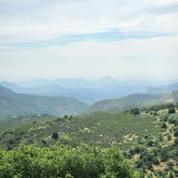
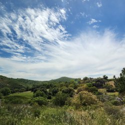
The Iron Mountain hiking trail in Poway is good for both beginners and intermediate hikers. The trail extends just over 5 miles round trip, with manageable uphill routes. There were plenty of friendly hikers in the vicinity. Towards the midway section of the trail, you will find a refreshing stream. As you go on a higher plane, you will see stunning vistas of open fields, plenty of trees and a clear skyline.
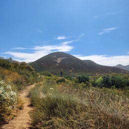

Iron Mountain is located in Poway, and it offers many trails to hike, run, or just to sit back and enjoy nature away from the bustling city. We came here early in the morning to get a quick break from the city and just to sit back and enjoy the beautiful mountains and trails that this place has. The parking here is on a gravel rock parking lot that has ample parking and can be easily accessed from the street. The entrance is covered in an abundance of trees and shade as you walk up to Iron Mountain. The trails are easily identified by the dirt pavement on the ground. Please be prepared to bring canteens of water and ice since there are no water stations on site, and during the summer months, it can get hot. There are many signs throughout the trail reminding you of rattlesnakes. Through our hike, we saw many lizards and butterflies and heard notices we would have never heard in the city. There are a couple of lakes here, and we even saw a sign for night fishing. There is a restroom in the parking lot, and when we we left, we decided to skip it and wait until we got home since it definitely needed attention. Overall, it was a great place to go to and enjoy nature at its finest. I highly recommend coming in the early fall or spring and early in the summer months to avoid the heat since it can get pretty hot and, as always, hydrate, hydrate, and hydrate!


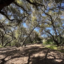
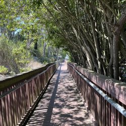
IRON MOUNTAIN-HIKERS WANTED The entire trail is wondrous with panoramic vistas of rolling hills, distant mountains, and boulder formations. One of the highlights of the hike was the tree arch entry that greets you with blessings for a good hike. And that's about all the shade you will get :). AMENITIES The portopotties are a sanitary mayhem and need to be closed for hazmat. The stench reaches the parking lot. Parking & trail are free. HOW FIT DO YOU HAVE TO BE FOR THIS HIKE? If you do cardio at least 4 hours weekly, you can manage this hike. But I also saw: A woman with flip flops A man carrying two 3 gallon jugs filled with water All age ranges and weight classes A first timer hiker and the list goes on. WHAT WAS YOUR OVERALL EXPERIENCE? I experienced the hike to be fun and interesting with the different terrain, views, switchbacks and boulders. If you can step up on a curb or do lunges then you can step on, over, or to the side of the boulders. With that being said, there are walking crevasses next to the boulders on the trail. I heard the hike was hard and because of my success on Saturday. I thought it was a fluke, so I went back the following next day. And it was just as enjoyable. Overall, this 5.8 mile hike offered a mix of natural beauty, conditioning, and satisfaction. It's a great way to connect with friends, groups, nature and obviously movement. I highly recommend Iron Mountain instead of Cowles mountain. HIGHLIGHTS Well maintained and clearly marked Perfect for new solo hikers No dog or human feces on trail NEED TO KNOW Can be done with/out trekking poles. I take mine because dogs were not leashed, although required San Diego temps can still reach the 80's in October. "A mustard seed of faith can move mountains. Have a mountainous faith to move every obstacle in your path." --Juken #JUKEN123 #ironmountainsd #hikepowaysd #hikepanoramicviews


They have toilets, trash, dog bags, and a parking lot. The trees on the pathway are pretty. The rest of the trail is very open air.


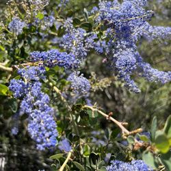
Do it! Gorgeous trail that has a nice combo of flat-ish and incline paths. We came for a sunrise hike and were not disappointed. Right now in late March all of the California Lilac were in full bloom and it gave new meaning to that like "purple mountain majesty". Took us about 3.5 hours because we lingered at the summit. There were sweet little streams and trickles of water that made the experience even better as we hiked to the sound of running water here and there. It was a partly cloudy morning so the sun was kinder than summer months, enough pockets of shade to hide behind from large boulders. Hoping to be back with my 8 year old who is new to hiking but could most likely do this trail with no sweat as the path is well maintained and not too difficult IMO. Happy hiking y'all!


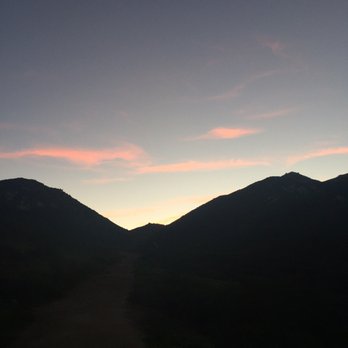
***This Review Is About Hiking To See the Sunrise!*** As you can see from my pics, the views are STUNNING when you come here for the sunrise. You'll see lots of clouds floating in the air and beautiful mountain views (of course). Photos don't even do it justice. You feel like you're higher than you really are! Even Mt. Soledad is barely peeking through the clouds. It looked like a little island in the sky. So cool. TRAIL LENGTH: -5 to 6 miles (My phone always says this hike is closer to 6, despite most sites saying it is closer to 5 miles, fyi) TRAIL TERRAIN: -Mostly dirt & lots of rocks. Not quite a simple hiking path like Potato Chip or Penasquitos. I found this hike more challenging for this reason. You can't zone out as much because you have to watch where you're going/stepping. Though I've seen experienced runners sprint up and down this trail, I would not recommend it. TIPS FOR A SUNRISE HIKE: - Start about 1 hr before that morning's sunrise, or start 1.5 hrs early if you think it will take you awhile to get up there. - Pack lots of water/electrolyte drinks. I like to bring 2 bottles of water/Gatorade personally. - In the summer months, I usually start around 5am because it takes about 1 hr for me to get up to the summit. I run hot so I just wear leggings & a tank top. Temp is in the 60s when I start. - I've done this hike at sunrise a few times in July. It's not dark enough to the point where you need a flashlight. - Optional: bring a snack to eat at the summit to reward yourself as you take in the view. There are 2 picnic tables! DOG OWNERS: -I love hiking with my dog too, but PLEASE look after your dog. Keep your dog leashed (even if they have perfect recall) for the safety of others. Also be aware some dogs/humans are not comfortable with dogs walking/running towards them. -Clean up after your dog. So so so many irresponsible owners do not pick up after their dog, and it's just disgusting. I have a dog too, but please respect the trail and other hikers. I know it sucks to hold onto it for so many miles (there's only 1 trash can & it's at the entrance), but be mindful of others. OTHER COMMENTS: -The terrain is DIRT & ROCKS. You will literally have to climb/walk on actual rocks. It is very easy to slip and fall or twist your ankle so please be careful. I've seen people run up and down this trail, but that is something I personally would not do. -I've done the hike in regular running shoes (HOKAs) and had no issue. However, be aware your shoes/socks will have a layer of dirt on them by the end, so don't wear your favorite white shoes. -There is almost NO SHADE on this trail, so in the warmer months, I recommend doing it closer to sunset or before the sun rises. PARKING: -Parking is free for everyone! On weekends, if you are here around 8am, the parking lot will already be at 75-85% capacity, just fyi. There is extra parking on the road though. RESTROOMS: -There are restrooms located in the parking lot & none others on the entire trail. As of July 2021, I know that they're open to the public. (I believe they had closed temporarily due to the pandemic last year.)


This is amazing trail, weather your aiming for the peak or just base of the trail. Either it's enjoyable
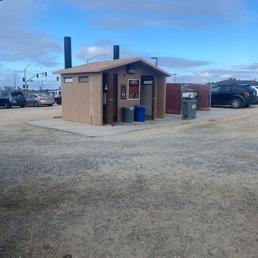

Great 6 mile workout for my soul. Came during a weekday, bright and early to avoid the crowds. Decent parking , but nasty bathrooms at the start of the trail. Thankfully I'm always prepared and brought everything from wipes, toilet seat covers, spray and hand sanitizer!! Haha! But use them before you start because it's a long hike and there are no restrooms on the path. Don't get to comfortable with the shaded archway leading onto the trail because that is the only shade you get. I highly recommend lots of water and sunscreen with a good pair of hiking boots. The trail can be steep and rocky at times. The view at the top makes it all worth it! Great hike to clear your mind and a great workout for the soul.


Did this hike in honor of my friend Travis. Our daughter and I will never forget you. Lovely hike, in total took me about 2 hours. The view at the top was breathtaking. Challenging yet doable. Have fun and be safe everyone.


Great hike. Not too hard not too easy. Not too long not too short . Very moderate . You should hike this


We're slowly getting back into our hiking groove, carefully navigating a post-pandemic great outdoors. This was our first time hiking Iron Mountain, and we're now fans of this spot. The beautiful and welcoming tree tunnel really sets the mood, welcoming you in before opening up to the trails. And goodness, that tree tunnel is absolutely a blessing on your way back to the parking lot, offering respite from the sun, dropping the temperature by a good 10 degrees. We arrived a bit later than planned, as our morning started with a lot more lazing-in-bed than prepping-to-hike, but it worked out, because we were able to find parking in the dirt lot. We set out at around 11:30 am, which isn't smart on most days, but this particular Saturday in April was cool and a bit overcast, which helped a ton. There's a lot of good signage along the trails, which helps those who get lost easily...or frequently. It was also nice to see that the rescue team was on hand, buzzing the trails in the bright yellow helicopter, keeping an eye out for anyone in distress. The trails did get a bit tight - it's a popular spot - but for the most part, people were respectful and tried to keep as much distance as possible. There were a fair number of mask-less hikers out, but that's not the trail's fault. You get those people everywhere. We didn't spend as much time at the top as I would've liked - it was quite packed up there and we could see more people making their way to the summit, but it is quite pretty there. We were at least able to catch our breath and take a few pictures before making our way back down. I imagine we'll be heading back to Iron Mountain for another hike later this year, but we're also eager to explore some of our city's other trails, first. I am glad that we smothered ourselves in sunblock and had 64 ounces of water on us. There's not much shade on those open dirt trails.


This is the prettiest hike I've been on in San Diego. The trail itself is pretty typical for a San Diego trail- rocks, succulents, sandy dirt/gravel pathways. The surroundings, though, is what I found most impressive- it was so green! Many San Diego trails (while sometimes having better views of the city) have a view that's predominantly 'dry' from dirt/rocks. The hike was a bit longer than I expected, but not terribly strenuous. After the first stretch, the incline is pretty steady. The top of the mountain is not terribly large, so I didn't spend too much time up there. The trail was pretty busy, but not too crowded. Lots of dogs were on the trail as well. read more


12 years ago
I really liked this mountain, wasn't to hard definitely for a intermediate hiker. It took me and my friend only two hours to hike this one hour there and one hour back , but we are pretty experience hikers we did jog a little big back so it took up less time. I must say though It was supper hot outside though make sure to bring sunscreen a hat and plenty of water! The top has amazing views deff. A must see !! Oh and we went around 1030 not a lot of people there at that time I guess.. So try around that time if you don't really have nothing planned for the rest of the day. read more


12 years ago
This was an awesome hike that was very easy to get to and find parking. We went the day after Thanksgiving (too much foooood) and expected it to be super crowded but to our surprise, it wasn't too bad! We went around noon and it was a tad hot but we brought enough water and left the pup at home so we were able to finish the whole thing in about 2.5 hours. The view at the peak was great! It was a super clear day so we could see all the way to downtown! The hike is pretty flat for half of the hike and the ascent to the peak gets a bit steep. There are several places for you to stop and get some shade and rest on the way up. Great hike with great views! read more


5 years ago


11 years ago
I usually do the Grasslands Preserve trail daily but they close the gates at 7 and I wasn't going to make it so I stopped by Iron Mtn which is on my way home. I've done Iron Mtn before but it seemed a lot easier this time.. Yay! Guess the Grasslands is a good workout! I hate the first mile. It seems the hardest. Not sure why. Guess getting started with anything is hard. Anyway, it was uneventful snd it was good to work up a sweat. I started at 6:30 and got back to the car at dusk. Nice hike! read more


11 years ago
I love this hike. It has lots of switch backs so Its not too challenging and has a really beautiful view of Poway. Takes about 2 hours round trip. The best time I've ever gone was when I went up before sunrise and there was a fog rolling in. By the time I got to the top the sun came up and there was a fog sitting over all of San Diego and Poway. It was the most beautiful thing I have ever seen. It was like I was standing on top of the clouds. I have never been so breath taken and so in awe at nature. I've posted a picture but a must experience of you ever get the chance. read more


8 years ago
So far the best hiking place I've been in San diego. I love that it has literally a mountain feels. Trail going in the center surrounded by mountains. Make sure to wear hiking sure specially when its raining. Very muddy but overall it was fun experience definitely coming back again!!! read more


Took about 3 hours to hike roundtrip, it was a simple, "easy" hike. Hiked on a Sunday warm morning (there was a nice breeze though). The only shade you can get is at the beginning where the trees make an arc. This hike is easy compared to potato chip rock/mount Woodson trail. Not many inclines, more flat parts, not that much at the top. There are nice views at different parts and at the top. There are benches at the top, no trash cans or bathrooms, it's all at the beginning so do all your business there! They do have doggy bags at the bottom and top though! Encountered many hikers and dogs. Parking lot is small, people also park along the 67. Make sure to bring at least 2 bottles of water and some snacks, depends on you and the weather. read more


Good intermediate Trail, about 3 miles from bottom to top! Lots of rocky switchbacks once your about 1mile away from peak. 360 degree views of the county is real nice! Gets crowded on the weekends so if you got time during the weekday do that instead! #tryityoumightlikeit read more


8 years ago
Great hike , the place is well kept , very good for people trying to challenge themselves , moderate for strong athletes, me and my dog loved it read more


I'm guessing this is one of the most easily accessed hikes in the San Diego area. Best to hike Iron Mountain in the mid-Fall, Winter & early Spring portion of the year. Just did this hike for 10th time on Friday/Caesar Chavez Day and it was perfect conditions, clear for nice views, maybe 75 degrees and a cool steady breeze. One troublesome part of this otherwise challenging/relaxing hike is the remnants of past car break-ins on the off-street parking, (smashed windows) I've been lucky so far. Although, I probably just jinxed myself... read more


10 years ago
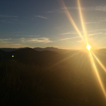
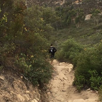
I would say that this is a pretty moderate hike. I came here with a friend to watch the sunrise and it was GORGEOUS. There was quite a bit of water in the creek since there was a lot of rain in San Diego County for the past week. The first part of the hike is pretty flat and level. Once you get near the top, there are a lot more rocks and it's much steeper. Be careful not to slip in the gravel. Also, it was very windy once we got to the peak, but a beautiful view nevertheless. I saw a lot of people bring their dogs as well, so it's definitely a dog-friendly hike. It took around 2 and a half hours round-trip for us. Definitely bring water and appropriate shoes. My friend wore her Chacos which seemed to work well since there were some muddy areas on the trail. read more





8 years ago
This is one of my favorite east county hikes. It takes just over an hour to get to the peak and there are alternate trails along the way. The view at the top is awesome. On a clear day you can see...well, everything! It's not a difficult hike but may be a bit tough for a beginner. Plenty of parking at the new trailhead. read more


10 years ago
Today couldn't be a better day to hike here, nice cool weather. I took my in-laws who are visiting us from Europe. We have hiked other places like Potato Chip Rock, Elfin Forest... But today they admitted it was one of the best and most difficult hikes we have done. Most people did same way to Iron Mountain Peak up and down, which is about 6.5 miles round trip. On the way back we took Elaine Trail which is narrower, rockier and steeper, in the end we hiked over 8 miles to go back to the parking lot. On the way back I almost thought that we got lost but my adventurous father in law found the way back to the car Our legs and butt got a really good workout today, let me tell you if my 60+ year old in-laws can do this kind of hike, anyone can do it except small kids! read more




6 years ago


11 years ago
Iron Mountain is a fun, partial day hike! Bring lots of water- I promise, you'll need more than you think. It is an enjoyable hike! Nothing crazy special, but I would recommend making an afternoon of it with friends! read more


8 years ago
Beautiful scenery, moderate hike, very well marked almost impossible to get lost, busy on the weekends read more


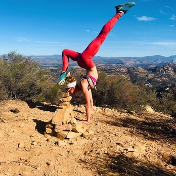


IRON MOUNTAIN is a park located at the intersection of Poway Road and Route 67. Route 67 is distinguished by the fact that it takes you to a very special town, known as, "Julian." And just north of Julian, is Volcan Mountain. Volcan Mtn. has two hiking trails, one leading you directly to the summit and the other, which is a loop, taking you through groves of 5 kinds of oak trees. Anyway, two parking spots (two "staging areas") are available for starting your day at Iron Mountain. The first is at the intersection mentioned above, and the second is at Ellie Lane, located about a mile north on Route 67. SHORTER WAY TO IRON MTN. PEAK; LONGER WAY TO IRON MTN. PEAK. The shorter way to Iron Mtn. peak is just to take Iron Mtn. trail the entire way. Start at the eastern terminus of Poway Road, hike the arrow-straight trail to the ridge, and turn south at the ridge, and enjoy the multiple, scenic switchbacks that bring you to the peak. The longer way to Iron Mtn. peak is to first take Ellie Lane Trail up to the Table Rock area, followed by a relatively level walk that takes you southwards to Wild Horse Trail. Wild Horse Trail then takes up eastwards to the top of the ridge, which is followed by walking downhill a short while and then passing Ramona Overlook, and then continuing southwards by taking Iron Mtn. trail all the way to the peak. To date, I've hiked to Iron Mtn. peak (2696 feet) on three different occasions. Highlights of the scenery include: (1) On Ellie Lane Trail, you can get real close to those huge, spheroid boulders that dot the northern landscape and make the mountain slopes look like a field of scattered marshmallows; (2) Ellie Lane Trail takes you to "Table Rock." Table Rock is not much to look at, but if you stand near table rock and gaze to the south, you will see a mountain peak in the shape of a perfect cone. This perfect cone is abundantly photogenic, especially in the early morning. Then you hike past the spur trail leading to Ramona Overlook; (3) On the Iron Mtn. Trail, once you are above the 2,500 foot elevation level, the scenery becomes more photogenic. In the early a.m., when you gaze to the east, what you see three or four different horizon lines. MAGIC OF 300mm TELEPHOTO LENS. Each horizon line is defined by a different mountain range with its own profile. This is the perfect opportunity for using a telephoto lens. I use a 300mm telephoto lens for photographs. The 2,500 foot high location provides a perfect opportunity for that "special effect" where the 300mm telephoto lens compresses all of the horizons in a special way, so that the following effect becomes more dramatic. The effect is that the closest horizon is most distinct, the next horizon beyond that is hazy, and the next and most distant horizon beyond that is very indistinct (as though it was obscured by smoke); (4) As you approach the very top of Iron Mtn., what also comes into view is the marshmallow-dotted slopes of Woodson Mountain (2 miles to the east). And so, this provides another photo-op for those using a standard 50mm lens, as well as for photographers with a 200mm or 300mm telephoto lens. METAL DISC-MAP AT THE PEAK OF IRON MTN. At the end of the trail is a metal disk, with a map on the disk. The map has names of various mountains with lines pointing to each of the mountains, near and far. One of them is "Mount Whitney" and the marker states that it is 15 miles away. "Look at this," I said to another hiker, a man about 50, "It says that Mount Whitney is only 15 miles away!!!" The man replied, "Ohhh, it looks like for all of these years I have been taking the long way to Mount Whitney!!!" I was glad that the man immediately understood my point. My point was to suggest that something was really, really weird about the disk-map. But later that day, I learned that there are two Mount Whitneys, where the nearby Mt. Whitney is in San Marcos. WATER, HORCHATA, AND CHILI RELLENOS. Even as late as November, you may encounter hot days when hiking Iron Mtn. For this reason, I recommend taking two cans of soda water (or whatever form of H2O you prefer). If you take the longest route, the hike can be around seven miles altogether. On a hot day, a 7-mile hike on Iron Mtn. can pose a real health risk, if you don't bring one or two cans of water. Please also note that, at Iron Mtn., Mount Woodson, and at Mission Trails Regional Park, helicopter rescues of injured hikers or of hikers with heat stroke occur every year. And so, as they say, "Better safe than sorry." Afterwards, I recommend Oscar's Mexican restaurant on Poway Road. Please see my review of Oscar's. After my first Iron Mtn. hike, which was on a hot day, I ordered a large horchata and after that, had a refill of a large horchata. I was shocked by how much water I needed to drink, to recover from my 7-mile hike. But I was pleased with the yummy, yummy horchata (and also pleased by the yummy, yummy chili rellenos). read more


11 years ago
I really like this one! There are a bunch of trails so you can work harder or not so much. My dog loves it and it's pretty beautiful at sunset. I definitely recommend bringing some water as it gets pretty hot during the day, but also recommend hiking in the evening. Also, the parking lot is directly across 67 on Poway Rd. GPS took me down 67 for awhile, but just go straight through the light. read more


9 years ago
Good hike in the Poway area. Lots of switchbacks as you get closer to the top. Not a difficult hike, but it's not a short one as well. Be prepared with some water and a snack and you'll be fine. There is designated parking lot for this trail. A bathroom is also located in this lot. Be careful and don't leave valuables in the open in your car. Other than that, good hike after you've down Cowles Mountain a few times. read more


7 years ago
Went on a very busy holiday. Hike itself was beautiful and rocky. Inclines were not difficult. Only problem was that it was very crowded at the top. It may have just been due to the holiday. I would still recommend this hike and plan to go again. read more


14 years ago

15 years ago

13 years ago

13 years ago
This is a great place to hike an see the entire San Diego area. The view from the top is spectacular and on a clear day you can see the ocean. You get a panoramic view of Ramona, north county basically everywhere. It is important to get there early in the morning if you want to get a parking space. Otherwise you will have to park on the side of the Hwy. If you go in the summer it is best to start before it gets hot out. read more


13 years ago

13 years ago

16 years ago

Iron Mountain is a wonderful hike in the Poway area. With a nice zig-zag trail and some hidden shortcuts, you can have some fun with this trail. There is very little shade and we went around 11 a.m. so the heat was pretty brutal but it was still a fantastic view towards the top and it's pretty simple to find your way back when taking the shortcuts. Parking isn't too bad though there is no water fountain at the restroom area and the restrooms themselves are pretty run down. Overall, if you enjoy a good hike, I would say Iron Mountain is a great option and it's best to get here a bit earlier if you have problems with heat exhaustion. read more


15 years ago

10 years ago

18 years ago
We got up early this morning and went to Iron Mountain for the first time. We wanted to switch it up from our standard Mission Trails. It was a beautiful hike, pretty rugged. I wore my hiking sandals and was quite comfortable, although I did see a couple people eat it on the loose rocks. I'm quite a clutz but did okay! It was hot, but we had plenty of water so it was bearable. Will definately come back here next weekend, it was wonderful exercise and beauty. read more


6 years ago

More info about Iron Mountain
14847-14909 California Hwy 67
Poway, CA 92064
Directions
Hours
Indoor Amenities
Outdoor Amenities
Ask the Community - Iron Mountain
Is this beginner friendly hike? Looking to do more hiking with my friend!
The total distance is about 6 miles (out & back) with elevation gain of 1,125 ft. So it's rated as "moderate" (i.e., more difficult than "easy").
Is this hike open during the COVID-19 lockdown period?
Yes. No restrooms open though. Hand washing station available when we went!
Is this trail pretty clear to easily wear my babies on me for?
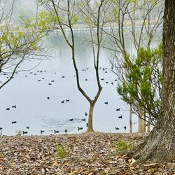
Not sure how old your kids are, but mine started hiking with hiking boots when she was about six. There are rattlesnakes - lots. Lake Poway is a much better place - row boats to rent, kids playground - ducks and wildlife and it's nice and cool. Iron…
Review Highlights - Iron Mountain
You might also consider











Why does Yelp recommend reviews?
19 reviews that are not currently recommended
The reviews below are not factored into the business's overall star rating.

15 years ago

10 years ago

14 years ago

16 years ago

8 years ago

10 years ago
6 years ago

9 years ago

12 years ago

15 years ago
14 years ago
15 years ago


11 years ago

15 years ago

14 years ago

14 years ago

13 years ago


