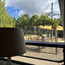
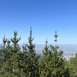
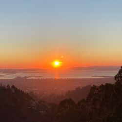
Hulet Hornbeck Trail Photos


You might also consider
More like Hulet Hornbeck Trail
Recommended Reviews - Hulet Hornbeck Trail
Start your review...

Reviews With Photos

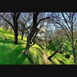
Great! I did this trail for the first time today, with a friend. At the staging area, an older gentleman asked my male friend if he thought I could make it up the hill. What a joke. Of course I made it up the hill. The first part of the trail is fairly steep and uphill. Go when the ground is dry. Once we got to the top, we saw beautiful views. We continued on to the cow barn and we also found the secret swing. Lovely views of Mount Diablo and a great trail. You could walk up here for hours, in different directions and you can also walk to the John Muir House and to the other side of Highway 4.

"Now I know why there were no other bikers." In past years I started at the far eastern end. Today I started from the northwest Trailhead, which is just off Carquinez Scenic Drive. There's a nice staging area there, which has room for plenty of cars. Plus it also has a restroom there. The trail itself is covered for much of the way going up to the top. For hiking, I can see how it would be a pleasant trip. Not so much for biking. Today, I was planning to bike on this trail, but I did not realize how narrow and steep it was. I did not see any other bikers, and I think I know why. Oh well, I got some exercise pushing the bike up tough sections. When you get up to the top, it's much easier. read more


6 years ago
Lovely trail several minutes from "downtown" Martinez. Can be a bit strenuous for some with some uphills, but a great place to take in views of the water (we could see our neighborhood in Benicia...sort of) and Mount Diablo. Vault toilet at the trail head. This is our go to spot when we don't want to drive all the way to the Lafayette reservoir or to the Berkeley hills trails. read more


8 years ago
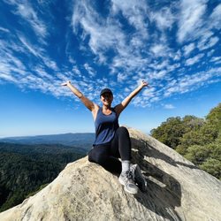
Okay, beautiful hike, but this is for those who are advanced! I love hiking, go as often as I can, but this hike just about killed me! All uphill for over a mile straight, with lots of mud. Once you get to the top and turn right, it levels out. If you want to find the secret tree swing, you have to keep going right, around the bend, past the bench that overlooks the straight, and there is another high hill with a lone tree at the top. Gorgeous!! But this hike was HARD and I had to hold onto my husband's shoulders the entire way back down or I would have slipped and fallen from the mud. read more


8 years ago
Great! I did this trail for the first time today, with a friend. At the staging area, an older gentleman asked my male friend if he thought I could make it up the hill. What a joke. Of course I made it up the hill. The first part of the trail is fairly steep and uphill. Go when the ground is dry. Once we got to the top, we saw beautiful views. We continued on to the cow barn and we also found the secret swing. Lovely views of Mount Diablo and a great trail. You could walk up here for hours, in different directions and you can also walk to the John Muir House and to the other side of Highway 4. read more


10 years ago
This trail is tough. It is very steep and up hill. A less up hill trail is further down the road and it leads to the same spot but it is longer and more gradual of an incline. There is a switch back section in open feild that is in the sun but most of the trail leading up to the top is shaded by many trees. If you are going after the rainy season I'd use bug spray. Dont forget sunscreen and protective clothing. I always bring my phone to to take pictures! It can be a tough hike but it is well worth it and tons of fun. I would not recommend this trail for children. If you have dogs though I'm sure they will love it! I have seen a few people with dogs out here every now and again. I believe if you go left after getting to the top at some point it leads to the old historic John Muir house but I have never gone that far, maybe one day. If you come in the spring there are lots of wild flowers, but the trail tends to be a little overgrown and in the rainy season it is pretty muddy. I think late spring to early fall is your best bet. :D read more


10 years ago
8 years ago
More info about Hulet Hornbeck Trail
1 Carquinez Scenic Dr
Martinez, CA 94553
Directions
Hours
Outdoor Amenities
Ask the Community - Hulet Hornbeck Trail
You might also consider


Hulet Hornbeck Trail - hiking - Updated May 2026
Best of Martinez
People found Hulet Hornbeck Trail by searching for…
Walking Trails in Martinez, CA
Off Road Trails in Martinez, CA
Places to Take Pictures in Martinez, CA
Fun Things to Do in Martinez, CA
Beautiful Views in Martinez, CA
Waterfall Hike in Martinez, CA
Free Things to Do in Martinez, CA
Running Trails in Martinez, CA
Things to Do on a Rainy Day in Martinez, CA
Cruising Spots in Martinez, CA
Scenic Overlook in Martinez, CA
Hiking Trails Kid Friendly in Martinez, CA
Trending Searches in Martinez, CA
Boat Rental near Hulet Hornbeck Trail
Botanical Gardens near Hulet Hornbeck Trail
Bounce House Rentals near Hulet Hornbeck Trail
Campgrounds near Hulet Hornbeck Trail
Cherry Picking near Hulet Hornbeck Trail
Cliff Jumping near Hulet Hornbeck Trail
Dog Friendly Things To Do near Hulet Hornbeck Trail
Flower Fields near Hulet Hornbeck Trail
Flower Shop near Hulet Hornbeck Trail
Garage Sales near Hulet Hornbeck Trail
Hair near Hulet Hornbeck Trail
Lakes & Ponds near Hulet Hornbeck Trail
Nurseries & Gardening near Hulet Hornbeck Trail
Outdoor Activities near Hulet Hornbeck Trail
Outdoor Furniture Stores near Hulet Hornbeck Trail
Parks near Hulet Hornbeck Trail
Party Equipment Rentals near Hulet Hornbeck Trail
Pedicure near Hulet Hornbeck Trail
Pick Your Own Farms near Hulet Hornbeck Trail
Picnic Areas near Hulet Hornbeck Trail
Places To Take Pictures near Hulet Hornbeck Trail
Running Trails near Hulet Hornbeck Trail
Scenic Drive near Hulet Hornbeck Trail
Secret Spots near Hulet Hornbeck Trail
Strawberry Picking near Hulet Hornbeck Trail
Sunrise View near Hulet Hornbeck Trail
Swimming Holes near Hulet Hornbeck Trail
Table And Chair Rentals near Hulet Hornbeck Trail
Browse Articles
Browse Nearby
BEST of Martinez, California Coffee near Hulet Hornbeck Trail
BEST of Martinez, California Restaurants near Hulet Hornbeck Trail
BEST of Martinez, California Things to Do near Hulet Hornbeck Trail
BEST of Martinez, California Walking Trails near Hulet Hornbeck Trail
BEST of Martinez, California Breakfast near Hulet Hornbeck Trail
BEST of Martinez, California Parks near Hulet Hornbeck Trail
BEST of Martinez, California Campgrounds near Hulet Hornbeck Trail
BEST of Martinez, California Hotels near Hulet Hornbeck Trail
BEST of Martinez, California Sightseeing near Hulet Hornbeck Trail
Browse Brands
Related Searches in Martinez, CA
Affordable Kayak Rental Services in Martinez, California
Best Fishing Locations and Guides in Martinez, California
Best Nature Trails for Hiking in Martinez, California
Best Places for Horseback Riding in Martinez, California
Check Out Off Road Trails in Martinez, California
Discover Dog Friendly Trails to Explore in Martinez, California
Discover Kid Friendly Hiking Trails in Martinez, California
Discover Scenic Hiking Trails in Martinez, California
Discover Scenic Mountain Bike Trails Near Martinez, California
Discover Scenic Waterfall Spots in Martinez, California
Discover Top Nature Parks to Visit in Martinez, California
Discover Walking Parks in Martinez, California Near You
Discover a Hiking Trail in Martinez, California
Discover the Best Night Hike Trails in Martinez, California
Discover the Best Running Track in Martinez, California
Dog-Friendly Hikes With Dogs in Martinez, California
Enjoy Camping Adventures Around Martinez, California
Enjoy Kayaking Adventures in Martinez, California
Enjoy Tent Camping Spots Around Martinez, California
Enjoy a Beautiful Waterfall Hike in Martinez, California
Enjoy a Peaceful Nature Walk in Martinez, California
Enjoy the Best Picnic Spots and Ideas in Martinez, California
Enjoy the Best Walking Path in Martinez, California
Enjoy the Best Walking Trails in Martinez, California
Explore Beautiful Parks and Green Spaces in Martinez, California
Explore Easy Hikes Perfect for All in Martinez, California
Explore Fun Activities to Do in Martinez, California
Explore Popular Campgrounds Near Martinez, California
Explore the Best Beach Spots in Martinez, California
Explore the Best Swimming Holes Around Martinez, California
Explore the Best Trail Options in Martinez, California
Family Friendly Hiking With Kids in Martinez, California
Find Beautiful Views in Martinez, California
Find the Best Parks for Picnics in Martinez, California
Find the Best Scenic View Locations in Martinez, California
Great Places to Walk in Martinez, California
Hiking Trails With Waterfalls in Martinez, California
Off Leash Dog Hiking Trails in Martinez, California
Plan a Scenic Drive Route Near Martinez, California
Popular Outdoor Activities to Try in Martinez, California
Popular Picnic Spots to Visit in Martinez, California
Safe River Swimming Areas in Martinez, California
Safe and Fun Parks for Kids in Martinez, California
Top Climbing Spots and Gyms in Martinez, California
Top Paddleboarding Activities in Martinez, California
Top Running Trails to Explore in Martinez, California
Top Swimming Lakes to Enjoy in Martinez, California
Top Swimming Spots and Pools in Martinez, California