Mt Diablo Summit Photos


You might also consider
More like Mt Diablo Summit
Recommended Reviews - Mt Diablo Summit
Start your review...

Reviews With Photos

Brought hubs to the summit because he's never been! What a fun drive. I drove so he could look out over the landscape. We saw a Tarantula cross the road! Do you know why it crossed the road? To get to the other side!! Tarantulas and rattlers are common on Mt Diablo. Just be aware and don't freak out. At the summit you'll find beautiful vistas. 360 degrees of them. The observation deck no longer has a telescope but it's still a must. Go into the visitor center and climb the stairs to get the best views around. The visitor center has Mementos, snacks and drinks. All very reasonably priced. The restrooms are down some steep-ish stairs and the stalls are small. Not accessible friendly. However, there was a picnic area we saw on the way down that did have restrooms easier to use. Want to get over 3,000 feet up? This is the place. Bring something to warm up in just incase. We found it much cooler than it was at the base. Entrance at Northgate was $10.


First Hike in 2024; started the Six Peak Challenge. Self paid entrance fee at gate, bathrooms at trailhead, started at 8am when park officially opened. Some areas were muddy at the lower levels, we jumped over 6 creek crossings. My favorite sight was at the last lookout along Eagle Peak Trail to see Suisun Bay with a mountain range rising above the fog level, then a pink layer, a blue layer, and finally the full blanket of clouds. We hiked at a fairly quick pace, photos and bathroom at the summit then down to the Picnic Area for trail lunch at noon. Returning via Mitchell Canyon Fire Road was easy and serene.

My friend and I meet monthly, and we go somewhere in the larger Bay Area. She took drove us to the Mount Diablo Summit because I had never been there. We didn't have much time, and that is something to keep in mind. It takes more time than you might think to drive to the Summit. My friend had a doctor's appointment that she had to keep. It made it so we couldn't stay long. There is a parking lot at the top with panoramic views. The day we went, the air didn't look so clean, but the views were still amazing! We had a packed lunch that we gobbled up as we took in the distant vistas. On the way up to the summit, there were signs for different trails. If you like to hike, just make sure you have enough time, and bring some hiking shoes. I know if we go again, we will allow more time. We had to use the restroom, so we went into a large rock covered building--which is a museum. We asked the manager where the restrooms were, and he told us to cross the parking lot and go down the stairs. So, when you go up there, if you want to find the restrooms, they are across from the building. The stairway down to the restrooms is kind of steep. There is a handrail to hold on to. When you exit the ladies' restroom, be prepared to see an AMAZING view!!! Both the museum and the restrooms are not wheelchair accessible.

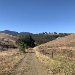
Well, it's not like the Von Trapp family scaling the Alps to escape the Nazis, but if Rolf gave them the keys to his Prius (surely he had one), then they could've come here after their escape. It even surprises me that I had never driven up to the summit of Mt. Diablo since I've been in the Bay Area since the Paleozoic era. It's the most prominent peak in the East Bay even though at 3,849 feet, it's not quite the highest point in the Bay Area. That would be Mt. Hamilton down in San Jose, but it's a visual touchpoint for a lot of travel vloggers on YouTube who have nothing else to say about this area. As an official state park, it costs $10 to enter by car unless you plan to show off and cycle up there. Don't do that on my account. I'll just buzz around you and hope you don't drop off the cliff. Just because I know Walnut Creek more than Danville, I took the North Gate entrance and then exited through the South Gate just to mix it up. Either way, it takes 45 minutes or so to get to the summit even when the long, winding two-lane road is relatively empty. You can stop for viewpoint stops, though I have to admit the Tri-Valley area wasn't that exciting visually. The scope of the panorama, however, was nothing short of impressive. Once at the summit, there was a decent-size parking lot, and if full, there was a spillover lot down a slight hill. I was pleasantly surprised that there was an actual visitors center with the expected taxidermy on display of the local fauna. You can place your foot on the actual mountain summit inside the building. There was also a newish looking observation deck and a vintage stone beacon tower where there's a Pearl Harbor memorial marker. There was even a gift shop where a helpful ranger answered any questions I had about the area. It would be a darn shame if you get back in your car before walking the easy-peasy Mary Bowerman Trail. It was named after a local botanist who saved a lot of the flora on the mountain during her lifetime. Less than a mile long and a big chunk covered by a wooden boardwalk, it looped around the peak just below the summit affording the 360-degree views you came for and a close-up look at a big rock called the Devil's Pulpit. If you take the South Gate route, make sure to make a stop at Rock City, a unique formation of huge rocks that provides picnic grounds and additional hiking opportunities to Sentinel Rock. You should allot at least four hours for your Mt. Diablo expedition if you don't want to careen down the mountain. RELATED - Up for a hike? Here's a collection of trails I've walked and reviewed: http://bit.ly/2OrC8nU

"96 Minutes going up, 56 Minutes going down. But it's not my Fault" This is one of the top attractions in the East Bay. There are a variety of ways to get to the summit. I run up via the summit Trail, but many bikers come up the road. I also see a lot of hikers on the trail. Most of them make it to the top. From the town of Diablo, it's 5 miles to the summit. There is a gift shop there, as well as exhibits explaining the history. I just skip the exhibits and buy some ice cream. Don't forget to say hello to Bruce, who often works the gift shop desk. He's the one who sells me the ice cream. There is a drinking faucet, as well as bathrooms at the Summit. There are plenty of spaces at the upper parking lot, but many more down below. But it's a quarter mile walk. There's also an interesting history about surveying. It turns out that Mount Diablo is an important point in surveying. Today I ran into a park ranger at the gift shop. He explained how they bring helicopters in to rescue hurt hikers. They lower a basket from the helicopter and bring you up in a funny suit. Don't let that be you! Today, I was a few minutes slower getting up to the summit. But it's not my fault! I was recovering from broken ribs and that slowed me down a little bit. I'm just glad they didn't have to bring the helicopter in for me. That would be so unmanly.

Mt. Diablo is a must for anyone living or visiting the area. You will enter a whole different world by the time you reach the summit. The visitors center is welcoming and the staff are friendly and full of information. You can see so far in so many directions. There are firefly's, tarantulas, Conor's, wild pigs, mountain lions, on and on. There are bicyclist, including my dentist, that ride to the top. AMAZING! There are a amateur astronomers who meet at night at the top when there's a full moon. It even snows at Mt. Diablo. If you want to step outside the Bay Area and into another world My. Diablo is the place for you. -J.Porter

Mount Diablo has been on our bucket list for a long time, and we finally made the drive up this morning, the day before the kids go back to school after over a year of home schooling. The drive from Pleasanton to the base of Mount Diablo was easy, but as we started our climb, I had to drive slowly and carefully as we were in the lane on the edge of the mountain, and there was no guardrail. More importantly, this is a prime route for Bay Area bicyclists - I had to cautiously overtake those who were climbing slowly, while keeping an eye out for others who were careening down at breakneck speed. Once at the top, we used the restrooms (smelly but serviceable) and stopped by the visitors center to pick up maps and buy a few souvenirs - a patch for my safari vest, a couple of baseball caps, and a giant stuffed rattlesnake to adorn our youngest one's bedroom (she plans to place it under her bed when the cleaning ladies visit next week). We wanted to do a short non-strenuous hike, and the ranger recommended the mile-long Mary Bowerman trail, which starts just below the summit and goes all the way around. This was a good choice as it was flat, but it is not for the faint of heart, as more than half of it is narrow and unpaved, with very few places for a shady rest. We enjoyed it nevertheless, stopping by each of the 14 markers and reading about the unique plants and geology of the mountain from the trail brochure, which was very educational. The drive down the mountain was easier as our lane mostly hugged the side of the mountain, and the bicyclists were going down on our side of the road as fast we were! We arrived home dusty, tired and happy! We will be back during tarantula hatching season!

Great view spot from the top of the east bay. Definitely Recommend going if you live in the bay. It gets really cold outside so dress warmly and get ready to take photos. They have plenty of hiking trails and biking trails and walking trails as well. Long drive up and slow so def make advantage of the park. $10 entry fee and also download google maps offline of the place


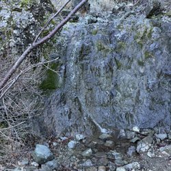
Beautiful day at rock city. Very nice breeze and not very many people compared to many on weekends !Would have taken more photos but sadly phone ran out of juice! The drive is was nice takes about 15 mins from the start from Diablo to get too the entrance gate which will cost 10 $ to enter which is fine since this will go to salaries and up keep of park. Lots of rocks to climb and walk on and have the feeing you are on the top of the world! Will visit again!

Mt Diablo Sumit at a height of 3849 feet has got a lot of history around seismic and volcanic activity. It's Cold and windy in winter so please Dress appropriately to enjoy the summit views. We wanted to see snow in BayArea and with recent winter there was snow at the summit. With nice California sunny weather, most of the snow had melted away ;( . There was some at mount mary trail mt diablo state park. this is not far from summit and has got amazing view of Richmond The Park entrance fee is $10 per vehicle. Parking at the summit is limited but there is bigger parking space before the summit. But worth the drive ... amazing views of the bay. On a nice clear sky, you can have a view of 80 miles around the summit. Evening sunset views are the prettiest. Mt Diablo people come for training for the Yosemite half dome hike. Lots of bikers on the way. The visitors center has a mini Exhibit that closes at 4.00 pm

Came here on a Sunday at 12pm and it wasn't extremely busy but as we were leaving it did get a little more packed. I've lived an hour away for 35+ years and have always seen this mountain in the distance in the sunset and it looked so big but coming here and actually being at the summit it doesn't give you the euphoric experience you might be hoping for. Don't get me wrong, I love all nature regardless of aesthetics, just letting others know so they're not disappointed. The area is more like the foothills. This is still a beautiful place for hikes and picnics. There are several picnic nooks along the roads leading up to the summit that you might miss if you don't pay attention because they are nestled in the trees off the side of the hill. And plenty of restrooms off to the side if you missed the big building of restrooms near the South Gate entrance. **PLEASE READ** Multiple signs are posted about sharing the road and NOT passing cyclists. Unfortunately someone did pass from what I'm assuming was caused by someone doing this exact thing (a memorial bike was posted along the side of the road). I can't stress this enough...these roads are narrow and these cyclists are going as fast as they can up a steep incline...be patient, relax and enjoy the views as you travel in your car. When my son and I were headed up we were not in a rush and weren't bothered at all. One of the cyclists waved us along as if it were safe to pass, which I can appreciate, however, as I was slowly moving around him another cyclist was coming downhill around the corner! Luckily I trusted my instincts and wasn't going too fast and proceeded with caution. I was able to get back behind the cyclist allowing the other guy to come around the corner. DO NOT TRUST THE WAVE ALLOWING YOU TO PASS. Only go if YOU have a clear line of sight. Otherwise, like I said, enjoy the views. It's not worth the risk. There is a post on one of the trails with a sign that asks you to place your phone in the bracket to upload a pic to track the progress from the Morgan fire. Please do this if you have social media! It allows ppl to keep tabs on the area to see how far along recovery has come. You're up there anyway, might as well help the cause :)

This has been on my want to hike list for a long time and I finally got to do it on a perfect day. The weather was great, overcast and cool. We hiked it so fast and the views were spectacular. I can't wait to hike this in the spring with all the flowers in bloom. There are so many surrounding trails and I want to do them all! Lots of bathrooms throughout the trail. There is a visitor center at the top which you can drive to also. Please come and creat your own adventure. read more


My God-father lives nearby, and he thought this would be a nice little distraction from the bustling cities below. He was right. The drive up was intense. It's been a while since I drove roads similar to this, so it wasn't too bad, up. Hopefully down is OK too. There is a small entry fee (per car), but also a senior discount. So we only had time for the Summit. There are more Yelp! listings for other parts of the park. OK, so I was not prepared for the breathtaking views! It was a slightly hazy, or was it smoggy, day... But the views were still fantastic! If the views were not enough, there is a visitors' center in the light tower at the summit. Inside is lots of information, a Rangers' Station, and several informative and/or interactive displays. And there is camping in Mt Diablo too! To make things even more interesting, we took a different route down. I don't like backtracking, so this was a bonus... And i wasn't too bad. read more


1 year ago
California hiking is....different. But overall this was a good trail. It was an easy hike, clear trail with no route finding or scrambling required and a whole facility at the top. In fact, you can even just drive. There's a $10 fee to enter the park and then a bit more driving until you reach the trail head. I went on a cloudy day so the view wasn't crazy but the clouds were cool. read more


2 years ago
Brought hubs to the summit because he's never been! What a fun drive. I drove so he could look out over the landscape. We saw a Tarantula cross the road! Do you know why it crossed the road? To get to the other side!! Tarantulas and rattlers are common on Mt Diablo. Just be aware and don't freak out. At the summit you'll find beautiful vistas. 360 degrees of them. The observation deck no longer has a telescope but it's still a must. Go into the visitor center and climb the stairs to get the best views around. The visitor center has Mementos, snacks and drinks. All very reasonably priced. The restrooms are down some steep-ish stairs and the stalls are small. Not accessible friendly. However, there was a picnic area we saw on the way down that did have restrooms easier to use. Want to get over 3,000 feet up? This is the place. Bring something to warm up in just incase. We found it much cooler than it was at the base. Entrance at Northgate was $10. read more

Nice place to explore. Beautiful views! The visitor center is quaint with a small display of the native animals. The actual summit is inside. We came when there was a bit of snow. Short little hiking trail. There are public restrooms here. read more


First Hike in 2024; started the Six Peak Challenge. Self paid entrance fee at gate, bathrooms at trailhead, started at 8am when park officially opened. Some areas were muddy at the lower levels, we jumped over 6 creek crossings. My favorite sight was at the last lookout along Eagle Peak Trail to see Suisun Bay with a mountain range rising above the fog level, then a pink layer, a blue layer, and finally the full blanket of clouds. We hiked at a fairly quick pace, photos and bathroom at the summit then down to the Picnic Area for trail lunch at noon. Returning via Mitchell Canyon Fire Road was easy and serene. read more


My friend and I meet monthly, and we go somewhere in the larger Bay Area. She took drove us to the Mount Diablo Summit because I had never been there. We didn't have much time, and that is something to keep in mind. It takes more time than you might think to drive to the Summit. My friend had a doctor's appointment that she had to keep. It made it so we couldn't stay long. There is a parking lot at the top with panoramic views. The day we went, the air didn't look so clean, but the views were still amazing! We had a packed lunch that we gobbled up as we took in the distant vistas. On the way up to the summit, there were signs for different trails. If you like to hike, just make sure you have enough time, and bring some hiking shoes. I know if we go again, we will allow more time. We had to use the restroom, so we went into a large rock covered building--which is a museum. We asked the manager where the restrooms were, and he told us to cross the parking lot and go down the stairs. So, when you go up there, if you want to find the restrooms, they are across from the building. The stairway down to the restrooms is kind of steep. There is a handrail to hold on to. When you exit the ladies' restroom, be prepared to see an AMAZING view!!! Both the museum and the restrooms are not wheelchair accessible. read more


Well, it's not like the Von Trapp family scaling the Alps to escape the Nazis, but if Rolf gave them the keys to his Prius (surely he had one), then they could've come here after their escape. It even surprises me that I had never driven up to the summit of Mt. Diablo since I've been in the Bay Area since the Paleozoic era. It's the most prominent peak in the East Bay even though at 3,849 feet, it's not quite the highest point in the Bay Area. That would be Mt. Hamilton down in San Jose, but it's a visual touchpoint for a lot of travel vloggers on YouTube who have nothing else to say about this area. As an official state park, it costs $10 to enter by car unless you plan to show off and cycle up there. Don't do that on my account. I'll just buzz around you and hope you don't drop off the cliff. Just because I know Walnut Creek more than Danville, I took the North Gate entrance and then exited through the South Gate just to mix it up. Either way, it takes 45 minutes or so to get to the summit even when the long, winding two-lane road is relatively empty. You can stop for viewpoint stops, though I have to admit the Tri-Valley area wasn't that exciting visually. The scope of the panorama, however, was nothing short of impressive. Once at the summit, there was a decent-size parking lot, and if full, there was a spillover lot down a slight hill. I was pleasantly surprised that there was an actual visitors center with the expected taxidermy on display of the local fauna. You can place your foot on the actual mountain summit inside the building. There was also a newish looking observation deck and a vintage stone beacon tower where there's a Pearl Harbor memorial marker. There was even a gift shop where a helpful ranger answered any questions I had about the area. It would be a darn shame if you get back in your car before walking the easy-peasy Mary Bowerman Trail. It was named after a local botanist who saved a lot of the flora on the mountain during her lifetime. Less than a mile long and a big chunk covered by a wooden boardwalk, it looped around the peak just below the summit affording the 360-degree views you came for and a close-up look at a big rock called the Devil's Pulpit. If you take the South Gate route, make sure to make a stop at Rock City, a unique formation of huge rocks that provides picnic grounds and additional hiking opportunities to Sentinel Rock. You should allot at least four hours for your Mt. Diablo expedition if you don't want to careen down the mountain. RELATED - Up for a hike? Here's a collection of trails I've walked and reviewed: http://bit.ly/2OrC8nU read more


"96 Minutes going up, 56 Minutes going down. But it's not my Fault" This is one of the top attractions in the East Bay. There are a variety of ways to get to the summit. I run up via the summit Trail, but many bikers come up the road. I also see a lot of hikers on the trail. Most of them make it to the top. From the town of Diablo, it's 5 miles to the summit. There is a gift shop there, as well as exhibits explaining the history. I just skip the exhibits and buy some ice cream. Don't forget to say hello to Bruce, who often works the gift shop desk. He's the one who sells me the ice cream. There is a drinking faucet, as well as bathrooms at the Summit. There are plenty of spaces at the upper parking lot, but many more down below. But it's a quarter mile walk. There's also an interesting history about surveying. It turns out that Mount Diablo is an important point in surveying. Today I ran into a park ranger at the gift shop. He explained how they bring helicopters in to rescue hurt hikers. They lower a basket from the helicopter and bring you up in a funny suit. Don't let that be you! Today, I was a few minutes slower getting up to the summit. But it's not my fault! I was recovering from broken ribs and that slowed me down a little bit. I'm just glad they didn't have to bring the helicopter in for me. That would be so unmanly. read more

3 years ago
Mt. Diablo is a must for anyone living or visiting the area. You will enter a whole different world by the time you reach the summit. The visitors center is welcoming and the staff are friendly and full of information. You can see so far in so many directions. There are firefly's, tarantulas, Conor's, wild pigs, mountain lions, on and on. There are bicyclist, including my dentist, that ride to the top. AMAZING! There are a amateur astronomers who meet at night at the top when there's a full moon. It even snows at Mt. Diablo. If you want to step outside the Bay Area and into another world My. Diablo is the place for you. -J.Porter read more


Mount Diablo has been on our bucket list for a long time, and we finally made the drive up this morning, the day before the kids go back to school after over a year of home schooling. The drive from Pleasanton to the base of Mount Diablo was easy, but as we started our climb, I had to drive slowly and carefully as we were in the lane on the edge of the mountain, and there was no guardrail. More importantly, this is a prime route for Bay Area bicyclists - I had to cautiously overtake those who were climbing slowly, while keeping an eye out for others who were careening down at breakneck speed. Once at the top, we used the restrooms (smelly but serviceable) and stopped by the visitors center to pick up maps and buy a few souvenirs - a patch for my safari vest, a couple of baseball caps, and a giant stuffed rattlesnake to adorn our youngest one's bedroom (she plans to place it under her bed when the cleaning ladies visit next week). We wanted to do a short non-strenuous hike, and the ranger recommended the mile-long Mary Bowerman trail, which starts just below the summit and goes all the way around. This was a good choice as it was flat, but it is not for the faint of heart, as more than half of it is narrow and unpaved, with very few places for a shady rest. We enjoyed it nevertheless, stopping by each of the 14 markers and reading about the unique plants and geology of the mountain from the trail brochure, which was very educational. The drive down the mountain was easier as our lane mostly hugged the side of the mountain, and the bicyclists were going down on our side of the road as fast we were! We arrived home dusty, tired and happy! We will be back during tarantula hatching season! read more


Great view spot from the top of the east bay. Definitely Recommend going if you live in the bay. It gets really cold outside so dress warmly and get ready to take photos. They have plenty of hiking trails and biking trails and walking trails as well. Long drive up and slow so def make advantage of the park. $10 entry fee and also download google maps offline of the place read more


2 years ago
Entrance fee $10, they have a restroom.. 20min zizig drive before the summit. Overall it's peaceful scenic drive. read more


5 years ago
Beautiful day at rock city. Very nice breeze and not very many people compared to many on weekends !Would have taken more photos but sadly phone ran out of juice! The drive is was nice takes about 15 mins from the start from Diablo to get too the entrance gate which will cost 10 $ to enter which is fine since this will go to salaries and up keep of park. Lots of rocks to climb and walk on and have the feeing you are on the top of the world! Will visit again! read more


4 years ago
Mt Diablo Sumit at a height of 3849 feet has got a lot of history around seismic and volcanic activity. It's Cold and windy in winter so please Dress appropriately to enjoy the summit views. We wanted to see snow in BayArea and with recent winter there was snow at the summit. With nice California sunny weather, most of the snow had melted away ;( . There was some at mount mary trail mt diablo state park. this is not far from summit and has got amazing view of Richmond The Park entrance fee is $10 per vehicle. Parking at the summit is limited but there is bigger parking space before the summit. But worth the drive ... amazing views of the bay. On a nice clear sky, you can have a view of 80 miles around the summit. Evening sunset views are the prettiest. Mt Diablo people come for training for the Yosemite half dome hike. Lots of bikers on the way. The visitors center has a mini Exhibit that closes at 4.00 pm read more


Came here on a Sunday at 12pm and it wasn't extremely busy but as we were leaving it did get a little more packed. I've lived an hour away for 35+ years and have always seen this mountain in the distance in the sunset and it looked so big but coming here and actually being at the summit it doesn't give you the euphoric experience you might be hoping for. Don't get me wrong, I love all nature regardless of aesthetics, just letting others know so they're not disappointed. The area is more like the foothills. This is still a beautiful place for hikes and picnics. There are several picnic nooks along the roads leading up to the summit that you might miss if you don't pay attention because they are nestled in the trees off the side of the hill. And plenty of restrooms off to the side if you missed the big building of restrooms near the South Gate entrance. **PLEASE READ** Multiple signs are posted about sharing the road and NOT passing cyclists. Unfortunately someone did pass from what I'm assuming was caused by someone doing this exact thing (a memorial bike was posted along the side of the road). I can't stress this enough...these roads are narrow and these cyclists are going as fast as they can up a steep incline...be patient, relax and enjoy the views as you travel in your car. When my son and I were headed up we were not in a rush and weren't bothered at all. One of the cyclists waved us along as if it were safe to pass, which I can appreciate, however, as I was slowly moving around him another cyclist was coming downhill around the corner! Luckily I trusted my instincts and wasn't going too fast and proceeded with caution. I was able to get back behind the cyclist allowing the other guy to come around the corner. DO NOT TRUST THE WAVE ALLOWING YOU TO PASS. Only go if YOU have a clear line of sight. Otherwise, like I said, enjoy the views. It's not worth the risk. There is a post on one of the trails with a sign that asks you to place your phone in the bracket to upload a pic to track the progress from the Morgan fire. Please do this if you have social media! It allows ppl to keep tabs on the area to see how far along recovery has come. You're up there anyway, might as well help the cause :) read more


2 years ago
6 years ago
Mt. Diablo is as beautiful as ever. I had actually put off visiting the summit for some time because I somehow made the drive out to be scary in my head. Totally wasn't. I had hiked on various trails around Mt. Diablo's base starting from Clayton/Walnut Creek in the past. I'd even attempted to drive up Mt. Diablo with my family when I was in the 3rd grade. It's always been my view from my backyard in pretty much every house I've lived in growing up. And one of my favorite sites to see when I exit the freeway coming home. Mt. Diablo is a constant in a world of change. It's always so picturesque with the sun setting behind it. Or the clouds closing in on it. The view never looks the same, so it can never get old. After admiring it from afar for over 20 years, I finally made a quick trip the same week SIP ordinances were put in place (mid-March). The hills surrounding Mt. Diablo were still a lush green. It had rained the day before and there was still some icy snow left on the ground, but the sun came out to play the same day we decided to go. The visitor center was closed, parking was free, and not many people had the same idea as us. It was great to take in the panoramic views of the east bay and take in the fresh air at a higher elevation. The drive isn't long at all, completely safe, and pretty fun to do in a regular sized car. There are many stops along the road that you can make for great photos. I hope to return and try rock city or hike...whenever Bay Area air quality is back to healthy. read more


6 years ago
8 years ago
By far the most beautiful hike I have been on with great views and wonderful abundance of plants and flowers, I do not usually see on any other hikes I have been to so far. Came here at 7am to beat the heat and it was perfectly planned. I wore leggings and high socks with a tank top. Spring time in the end of May, so many bugs!!! I saw swarms of lady bugs and flying pincher bugs. They were constantly flying on us. I wore a tank top and was bitten three times on my arms and my friend through her leggings on her thigh. Lots of lizards running around. Parking is $10. You will fill out an envelope for your car info and drop in an envelope with your money in the box. We drove up to the middle of the summit and parked in the big parking lot. We took the Juniper trail which is supposedly the harder trail. The trail was very well kept with trimmed trees and bushes, as well as rocked trails. Lots and lots of rocks! Good to wear hiking trail shoes to not slip. The Juniper trail was very steep. We took the Mary Bowerman trail after the Juniper Trail to get to the top which had a cement trail on the edge of the mountain leading to large binoculars to scenes view of the Bay Area. It was apparently rattle snake season, but I did not see any luckily. There are bathroom stops and benches with picnic tables to sit at to take a nice lunch before heading close up to the top before the Mary Bowerman trail. Restrooms are clean with no soap. I shall try hiking from the bottom of the summit next time. Our hike was about 3.5-4 hours stopping quiet often for pictures and snacks. I was informed that the hike from the bottom of the summit is about 6-7 hrs. Definitely coming back!!! read more


So...It was my first time here and I feel like I hit the lottery because, I didn't realize at the time, but it was wildflower season and everything was in FULL BLOOM!! The pictures really don't do justice of the colors that were abundant everywhere I looked! Seas of orange poppies elated my mood to maximum happiness overdrive. It was so cool! Highly recommend to hike here during the wildflower season. I will caution this is not an easy hike so bring proper footwear, water, and snacks and enjoy! read more


A friend and we're looking to take advantage of the beautiful weather today. Neither of us are from here so went to Yelp to get some advice. Did not disappoint. We hiked the Juniper trail. Parked at the campground entrance and hiked up to the summit. The parking was scarce, but we made it work. There are 2 outhouse style toilets at the parking lot. The views on this hike are worth every bit of your legs being sore the next day. It is a steep climb up and steep on the way down. Be sure you have solid shoes to help you up and down. read more


7 years ago
BRING CASH AND A PEN FOR PARKING PERMIT NEAR ENTRANCE! I drove from San Ramon to the Blackhawk/Danville side. Then I followed the map to the Juniper Campgrounds. I did the Juniper Trail (park at the lot in front of juniper campground, trail is to the right near a sitting area with BBQs) and it was not too bad maybe 2 miles round trip. I also took a detour and did the Moses Rock Ridge Trail that is along the juniper trail (1/2 a mile). It was an easy trail and has some pretty views. Once you're off the juniper trail you have to cross the street and get on the summit trail which is 0.2 to the visitor center and viewpoint. You could also just walk along the road but there are cars so be careful. I recommend going on the Mary Bowerman Trail (it's paved). If you keep going past the pavement you can see some more of the valley. If you have time, I enjoyed the back view. I wouldn't say the view from Mt. Diablo is extremely unique, but I wouldn't say it's a complete waste of time either! It's about the adventure there, right (lmao sorry) Happy Hiking! read more
 - Hiking Near Me - Clayton, California")


3 years ago
Beautiful views for miles when you reach the summit at Mt. Diablo. The drive is 10.7 miles from the Athenian School to the summit. The average grade is about 6 to 7% and pretty consistent all the way up. On this day I chose to bike to the top, and it took me a little over an hour to reach the summit. When you reach the top, there is a small parking lot and a visitor center. When I reached the top, I was very glad that the visitor center had sodas, gatorades, and snacks available for purchase. There is a large vista observation area on the top of the visitor center and the view is unbelievable. read more

5 years ago
Last July.... it was awesome. you can see all of NV from the top. my son kept saying he wanted a flying squirrel suit so he could jump off. read more

It's a good hike. Very good scenery. You go through the forest, then up the mountain slope, then onto a bigger mountain slope ... lot of hills to climb. I need to go back here soon as I heard there are some great pokemon to be caught. The summit is up at the top with an area to view 360. Pretty neat. Parked at the very bottom then hike through the entire trail. If you're lazy, then you can drive up to the summit itself ... but that's weaksauce! read more


My friend and I decided we wanted to have a picnic in a beautiful area because we were both in Concord at the same time, we decided to take our lunch to the top of Mt Diablo Summit. We had a spectacular view and found it exciting to see the rain clouds come blowing in. Because of a major storm that was soon arriving, we decided to make our descent back into the valley down below in-order to avoid any torrential rain and strong winds. read more


9 years ago
The Mt. diablo summit is a very picturesque site that offers views of San Francisco and Sacramento any given clear day. It is about 40 minutes from San Francisco and it takes about 35 min to drive up to the summit. Once on the summit you you can take the Mary Bowman trail. It loops around the visitors' center for a distance of .2 miles and offers amazing photo ops, views, animal sightseeing, and free binoculars. Be aware it gets really chilly up top, so bring warm clothing. Also, watch out for cyclists and equestrian crowd. In terms of logistics, carpool, and check fire status before coming over. The vehicle entry fee is 10 dollars. read more


6 years ago
SPECTACULAR Too say the least ! It was an amazing experience ! It's a must to get to that summit read more


A tremendous park to go to. I'm a big fan of hiking, but this particular rocky mountain is more of scenery/view type of thing. Once you get here, you will pass by the booth and suck your $10.00 to get in (bring cash!). NO, you are not there yet, you still have 10 mile drive awaits you. Keep swerving and driving up to the summit. It gets pretty exciting and electrifying as you elevate the mountain of Mt. Diablo, you will encounter a breathtaking view. After overcoming numerous of sharp turns and swerving at 10-20mph, you will meet an open large parking area where you can sight-see the entire bay. There's a guide where iconic places are, such as Mission Peak, Golden Gate, and so forth. From there, you can hike maybe a couple miles up to the peak near the observation tower, which is currently close even though the sign says they're open (smh, it needs update). There are snow up there. There are bathrooms available, too. Great place to appreciate your Bay Area! read more


8 years ago
If you're looking for a great bike route with some phenomenal views, Diablo is BREATHTAKING! We did the advanced route that we found at this website: http://www.inl.org/bicycle/diablo.html I highly recommend this route if you're an experienced cyclist looking for a challenging, fun, and beautiful climb. (Watch out for the last 30m-40m up to the parking lot...I felt like my heart was going to explode as I was riding up it!) The roads for a majority of the way are well paved, and you'll be working with an ~7% grade till the last part of Summit Road, where it kicks up to at least 13%. There are water spigots along the way and a fountain at the very top, so we had no issues with having an adequate amount of water. There is also a summit museum you can check out, and did I mention the amazing views? ;-) Despite the fact that there is no hot dog stand at the top (like Mt. Tam), I would give this place more than 5 stars if I could! EPIC view WIN! P.S. And now that I've reviewed this, you can Check In on your iPhone :) I gotta admit...there's just something badass about being to check in at the top of Mt. Diablo after climbing 3849 ft. with horsepower = ONE WOMAN. Boom! read more


I went to the Mt. Diablo State Park with a couple of friends. Before getting into the park, you have to pay a $10.00 fee to enter so have cash with you. After that, just keep going straight on the road for about 10 miles and you'll end up on the summit eventually. Driving up to the Summit can be scary because of it's winding roads so be careful! It doesn't help that there were also lots of bikers and blind turns when driving up as well. We had to follow a few bikers a couple of times before we could pass them up because of oncoming traffic and a few more bikers speeding down the mountain. There are a few places where you can pull over to snap a few pictures but the road is mostly narrow so just be cautious. Once you get up to the Summit , you can appreciate all the great views of the Bay Area. If you look hard enough, you could see San Francisco from up there! There's plenty of spots to take nice pictures and some signs with information about the Summit. I also saw an observation tower but it was not open at the time. The sign next the tower said the visiting center is open from 10 am - 4 pm so plan accordingly. Parking was not a problem as there was plenty of spots and the lot itself was pretty spacious. Also, be sure to bring a jacket because it can get really cold up there. There was a lot of wind and a cold breeze when I was there and it was a sunny day! I take away one star from the review because the bathrooms were closed at the time when I needed to use them and the observation tower was closed so I couldn't see everything. This a great place to appreciate the scenery of the Bay Area and worth the drive! read more


10 years ago
Hiked today from the Ranger station, to Mount Diablo summit, to Eagle Peak. I believe it was supposed to take 13 miles, but we couldn't follow the online map easily so it turned out to be 16 miles. I recommend planning your routes ahead of time, because you run into a lot of forks. Started at 830am. Paid $6 for parking I would say this hike was medium hard. It was slightly difficult (in my opinion) only because of the longer distance. This is my second time hiking Mount Diablo last summer in July/August. Last summer was a super hot, since I did not get much shade. We took the Eagle Peak trail, did the loop, and came back on Mitch Canyon Rd. That was 10 miles. Today, we took the opposite route--taking the Mitch Canyon Rd, went to Mount Diablo, Eagle Peak, then Eagle Peak trail. This was 16 miles (detours included). From both experiences, I have found that my knees died. One of our friends who have knee problems definitely struggled on this hike. However, there is a way to lessen the strain on your knees (you will thank me later). Take the Eagle Peak trail UP then Mitch Canyon trail DOWN since that darn Eagle Peak route is steep. If you want the most bang for your buck and want to hike, go to Eagle Peak. Today, we saw the Sierras. The SIERRAS! Super nice. If you do not hike often, you might struggle slightly. I panted heavily on the way up. If you are ambitious and want to hike both summits, go for it. It was not bad. Warning: The Mount Diablo summit has a lot of traffic with kids running about. Mount Diablo summit had a decent scenery, but Eagle Peak was better (in my opinion). Maybe I was affected by the kids running about. Overall: beautiful park and good hike. Somewhat difficult but somewhat worth it. read more


Page 1 of 3
More info about Mt Diablo Summit
Top Of Summit Rd
Clayton, CA 94517
Directions
Hours
Indoor Amenities
Outdoor Amenities
Ask the Community - Mt Diablo Summit
Are we allowed to go hiking/walking here due to some being closed?
Sneks sneks 😬😬😭
Review Highlights - Mt Diablo Summit


Why does Yelp recommend reviews?
Mt Diablo Summit - hiking - Updated June 2026
Best of Clayton
People found Mt Diablo Summit by searching for…
Snow Play in Clayton, California
Hiking Trails With Waterfalls in Clayton, California
Scenic Drive in Clayton, California
Tourist Attractions in Clayton, California
Places to Take Pictures in Clayton, California
Photo Spots in Clayton, California
Hot Springs in Clayton, California
Attractions in Clayton, California
Things to Do in Clayton, California
Scenic View in Clayton, California
Day Trips in Clayton, California
Beautiful Views in Clayton, California
Watch Sunset in Clayton, California
Walking Trails in Clayton, California
Secret Spots in Clayton, California
Sunset Views in Clayton, California
Star Gazing in Clayton, California
Campgrounds in Clayton, California
Off Road Trails in Clayton, California
Trending Searches in Clayton, CA
Black Owned Nail Salons near Mt Diablo Summit
Boat Rental near Mt Diablo Summit
Cliff Jumping near Mt Diablo Summit
Day Trips near Mt Diablo Summit
Dog Friendly Trails near Mt Diablo Summit
Fireworks near Mt Diablo Summit
Fishing Spots near Mt Diablo Summit
Jet Ski Rental near Mt Diablo Summit
Kayak Rental near Mt Diablo Summit
Lakes & Ponds near Mt Diablo Summit
Outdoor Activities near Mt Diablo Summit
Places To Walk Around near Mt Diablo Summit
Public Pools near Mt Diablo Summit
Public Shower near Mt Diablo Summit
River Swimming near Mt Diablo Summit
Rock Quarry near Mt Diablo Summit
Scenic Night View near Mt Diablo Summit
Scenic Overlook near Mt Diablo Summit
Secluded Spots near Mt Diablo Summit
Soccer Store near Mt Diablo Summit
Splash Pad near Mt Diablo Summit
Strawberry Picking near Mt Diablo Summit
Sunrise View near Mt Diablo Summit
Swimming Holes near Mt Diablo Summit
Swimming Lakes near Mt Diablo Summit
Watch Sunset near Mt Diablo Summit
Browse Articles
Browse Nearby
BEST of Clayton, California Restaurants near Mt Diablo Summit
BEST of Clayton, California Coffee near Mt Diablo Summit
BEST of Clayton, California Parks near Mt Diablo Summit
BEST of Clayton, California Things to Do near Mt Diablo Summit
BEST of Clayton, California Lakes near Mt Diablo Summit
BEST of Clayton, California Breakfast near Mt Diablo Summit
BEST of Clayton, California Campgrounds near Mt Diablo Summit
BEST of Clayton, California Hot Springs near Mt Diablo Summit
Browse Brands
Related Searches in Clayton, CA
Affordable Kayak Rental Services in Clayton, California
Best Fishing Locations and Guides in Clayton, California
Best Nature Trails for Hiking in Clayton, California
Best Places for Horseback Riding in Clayton, California
Check Out Off Road Trails in Clayton, California
Discover Dog Friendly Trails to Explore in Clayton, California
Discover Kid Friendly Hiking Trails in Clayton, California
Discover Scenic Hiking Trails in Clayton, California
Discover Scenic Mountain Bike Trails Near Clayton, California
Discover Scenic Waterfall Spots in Clayton, California
Discover Walking Parks in Clayton, California Near You
Discover a Hiking Trail in Clayton, California
Discover the Best Night Hike Trails in Clayton, California
Dog-Friendly Hikes With Dogs in Clayton, California
Enjoy Camping Adventures Around Clayton, California
Enjoy Kayaking Adventures in Clayton, California
Enjoy Tent Camping Spots Around Clayton, California
Enjoy a Beautiful Waterfall Hike in Clayton, California
Enjoy a Peaceful Nature Walk in Clayton, California
Enjoy the Best Picnic Spots and Ideas in Clayton, California
Enjoy the Best Walking Path in Clayton, California
Enjoy the Best Walking Trails in Clayton, California
Explore Beautiful Parks and Green Spaces in Clayton, California
Explore Easy Hikes Perfect for All in Clayton, California
Explore Fun Activities to Do in Clayton, California
Explore Popular Campgrounds Near Clayton, California
Explore the Best Beach Spots in Clayton, California
Explore the Best Swimming Holes Around Clayton, California
Explore the Best Trail Options in Clayton, California
Family Friendly Hiking With Kids in Clayton, California
Find Beautiful Views in Clayton, California
Find Cozy Camping Cabins in Clayton, California
Find the Best Parks for Picnics in Clayton, California
Find the Best Scenic View Locations in Clayton, California
Great Places to Walk in Clayton, California
Hike the Popular Waterfall Trail in Clayton, California
Hiking Trails With Waterfalls in Clayton, California
Off Leash Dog Hiking Trails in Clayton, California
Plan a Scenic Drive Route Near Clayton, California
Popular Outdoor Activities to Try in Clayton, California
Popular Picnic Spots to Visit in Clayton, California
Safe River Swimming Areas in Clayton, California
Safe and Fun Parks for Kids in Clayton, California
Top Climbing Spots and Gyms in Clayton, California
Top Paddleboarding Activities in Clayton, California
Top Running Trails to Explore in Clayton, California
Top Swimming Lakes to Enjoy in Clayton, California
Top Swimming Spots and Pools in Clayton, California
People who viewed Mt Diablo Summit also viewed
Mount Diablo State Park
385 reviews
Rock City Park
8 reviews
Upper San Leandro Reservoir
10 reviews
Lime Ridge Open Space - Concord
20 reviews
Lafayette Reservoir
469 reviews
Acalanes Ridge Recreation Area
16 reviews
Sugarloaf Open Space
14 reviews
Lime Ridge Open Space
33 reviews
Juniper Campground
17 reviews
Creek Walk
7 reviews