Castle Rock State Park Photos




You might also consider


More like Castle Rock State Park
Recommended Reviews - Castle Rock State Park
Start your review...


Reviews With Photos
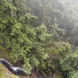


This was a really neat surprise, an unplanned stop at the top of the mountain. It was a very foggy day, and it made this mossy redwood forest have a ton of mystique while hiking through it. Trails were clearly marked and the difficulty was easy to understand. Park Rangers at the pay station were very helpful, suggesting a great route for a moderate 2 hour round-trip hike. Castle Rock fall was a neat view, the waterfall wasn't anything huge, but watching it cascade down a steep drop was interesting. Apparently on a less foggy day, the view from here is also outstanding. When I went, the fog was so dense, you could barely see beyond 50 feet or so. That did make it a pretty sparse day at the park, so I had a quiet hike without seeing many other people. The actual Castle Rock is pretty darn cool looking, and aptly named! Most any visitor can access this easily from the parking lot, no matter their fitness level. I would definitely come back when in SF next time on a clearer day to catch some of the views I missed!


How spoiled we are to be surrounded by so many beautiful parks. I visited Castle Rock on Saturday around 10am. There was plenty of parking in the lot, which was $10. There's a few spots on the road, which are free but hard to get. There are maps available and we decided on the 2.5 mile one, I believe it was called the Saratoga loop? The views were breathtaking. Plenty of trees and yes, lots of giant rocks. Toward the middle of the hike there were huge boulders that we climbed and were able to really take in the view. Along the trail there were two separate groups of rock climbers, this was cool to see. When we were done with this hike we found another one on the other side of the road called the Skyline trail. This was also beautiful and had fewer people. It was only a mile long but more challenging than the one we had just finished, due to the incline. Cell phone coverage isn't great so make sure you download a map of the area beforehand.
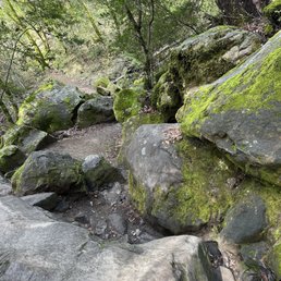

I've heard so much about this hiking spot and it didn't disappoint at all. Reading through the reviews parking was what I was worried about as they stated to come real early. Got here at 10am on Saturday and was surprised there was a lot of parking. If you park inside the State Park it's $10, but there's free parking that's about a 5 minute walk on the road. One of most organized parks I've been too lol. Signs everywhere and the maps are detailed on distance for each trail. The views are and trails are amazing. Well worth the visit. Would highly recommend this trail.


I have come here a handful of times over the past handful of years. It is a really nice place to hike, and looking at the giant boulders in the park too, I can see why it is a popular bouldering spot. During my most recent visit, it was very foggy in the mountains, but that gave the park a very atmospheric feel. There used to be this gravel parking lot that was free, but lately it's been closed and so you have to go to the paved parking lot nearby and pay $10 for parking. I think it is worth it though if you plan to hike for a bit - plus there are restrooms and picnic tables there. This place is quite the g em in the South Bay area and I would definitely recommend hiking here !
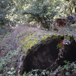


Arrived to the trailhead by 8:30 on Saturday after Thanksgiving with friends. Weather was beautiful, cold but no wind. As popular as this trail is, the $10 parking lot was sparsely filled, later it filled up as we were leaving at 11ish. The huge parking lot and restrooms were quite classy. In 3 hours time, we were able to visit everything we had planned - climbed on Goat Rock, basked at the vast views on a rock along Saratoga Gap Trail, saw the waterfall which was just trickling, and visited the famous and crowded Castle Rock. This is a great hiking destination because it is close to town, great views, and fun opportunities to scamper on rocks.


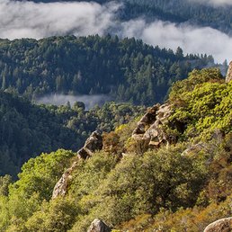
I recently visited Castle Rock Regional Recreation Area, often called Castle Rock Park by locals, and I'm giving its picnic area a solid 4-star rating. Nestled in a scenic canyon along Pine Creek within the Diablo Foothills Regional Park, this spot offers a delightful escape with a mix of natural beauty and practical amenities that make it a great choice for a picnic outing. The picnic area itself is well-equipped and thoughtfully designed. There are eight reservable sites, with capacities ranging from 50 to 100 people, which makes it ideal for both small family gatherings and larger group events. I appreciated the ADA accessibility--wheelchair-friendly pathways, accessible picnic tables, restrooms, and changing rooms ensure everyone can enjoy the space comfortably. The sites are partially shaded, offering a nice balance of sun and cover, and there are even drinking fountains and a swimming pool nearby for those hot summer days. The quarter-mile walk from the parking lot to the picnic sites is manageable, though I'd recommend bringing a wagon for heavier items as there's no shuttle service. The setup felt practical yet serene, with the surrounding canyon and views toward Mt. Diablo adding a peaceful backdrop to our meal. What really stood out was the access to nature right beyond the picnic area. After eating, we ventured onto the trails that wind up the canyon, and within a mile, it felt like we were deep in the countryside despite being on the edge of Walnut Creek. The trails connect to over 18,000 acres of public lands, including Mt. Diablo State Park, which is perfect for a post-picnic hike. The park also has amenities like basketball courts, horseshoe pits, and a volleyball court, which added some fun for the kids in our group. One thing to note--parking can be tight, especially in summer, so arriving early is a good idea. Also, while dogs are allowed in the park section, they're not permitted on the rangeland trails, which was a slight bummer for our pup. Overall, Castle Rock Park's picnic area offers a fantastic blend of convenience and natural charm. It's not perfect--public transit access is limited, and the walk from parking might be a hassle for some--but the setting and facilities make it a spot I'd happily return to for a relaxing day out.


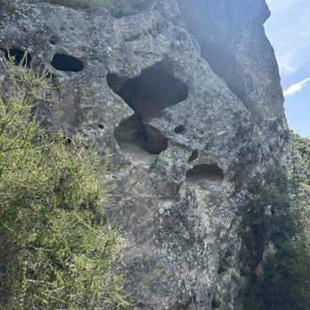
This park is one of the best outdoor bouldering spots around San Jose and hosts some incredible hikes. I always hike after it rains because the skies shine brighter. The park has sandstone formations as you can see in my videos. They make some cool "caves" to explore and get some shade in. I recommend coming here! There is paid parking and free parking if you're willing to walk a bit further to get to trailheads.


print a map or have satellite gps...cellphone reception is extremely spotty...$10 per vehicle to park in the lot...credit card accepted...print and place inside the car dashboard...take a picture of the map and start your hike...the trails are shaded by trees...castle rock loop is an easy trail for even toddlers...from the main entrance, it's about 3/4th the way to reach the rocks...enormous rocks with tunnels carved into them...natural playground for children to sit inside the rocks...explore through numerous rooms and cave-like passageways...some too cramp for adults...keep an eye on the children since a slip or fall can be painful....be very careful where you step since this area is infested with fire ants that have painful bites...active bee hives also spotted...other than that, it is a wonder place to hike, explore and play...great hike for children!


25 days ago
Have long eyed the Castle Rock State Park and glad we finally went! The park charges a nominal parking fee ($10 at time of writing); the parking fee is waived if you have one of the supported passes. Check their site for more info: https://www.parks.ca.gov/?page_id=538# We really enjoyed our hike here. The space is beautiful, and the trails are well-maintained. The trailhead had plenty restrooms as well. We made it up to Goat Rock Lookout, back down, then detour to the waterfall. It took ~1.5 hours in total, which was perfect for a end-of-day hike before the park closes at sunset. The view up at Goat Rock Lookout was breathtaking! read more
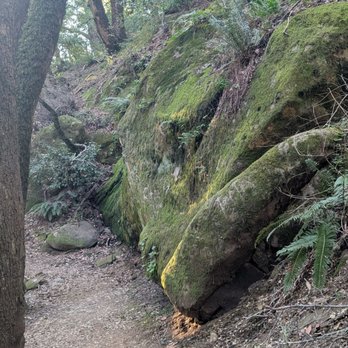


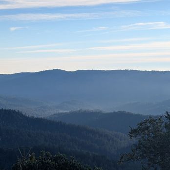


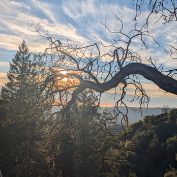


If you're looking for another place that has breathtaking views surrounding the whole Santa Cruz Mountains (but don't want to go all the way to Portola Valley), Castle Rock State Park is the place for you. This place is usually my go to when the weather is just perfect and you want good views of the mountains viewing the Monterey Bay and the Santa Clara Valley. In addition, the park is even open during the cold winter season, where it occasionally will snow (because of how high the elevation is, the main base is situated at about 3,200 feet above sea level). This place has been my go-to park for hiking for a while, because of its terrain. At the same time, it's also been because of how much snow they get when cold fronts come into effect. They are also open year-round, so definitely swing by this state park when you do get the chance to! It's a decision you'll never regret. read more


6 months ago

29 days ago
Pretty good state park if you're looking for hiking in the Bay Area. Trails are maintained and nice with lots of scenery. read more


7 months ago


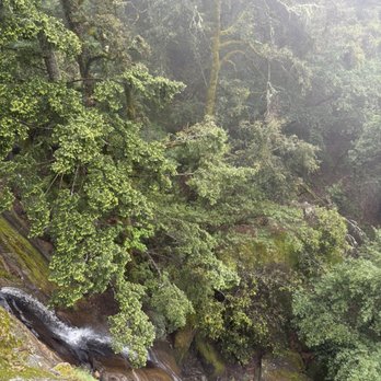
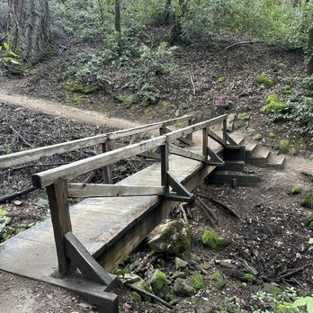
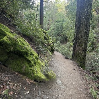
This was a really neat surprise, an unplanned stop at the top of the mountain. It was a very foggy day, and it made this mossy redwood forest have a ton of mystique while hiking through it. Trails were clearly marked and the difficulty was easy to understand. Park Rangers at the pay station were very helpful, suggesting a great route for a moderate 2 hour round-trip hike. Castle Rock fall was a neat view, the waterfall wasn't anything huge, but watching it cascade down a steep drop was interesting. Apparently on a less foggy day, the view from here is also outstanding. When I went, the fog was so dense, you could barely see beyond 50 feet or so. That did make it a pretty sparse day at the park, so I had a quiet hike without seeing many other people. The actual Castle Rock is pretty darn cool looking, and aptly named! Most any visitor can access this easily from the parking lot, no matter their fitness level. I would definitely come back when in SF next time on a clearer day to catch some of the views I missed! read more


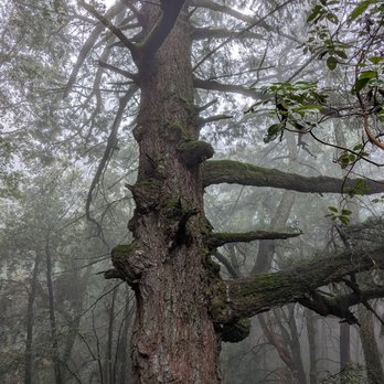


How spoiled we are to be surrounded by so many beautiful parks. I visited Castle Rock on Saturday around 10am. There was plenty of parking in the lot, which was $10. There's a few spots on the road, which are free but hard to get. There are maps available and we decided on the 2.5 mile one, I believe it was called the Saratoga loop? The views were breathtaking. Plenty of trees and yes, lots of giant rocks. Toward the middle of the hike there were huge boulders that we climbed and were able to really take in the view. Along the trail there were two separate groups of rock climbers, this was cool to see. When we were done with this hike we found another one on the other side of the road called the Skyline trail. This was also beautiful and had fewer people. It was only a mile long but more challenging than the one we had just finished, due to the incline. Cell phone coverage isn't great so make sure you download a map of the area beforehand. read more


I've heard so much about this hiking spot and it didn't disappoint at all. Reading through the reviews parking was what I was worried about as they stated to come real early. Got here at 10am on Saturday and was surprised there was a lot of parking. If you park inside the State Park it's $10, but there's free parking that's about a 5 minute walk on the road. One of most organized parks I've been too lol. Signs everywhere and the maps are detailed on distance for each trail. The views are and trails are amazing. Well worth the visit. Would highly recommend this trail. read more






11 months ago
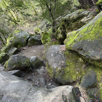
Enjoyed the hike here. Can't wait to explore more and try different trails. We unfortunately were not able to see the falcon which we were searching for to take some bird photos. Hopefully next time. read more


3 months ago

5 months ago

1 year ago
I have come here a handful of times over the past handful of years. It is a really nice place to hike, and looking at the giant boulders in the park too, I can see why it is a popular bouldering spot. During my most recent visit, it was very foggy in the mountains, but that gave the park a very atmospheric feel. There used to be this gravel parking lot that was free, but lately it's been closed and so you have to go to the paved parking lot nearby and pay $10 for parking. I think it is worth it though if you plan to hike for a bit - plus there are restrooms and picnic tables there. This place is quite the g em in the South Bay area and I would definitely recommend hiking here ! read more


1 year ago

1 year ago
Castle Rock State Park is a pretty nice place to come hike. There are really nice views on the way there. There are some trails to go hiking on. The views at Castle Rock are very beautiful. Will be coming back again. read more
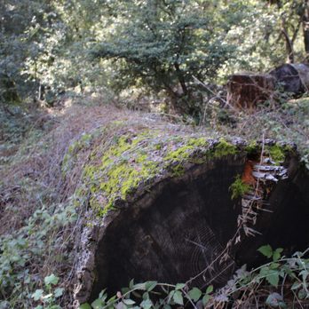

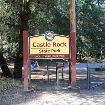


Arrived to the trailhead by 8:30 on Saturday after Thanksgiving with friends. Weather was beautiful, cold but no wind. As popular as this trail is, the $10 parking lot was sparsely filled, later it filled up as we were leaving at 11ish. The huge parking lot and restrooms were quite classy. In 3 hours time, we were able to visit everything we had planned - climbed on Goat Rock, basked at the vast views on a rock along Saratoga Gap Trail, saw the waterfall which was just trickling, and visited the famous and crowded Castle Rock. This is a great hiking destination because it is close to town, great views, and fun opportunities to scamper on rocks. read more


1 year ago
Having back here for awhile, the park is still clean and this time WiFi is much not working. Parking is $10 for one car and entrance is easy especially there is trail arrow showing which direction and distances. I came here on Saturday morning and it was empty, but parking seem full. read more

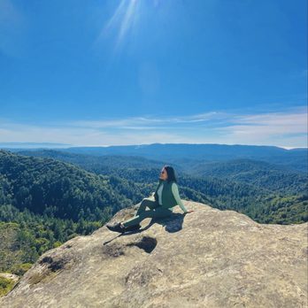


1 year ago
I recently visited Castle Rock Regional Recreation Area, often called Castle Rock Park by locals, and I'm giving its picnic area a solid 4-star rating. Nestled in a scenic canyon along Pine Creek within the Diablo Foothills Regional Park, this spot offers a delightful escape with a mix of natural beauty and practical amenities that make it a great choice for a picnic outing. The picnic area itself is well-equipped and thoughtfully designed. There are eight reservable sites, with capacities ranging from 50 to 100 people, which makes it ideal for both small family gatherings and larger group events. I appreciated the ADA accessibility--wheelchair-friendly pathways, accessible picnic tables, restrooms, and changing rooms ensure everyone can enjoy the space comfortably. The sites are partially shaded, offering a nice balance of sun and cover, and there are even drinking fountains and a swimming pool nearby for those hot summer days. The quarter-mile walk from the parking lot to the picnic sites is manageable, though I'd recommend bringing a wagon for heavier items as there's no shuttle service. The setup felt practical yet serene, with the surrounding canyon and views toward Mt. Diablo adding a peaceful backdrop to our meal. What really stood out was the access to nature right beyond the picnic area. After eating, we ventured onto the trails that wind up the canyon, and within a mile, it felt like we were deep in the countryside despite being on the edge of Walnut Creek. The trails connect to over 18,000 acres of public lands, including Mt. Diablo State Park, which is perfect for a post-picnic hike. The park also has amenities like basketball courts, horseshoe pits, and a volleyball court, which added some fun for the kids in our group. One thing to note--parking can be tight, especially in summer, so arriving early is a good idea. Also, while dogs are allowed in the park section, they're not permitted on the rangeland trails, which was a slight bummer for our pup. Overall, Castle Rock Park's picnic area offers a fantastic blend of convenience and natural charm. It's not perfect--public transit access is limited, and the walk from parking might be a hassle for some--but the setting and facilities make it a spot I'd happily return to for a relaxing day out. read more
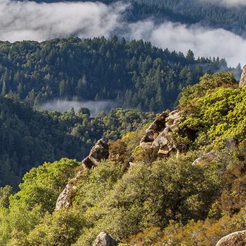

This park is one of the best outdoor bouldering spots around San Jose and hosts some incredible hikes. I always hike after it rains because the skies shine brighter. The park has sandstone formations as you can see in my videos. They make some cool "caves" to explore and get some shade in. I recommend coming here! There is paid parking and free parking if you're willing to walk a bit further to get to trailheads. read more


1 year ago

print a map or have satellite gps...cellphone reception is extremely spotty...$10 per vehicle to park in the lot...credit card accepted...print and place inside the car dashboard...take a picture of the map and start your hike...the trails are shaded by trees...castle rock loop is an easy trail for even toddlers...from the main entrance, it's about 3/4th the way to reach the rocks...enormous rocks with tunnels carved into them...natural playground for children to sit inside the rocks...explore through numerous rooms and cave-like passageways...some too cramp for adults...keep an eye on the children since a slip or fall can be painful....be very careful where you step since this area is infested with fire ants that have painful bites...active bee hives also spotted...other than that, it is a wonder place to hike, explore and play...great hike for children! read more


3 years ago
When I think of rock climbing, I think of adventurers attached to ropes, climbing a vertical rock wall. Well, there's some of that going on here, including near the waterfall, where hikers can take a break and enjoy the views while observing climbers nearby. But I didn't realize that hiking the mountain would involve clambering over endless rocks and boulders along the trail, lots of steps to climb, uneven pathways, and steep gradients. I actually freaked out when we had to climb through rugged and narrow passageways, requiring balancing skills, along the edge of the cliff (if I knew what I was signing up for, I would have declined, especially with spotty cell signal if I needed to call for help). But the views of the Santa Cruz Mountains and beyond were amazing.... which leads me to what I loved about the setting, despite my slight nervousness at scarier parts and the physical exertion of hiking at this park. Plenty of shaded trails on rock and dirt pathways, venturing through a forest of trees, as well as tons of greenery (including poison oak, beware), and crossing bridges over the creek along the Saratoga Gap Trail... Trekking to and through Goat Rock, admiring the magnificent and holey rock formations and cave-like structures, like at Dan Seldow's Fraggle Rock Grove, taking in spectacular views at Emily Smith Observation Point... More rock climbing to get to the actual castle rock (it's like a treehouse except it's a giant rock you can climb, instead of a tree, and of course with more holes and caves). There are a lot of similar giant oddly-shaped boulders in the vicinity along the Castle Rock trail, with groups of hikers and campers climbing or picnicking around the structures, but this massive rock formation is larger and clearly labeled, and there's a small restroom nearby. The only downside to Castle Rock Park, besides the risk of falling to your death, is the annoying flies and gnats on a hot day. Otherwise, this was definitely a beautiful and unique hiking experience (and we didn't even do the most challenging trails at the park, which could possibly be more interesting). Also, parking is plentiful, whether at the $10 lot or on the side of the road. read more


Cool short hike to Goat Rock, it's about 1 mile up. You can make the loop longer by just keep going on the Ridge Trail. We made the loop and it came out to about almost 5 miles. There's a lot of shade on the trail, so even if it's hot in the city, it's about 10 degree cooler up there. Nice trees and scenery. On a clear day you can see the ocean. Good short hike. read more


1 year ago
Castle Rock State Park, nestled in the Santa Cruz Mountains, is absolutely beautiful. I hiked the Saratoga Trail partially and Castle Rock Trail, which form a loop. The Saratoga Trail led to a lovely waterfall and had stunning views of the mountains throughout. Some parts of the hike are easy, while others can be more challenging--especially the Ridge Trail above Saratoga, which I only completed a bit of it due to its steeper climb. The rock formations on the Castle Rock Trail were especially unique and worth seeing. I went on a weekday (Wednesday) and was able to park outside for free since the lot gate was closed--it was quiet and peaceful. On weekends, it may be busier with a $10 fee. The park is huge with many trails left to explore. While I personally prefer the mountain views at Russian Ridge, Castle Rock's waterfall and rock features make it a place I'd definitely recommend. Note: no dogs allowed. read more


1 year ago

2 years ago
Great trail! With lots of climbing up and down. We stopped at the rock because going around seemed very sketchy, but I guess if you walk around it it's a loop. Drive up is a solid 30 minutes. Gets very hot but there is lots of shade. Overall hike in the loop takes 1hr - 1.3hours. read more


One of my favorite hikes in the Bay Area! A must hike place to go and try. It's considered a moderate loop hike with some rock climbing involved. I loved it. There are also rock climbing for advance hikers here but you bring your own equipment. Fun watching them! Only 5 miles but a heavily traffic trail as many love it here as well. Nice mountain views and half the trail is shaded. There is plenty of paid parking here but if you don't want to pay, there are plenty of outside parking as well. It's best to go early morning to beat the heat and crowd especially in the weekend. A definite recommended trail for many first time hikers or regular hiker. A good sweat to get your heart pumping! [39th/100] read more


It's been a minute since I've hiked the trails at Castle Rock actually over 20 minutes I'd you catch my drift. I use to frequent Castle rock about once a month, boy how it's changed, there is a brand new parking lot right near the 1st small one "which was packed full of cars" admission for parking $10!! The park it's self is beautiful with miles of trails, I walked for about 2 hours, you can do some rope climbing on rocks at the park as well. I would recommend bringing a pair of walking sticks as parts of the trail can be. Treacherous with slick rocks. read more
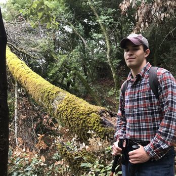
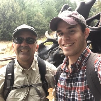
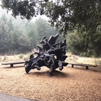


One of my favorite hiking spots! There are a lot of rocks and panoramic views of lush green trees. On the trail, you do have to climb over rocks at some points. Some areas of the trail is shaded while others aren't so bring a hat. We also came across a lot of climbers bouldering because there are a lot of designated spots for that along the trail. We parked outside of the parking lot so was able to avoid the $10 parking fee. read more
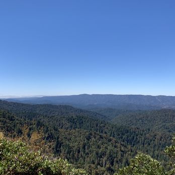

2 years ago

3 years ago
Amazing and beautiful park close to the south Bay area. It's $10 to park and there are beautifully maintained trails for every skill level. I did the Castle Rock Falls and also the Goat Rock overlook and it was quite the view! Would definitely love to come back. read more


6 years ago
A very fun & rewarding hike. Gorgeous views that make climbing the rocks so worth it. This hike has a little bit of everything in terms of hiking--maneuvering over rocks, stomping on dirt paths, rock climbing, & more. The sound of the waterfall streams are so relaxing and the views are breathtaking. I wish I packed lunch and had a picnic on a giant rock...next time :). Some incline, but not too much. The hike itself gives you a challenge because of all the obstacles. There are a good amount of trails with little side trails to explore. Definitely a place to return to more than once. We did the castle rock falls and used the inter connector trail to reach the goat rock trail, which looped us back to the parking lot. It was the perfect 2.5hr ish hike (including our stops). The drive up is a bit windy. New parking lot is spacious may get busy during the weekends. For social distancing they marked the trails as one way to prevent face to face passing. read more


2 years ago

2 years ago
I went on a Monday which I believe was a holiday for most so there wasn't anyone at the toll booth. I believe there usually is a parking fee but I'm not too sure as I didn't see any signs about it. Parking is easy and accessible. There are a few options along the road. I parked in the Alum Rock parking area. On the right side is a creek and a trail you can follow. All the trails are fairly easy and the views are beautiful as well. It's a great place to take the family or if you're more of a beginner hiker read more


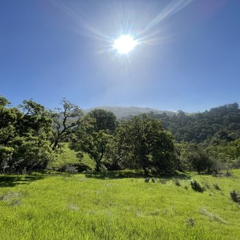


This is probably one of my favorite hikes in the Bay Area. This is a pretty easy hike and super beautiful! The view is amazing here and there's plenty of shade. I definitely recommend going in the morning when there aren't too many people. There are two parking lots - the main one & overflow. In addition, there's street parking (free btw). Remember to bring bug spray bc there are bugs! Also, I recommend the road through downtown Saratoga to get here. I took road from 17 and hated it as there are some areas where it got too narrow. read more


4 years ago
We started coming to Castle Rock when I first moved to San Jose-- wild and child-free it became one of our go to hiking trail(s) in the South Bay. Six years later, we're still wild (or at least that's what I tell myself) but now with a child, and still come here with our almost two-year old who is not quite ready to hike on his own but enjoys every moment in the hiking carrier. The Castle Rock Loop is really good if you have small kids and want to take them on an adventure. You'll come across many rock climbers and the formations are beautiful. I'd say this loop is doable by 3-4 year olds, There's an incline so just have to be careful. We did the Castle Rock Falls Trail this past week, which is a bit longer. You go to Castlerock Falls and come back. There's a deck from which you can look down at the falls (it's very steep). Some parts of the trail proved just a little tough and required maneuvering; husband is used to the carrier so we were okay. If the child is walking then just have to be extra careful, some steep places. Both of these trails are shaded so layer up if you're going during winter. The longer trails are a mix with beautiful panoramic views. There are two paid parking lots and if you come early you can park for free outside. The smaller parking lot only takes cash. Rangers are also there to help you decide on trails. read more

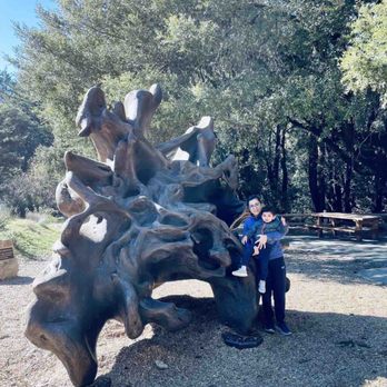

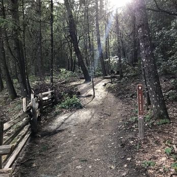
Castle Rock features some of the most unique rock formations that I've ever seen in a California State Park. In addition to the rock formations, Castle Rock is filled with tons of versatile hiking trails, a plethora of different plant species, campsites, rampant wildlife, and even a waterfall. And those views! I can't forget about those gorgeous views of the Santa Cruz Mountains. Should you embark on a hike through the mountains, be prepared for your eyes to be met with rolling green hills and beautiful blue skies (weather permitting). Right from the gate, I have to mention how limited the parking situation is. You need to get here at the crack of dawn to secure a spot in one of the two parking lots that sit right in front of the entrance. Their main parking lot has about maybe 30 spots or so, and the parking lot across the street has about an additional 40 spots. This is a very busy park. VERY busy. Especially on the weekends. No parking is allowed on the side of the road. Chances are, you may not get to park in either lot. The alternative: Park at one of the nearby Sanborn County Park lots and hike your way over. I parked about 1.5 miles down the road at the Summit Rock parking lot and hiked the Skyline Trail which connects directly to Castle Rock State Park. It added an extra 3 miles to my 6 mile hike through Castle Rock, but it was convenient considering the situation. If you don't mind the extra trek, I'd recommend it. Otherwise, get to the park before 8 am and make sure you have $10 cash for the parking fee. So now that I've gotten that out of the way, let's talk about the actual park. This park really has a great mix of everything. Most of the trails are shaded so you won't have to worry about too much sun exposure. Hiking trails range from easy to difficult, and there's a trail map near the entrance. There's no visitor center here, so I'd recommend studying a map or using the alltrails app to map out your hike. We took the Saratoga Gap loop to the Ridge Trail which made for a moderate 6 mile hike. The hike was filled with various different terrains ranging from flat and paved to steep and narrow through the ridges. If you're afraid of heights, I'd avoid the Ridge Trail. The views are incredible, but there are some parts where you're literally on the edge of the ridge with no barriers and only the rock behind you to hold onto. There's this one gnarly section where you have to hold onto a thin ass rope to get over the rock. Kind of scary, but also a great adrenaline rush (picture worthy too). If you've ever hiked Mount Diablo or the Diablo Foothills/Castle Rock Regional Park in CoCo County, the rock formations are quite similar. The major differences really come down to the size and the location. Castle Rock has some really huge rocks with the craziest looking formations! I saw so many kids crawling into the rocks with human sized holes in them. Gotta love nature! What I also really loved about this park was how green it is. Often times when I've gone to a park that features rock formations, the park isn't as green and doesn't have as many trees or shady spots. But, Castle Rock is the perfect culmination of the two. Tall beautiful trees line the trails alongside vibrant ferns and huckleberries. A botanist could have a lot of fun here. Castle Rock Falls is also a neat sight to see! It wasn't flourishing with water when we went, but I always find something so enchanting about any type of waterfall. We didn't camp here but we did pass by a campsite or two during our hike. Although the trails are mostly shaded, you should still bring plenty of water for the inclines. And don't forget your bug spray! The bugs weren't too crazy but they were out there. This park is really gorgeous and the hike was fun and challenging. I would definitely come back to explore more of the trails and rock formations. read more




Page 1 of 11
More info about Castle Rock State Park
15451 Skyline Blvd
Los Gatos, CA 95032
Directions
(408) 868-9540
Call Now
Visit Website
https://www.parks.ca.gov
Hours
Indoor Amenities
Outdoor Amenities
Other Amenities
Ask the Community - Castle Rock State Park
Are any of these trails appropriate for Jeeps?
No, the trails are for hiking only.
Is it open right now or do they still have signs saying it's closed?
It's open now
Hi! Does anyone know if this is currently open during this time?
The park is open daily from 8am until sunset.
How many miles is this trail?
Saratoga Gap to Falls Overlook to Interconnector Trail to Goat Rock to Saratoga Gap is about 8-9 miles
Are the bike trails beginner friendly?
Yes and No. They only allow bikes on certain parts of the trails. The yes part is there are flat areas a beginner could ride with no problem. But then comes the hills and curves and turns and narrow ridges that can be a real learning experience. You… Read more
Is it ok for kids? Were not expert hikers or rock climbers, but the kids- 5, 8,& 10 love to climb and explore.
Yes there are short easier trails that depart from the main visitor center. You can take the trail to the waterfall viewing platform that I believe is under a mile round trip. If your kids are more adventurous you can take them to the first section… Read more
Do the beginners trails have very steep inclines?
Yes, it has a variety of trails but I would say inclines are all over the trails. Once you get to the skyline you would think it is all worth it. Regular tennis shoes it's fine for hiking the trails.
Do the campground bathrooms have showers?
No, it's primitive camping in the backcountry. No car camping.
The drive to the hiking trail seems scary to drive on. Is there a way to get there without driving on the single-lane, scary one lane road or walk to the trail?
Negative. Either Black Rd or Hwy 9 your only two options
Is there free parking? If so, where is it located? Thanks!
If you want to park in the main lot there is a cost. However, there is some limited space along the street that is free if it's available.
We're beginner hikers so I was wondering what's the easiest trail to get to the very top view? Or are all the trails intermediate/advanced? Thanks!
There is no view at the very top, but there are views to be had in CR. For a very short hike (under 2 miles) take the Saratoga Gap Trail from main entrance, downhill until you reach the waterfall viewing platform (some views). then return the way… Read more
Review Highlights - Castle Rock State Park
You might also consider









Why does Yelp recommend reviews?
19 reviews that are not currently recommended
The reviews below are not factored into the business's overall star rating.
10 years ago

5 years ago

5 years ago

11 years ago

4 years ago
7 years ago
12 years ago

8 years ago

12 years ago

11 years ago
2 years ago

9 years ago

19 years ago

13 years ago

11 years ago

8 years ago

12 years ago
11 years ago
Castle Rock State Park - parks - Updated May 2026
Best of Los Gatos
People found Castle Rock State Park by searching for…
Hiking Trails With Waterfalls in Los Gatos, CA
Great View Points in Los Gatos, CA
Scenic Drives in Los Gatos, CA
Tourist Attractions in Los Gatos, CA
Rock Climbing in Los Gatos, CA
Redwood Trees in Los Gatos, CA
Dog Friendly Hiking Trails in Los Gatos, CA
Redwood Forest in Los Gatos, CA
Trending Searches in Los Gatos, CA
Baseball Fields near Castle Rock State Park
Boat Rental near Castle Rock State Park
Botanical Gardens near Castle Rock State Park
Bounce House Rentals near Castle Rock State Park
Campgrounds near Castle Rock State Park
Cherry Picking near Castle Rock State Park
Cliff Jumping near Castle Rock State Park
Dog Friendly Things To Do near Castle Rock State Park
Dog Friendly Trails near Castle Rock State Park
Fishing Lake near Castle Rock State Park
Flower Fields near Castle Rock State Park
Flower Shop near Castle Rock State Park
Free Picnic Areas near Castle Rock State Park
Garage Sales near Castle Rock State Park
Hair near Castle Rock State Park
Hiking near Castle Rock State Park
Lakes near Castle Rock State Park
Lookout Points near Castle Rock State Park
Nurseries & Gardening near Castle Rock State Park
Off Leash Dog Parks near Castle Rock State Park
Outdoor Activities near Castle Rock State Park
Outdoor Basketball Courts near Castle Rock State Park
Outdoor Furniture Stores near Castle Rock State Park
Party Equipment Rentals near Castle Rock State Park
Pedicure near Castle Rock State Park
Pick Your Own Farms near Castle Rock State Park
Picnic Areas near Castle Rock State Park
Places To Take Pictures near Castle Rock State Park
Places To Walk Around near Castle Rock State Park
Rainy Day Activities near Castle Rock State Park
Rock Quarry near Castle Rock State Park
Running Trails near Castle Rock State Park
Scenic Drive near Castle Rock State Park
Scenic Night View near Castle Rock State Park
Scenic Places To Walk near Castle Rock State Park
Secluded Spots near Castle Rock State Park
Secret Spots near Castle Rock State Park
Splash Pad near Castle Rock State Park
Star Gazing near Castle Rock State Park
Strawberry Picking near Castle Rock State Park
Sunrise View near Castle Rock State Park
Swimming Holes near Castle Rock State Park
Tennis Courts near Castle Rock State Park
Walking Trails near Castle Rock State Park
Browse Nearby
BEST of Los Gatos, California Coffee near Castle Rock State Park
BEST of Los Gatos, California Restaurants near Castle Rock State Park
BEST of Los Gatos, California Things to Do near Castle Rock State Park
BEST of Los Gatos, California Hiking near Castle Rock State Park
BEST of Los Gatos, California Breakfast near Castle Rock State Park
BEST of Los Gatos, California Wineries near Castle Rock State Park
BEST of Los Gatos, California Campgrounds near Castle Rock State Park
Browse Brands
Related Searches in Los Gatos, CA
Affordable Bike Repair Services in Los Gatos, California
Affordable Bike Tune Up Services in Los Gatos, California
Affordable Kayak Rental Services in Los Gatos, California
Affordable Road Bike Rental in Los Gatos, California
Best Dog Hiking Trails Around Los Gatos, California
Best Electric Bike Rental Services in Los Gatos, California
Best Fishing Locations and Guides in Los Gatos, California
Best Nature Trails for Hiking in Los Gatos, California
Best Off Leash Dog Parks in Los Gatos, California
Best Parks for Parties and Events in Los Gatos, California
Best Places for Horseback Riding in Los Gatos, California
Best Sledding Spots and Fun in Los Gatos, California
Best Used Bikes for Sale Near Los Gatos, California
Best Water Parks for Kids in Los Gatos, California
Best Waterfalls and Swimming Holes in Los Gatos, California
Check Out Great Playgrounds in Los Gatos, California
Check Out Off Road Trails in Los Gatos, California
Discover Baseball Fields Around Los Gatos, California
Discover Beautiful Garden Spots in Los Gatos, California
Discover Dog Friendly Trails to Explore in Los Gatos, California
Discover Fun Toddler Parks in Los Gatos, California for Your Little One
Discover Kid Friendly Hiking Trails in Los Gatos, California
Discover Lakes & Ponds to Explore in Los Gatos, California
Discover Popular Bike Tours in Los Gatos, California
Discover Popular Bike Trails in Los Gatos, California
Discover Popular Photo Spots in Los Gatos, California
Discover Public Beaches to Visit in Los Gatos, California
Discover Scenic Bike Paths in Los Gatos, California
Discover Scenic Hiking Trails in Los Gatos, California
Discover Scenic Mountain Bike Trails Near Los Gatos, California
Discover Scenic Waterfall Spots in Los Gatos, California
Discover Soccer Fields in Los Gatos, California Near You
Discover Top Nature Parks to Visit in Los Gatos, California
Discover Top State Parks to Visit in Los Gatos, California
Discover Walking Parks in Los Gatos, California Near You
Discover a Hiking Trail in Los Gatos, California
Discover the Best Beaches in Los Gatos, California
Discover the Best Kids Park Spots in Los Gatos, California
Discover the Best Night Hike Trails in Los Gatos, California
Dog-Friendly Hikes With Dogs in Los Gatos, California
Enjoy Biking Adventures Around Los Gatos, California
Enjoy Camping Adventures Around Los Gatos, California
Enjoy Exciting Mountain Biking Adventures in Los Gatos, California
Enjoy Hiking Adventures in Los Gatos, California
Enjoy Kayaking Adventures in Los Gatos, California
Enjoy Tent Camping Spots Around Los Gatos, California
Enjoy a Beautiful Waterfall Hike in Los Gatos, California
Enjoy a Peaceful Nature Walk in Los Gatos, California
Enjoy the Best Picnic Spots and Ideas in Los Gatos, California
Browse Articles
People who viewed Castle Rock State Park also viewed

Sanborn County Park
172 reviews

Hunter's Point
37 reviews

St Joseph's Hill Open Space Preserve
60 reviews

Bear Creek Redwoods Preserve
32 reviews

Alum Rock Park
371 reviews

Saratoga Quarry Park
21 reviews

Mount Umunhum
33 reviews

Portola Redwoods State Park
157 reviews

Villa Montalvo
46 reviews

Alviso Marina County Park
236 reviews