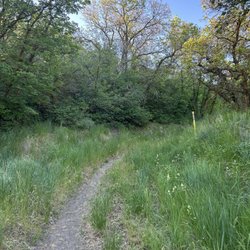
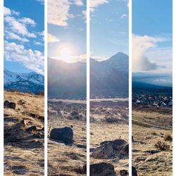
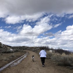
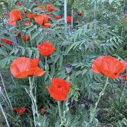
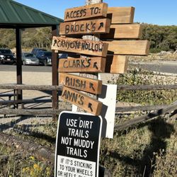
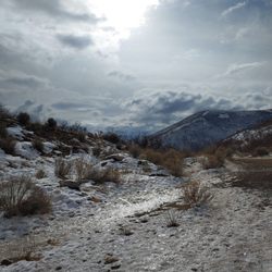
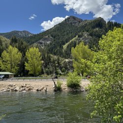
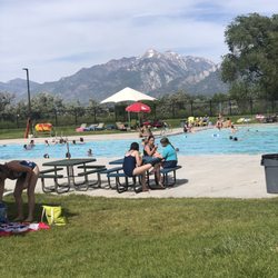
Horsetail Falls Trail Photos


You might also consider
More like Horsetail Falls Trail
Recommended Reviews - Horsetail Falls Trail
Start your review...

3 years ago
Rocky and steep! Definitely a harder to moderate hike. We brought a baby and a three year old . I don't recommend that young of kids yet I don't regret it. We had a great time. Definitely took our time. Such a great workout with lots of little creeks running through. Loved it! We went to the lower view of the falls and that wa a enough for us. read more


Another uphill hike - with upper and lower trail options. Feeling a bit ragged after the first 1/4 mile uphill hike, we chose the lower route and have no regrets! Never having crossed a log bridge quite like this one - it was a good portion of the thrill! Add to that the glowing, pre-sunset kissed, fiercely and beautiful surging river below - full of rapids and mini-waterfalls. This made for a very happy hike! It felt like hiking in an Alpine version of Fern Gully - light filtering through the tall pine canopy - it felt like there was a special nature magic/spirit in this place! read more


6 years ago
Horsetail Falls was an awesome hike!! It took us quite a while to find a parking spot since there is only room for about 15 cars, and the already-narrow road was lined with cars. It was about a 10 minute walk from our car to the trail head, but it wasn't that much of an inconvenience. The trail was steep and constant; it stayed at an incline the entire time and never really leveled out. It was very heavily-trafficked, and there were lots of dogs! It didn't feel crowded, though, since the path was pretty wide. We were also shaded by trees almost the entire hike, which was nice in the hot Utah summer. The waterfall at the top wasn't breathtaking, but it was definitely pretty. It made the previous 2.25 miles up worth it! Plus, the mist coming off it feels amazing on sweaty, hot skin. Overall, Horsetail Falls was a great hike! TIP: When you get to the wooden sign, turn left and hang on to the rope. This leads you to the best view of the falls! read more

4 years ago
More info about Horsetail Falls Trail
Horsetail Falls Trl
Alpine, UT 84004
Directions
Hours
Outdoor Amenities


Horsetail Falls Trail - hiking - Updated June 2026
Best of Alpine
People found Horsetail Falls Trail by searching for…
Beautiful Views in Alpine, Utah
Hiking Trails With Waterfalls in Alpine, Utah
Lookout Points in Alpine, Utah
Off Road Trails in Alpine, Utah
Scenic Overlook in Alpine, Utah
Walking Trails in Alpine, Utah
Running Trails in Alpine, Utah
Off Leash Dog Hikes in Alpine, Utah
Natural Hot Springs in Alpine, Utah
Places to Take Pictures in Alpine, Utah
Dog Friendly Trails in Alpine, Utah
Trending Searches in Alpine, UT
4th Of July Fireworks near Horsetail Falls Trail
Boat Rental near Horsetail Falls Trail
Cliff Jumping near Horsetail Falls Trail
Day Trips near Horsetail Falls Trail
Dog Friendly Trails near Horsetail Falls Trail
Fireworks near Horsetail Falls Trail
Fishing Spots near Horsetail Falls Trail
Jet Ski Rental near Horsetail Falls Trail
Kayak Rental near Horsetail Falls Trail
Lakes & Ponds near Horsetail Falls Trail
Outdoor Activities near Horsetail Falls Trail
Picnic Parks near Horsetail Falls Trail
Public Pools near Horsetail Falls Trail
Public Shower near Horsetail Falls Trail
River Swimming near Horsetail Falls Trail
Rock Quarry near Horsetail Falls Trail
Scenic Night View near Horsetail Falls Trail
Scenic Overlook near Horsetail Falls Trail
Secluded Spots near Horsetail Falls Trail
Soccer Store near Horsetail Falls Trail
Splash Pad near Horsetail Falls Trail
Strawberry Picking near Horsetail Falls Trail
Sunrise View near Horsetail Falls Trail
Swimming Holes near Horsetail Falls Trail
Swimming Lakes near Horsetail Falls Trail
Watch Sunset near Horsetail Falls Trail
Browse Articles
Browse Nearby
Browse Brands
Related Searches in Alpine, UT
Affordable Kayak Rental Services in Alpine, Utah
Best Fishing Locations and Guides in Alpine, Utah
Best Places for Horseback Riding in Alpine, Utah
Best Waterfalls and Swimming Holes in Alpine, Utah
Check Out Off Road Trails in Alpine, Utah
Discover Dog Friendly Trails to Explore in Alpine, Utah
Discover Scenic Mountain Bike Trails Near Alpine, Utah
Discover Scenic Waterfall Spots in Alpine, Utah
Discover Top Scenic Spots to Visit in Alpine, Utah
Discover Top State Parks to Visit in Alpine, Utah
Discover a Hiking Trail in Alpine, Utah
Discover the Best Night Hike Trails in Alpine, Utah
Discover the Best Running Track in Alpine, Utah
Enjoy Camping Adventures Around Alpine, Utah
Enjoy Kayaking Adventures in Alpine, Utah
Enjoy River Tubing Adventures in Alpine, Utah
Enjoy Tent Camping Spots Around Alpine, Utah
Enjoy Water Activities and Fun in Alpine, Utah
Enjoy a Beautiful Waterfall Hike in Alpine, Utah
Enjoy the Best Picnic Spots and Ideas in Alpine, Utah
Enjoy the Best Walking Trails in Alpine, Utah
Exciting Cliff Jumping Spots in Alpine, Utah
Experience Thrilling White Water Rafting in Alpine, Utah
Explore Beautiful Parks and Green Spaces in Alpine, Utah
Explore Easy Hikes Perfect for All in Alpine, Utah
Explore Fun Activities to Do in Alpine, Utah
Explore Nature Spots Around Alpine, Utah
Explore Popular Campgrounds Near Alpine, Utah
Explore Scenic Lakes to Visit in Alpine, Utah
Explore the Best Swimming Holes Around Alpine, Utah
Explore the Best Trail Options in Alpine, Utah
Family Friendly Hiking With Kids in Alpine, Utah
Find Beautiful Views in Alpine, Utah
Find Popular Ziplining Spots Around Alpine, Utah
Find the Best Scenic View Locations in Alpine, Utah
Hiking Trails With Waterfalls in Alpine, Utah
Off Leash Dog Hiking Trails in Alpine, Utah
Plan a Scenic Drive Route Near Alpine, Utah
Popular Fishing Spots to Explore in Alpine, Utah
Popular Outdoor Activities to Try in Alpine, Utah
Popular Picnic Spots to Visit in Alpine, Utah
Popular Things to See in Alpine, Utah
Safe River Swimming Areas in Alpine, Utah
Safe and Fun Parks for Kids in Alpine, Utah
Top Climbing Spots and Gyms in Alpine, Utah
Top Running Trails to Explore in Alpine, Utah
Top Swimming Lakes to Enjoy in Alpine, Utah
Top Swimming Spots and Pools in Alpine, Utah
People who viewed Horsetail Falls Trail also viewed
Stewart Falls Trailhead
24 reviews
Dog Lake Trail
7 reviews
Twin Lakes Pass
3 reviews
Mount Timpanogos - The Timpooneke Trail
1 review
Lower Bells Canyon Reservoir via Granite Trail Head
6 reviews
Red Pine Trail
4 reviews
Lisa Falls
3 reviews
Rocky Mouth Trail
8 reviews
Squaw Peak Trail
2 reviews
Lake Solitude Trailhead
7 reviews