Rockport State Park Photos


More like Rockport State Park
Recommended Reviews - Rockport State Park
Start your review...


Reviews With Photos

Love camping here! It's better in the off season since it's less crowded but anytime of the year is great. Very close to the salt lake valley and not too pricey. They have hook ups for glampers as well as primitive spots. You can camp right by the lake and walk to it in less than minutes. Definitely will return again


We were at Riverside campground campsite #4 which is near couple important amenities. One was drinking water emphasis on drinking and the other being the bathroom. Overall, it was a nice campsite there are couple things we wished were different. The campsites are pretty close to each other, we were lucky that we didn't have anyone right next to us. Two, there are little red ants (completely different from fire ants) that are just pesky and annoying. They don't hurt or bite, they are just everywhere. I'm not a bug enthusiast, so naturally I noticed them often whereas my boyfriend was unbothered. Three, there aren't kindling for fire so definitely bring some. You can buy firewood literally at camp so no need to haul and you are about 10mins drive round trip from a store that sells ice and firewood. We were able to make it work with the kindling at our site (we had fire 3 out of 4 days we were there, we chose not make fire one of the day) but people at campsite 3 and 1 you definitely will need something if you're planning on having fire more than once. On the positive side at campsite #4 we had cellular service the entire time there. I have T-Mobile and he has Verizon no issues at all with calls or texts or social media or maps. I was pleasantly surprised we had that well of a phone service. There's a picnic table to eat on or prep meals or play games. Fire ring is in great condition. Flat land for tent and there's couple trees for shade. Not good for hammock too far apart and also would go over fire ring. Campsite #3 doesn't have trees at all, so if you're there maybe bring a canopy for shade. You can hear the river and it's a very short walk to the river. Overall, good experience and will camp there again whenever I'm in that part of Utah!


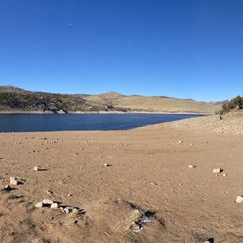
We come to Rockport every year in August for a family reunion. We normally camp in the cabins (and honestly didn't care much for it) but this year we decided to camp at the Juniper campground and we loved it more then the cabins. Only down fall is due to the drought in Utah this year there was hardly any water (only 40% full ) and it was super muddy but it's not the camp grounds fault. Stupid drought. We will definitely be back next year to camp in the campground again. They had the camp spots nice and clean for us when we got there. They even let us check in a little early. We also enjoyed fishing off the bank. Got a few bites but wasn't able to catch anything this time. In the past fishing right before the sun sets is the best time. We seem to usually catch fish around that time by the sale boat area. (Just east of the cabins). We used warms and pink salmon eggs. Can't wait for next years trip! read more


If you don't have a boat, you may not have as much fun here as others. I don't have a boat. The lake is awesome, though. Very clean and the water felt great. There are several beachy areas with covered picnic gazebos. Lots of shade trees down closer to the water, too. Camping is hit or miss. Some sites (the ones closest to the lake) offer no shade and blistering heat. The cottonwood area has lots of trees for shade and if you are lucky, there's a camping lot with a huge field attached for games like volleyball, throwing a football, etc. I can't divulge which one, because it would hurt my chances of being able to book it again, but if you care that much it should be pretty easy to figure out :) Full disclosure- I saw snakes here. One RAN (if snakes could run, that's what this one did) in front of me as I was walking across a grassy spot. I'm a little terrified of snakes so this was no bueno. Also there are tonnnns of Mosquitos so under no circumstances, do NOT forget insect repellent. Raccoons will get into stuff at night. You can hear them. Saw lots of cute little bunny rabbits and some deer. All in all, it's meh for camping, but the lake is awesome. read more


6 years ago
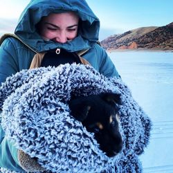
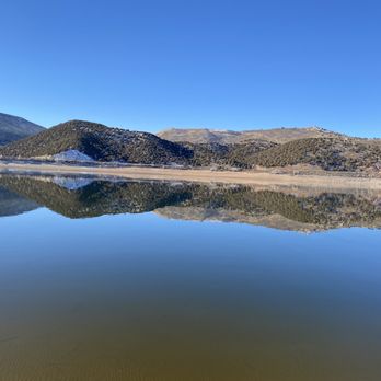
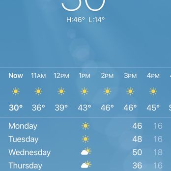
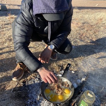
Freezing and beautiful weather in the month of December 2020. We stayed here for the night on our drive to go further up north. Very clean and beautiful scenery. We woke up and things inside the car were frozen. It wasn't bad though, we had our sleeping bags. read more




4 years ago
Love camping here! It's better in the off season since it's less crowded but anytime of the year is great. Very close to the salt lake valley and not too pricey. They have hook ups for glampers as well as primitive spots. You can camp right by the lake and walk to it in less than minutes. Definitely will return again read more

13 years ago

6 years ago
We were at Riverside campground campsite #4 which is near couple important amenities. One was drinking water emphasis on drinking and the other being the bathroom. Overall, it was a nice campsite there are couple things we wished were different. The campsites are pretty close to each other, we were lucky that we didn't have anyone right next to us. Two, there are little red ants (completely different from fire ants) that are just pesky and annoying. They don't hurt or bite, they are just everywhere. I'm not a bug enthusiast, so naturally I noticed them often whereas my boyfriend was unbothered. Three, there aren't kindling for fire so definitely bring some. You can buy firewood literally at camp so no need to haul and you are about 10mins drive round trip from a store that sells ice and firewood. We were able to make it work with the kindling at our site (we had fire 3 out of 4 days we were there, we chose not make fire one of the day) but people at campsite 3 and 1 you definitely will need something if you're planning on having fire more than once. On the positive side at campsite #4 we had cellular service the entire time there. I have T-Mobile and he has Verizon no issues at all with calls or texts or social media or maps. I was pleasantly surprised we had that well of a phone service. There's a picnic table to eat on or prep meals or play games. Fire ring is in great condition. Flat land for tent and there's couple trees for shade. Not good for hammock too far apart and also would go over fire ring. Campsite #3 doesn't have trees at all, so if you're there maybe bring a canopy for shade. You can hear the river and it's a very short walk to the river. Overall, good experience and will camp there again whenever I'm in that part of Utah! read more


5 years ago

11 years ago

10 years ago

11 years ago
9 years ago
13 years ago
More info about Rockport State Park
9040 N Hwy 302
Peoa, UT 84061
Directions
(435) 336-2295
Call Now
Hours
Outdoor Amenities
Ask the Community - Rockport State Park
Is this place dog friendly?