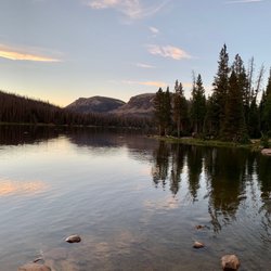
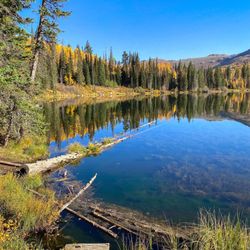
Nobletts Creek Trail Photos

You might also consider
More like Nobletts Creek Trail
Recommended Reviews - Nobletts Creek Trail
Start your review...

6 years ago
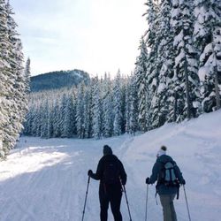
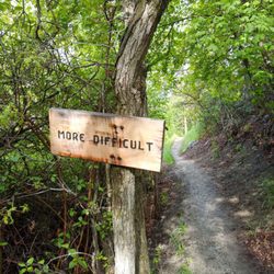
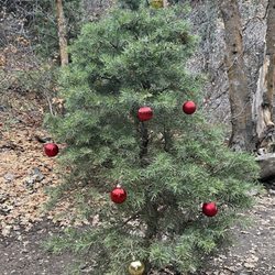
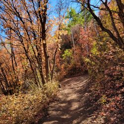
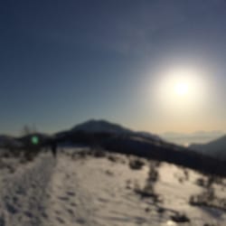
It's a short little hike--something like 1.1miles each way on the main trail, so you probably aren't going to make a day of it. And it's on the way to such great hiking farther up towards Wolf Creek Pass, so it's going to be overlooked by many. However, in the winter, this place is hopping. It's popular with the wintertime crowd, and the trees are all marked for winter x-country skiing and you'll hear a lot of motors that time of year, too. But I've only hiked it in summer--twice, actually--and both times it's been a delightful excursion. I ran it the first time, and though it's not perfect for running (some rocks later in the trail and some skinny parts that don't make for easy passing) it was fine. The last time I hiked it, I was carrying a picnic and that was just right. One mile, a nice cascade at the end, a lovely picnic, and back at sunset. You wander along a little river after parking in the massssssive parking lot (trailers, snowmobiles, you really have to see it in winter) and being near this brook is absolute loveliness. It drowns out the sounds as you leave the highway, and has enough pools and ponds that you can stop and wander. We crossed once for curiosity's sake and then went back to the trail and on our way. It's pretty easy, so kiddos could pick their way along the trickier portions, and still probably make it to the end. Just watch them near the water. It never gets too too deep, but they'll want to run and jump in it. Dogs, too. There have been groups hiking there on both my visits, as it's a well-marked trailhead and fairly popular. I quite like these little hikes you can do in a quick evening, though driving from SLC it doesn't much make sense to just come here for this hike, as the drive will take twice as long as the actual hike. read more


More info about Nobletts Creek Trail


Nobletts Creek Trail - hiking - Updated May 2026
Best of Francis
People found Nobletts Creek Trail by searching for…
Hiking Trails With Waterfalls in Francis, Utah
Scenic Overlook in Francis, Utah
Running Trails in Francis, Utah
Lookout Points in Francis, Utah
Free Campgrounds in Francis, Utah
Natural Hot Springs in Francis, Utah
Cruising Spots in Francis, Utah
Dog Hiking Trails in Francis, Utah
Off Road Trails in Francis, Utah
Lakes & Ponds in Francis, Utah
Walking Trails in Francis, Utah
Off Leash Dog Hikes in Francis, Utah
Trending Searches in Francis, UT
Browse Articles
Browse Brands
Related Searches in Francis, UT
Best Fishing Locations and Guides in Francis, Utah
Best Lookout Points to Visit in Francis, Utah
Best Places for Horseback Riding in Francis, Utah
Best Sledding Spots and Fun in Francis, Utah
Check Out Off Road Trails in Francis, Utah
Discover Dog Friendly Trails to Explore in Francis, Utah
Discover Popular Bike Trails in Francis, Utah
Discover Popular Photo Spots in Francis, Utah
Discover Scenic Mountain Bike Trails Near Francis, Utah
Discover Stunning Skyline View Spots in Francis, Utah
Discover Top Nature Parks to Visit in Francis, Utah
Discover a Hiking Trail in Francis, Utah
Discover the Best Night Hike Trails in Francis, Utah
Discover the Best Running Track in Francis, Utah
Dog-Friendly Hikes With Dogs in Francis, Utah
Effective Stairs Workout Spots in Francis, Utah
Enjoy Camping Adventures Around Francis, Utah
Enjoy Exciting Mountain Biking Adventures in Francis, Utah
Enjoy Scenic Night View Experiences in Francis, Utah
Enjoy Tent Camping Spots Around Francis, Utah
Enjoy the Best Night View Spots in Francis, Utah
Enjoy the Best Picnic Spots and Ideas in Francis, Utah
Enjoy the Best Tubing Experiences in Francis, Utah
Enjoy the Best Walking Trails in Francis, Utah
Exciting Cliff Jumping Spots in Francis, Utah
Experience Stunning Sunset Views in Francis, Utah
Explore Beautiful Parks and Green Spaces in Francis, Utah
Explore Bike Rentals Throughout Francis, Utah
Explore Easy Hikes Perfect for All in Francis, Utah
Explore Popular Campgrounds Near Francis, Utah
Explore Popular RV Parks Around Francis, Utah
Explore Popular Scenic Overlook Points in Francis, Utah
Explore Popular View Points Around Francis, Utah
Explore Scenic Lakes to Visit in Francis, Utah
Explore Secret Spots Worth Visiting in Francis, Utah
Explore the Best Swimming Holes Around Francis, Utah
Family Friendly Hiking With Kids in Francis, Utah
Find Cozy Camping Cabins in Francis, Utah
Find Parks and Recreation Activities in Francis, Utah
Find the Best Scenic View Locations in Francis, Utah
Off Leash Dog Hiking Trails in Francis, Utah
Perfect Spots to Watch Sunset in Francis, Utah
Popular Things to Do in Francis, Utah
Safe River Swimming Areas in Francis, Utah
Top Paddleboarding Activities in Francis, Utah
Top Running Trails to Explore in Francis, Utah
Top Swimming Lakes to Enjoy in Francis, Utah
Uncover the Best Secluded Spots Around Francis, Utah
People who viewed Nobletts Creek Trail also viewed
Mount Timpanogos - The Timpooneke Trail
1 review
Lake Solitude Trailhead
7 reviews
Mirror Lake Scenic Byway
19 reviews
Iron Mountain Trail
2 reviews
Empire Pass Overlook
1 review
Rob's Trail
2 reviews
Provo River Falls
3 reviews
Crystal Lake Trailhead
2 reviews
Pine Hollow Trailhead
1 review
Glenwild Area Trails
1 review