Provo River Falls Photos


You might also consider
More like Provo River Falls
Recommended Reviews - Provo River Falls
Start your review...

6 years ago
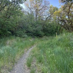
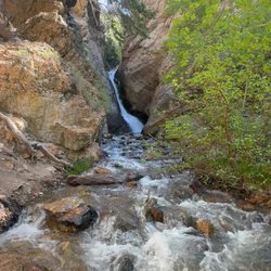
Located along the Mirror Lake Highway, just between mile markers 23 and 24, is a small turnout to a very impressive waterfall. To call it a waterfall is a bit of a misnomer, or at least feels incomplete. IT's more of a series of falls, or probably more accurately, cascades. Whereas most waterfalls actually, uh... fall, this is more of a whitewater tumble. There's not much freefall in the water, but it does cascade down a series of terraced rocks and the effect is quite beautiful. The parking lot isn't too big, so if it's a weekend and peak season, expect to park on the highway and walk in. No sweat, it's not far. You can see the falls from the parking lot, so no worries on long treks. From here, it's a choose your own adventure. There are some paved-ish (it's been a long while since they were maintained) trails, but it's not exactly accessible. Head down the stairs to the first and main overlook, or just head down the trail to the bottom falls and work your way back up over the rocks. It's a very popular place, and you'll see loads of picnickers and families. In the summer when the water levels recede, you may very likely see someone swimming, or see people venturing out over the terraced rocks. But in the spring/early summer, there's a dangerous level of water coming down the Provo River, so you'll want to say out of the frigid river itself. All told, you can see the whole thing in 15 mins and it's a nice pit stop along the Highway. If you intend to park and stay, you'll have to display a pass on your vehicle, which are available at a few locations along the highway on a self-serve basis. A three-day pass is currently $6 (no one-day passes available) and you get to park at any of the sights along the way with that pass. If you missed the self-serve station at the entrance on the Kamas side, or the (I think??) pass station at the Soapstone Basin restrooms, you can drive a little farther up the road (mile marker 25? 26?) and there's a self-serve station there. read more


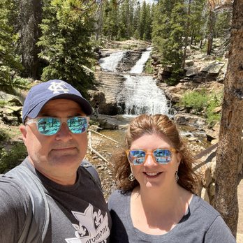
Thanks for finally adding this, Jeffrey. It's been a classic stop that is different every time I come. I've been here across every season and type of weather for 40 years. I never get tired of it. I've included a couple pictures 25 years apart and with very different water flows. The water and view many change, but it's going to look interesting to others long after I'm gone. read more


More info about Provo River Falls
UT-150
Mile Marker 23
UT, UT
Directions
(435) 783-4338
Call Now
Hours
Outdoor Amenities