Cancel

    Open app

    Search

    Willow Springs Trout Farm

    5.0 (1 review)

    Willow Springs Trout Farm Photos

    You might also consider

    More like Willow Springs Trout Farm

    Recommended Reviews - Willow Springs Trout Farm

    Your trust is our priority, so businesses can't pay to alter or remove their reviews. Learn more about reviews.
    Yelp app icon
    Browse more easily on the app
    Review Feed Illustration

    3 years ago

    Helpful 0
    Thanks 0
    Love this 0
    Oh no 0

    Ask the Community - Willow Springs Trout Farm

    Verify this business for free

    People searched for Lakes 137 times last month within 15 miles of this business.

    Verify this business

    Rockport State Park

    Rockport State Park

    4.2(13 reviews)
    13.6 mi

    We come to Rockport every year in August for a family reunion. We normally camp in the cabins (and…read morehonestly didn't care much for it) but this year we decided to camp at the Juniper campground and we loved it more then the cabins. Only down fall is due to the drought in Utah this year there was hardly any water (only 40% full ) and it was super muddy but it's not the camp grounds fault. Stupid drought. We will definitely be back next year to camp in the campground again. They had the camp spots nice and clean for us when we got there. They even let us check in a little early. We also enjoyed fishing off the bank. Got a few bites but wasn't able to catch anything this time. In the past fishing right before the sun sets is the best time. We seem to usually catch fish around that time by the sale boat area. (Just east of the cabins). We used warms and pink salmon eggs. Can't wait for next years trip!

    If you don't have a boat, you may not have as much fun here as others…read more I don't have a boat. The lake is awesome, though. Very clean and the water felt great. There are several beachy areas with covered picnic gazebos. Lots of shade trees down closer to the water, too. Camping is hit or miss. Some sites (the ones closest to the lake) offer no shade and blistering heat. The cottonwood area has lots of trees for shade and if you are lucky, there's a camping lot with a huge field attached for games like volleyball, throwing a football, etc. I can't divulge which one, because it would hurt my chances of being able to book it again, but if you care that much it should be pretty easy to figure out :) Full disclosure- I saw snakes here. One RAN (if snakes could run, that's what this one did) in front of me as I was walking across a grassy spot. I'm a little terrified of snakes so this was no bueno. Also there are tonnnns of Mosquitos so under no circumstances, do NOT forget insect repellent. Raccoons will get into stuff at night. You can hear them. Saw lots of cute little bunny rabbits and some deer. All in all, it's meh for camping, but the lake is awesome.

    Photos
    Rockport State Park
    Rockport State Park
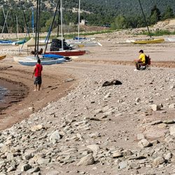
    Rockport State Park - Our favorite area to fish off the shore on the lake.

    See all

    Our favorite area to fish off the shore on the lake.

    Crystal Lake Trailhead - Reflection

    Crystal Lake Trailhead

    4.5(2 reviews)
    14.5 mi

    First off, note that this is sometimes called the Crystal Trailhead, and also referred to by the…read moreForest Service as Lakes Country Trail #066. The latter refers to a specific route, but we'll get to that. You will also see references to Notch Mountain Trail #081 and Clyde Lake Trail. We'll get to those, too. Oh, and while the following list of trails don't leave right from this trailhead, it's the most popular (and in some cases only) connections to North Fork Provo River Trail, Marjorie Lake Trail, Duck Lake Trail, Long Lake Loop Route Trail, and the Middle Fork Weber River Trail. It's all the same place, though -- this trailhead. Confused yet? Let's dive in. First things first, you've got to find the trailhead. To do that, get to Kamas and then travel up Highway 150 (The Mirror Lake Highway) about 25 miles until you see the signs to turn off for Trial Lake and Washington Lake. You'll turn north, pass Trial Lake, and at the signs, turn right and pass the Washington Lake Campground and continue on the dirt road (easily passable in all types of cars) for a few hundred yards until reaching the parking area. There is lots of parking, a few picnic tables, and vault toilets. In the busy summer months, this parking lot fills up fast on weekends. Like, fills WAY up. With all kinds of creative parking. I've watched over the last decade as it went from a somewhat busy spot to outright chaos on Saturdays. When it's full, they have overflow parking back down the road to the last junction and further west, but it will tack on almost 2/3 mile onto your hike each way. That's been a real bummer to see, and a nuisance when you just want to get out and hike and end up going over a mile on pavement because the main parking lot was full. But enough of the downsides of the popularity, let's dive into why so many people pick this hike. The reason, really, is that it's not just one hike, it's many. I will preface this with one giant note: GET A MAP. Seriously, the Forest Service has worked hard to make great trails and have a 2016 edition map that's very detailed and much more realistic that the USGS or other maps. Here, more than at any other trailhead, I've noticed that Forest Service maps are wildly different (and more accurate) than other versions. Below are the hikes that take off from this trailhead: Lakes Country Trail #066 This is one of three trails that have their terminus at the parking lot proper. This is the most popular, and it goes due west from the outer apex of the parking loop. It's signed and is the one that takes you to the northeastern shore of Crystal Lake. From there, it starts to rise and there's a turnoff to Clyde Lake (next paragraph), then past that you'll hit more switchbacks before cutting through a mountain pass with views of Mt. Watson. Then you traverse the rocks and have all kinds of decisions to make: you can peel off and go to the North Fork Provo River Trail which takes you towards Marjorie Lake and eventually allllll the way back down (nearly 10 miles) to the Highway, popping out about 3 miles below Soapstone. Or you can turn north on the Middle Fork Weber River Trail, but few do. There's another turn for Weir, Pot, and Duck Lakes (not shown on the maps) as well, but most people pass the Marjorie turnoff and press on to Long Lake. This aptly named, long, skinny lake is at around 2.5 miles in from the trailhead. It's a fine destination, but if you have the will, grit it out another mile and a half or so to Island Lake. It's gorgeous. From here, the Lakes Country Trail #066 goes on a bit, then ends at a junction with the Smith-Morehouse Trail and the Big Elk Lake Trail. Clyde Lake Trail Technically, you begin on the Lakes Country Trail #066, but only go a half mile or so before turning uphill to the right towards Clyde Lake. The Forest Service cut a new trail here in the last couple of years, so don't be confused by a sign in the old trail, with an arrow pointing away from what you think is that old trail. Now you pass Crystal Lake before turning off to Clyde, instead of turning off just before. It makes sense. This trail climbs up and delivers you to Cliff Lake, Watson Lake, and eventually Clyde, but most people veer east at Watson and go up to Wall Lake. This also isn't shown on the map, but makes a nice loop. Wall Lake/Notch Mountain Trail This trail also takes off from the Crystal Lake Trailhead. It bisects the Lily Lakes and runs right up the chute to Wall Lake. Then you can jog east and go past Hope Lake, turn back west and go right through a big notch in the mountain to overlook Lovenia Lake. The trail goes on north, downhill for miles before hitting the Main Fork Weber River Trail. Crysal Lake (South) Trail My own name for it, but you can take a short trail to the south shore of Crystal Lake. It leaves from the southwest end of the parking loop. This area is rife with lakes and hikes. I've kept some secrets. It gets heavy usage but is still so special. Be safe and enjoy!

    This trail head gives access to many, many different trails, many of which lead to spectacular…read morelakes. The trails around here aren't too difficult or strenuous, but they are breathtaking. I highly recommend for all levels!

    Photos
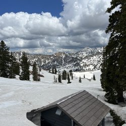
    Crystal Lake Trailhead - Some areas closed to camping

    Some areas closed to camping

    Crystal Lake Trailhead - Lake

    Lake

    Crystal Lake Trailhead - One of many lakes

    See all

    One of many lakes

    Currant Creek - Lake

    Currant Creek

    3.3(4 reviews)
    32.9 mi

    worst fucking reservoir EVER, fishing is genuinely dog shit... first time i went i caught about 25…read moreshitty small rainbows, and the second time i caught 1 of the shitters. And no i'm not some fisherman who doesn't know what they're doing, im advanced and know how to fish, the fishing is just shit, do NOT go there, wasted an entire day where i was super excited to go just to be fucked

    I love to camp. Usually I just find a spot off a dirt road and call it good. However I do camp…read morewith people who like the comforts of an established campground. Current Creek campground is a large place with 4 loops. My favorite is D loop because it's closest to the lake. Bathrooms have flush toilets but no showers. Each camp site has a picnic table, grill, fire pit and concrete pad. The camp host station sells ice, firewood and some bare essentials. The star of the show is the lake. Usually you'll find me sitting on the shore waiting for a fish to bite. I've caught rainbows and tiger trout. But even if you don't catch anything the views are spectacular. If you should get lucky and decide to keep your catch there is a fish cleaning station by the boat ramp. Directions, there are 3 ways to get there all involve a bit of graded dirt road. You can take hwy 40 to the Current Creek Road and drive up next to the river, then around the lake. Next option is to turn off hwy 40 at the chicken creek area and take FS road #82. The turn is just before the UDOT facility. Lastly you can take center street from Heber past the Timber Lakes community. There is no cell phone service at the lake or campground. :)

    Photos
    Currant Creek - Buck deer

    Buck deer

    Currant Creek
    Currant Creek - Fishing in the rain.

    See all

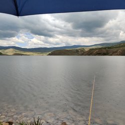
    Fishing in the rain.

    Willow Springs Trout Farm - lakes - Updated May 2026

    Loading...
    Loading...
    Loading...