Bear River State Park Photos


More like Bear River State Park
Recommended Reviews - Bear River State Park
Start your review...

5 years ago


6 years ago
9 years ago
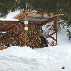
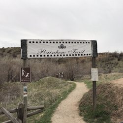
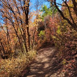
Great place to get out and walk and get your legs moving after traveling along I-80, got to see Bison and a few Elk, clean bathrooms, and a playground for the kids, walking trail has beautiful scenery and descriptions of the park at various locations. Picnic areas with grills available and nearby restaurants to eat at as well. read more


14 years ago
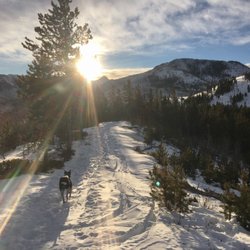
Beautiful state park in Wyoming. Easy access from the highway, plenty of facility (clean restrooms) from different entrance. Nice paved walking trail where you could hear the sounds of the running river and the birds will argue with one another. An area where you can view mountain elks and dangerous bison. I did 5 miles back and forth on paved trail. I think hiking trails are longer. read more

8 years ago
More info about Bear River State Park
601 Bear River Dr
Evanston, WY 82930
Directions
(307) 789-6540
Call Now
Hours
Outdoor Amenities
Ask the Community - Bear River State Park


Bear River State Park - hiking - Updated July 2026
Best of Evanston
People found Bear River State Park by searching for…
Things to Do in Evanston, Wyoming
Playgrounds in Evanston, Wyoming
Hiking Trails in Evanston, Wyoming
Picnic Spots in Evanston, Wyoming
Picnic Areas in Evanston, Wyoming
Walking Trails in Evanston, Wyoming
Easy Hikes in Evanston, Wyoming
Beautiful Views in Evanston, Wyoming
Parks for Kids in Evanston, Wyoming
Hiking With Kids in Evanston, Wyoming
Running Trails in Evanston, Wyoming
Scenic Views in Evanston, Wyoming
Parks BBQ Grills in Evanston, Wyoming
Playgrounds for Kids in Evanston, Wyoming
Waterfalls in Evanston, Wyoming
Picnic Areas BBQ Pits in Evanston, Wyoming
Nature Walks in Evanston, Wyoming
Off Road Trails in Evanston, Wyoming
Trending Searches in Evanston, WY
Browse Articles
Browse Nearby
Browse Brands
Related Searches in Evanston, WY
Best Fishing Locations and Guides in Evanston, Wyoming
Best Fun Things to Do in Evanston, Wyoming
Best Nature Trails for Hiking in Evanston, Wyoming
Best Off Leash Dog Parks in Evanston, Wyoming
Best Places for Horseback Riding in Evanston, Wyoming
Best Sledding Spots and Fun in Evanston, Wyoming
Best Waterfalls and Swimming Holes in Evanston, Wyoming
Check Out Off Road Trails in Evanston, Wyoming
Discover Dog Friendly Trails to Explore in Evanston, Wyoming
Discover Popular Bike Trails in Evanston, Wyoming
Discover Popular Photo Spots in Evanston, Wyoming
Discover Scenic Mountain Bike Trails Near Evanston, Wyoming
Discover a Hiking Trail in Evanston, Wyoming
Enjoy Camping Adventures Around Evanston, Wyoming
Enjoy Tent Camping Spots Around Evanston, Wyoming
Enjoy the Best Picnic Spots and Ideas in Evanston, Wyoming
Enjoy the Best Tubing Experiences in Evanston, Wyoming
Enjoy the Best Walking Trails in Evanston, Wyoming
Explore Beautiful Parks and Green Spaces in Evanston, Wyoming
Explore Bike Rentals Throughout Evanston, Wyoming
Explore Easy Hikes Perfect for All in Evanston, Wyoming
Explore Family-Friendly Zoos and Wildlife in Evanston, Wyoming
Explore Jet Skis for Sale or Rent in Evanston, Wyoming
Explore Popular Campgrounds Near Evanston, Wyoming
Explore Popular RV Parks Around Evanston, Wyoming
Explore Popular View Points Around Evanston, Wyoming
Explore Scenic Lakes to Visit in Evanston, Wyoming
Explore Top Dog Parks in Evanston, Wyoming Near You
Explore Top Water Parks in Evanston, Wyoming Today
Explore the Best Boating Spots in Evanston, Wyoming
Explore the Best Trail Options in Evanston, Wyoming
Family Friendly Hiking With Kids in Evanston, Wyoming
Find Fun Kids Activities Outdoor in Evanston, Wyoming
Find Parks and Recreation Activities in Evanston, Wyoming
Find Top Skate Parks in Evanston, Wyoming for All Skill Levels
Find the Best Playgrounds to Visit in Evanston, Wyoming
Find the Best Scenic View Locations in Evanston, Wyoming
Find the Best Swimming Pools in Evanston, Wyoming Today
Hiking Trails With Waterfalls in Evanston, Wyoming
Must-See Tourist Attractions Around Evanston, Wyoming
Off Leash Dog Hiking Trails in Evanston, Wyoming
Popular Kids Activities in Evanston, Wyoming
Popular Things to Do in Evanston, Wyoming
See Top Fireworks Events in Evanston, Wyoming
Top Climbing Spots and Gyms in Evanston, Wyoming
Top Paddleboarding Activities in Evanston, Wyoming
Top Running Trails to Explore in Evanston, Wyoming
Top Swimming Lakes to Enjoy in Evanston, Wyoming