Harrison Hills Park Photos


You might also consider
More like Harrison Hills Park
Recommended Reviews - Harrison Hills Park
Start your review...

Reviews With Photos

Thanks to park rangers Clay and Rachel one afternoon, I went on a private guided hike of Harrison Hills Park. I'd never been there before but was very impressed with both the rangers and their knowledge and the park itself. Harrison Hills Park is one of the smaller parks in Allegheny County but makes up for it with well maintained blazed trails including several breathtaking overlooks. Harrison Hills also has an environmental center where they hold educational events that are open to the public. There are several shelters/groves and a lovely playground for kids to enjoy. It's not the closest park to me, but it's also not far from the city and is very family friendly. I'd recommend it for a nice afternoon outdoors.

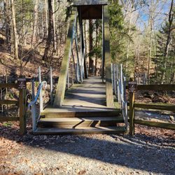
This summer I was on a mission to get outdoors and explore my area. Despite growing up near this park, I never went. The park is broken into two main sections one with fields, one with a traditional park. I went to the park area and discovered this great overlook. There is a bench there. The park is good for both kids and adults. There is playground equipment as well as a paved path for biking, rollerblading, walking, and jogging.

5 years ago
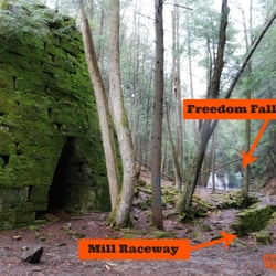
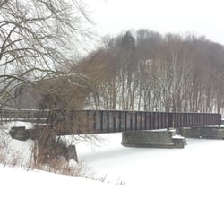
I recently drove out to Harrison Hills Park, which is in Natrona Heights, for a guided hike put together by the local park rangers. The particular hike I went on ultimately had more talking than hiking, so my mother (who had invited me) and I left the group early to walk on our own. With that in mind, my visit here was relatively brief, but I loved what I saw! Harrison Hills Park itself is a 500 acre park, so needless to say, my mom and I did not trek through much of it at all. We started out by wandering some trails overlooking the river; and after a while, we drove to a different parking lot so we could venture down other trails and visit a pond. Since it was the fall, we primarily saw lots of gorgeous autumn colors while walking; not only that, but we got lucky and a pair of bald eagles flew past us when we were above the river. That was a stunning sight I won't soon forget! As mentioned earlier, some guided programs are offered here by various groups, which I think are a great, especially for families. And during my visit, we also passed a playground and soccer field, which is more great news for families! I also want to mention that according to the park website, "Along with the usual walking, jogging, hiking and biking trails, there is a paved trail that is wonderful for wheelchairs." It's not often that I see accessibility like that in nature parks, so kudos to the volunteers and group in charge of this area. The website is worth checking out in general, as this is a surprising versatile park. The site has information about everything from a learning center to a list of popular seasonal sports and activities. Very helpful for planning future visits. I look forward to visiting Harrison Hills Park again in the spring and summer. Between gorgeous wildflowers and seasonal birding and wildlife activities, those seasons are sure to be even more delightful times to experience this beautiful area! read more


6 years ago
This is an underrated park! There are so many trails with a wide range of difficulty. Several of the trails have great look outs too. Most of the trails are well marked but I still got lost a few times since the trails will split randomly. You could spend hours here and not cover the whole territory. There is picnic seating and a playground. Plenty of parking in various locations. read more


Thanks to park rangers Clay and Rachel one afternoon, I went on a private guided hike of Harrison Hills Park. I'd never been there before but was very impressed with both the rangers and their knowledge and the park itself. Harrison Hills Park is one of the smaller parks in Allegheny County but makes up for it with well maintained blazed trails including several breathtaking overlooks. Harrison Hills also has an environmental center where they hold educational events that are open to the public. There are several shelters/groves and a lovely playground for kids to enjoy. It's not the closest park to me, but it's also not far from the city and is very family friendly. I'd recommend it for a nice afternoon outdoors. read more


6 years ago
This summer I was on a mission to get outdoors and explore my area. Despite growing up near this park, I never went. The park is broken into two main sections one with fields, one with a traditional park. I went to the park area and discovered this great overlook. There is a bench there. The park is good for both kids and adults. There is playground equipment as well as a paved path for biking, rollerblading, walking, and jogging. read more

8 years ago
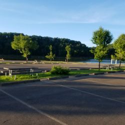
It's a really nice park that has lots of hiking trails,playgrounds and picnic areas. The best part is it's free and it's a safe place to enjoy the weekend. I'm surprised more people don't use the park it has a great view of the Allegheny river and is easy to access from RT 28. It's also clean and well maintained read more


8 years ago
14 years ago
11 years ago
More info about Harrison Hills Park
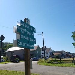
5200 Freeport Rd
Harrison Township, PA 15065
Directions
(724) 295-3570
Call Now
Hours
Outdoor Amenities
Ask the Community - Harrison Hills Park
Review Highlights - Harrison Hills Park


Harrison Hills Park - hiking - Updated May 2026
Best of Harrison Township
People found Harrison Hills Park by searching for…
Playgrounds in Harrison Township, PA
Scenic Drive in Harrison Township, PA
Beautiful Views in Harrison Township, PA
Things to Do in Harrison Township, PA
Places to Take Pictures in Harrison Township, PA
Cliff Jumping in Harrison Township, PA
Hiking Trails With Waterfalls in Harrison Township, PA
Scenic Overlook in Harrison Township, PA
Scenic Views in Harrison Township, PA
Flower Fields in Harrison Township, PA
Picnic Areas in Harrison Township, PA
Dog Swimming in Harrison Township, PA
Secluded Spots in Harrison Township, PA
River Swimming in Harrison Township, PA
Mountain Biking in Harrison Township, PA
Lakes & Ponds in Harrison Township, PA
Off Road Trails in Harrison Township, PA
Indoor Dog Park in Harrison Township, PA
What to Do in Harrison Township, PA
Tourist Attractions in Harrison Township, PA
Places to Run in Harrison Township, PA
Landmarks in Harrison Township, PA
Browse Nearby
BEST of Harrison Township, Pennsylvania Restaurants near Harrison Hills Park
BEST of Harrison Township, Pennsylvania Parks near Harrison Hills Park
BEST of Harrison Township, Pennsylvania Things to Do near Harrison Hills Park
BEST of Harrison Township, Pennsylvania Coffee near Harrison Hills Park
BEST of Harrison Township, Pennsylvania Playgrounds near Harrison Hills Park
BEST of Harrison Township, Pennsylvania Campgrounds near Harrison Hills Park
BEST of Harrison Township, Pennsylvania Breakfast near Harrison Hills Park
BEST of Harrison Township, Pennsylvania Taxis near Harrison Hills Park
BEST of Harrison Township, Pennsylvania Hotels near Harrison Hills Park
Browse Brands
Browse Articles
People who viewed Harrison Hills Park also viewed
Sewickley Heights Borough Park
5 reviews
Thornburg Conservation Park
3 reviews
Fall Run Park
29 reviews
Riverview Park
2 reviews
Observatory Hill
Girty's Woods
2 reviews
Highland Park
44 reviews
Highland Park
Point State Park
132 reviews
Downtown
Panther Hollow Trail
6 reviews
Squirrel Hill
Mellon Square
8 reviews
Downtown
North Park Latodami Nature Center
3 reviews