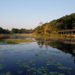
1. Buttermilk Falls Trail

0

Kittanning, PA

Cancel

Open app

Search

Buttermilk Falls Trail

3.0 (4 reviews)
Open • Open 24 hours

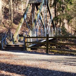
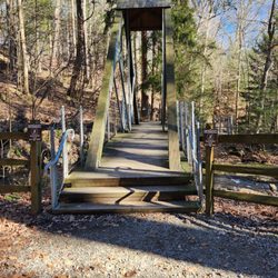
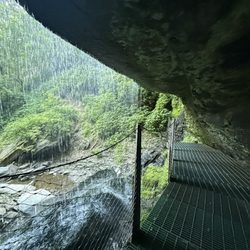
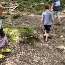
Buttermilk Falls Trail Photos

Recommended Reviews - Buttermilk Falls Trail

Your trust is our priority, so businesses can't pay to alter or remove their reviews. Learn more about reviews.
Yelp app icon
Browse more easily on the app
Review Feed Illustration

1 year ago

Helpful 0
Thanks 0
Love this 0
Oh no 0

3 years ago

Helpful 1
Thanks 0
Love this 1
Oh no 1

6 years ago

Helpful 1
Thanks 0
Love this 1
Oh no 0
Photo of George M.
200
340
896

9 years ago

Helpful 1
Thanks 0
Love this 2
Oh no 0

Verify this business for free

Get access to customer & competitor insights.

Verify this business

McConnells Mill State Park

McConnells Mill State Park

4.6(51 reviews)
35.3 mi

This beautifully maintained park is a must-visit just 30-40 mins north of Pittsburgh. We planned to…read morevisit the old grist mill and walk the 3 mile out-and-back Kildoo trail over the weekend. It seemed like everyone else had the same plan! Get there early to secure a close parking slot, otherwise, you'll be circling for a while or parking down towards the picnic area. The trail entrance to head down to the mill by the picnic area is currently closed off for stair repairs. They had staff down at the mill sharing a bit of the history to go along with all of the photos and signs with information throughout. The trail was perfectly shaded, mossy, and cool right along the river. I can't wait for my next visit.

If you live in Pittsburgh or are just visiting the area, McConnells Mill is one of the best day…read moretrips around. It's only about 40 miles north up I-79, so it's an easy drive from the city, but it feels like a completely different world once you get down into the gorge. I've been going there for years with friends and family, and it became my go-to spot to take people when they would visit from out of town. Everyone always loves checking out the historic old gristmill and the red covered bridge right next to it. It's a great, classic view, and if you go during the summer, they usually open up the mill for tours so you can see how it all used to work. The hiking there is fantastic, too, with a good mix of trails depending on what you're up for. You can take a pretty easy walk back to Hell's Hollow Falls, or you can tackle the rougher, rockier trails that run right along Slippery Rock Creek. You definitely want to wear sturdy shoes because the terrain gets steep and the rocks get slick, but the scenery with the rushing whitewater and massive boulders is totally worth it. It's just a beautiful, simple place to get outdoors for a few hours. Whether you want a challenging hike or just want to sit by the water and look at the old bridge, it never disappoints.

Photos
McConnells Mill State Park

See all

Harrison Hills Park

Harrison Hills Park

4.7(11 reviews)
17.2 mi

I recently drove out to Harrison Hills Park, which is in Natrona Heights, for a guided hike put…read moretogether by the local park rangers. The particular hike I went on ultimately had more talking than hiking, so my mother (who had invited me) and I left the group early to walk on our own. With that in mind, my visit here was relatively brief, but I loved what I saw! Harrison Hills Park itself is a 500 acre park, so needless to say, my mom and I did not trek through much of it at all. We started out by wandering some trails overlooking the river; and after a while, we drove to a different parking lot so we could venture down other trails and visit a pond. Since it was the fall, we primarily saw lots of gorgeous autumn colors while walking; not only that, but we got lucky and a pair of bald eagles flew past us when we were above the river. That was a stunning sight I won't soon forget! As mentioned earlier, some guided programs are offered here by various groups, which I think are a great, especially for families. And during my visit, we also passed a playground and soccer field, which is more great news for families! I also want to mention that according to the park website, "Along with the usual walking, jogging, hiking and biking trails, there is a paved trail that is wonderful for wheelchairs." It's not often that I see accessibility like that in nature parks, so kudos to the volunteers and group in charge of this area. The website is worth checking out in general, as this is a surprising versatile park. The site has information about everything from a learning center to a list of popular seasonal sports and activities. Very helpful for planning future visits. I look forward to visiting Harrison Hills Park again in the spring and summer. Between gorgeous wildflowers and seasonal birding and wildlife activities, those seasons are sure to be even more delightful times to experience this beautiful area!

The playgrounds are great and the dog park was really big with shaded places to sit. The Rachel…read moreCarson trail starts here as well.

Photos
Harrison Hills Park
Harrison Hills Park
Harrison Hills Park

See all

Clarion-Little Toby Creek Trai - Perfect to share with your best friend

Clarion-Little Toby Creek Trai

5.0(4 reviews)
46.4 mi

The Clarion-Little Toby Creek Trail is an approximately 18-mile long rails-to-trails path…read moreconnecting Brockway with Ridgway, PA. It's one of the few bike trails within a 100 mile radius of Pittsburgh that my husband Rick and I hadn't tried. So on a bee-you-teeful autumn weekend day--you know the kind: when it's not too cool out, the fall colors are at their peak, and it feels great just to be alive--we decided to fill in the gap and take a 36 mile round trip on the trail. Believe me folks, this trail is well worth the 90 mile drive from Pittsburgh. This is a very picturesque trail, meandering along the Little Toby Creek and the Wild and Scenic Clarion River through Jefferson and Elk Counties It uses the path of a former Pennsylvania Railroad Line, which was built in 1886 to transport lumber and coal from the mills and the mines to the markets. The line served many towns along the way, many of which have simply faded away. The last trains ran in 1968 and the tracks were demolished in 1972. Nature began to reclaim the line, however the present bike trail was built in 1992. We began our ride at the southern trailhead in Brockway. The trail begins at 7th Avenue Extended, about 1/4 mile north of Main Street (PA 28) and just south of the intersection of 7th Avenue Extended and McCollough Avenue. The address I gave you is approximate, based on Google Maps. Parking is available at the trailhead. Just look for the football field. We began heading NW out of town through a little wooded area. About a half mile into our ride, we crossed Baghdad Run--one of several along the Toby Creek portion of the ride. All in all, we crossed Jenkins Run, Little Vineyard Run, Vineyard Run, Coward Run, and Laurel Run. At MP 14.5 we came to the first Ghost Town we'd encounter, Carrier. Please note that the mileposts are measured from Ridgway, the opposite end of the trail from where we began our ride. We were going through some heavily wooded areas with a high shade canopy. We passed another Ghost Town site, Vineyard, at MP13.3 and then traveled another mile before coming up on yet another ghost town, Blue Rock. Blue Rock has perhaps the most famous site along the trail, the Blue Rock Swinging Bridge. It's a suspension bridge, built by volunteers from "Friends of the Toby" and the Future Farmers of America and is anchored by the abutments of an old railroad bridge that crossed Little Toby Creek. We decided it would be a good rest stop and yes we did cross the bridge on foot. And yes, it's cross at your own risk. We passed a few more Ghost Town sites and like many in Pennsylvania, these were once thriving towns. However they began dying off when the timber and coal played out. Some survived beyond that, but today they have all disappeared. We made our way north along the creek, passing under PA 949 before reaching the confluence of the Little Toby Creek and the Clarion River. Recent research indicates that Native American tribes used the river and creek as transportation, traveling the ridges of the Clarion River and Toby Creek to trade with tribes on the West Branch of the Susquehanna River. Just north of the highway, we began heading in an easterly direction, towards Ridgway. Here the trail is adjacent to an active rail line, the Buffalo & Pittsburgh RR. So caution must be used when traveling through here. At MP 5, we passed the B&P RR trestle, then past the site of Mill Run Dam, which was destroyed in a 1936 flood. Just north of this point, the trail detours on PA 949 for about 2/10s of a mile. There's no trail bridge here, ergo the detour, however the highway is very lightly used. From that point it's quick turn back onto the trail and an easy ride into Ridgway. Rick and I took a break here before pedaling back. The Clarion-Little Toby Creek Trail features some of the most peaceful scenery found on any PA trail. It should be on anyone's "must bike" trail list. Just be aware of a few things. 1) There are no facilities or services anywhere along the trail. No restrooms, no places to get food, no water pumps or drinking fountains, no anything. Be sure bring plenty of food and water with you before hitting the trail (there are places to obtain these in Brockway and Ridgway). 2) Use caution when biking along the shared corridor with the railroad and on the short highway segment. 3). Bike to your own abilities and at your own pace. 4) I've said it before and I'll say it again. Make sure your bike is in tip-top mechanical shape before venturing out. This trail is extremely isolated and it's a long walk back if you gotta schlep a broken down bike. Be sure to bring a chain tool, mini-pump, and tire repair kit.

What can I say about the best hiking/biking trail in the region? The 18-mile surface was a formerly…read morea railroad, but now hosts thousands of visitors year round who enjoy the peaceful calm of being in the Allegheny National Forest with their loved ones or alone. Dogs love it and you will find them on each section of the trail. The views are breathtaking and it follows the wild and scenic Clarion River. There are picnic benches or benches to stop and have your lunch or just watch the ducks, geese, bald eagles or other wildlife. Incredible opportunities for photographers. Not to be missed.
Photos
Clarion-Little Toby Creek Trai

See all

Buttermilk Falls Trail - hiking - Updated November 2026

Loading...
Loading...
Loading...