
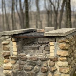
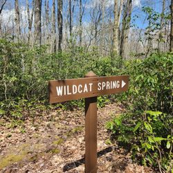
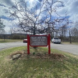
Forbes State Forest Photos


More like Forbes State Forest
Recommended Reviews - Forbes State Forest
Start your review...

Reviews With Photos

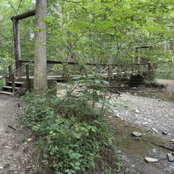
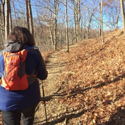
If you like hiking, biking, skiing, living your life-being active-outside...this is a great place to go! There are all kinds of trails and adventures to take here. I do recommend figuring out which area you'd be most interested in going to before heading out or which activity you'd want to pursue, even downloading some apps can give you additional helpful information such as the best place to park to begin your journey. (The app AllTrails is very useful) There is also geocaching, a ski lift and waterfalls. There are some difficult(steep) trails and there are some super simple(flat) trails. The trails are very well marked with tree markers that have different colors based on which trail you start on and if you're wanting to take a short cut, most of those pathways have a different color marking the way. The whole entire park is decorated with different kinds of trees, ferns and wild flowers. The lookouts showcase areas all around. There are some areas that are very excellent for bird watching as well. So choose your adventure-prepare for it-and go enjoy it! (Or wing it if you're that kind of person)


1 year ago
Lovely place to hang out with nature. Go as soon as u get the chance, I promise it's worth it! read more
5 years ago
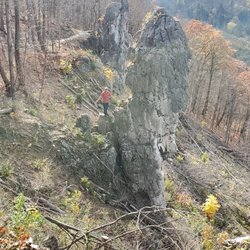
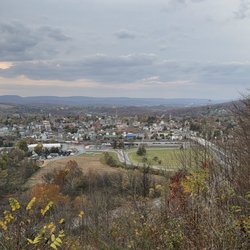
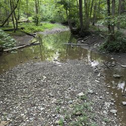
This is a beautiful area. It is very large and offers a lot of trails (300+ miles!) and plentiful opportunities for outdoor activities like hiking, biking, horseback riding, and more. The woods are just gorgeous, and there are a lot of interesting plants and wildlife to observe. We did an enjoyable short hike out to the Camp Buckey Overlook. The trail was very nice - it had been raining earlier, and the woods felt very atmospheric with a little bit of fog. But the real gem was coming up onto these amazing rock formations and catching a glimpse of the fantastic view over Deer Valley Lake. It was just stunning and well worth a visit! read more


7 years ago
If you like hiking, biking, skiing, living your life-being active-outside...this is a great place to go! There are all kinds of trails and adventures to take here. I do recommend figuring out which area you'd be most interested in going to before heading out or which activity you'd want to pursue, even downloading some apps can give you additional helpful information such as the best place to park to begin your journey. (The app AllTrails is very useful) There is also geocaching, a ski lift and waterfalls. There are some difficult(steep) trails and there are some super simple(flat) trails. The trails are very well marked with tree markers that have different colors based on which trail you start on and if you're wanting to take a short cut, most of those pathways have a different color marking the way. The whole entire park is decorated with different kinds of trees, ferns and wild flowers. The lookouts showcase areas all around. There are some areas that are very excellent for bird watching as well. So choose your adventure-prepare for it-and go enjoy it! (Or wing it if you're that kind of person) read more


 - Hiking Near Me - Laughlintown, Pennsylvania")


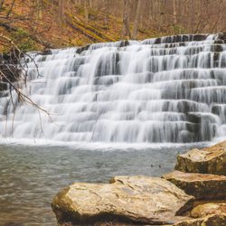
This place is amazing. We visited Blue Hole and yes, this swimming hole has blue water. We also went to Cole Run Waterfall. A short hike with an amazing waterfall. We are looking forward to returning and exploring some more. read more

If you have 2 sets of mammaries, then not only do you have orbs, you have "Fourbs." It's a scientific fact, I'm from Oxford, so I know the Oxford Dictionary. Thanks. This State Forest is vast and magnificent, but I found it to be a little disorganized. The smell of the forest and the remote wilderness even less than an hour from a huge city like Pittsburgh, are really inspiring. I loved every second I spent here. Except for those seconds that I was lost and trying to figure out how to get back to the main road with no service. Wandering around here is a little tricky as nothing seems to be signposted very well. You really need to know the region, or go with someone that does. Nevertheless, it's the definition of rural forested wilderness, and I'd recommend it to anyone in the area who likes nature. I've even spent a couple of nights sleeping in the parking lot although that - trust me - is a scary experience in the pitch black, and you have to have some large inflatable objects made by Wilson to get through it without having a panic attack. And no I don't mean large fourbs. read more

More info about Forbes State Forest
Ask the Community - Forbes State Forest


Forbes State Forest - hiking - Updated July 2026
Best of Laughlintown
People found Forbes State Forest by searching for…
Swimming Holes in Laughlintown, PA
Campgrounds in Laughlintown, PA
Hiking Trails With Waterfalls in Laughlintown, PA
Beautiful Views in Laughlintown, PA
Places to Swim in Laughlintown, PA
Scenic Overlook in Laughlintown, PA
Waterfalls in Laughlintown, PA
Secret Spots in Laughlintown, PA
Swimming Lakes in Laughlintown, PA
Places to Take Pictures in Laughlintown, PA
Flower Fields in Laughlintown, PA
River Swimming in Laughlintown, PA
Off Road Trails in Laughlintown, PA
Walking Trails in Laughlintown, PA
Things to Do on a Rainy Day in Laughlintown, PA
Camping Sites in Laughlintown, PA
Fishing Spots in Laughlintown, PA
Things to Do in Laughlintown, PA
Running Trails in Laughlintown, PA
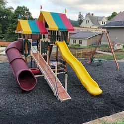
Playgrounds in Laughlintown, PA
Cliff Diving in Laughlintown, PA


