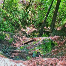
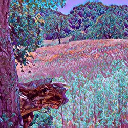
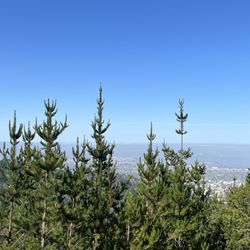
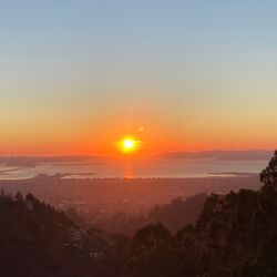
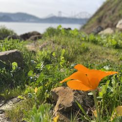
George Miller Trail Hiking Photos


You might also consider
More like George Miller Trail
Recommended Reviews - George Miller Trail
Start your review...


I remember when you could drive on this trail!! Currently it is a walking and biking trail only. We park on the Martinez side. Most of the time we stay on the paved trail, to Port Costa and back. About 3 miles round trip. There are plenty of spots with a bench you can take in the views. Sometimes we go ahead and venture off trail and get lost in the hills with the cows. Really spectacular views from off trail ;) Easy walk or intense hike, both are here. Dogs on leash. Thrilled to have this trail on our love where you live rotation. read more


5 months ago
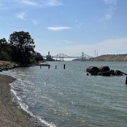
Beautiful paved trail for walking, biking, stroller or dogs on leash. Stunning views of the Carquinez Straits. Usually a pleasant breeze and accessible year round. The trail was once a road but multiple landslides left it 1 lane accessible, so it's been turned into a path for non autos or motorized vehicles. A gravel parking lot in Port Costa or off street parking on the Martinez side. Watch for closing hours. Enjoy you time outside with beautiful views and Amtrak route down below. Always great for a 1-4 mile walk. Newt crossings in early February. Be kind and enjoy the views read more


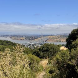
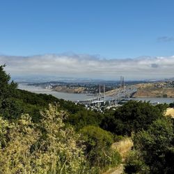
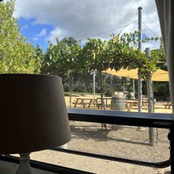
I don't think it's a far reach to call this trail as the Devil's Slide of this side of the bay since they're both wide, multi-use paved paths with a constancy in scenic views that make their respective short distances seem even shorter than they are (review: https://bit.ly/3FRBo5Z). How's that for parallelism? This one is a tad longer at a whopping 1.7 miles long, which means if it takes you longer than an hour or so, you're clearly dawdling. Not that there's anything wrong with that as there are benches at key points where you can pretend to take in the Carquinez Strait views while you're checking your Instagram feed. Not that I ever do that. I usually start on the Martinez side which requires driving a winding (mostly) two-lane road, Carquinez Scenic Drive until you need to stop and park on the side of the road. There's an actual parking lot on the other end of the trail, which you can get to by driving by way of Port Costa. Because I end up doing things the hard way, I actually walk through the hills and cattle gates that descend into Port Costa, get a Diet Coke at The Warehouse Cafe (review: https://bit.ly/3LlNq8O), and head back the same way to the trail. It just makes me feel more accomplished. Inefficient but accomplished. RELATED - Up for a hike? Here's a collection of trails I've walked and reviewed: https://bit.ly/2OrC8nU read more


George Miller has become my therapist. In this time of bullsh*** at every turn I have to get out and just walk it off. With an almost 3 mile walk round trip, it's perfect for myself and my dog. I've laughed, I've cried had some insightful thoughts while taking this walk. The path is paved and has minimal hills. You do need to watch out for bike riders on the trail too. I walk this trail at least three times a week. There are other harder more hike like trails available from the Martinez side of the trail. The basic paved George Miller is my go to. Please pick up your dog poop bags. There are at least five different garbage cans spread out along the trail. It won't kill you to carry your bag until you get to one. Its my favorite trail to this year. Sad to say I havent explored very many trails in the area because it's just such a great place to get the dog and get into some fresh air. read more


5 years ago
Parking is available at the Port Costa staging area. This is a great, paved, all purpose, out and back trail (about 3mi?). We saw tons of families with small kids, lots of leashed dogs, the most courteous bike riders ever, and even a wheel chair. There are biodegradable dog bags provided at the trail head, a picnic table at the mid-point, and a couple of benches should you just want to sit and take in the view of all the boats going by. Pro Tip - if you leave your headphones behind you can hear the sea lions (I think) bark from a bougie in the bay. Two thumbs up for an easy trail. read more


Found this jewel on 7x7 article on hike to Eastbay hidden gem. Had the urge to get back on that hiking tip for 2018. As you know I heart nature and even though the weather has been cloudy, rainy, and cold I said F * it lets go. Whoever thought there was a small town called Port Costa located in Crockett? Anyhoot short beautiful hike with gorgeous views of the Carquinez area. Also for those of you that have watched 13 Reasons Why was filmed here. The weather was cold and foggy but cleared up a little. I can imagine when summer pops up, it would be perfect to revist. read more


I found this place online . It was a little hard to get to but there was a little parking lot. There was a porter potty but it was locked due to COVID-19. This trail hugs the water. It is all paved so that's pretty good and it's easy to walk it. There's no shade that's the main I gave this place 4 stars but you get great pictures. read more


We have friends training for a three-day walk, so we did a 6-mile route with them from downtown Martinez to Port Costa. It took us about two hours, at a fairly quick pace. A big chunk of the walk was spent on this trail, which is very nice and has great views of the Carquinez Strait. You can also drive up and park closer to the start of the actual trail, on either the Martinez or Port Costa side. I really like that this portion of the trail is only open to pedestrians and cyclists. There are some hills so it is a great workout for sure. There is a port-o-potty at the gate on the Port Costa side. When you reach Reservoir St., make a right and follow the road down to the old school house. There, you'll find a sign that will point you right towards the Port Costa "Business District." Only 1/4 mile down the road, you will find the Warehouse Cafe (bloody marys!), Bull Valley Roadhouse (brunch!), etc. We had others join us to partake in drinks and brunch and then drive our tired butts back home. read more

6 years ago
Truly enjoyed walking there, with my dog, and seeing the views of the water. I found a place to park along the road right at the end of the road at the trailhead. My dog got a great walk and it was peaceful aside from the occasionally speeding bikes. There were more pedestrians than bikes. The trail was best suited to walking or jogging since it is not that long. People walk and bike the curvy road up there but it would be easy to get hit by a car with all the curbs so I personally wouldn't want to do that. The trail was terrific though. read more


4 years ago
7 years ago
If your in search of a fairly short easy hike with some amazing views this is the hike for you. The address on yelp isn't correct for some reason. You have to keep driving up the hill until you see the sign that reads "Carquinez straight regional shore line...." (see pic) parking is free but there are only a few parking spaces. You have to enter the green gate (see pic) to start the trail. Trail is grass/dirt so it can get very muddy after rain fall. Hiking shoes are definitely not a necessity. Dog friend poop bags are provided at the beginning of the trail. There are a lot of wild turkey and cows grazing thought out the trail, something to keep in mind if your planning on bringing your four legged friends. Trail is fairly flat with plenty of benches along the way to sit and enjoy the amazing views. The end of the trail has a short area of incline, but it's very mild. All in all I wish this trial was longer, but none the less very beautiful views. read more


8 years ago
10 years ago
More info about George Miller Trail
George Miller Trl
Crockett, CA 94525
Directions
Hours
Outdoor Amenities
Ask the Community - George Miller Trail
Review Highlights - George Miller Trail
You might also consider


George Miller Trail - hiking - Updated May 2026
Best of Crockett
People found George Miller Trail by searching for…
Hiking Trails in Crockett, California
Secret Spots in Crockett, California
Things to Do With Kids in Crockett, California
Beautiful Views in Crockett, California
Scenic Drive in Crockett, California
Walking Trails in Crockett, California
Running Trails in Crockett, California
Scenic View in Crockett, California
Places to Take Pictures in Crockett, California
View Points in Crockett, California
Playgrounds in Crockett, California
Picnic Areas in Crockett, California
Easy Hikes in Crockett, California
Waterfall Hike in Crockett, California
Off Road Trails in Crockett, California
Off Leash Dog Hiking Trails in Crockett, California
Hidden Spots in Crockett, California
Parks for Kids in Crockett, California
Scenic Overlook in Crockett, California
Trending Searches in Crockett, CA
Boat Rental near George Miller Trail
Botanical Gardens near George Miller Trail
Bounce House Rentals near George Miller Trail
Campgrounds near George Miller Trail
Cheap Plants near George Miller Trail
Cherry Picking near George Miller Trail
Cliff Jumping near George Miller Trail
Flower Fields near George Miller Trail
Flower Shop near George Miller Trail
Garage Sales near George Miller Trail
Garden Center near George Miller Trail
Lakes & Ponds near George Miller Trail
Nurseries & Gardening near George Miller Trail
Outdoor Activities near George Miller Trail
Outdoor Furniture Stores near George Miller Trail
Parks near George Miller Trail
Party Equipment Rentals near George Miller Trail
Pedicure near George Miller Trail
Photo Spots near George Miller Trail
Picnic Areas near George Miller Trail
Places To Take Pictures near George Miller Trail
Rock Quarry near George Miller Trail
Running Trails near George Miller Trail
Rv Rental near George Miller Trail
Scenic Drive near George Miller Trail
Sunrise View near George Miller Trail
Swimming Holes near George Miller Trail
Table And Chair Rentals near George Miller Trail
Browse Articles
Browse Nearby
BEST of Crockett, California Coffee near George Miller Trail
BEST of Crockett, California Restaurants near George Miller Trail
BEST of Crockett, California Things to Do near George Miller Trail
BEST of Crockett, California Walking Trails near George Miller Trail
BEST of Crockett, California Breakfast near George Miller Trail
BEST of Crockett, California Parks near George Miller Trail
BEST of Crockett, California Hotels near George Miller Trail
Browse Brands
Related Searches in Crockett, CA
Affordable Kayak Rental Services in Crockett, California
Best Fishing Locations and Guides in Crockett, California
Best Nature Trails for Hiking in Crockett, California
Best Places for Horseback Riding in Crockett, California
Best Waterfalls and Swimming Holes in Crockett, California
Check Out Off Road Trails in Crockett, California
Discover Dog Friendly Trails to Explore in Crockett, California
Discover Scenic Hiking Trails in Crockett, California
Discover Scenic Mountain Bike Trails Near Crockett, California
Discover Scenic Waterfall Spots in Crockett, California
Discover Walking Parks in Crockett, California Near You
Discover a Hiking Trail in Crockett, California
Discover the Best Night Hike Trails in Crockett, California
Discover the Best Running Track in Crockett, California
Dog-Friendly Hikes With Dogs in Crockett, California
Enjoy Camping Adventures Around Crockett, California
Enjoy Exciting Mountain Biking Adventures in Crockett, California
Enjoy Kayaking Adventures in Crockett, California
Enjoy Tent Camping Spots Around Crockett, California
Enjoy a Beautiful Waterfall Hike in Crockett, California
Enjoy the Best Picnic Spots and Ideas in Crockett, California
Enjoy the Best Walking Path in Crockett, California
Enjoy the Best Walking Trails in Crockett, California
Explore Beautiful Parks and Green Spaces in Crockett, California
Explore Easy Hikes Perfect for All in Crockett, California
Explore Fun Activities to Do in Crockett, California
Explore Popular Campgrounds Near Crockett, California
Explore the Best Beach Spots in Crockett, California
Explore the Best Swimming Holes Around Crockett, California
Explore the Best Trail Options in Crockett, California
Family Friendly Hiking With Kids in Crockett, California
Find Beautiful Views in Crockett, California
Find Popular Ziplining Spots Around Crockett, California
Find the Best Parks for Picnics in Crockett, California
Find the Best Scenic View Locations in Crockett, California
Great Places to Walk in Crockett, California
Hiking Trails With Waterfalls in Crockett, California
Off Leash Dog Hiking Trails in Crockett, California
Plan a Scenic Drive Route Near Crockett, California
Popular Outdoor Activities to Try in Crockett, California
Popular Picnic Spots to Visit in Crockett, California
Safe River Swimming Areas in Crockett, California
Safe and Fun Parks for Kids in Crockett, California
Top Climbing Spots and Gyms in Crockett, California
Top Paddleboarding Activities in Crockett, California
Top Running Trails to Explore in Crockett, California
Top Swimming Lakes to Enjoy in Crockett, California
Top Swimming Spots and Pools in Crockett, California
People who viewed George Miller Trail also viewed
Hulet Hornbeck Trail
7 reviews
Iron Horse Trail
47 reviews
Hidden Lakes Park
56 reviews
Las Juntas Open Space
1 review
Shell Ridge Open Space
62 reviews
John Muir National Historic Site
105 reviews
Waterfall Loop at Mount Diablo State Park
33 reviews
Martinez Marina
46 reviews
Rohrer Ridge Trail
2 reviews
Old Borges Ranch
29 reviews