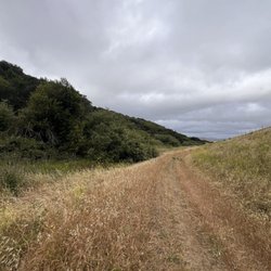
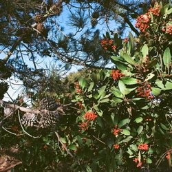
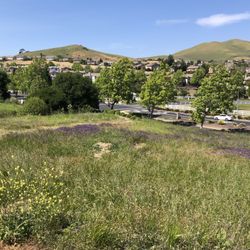
MY PHOTOGRAPHS: (1) Hawk perching on tree that is next to trail. I used a 300mm telephoto lens on…read moremy camera; (2) Tree next to trail with red berries; (3) Isolated grove of palm trees surrounded by an ocean of tall wheatgrass; (4) Pickleweed (has red color) and birds (a northern flicker and two quails); (5) Cracked mud in a dried marsh in a long strip of land between trail and the bay. The plants in the dried marsh are likely to be Frankenia salina. Mr.Rick Shroy, a photographer living in Oregon, told me that my photo is of a red-tailed hawk (and that it is not an osprey).
ATTRACTIONS. Mare Island San Pablo Bay Trail provides access to a part of the S.F. Bay area (the shoreline of San Pablo Bay) that few S.F. Bay area residents have ever seen. The trail allows hikers to see plants and birds that thrive in marshlands and tidal zones. What I liked best from my two visits in November 2020, were the views of several hawks zooming here and there over the vast fields of tall wheat grass, taking photographs of a hawk perching on the top branch of tree, and taking photographs of the thick tangles of alkali heath (Frankenia salina) that grow between the trail and San Pablo Bay. The alkali heath surrounds the dried mud flat situated between the trail and the Bay, and the alkali heath also grows in oval-shaped patches situated in the middle of the dried mud flat. These oval-shaped patches are cute looking.
DIRECTIONS TO THE TRAIL. From the west, take Route 37 to reach Mare Island. During your drive from the west, you will pass the parking lot and trailhead to TUBBS ISLAND TRAIL, which provides a nine-mile round trip hike, and access to the shore of San Pablo Bay. In contrast, the trail on Mare Island provides a round trip hike of only 2.8 miles, and the closest that this trail gets to San Pablo Bay is about 200 feet. If you are driving from the east, you need to find Tennessee Street in Vallejo, then drive south and cross the blue-colored bridge, and continue on to Azuar Drive, and then turn at Dump Road. At the end of Dump Road is a parking lot and the trailhead. Once on the trail, you hike south (towards San Pablo Bay) for 500 feet. Then, the trail takes a left turn (towards the east), and from there it is 7,000 feet to the very end of the trail (2.8 miles total round-trip hike).
BIRDS AND PLANTS. Birds found on Mare Island include a type of raptor called an osprey. A survey from the year 2013 revealed the presence of 60 adult ospreys nesting on Mare Island. My photographs include a large hawk sitting on a bare tree. It is possible that this is an osprey. Hikers will notice the vast expanses of tall light-colored grasses. The stems of these grasses are all dry and easy to snap in half. My two visits were in November 28 & 29 (late autumn), and so it is possible that these grasses are green in the spring. I believe that these are tall wheatgrass (Elytrigia pontica), the dominant plant at Mare Island. Tall wheatgrass tolerates soil that is high in salt. Pickleweed is green in the summer and red in the autumn. Hikers will enjoy the palm trees situated next to the trail, and the distant palm trees. The distant palm trees appear like isolated islands surrounded by an ocean of tall wheatgrass.
REFERENCES. (1) McGuire & Dvorak (1981) High salt-tolerance potential in wheatgrass. Crop Science. 21:702-705; (2) Ferner (2011) A profile of the San Francisco Bay National Estuarine Research Reserve (511 pages); (3) Brake, Wilson, Leong (2014) Status of ospreys nesting on San Francisco Bay. Western Birds. 45:191-198; (4) Mare Island Regional Park Task Force (2007) Mare Island Shoreline Heritage Preserve (94 pages); (5) www dot mareislandmuseum dot org; (6) www dot sfbayospreydays dot org.