Cancel

    Open app

    Search

    Las Juntas Open Space

    3.0 (1 review)

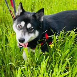
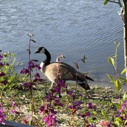
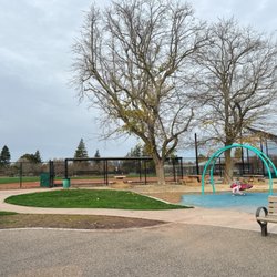
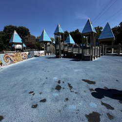
    Las Juntas Open Space Photos
    You might also consider

    Recommended Reviews - Las Juntas Open Space

    Your trust is our priority, so businesses can't pay to alter or remove their reviews. Learn more about reviews.
    Yelp app icon
    Browse more easily on the app
    Review Feed Illustration
    Photo of Chris L.
    3357
    1438
    7335

    6 years ago

    Helpful 65
    Thanks 0
    Love this 56
    Oh no 0

    You might also consider

    Verify this business for free

    People searched for Hiking 6,347 times last month within 15 miles of this business.

    Verify this business

    Iron Horse Trail

    Iron Horse Trail

    4.0
    (47 reviews)
    3.5 mi

    First let me say that this trail is far from uniform from one part to another. The northern portion…read morenear Concord COULD be scenic if all the encampments and trash was cleared out. This portion, miles 0-4, was recently repaved However there are no restrooms along this section. Miles 4-8 can be very congested with people walking dogs and pushing strollers. Even sections with "pedestrian only access" are largely unused and the multi purpose trail has most of the traffic. Miles 8-14 are not very scenic. Mostly backyards. Lots of cross streets making cycling less enjoyable. Miles 14-20 are more backyards and several more cross streets. There are a few narrow bridges over small creeks. Miles 20-24 are fairly industrial. The trail is much cleaner and better patrolled from Walnut Creek south. North is a totally different story. One park employee told me he thought I was brave to ride on that section of the trail. Not a place for families for sure.

    I absolutely adore the Iron Horse Trail. Been walking and running this trail for many years now,…read moreand it's still just as beautiful as the first time that I stepped upon it. The entire trail measures roughly 32 miles one way and stretches from Concord all the way to Pleasanton. I've only been on the Concord/Pleasant Hill/Walnut Creek side, but my dream has always been to traverse the entire trail in increments over time. The trail is a flat paved path that will take you through a plethora of parks, connecting trails, under freeway overpasses, and through a few tunnels. There is always greenery on the trail, no matter what season it is. It's not particularly challenging and there aren't any inclines, but it's perfect for a casual stroll or a long distance run. At any given time, you'll witness people walking their dogs and pushing strollers. Many people train for marathons and long distance running here. It's a wonderful family friendly and community driven trail that feels very safe. What I enjoy most about traversing this trail are the stunning views that I'm graced with every single time that I'm here. This trail has truly exposed me to the beauty of Contra Cost County. So many gorgeous wild flowers and lush vegetation. An ample amount of rampant wildlife. The most beautiful and peaceful community parks. Entrancing Views of the nearby communities. You will get to experience all of this along the Iron Horse Trail. People are so friendly on this trail. You tell get a sense of community here. There are also many bikers that use this trail too. There are several rest benches and doggie pooh pickup stations. You always see a trash can nearby to encourage cleanliness. There are mile markers on the main trail, and a second path that also runs parallel to the main path for most of the duration. It's a great place to clear your mind and to breathe in the fresh local air. Walking down this trail has gotten me through some tough times in the past, and it's filled with so many memories. So grateful to have this local gem practically in my backyard.

    Photos
    Crossing over the bridge in Walnut Creek
    Crossing over the bridge in Walnut Creek
    Iron Horse Trail
    Bridge

    See all

    Bridge
    Diablo Foothills Regional Park

    Diablo Foothills Regional Park

    4.5
    (45 reviews)
    6.7 mi

    Perhaps unfairly, but as an outsider, I tend to view this part of Contra Costa County as, how do I…read moreput it diplomatically...snooty. There are tract homes that are really mansions in gated communities here. You get a pretty good indication when you take the Livorna Road exit off 680 and head toward the hills. There's a convenient parking lot at the staging area, and the walk begins along a tree-laden path that leads into the Shell Ridge Trail. This is where the open rolling hills provide some challenges to the calves. You eventually make it to the most picturesque portion of the hike on the Mokelumne Coast-to-Crest Trail. This is where the residential areas disappear and you're at one with nature...except for the occasional mountain biker. Small mouth was warranted during such disturbances, but they didn't prevent me from a scenic view of Mt. Diablo (photo: https://bit.ly/3hZ96M1). Now I could've gone deeper into Mt. Diablo State Park, but hey, I'm not a rugged mountaineer. Instead I made a turn and precariously made my way downward to the Alamo Trail. I didn't realize I exited the park until I saw distracted people on the path yelling into their mobile phones as they let their dogs do their business. Hey, where's your scooper, sister? I think with more thoughtful planning, you can probably avoid the ritzy people with their ritzy homes. Maybe not. RELATED - Exploring this part of Contra Costa County? Here's a collection of places I've visited and reviewed: https://bit.ly/2x1rlsD

    This review is for the trail starting at the livorna road staging area…read more I really liked this trail. It's a lot of up and down. The map on all trails leaves out a few mountain top options, so I went off trail a few times and followed an alternative route. This is definitely a trail that you will need your map in order to stay on. I hiked on a cloudy September day, temperature around 75 to 80°. On a hot day with direct sunlight this would be potentially unbearable.

    Photos
    Diablo Foothills Regional Park
    Diablo Foothills Regional Park
    Diablo Foothills Regional Park

    See all

    Mount Wanda

    Mount Wanda

    4.7
    (20 reviews)
    3.8 mi

    Now that I'm such a seasoned hiker (tongue firmly in cheek), I can say with some temerity that I…read morefound this mile-long trail a bit, shall we say, short. I don't mind short trails, but I had to fill up my daily step requirement elsewhere and headed over to Briones for that purpose. That's not to say this trail wasn't worthwhile. It most definitely was as the 13% grade wasn't insurmountable. It allowed nice views of the Carquinez Strait and Mount Diablo at the top. The circuitous trails were surrounded by various oak trees and wildflowers. I made an attempt at following the riding trail that goes through a gamey tunnel under the highway, but it made a dramatic climb which deflated my unearned self-image of a seasoned hiker. Regardless you can see why John Muir took pleasure in taking his daughters with him through these hills. Wanda was the name of his eldest daughter. The trailhead is directly to your right at the Alhambra Avenue exit off Hwy 4. RELATED - Up for a hike? Here's a collection of trails I've walked and reviewed: https://bit.ly/2OrC8nU

    When the dog and I need a good hike that isn't too far from home and we can do in a reasonable…read moreamount of time, we come to Mt. Wanda. My man and I are hiking here every other weekend at least. The dog loves it. We recently did the Full Moon Hike that is put on by the Rangers. The kids tagged along. Its free and one of the few times you're allowed on the Mt. during the night. The kids had a wonderful time meandering around in the dark. It was fun to be out of our element with flashlights. The moon was beautiful. The only negative is ticks. We went hiking on Thanksgiving morning with our dog and proceeded to pull seven ticks off our dog. The most yet. Wear bug spray and make sure that your dog is properly protected. Morning, noon or night this is a great hike to take.

    Photos
    Mount Wanda
    Staging area entrance
    Staging area entrance
    Mount Wanda

    See all

    Las Juntas Open Space - hiking - Updated August 2026

    Loading...
    Loading...
    Loading...