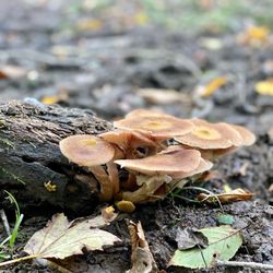
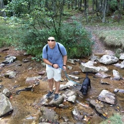
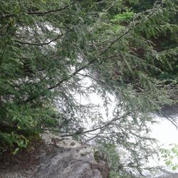
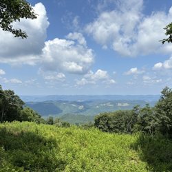
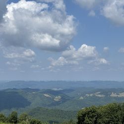
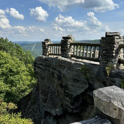
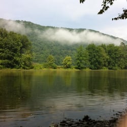
Freeland Boardwalk Photos

You might also consider
More like Freeland Boardwalk
Recommended Reviews - Freeland Boardwalk
Start your review...

26 days ago
A very peaceful stroll through the wildlife refuge using this boardwalk. Great idea in order to help keep the refuge less disturbed. In the area? Check It out! read more


More info about Freeland Boardwalk
Davis, WV 26260
Directions
Hours
Outdoor Amenities


Freeland Boardwalk - hiking - Updated May 2026
Best of Davis
People found Freeland Boardwalk by searching for…
Related Searches in Davis, WV
Best Fishing Locations and Guides in Davis, West Virginia
Best Fun Things to Do in Davis, West Virginia
Best Nature Trails for Hiking in Davis, West Virginia
Best Places for Horseback Riding in Davis, West Virginia
Best Spots for Star Gazing in Davis, West Virginia
Best Waterfalls and Swimming Holes in Davis, West Virginia
Check Out Off Road Trails in Davis, West Virginia
Discover Dog Friendly Trails to Explore in Davis, West Virginia
Discover Popular Bike Trails in Davis, West Virginia
Discover Popular Photo Spots in Davis, West Virginia
Discover a Hiking Trail in Davis, West Virginia
Discover the Best Night Hike Trails in Davis, West Virginia
Dog-Friendly Hikes With Dogs in Davis, West Virginia
Enjoy Camping Adventures Around Davis, West Virginia
Enjoy Exciting Mountain Biking Adventures in Davis, West Virginia
Enjoy the Best Picnic Spots and Ideas in Davis, West Virginia
Experience Stunning Sunset Views in Davis, West Virginia
Explore Beautiful Parks and Green Spaces in Davis, West Virginia
Explore Bike Rentals Throughout Davis, West Virginia
Explore Easy Hikes Perfect for All in Davis, West Virginia
Explore Family-Friendly Zoos and Wildlife in Davis, West Virginia
Explore Jet Skis for Sale or Rent in Davis, West Virginia
Explore Popular Campgrounds Near Davis, West Virginia
Explore Popular RV Parks Around Davis, West Virginia
Explore Popular Scenic Overlook Points in Davis, West Virginia
Explore the Best Boating Spots in Davis, West Virginia
Explore the Best Trail Options in Davis, West Virginia
Family Friendly Hiking With Kids in Davis, West Virginia
Find Beautiful Views in Davis, West Virginia
Find Popular Ziplining Spots Around Davis, West Virginia
Find Top Dog Swimming Spots in Davis, West Virginia
Find Top-Rated Disc Golf in Davis, West Virginia
Find the Best Playgrounds to Visit in Davis, West Virginia
Find the Best Swimming Pools in Davis, West Virginia Today
Great Places to Swim in Davis, West Virginia
Hiking Trails With Waterfalls in Davis, West Virginia
Plan a Scenic Drive Route Near Davis, West Virginia
Popular Fishing Spots to Explore in Davis, West Virginia
Popular Kids Activities in Davis, West Virginia
Popular Picnic Spots to Visit in Davis, West Virginia
Popular Things to Do in Davis, West Virginia
Relax at Natural Hot Springs Near Davis, West Virginia
Safe River Swimming Areas in Davis, West Virginia
Top Paddleboarding Activities in Davis, West Virginia
Top Playgrounds for Kids to Enjoy in Davis, West Virginia
Top Running Trails to Explore in Davis, West Virginia
Top Swimming Lakes to Enjoy in Davis, West Virginia
Top Things to Do With Kids in Davis, West Virginia
Top-Rated Basketball Courts to Play at in Davis, West Virginia
Browse Nearby
BEST of Davis, West Virginia Restaurants near Freeland Boardwalk
BEST of Davis, West Virginia Things to Do near Freeland Boardwalk
BEST of Davis, West Virginia Coffee near Freeland Boardwalk
BEST of Davis, West Virginia Breakfast near Freeland Boardwalk
BEST of Davis, West Virginia Shopping near Freeland Boardwalk
BEST of Davis, West Virginia Hotels near Freeland Boardwalk
BEST of Davis, West Virginia Horseback Riding near Freeland Boardwalk
Browse Brands
Trending Searches in Davis, WV
Campgrounds near Freeland Boardwalk
Nurseries & Gardening near Freeland Boardwalk
Party Equipment Rentals near Freeland Boardwalk
Pedicure near Freeland Boardwalk
Picnic Areas near Freeland Boardwalk
Places To Take Pictures near Freeland Boardwalk
Running Trails near Freeland Boardwalk
Spray Tanning Salons near Freeland Boardwalk
Browse Articles
People who viewed Freeland Boardwalk also viewed
Blackwater Falls State Park
92 reviews
Douglas Falls
2 reviews
Cathedral State Park
5 reviews
Dolly Sods Wilderness
11 reviews
Spring Run Trout Hatchery
1 review
Lost River State Park
14 reviews
Brighton Park
1 review
Canaan Valley National Wildlife Refuge
1 review
North Fork Mountain Inn
2 reviews
Three Rivers Guiding
3 reviews