
Coopers Rock State Forest Photos


More like Coopers Rock State Forest
Recommended Reviews - Coopers Rock State Forest
Start your review...


Reviews With Photos


One of the most beautiful places in WV! I've been coming here since I was a kid and I always enjoy it for all that it is. It's a great place to have a picnic or cookout. The hiking and mtb trails are great. The camping is great. They have a nice gift shop that also has your basic odds and ends that you might need while camping or hiking. The views from Raven Rock and the Overlook are captivating. There is a lot to see here including caves and wild animals. This is a beautiful place in all regards and I hope you get to enjoy it as much as I have over the years. Have fun and be safe :)


Great view. We did a short stop on our way home. It's a quick walk to the point from the parking area, wheelchair accessible too. Looking forward to coming back for some hikes maybe a camping trip?
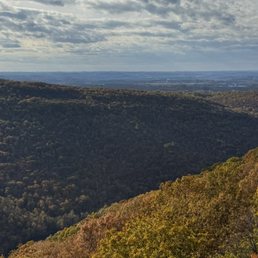

A beautiful spot with spectacular views. Almost heaven! We arrived on a wonderful sunny day. Easy walk to the viewpoint.
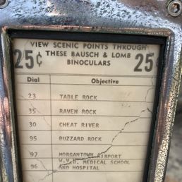

Very nice State Park located near Morgantown. We stopped on Saturday to see the Coopers Rock Overlook (Named after a fugitive Barrel Maker (Cooper) that supposedly hid out here while being pursued by the law). The overlook was easy to reach from the parking lot, and had a fantastic view. The overlook itself is built upon the rock and it surrounded by fencing (Built by the Civilian Conservation Corps during the depression) to keep people from falling off. The rock itself is also slightly angled, so it might be hard for some people to walk down. There is a cool trail that goes under the rock called the "Underlook" and that was not an easy hike because of all the rocks (some that needed traversing), but it was worth seeing in my opinion. Cheers!


In June 2023, our family made a road stop here on a drive from Washington DC to Morgantown, WV. This is a must-stop destination for quick views and a chance to stretch your legs. It will add about 30 minutes to your trip. We did not have enough time to check out the Raven Rock Trail. The main Cooper's Rock overlook is easily accessible from the parking lot and provides gorgeous views of the valley below. Second, it's close to I-68 (few minutes drive south of the freeway). Third, you can admire the results of work by the Civilian Conservation Corps (CCC) in the 1930s.


This is an amazing state forest for camping and hiking! I've stayed at the Rhododendron camp site and loved it. The bathroom is really clean and well maintained. There's a good amount of space between campsites too. The only downside of being over in this campsite versus the McCollum campsite is you have to drive to McCollum to access showers and a sink to clean your dishes. But in comparing both camp sites, Rhodedendron has more shade and is overall quieter. The park itself is so well maintained too. There's a great playground for kiddos, an awesome gift shop with ice cream and other snacks and goodies and tons of well maintained trails. This spot is awesome!!


Coopers rock is one of the coolest places I've ever visited got to see the sunset here it's a sight to see for sure


I've visited this spot twice, a few years apart in time. I have never hiked here or stayed longer than 20 minutes. The big scenic overlook of the Cheat River canyon is a very short walk from a parking lot - a perfect rest stop for the weary traveler needing to stretch their legs and re-energize. This time we also pushed our daughter in the toddler swings at the playground near the parking lot. If you live in the Morgantown area you have a gem right next to you - I imagine the camping is peaceful. Love all the rhododendrons growing in this area - just need to stop by when they are in bloom in the late Spring / early Summer.


Amazing views, geological sites, and hiking trails. The main overlook and the trails nearby the overlook rock formation are incredible. It was convenient how these main sites were all close together and pretty easily accessible from the parking and gift shop area. The main downside was the bathrooms. I don't expect much from state park restroom facilities, but the stalls at Cooper's Rock were very weird and only came up 4 feet from the ground, so adults could easily look over the top. Very awkward and unpleasant. We also hiked the Ravens Rock trail, which afforded another incredible overlook view at the end - it terminates along a power line path, so the trees are cut away for great views. The trail wasn't steep or challenging, but the surface was very rocky which made for rough walking. Do not attempt if you don't have good boots.


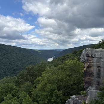
What a beautiful forest! We headed up to enjoy the famous Coopers Rock Overlook, which gives a lovely view of the Cheat River Gorge. The rock formations that make up the "deck" are fascinating in their own right, and the bridge, stone steps, and railings that help with access and safety on it were built by the Civilian Conservation Corps in the 1930s/early 1940s. Then, of course, there is the view, which includes the forest and river. There were also a lot of large birds flying overhead that were interesting to see. The walk to the overlook from the parking lot is not far, which also means you are close to other amenities including a playground, a couple of shelterhouses, benches in the shade, and the Trading Post. There are a lot of trail options available, and we also saw several rattlesnake crossing signs. A great view that's worth a stop even just to enjoy the overlook!


Cooper's Rock State Forest is a beautiful place for outdoor activities. We came for the hiking and gorgeous views, but you can also camp, fish, etc. There are short trails and extended hikes, and some of the trails are definitely rockier than I expected! We loved the Raven Rocks hike. But overall this park is a great day or weekend trip (or longer!)


Nice area to spend a few hours at. They have various spots for picnic and various trails at varied difficulty levels. We visited on a friday morning during labor day weekend and the weather was just perfect. There were very few people as well. We were not in a mood to hike but to just have a relaxing walk. So we took the Roadside trail. It is a out and back trail. Even though at times you could see and hear the cars, it was mostly a very peaceful walk. Not sure if people would have the same experience on busy summer days. They also have a lovely scenic overlook that you can literally drive to. You just have to walk a few steps and you are at the overlook. We were fortunate to have the entire overlook to ourselves for over 10 minutes. Lovely place to spend a few hours of your day.


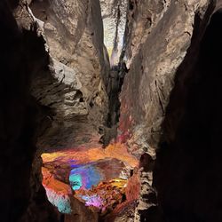
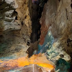
A group of friends and I stayed at Little Bear's Den in Deep Creek Lake Maryland and about 30 minutes from the lake is this state forest, across the state line. The walk to the views is about 1 minute on relatively flat but uneven stone terrain. You don't have to toil or hike to get to them. There was no cost, and the visitors center was under construction. There was plenty of parking during the day on a weekday in mid-July and very few others so it was nice getaway. We hiked one of the shorter trails that went down and around Coopers Rock (it's not paved or cleared out very well, and navigation is a bit difficult) but then got spooked by a woman who stated that she and her two toddler daughters encountered a rattlesnake (we didn't, luckily). If you can find it, there's a small cave under Coopers Rock that is markedly cooler (but expectedly pitch black). I would consider coming back here when it's not so hot and attempt one of the longer trails.


6 months ago
We had a wonderful few days camping at Coopers Rock! The sites are a good size and decently spaced apart so we have a good amount of privacy. The campsite bathroom was clean, well stocked and regularly maintained. All of the employees at the trading post were friendly as well! Park rangers drove around regularly (4-5 time through the campsite a day I'd say). My only wish would be adding closure information onto the website so people know ahead of time. During our visit the main overlook was under construction/maintenance so there was no access to it. Which was a little disappointing since it looks beautiful online! But it was a short 5 minute walk out to the overlook so it was easy to get back to a different trail. (It is clear the individuals who work and manage the park take great pride in it, and take care of the facilities wonderfully!). read more


My husband and I just went on a camping trip to Coopers Rock and loved our time there! The views were beautiful, the trails were well cleared, and the bathroom at the main overlook site was one of the cleanest bathrooms we've ever been in. The Ravens Rock trail has a beautiful outlook with cool, large rock structures. And the rock city trail was super fun too! The free maps of all the trails are very helpful. Some blazes could've been marked a bit clearer and some signs for trail heads could be adjusted as well. There is limited parking at trail heads so be sure to get there early to beat the crowds. The trading post was a fun addition with Coopers Rock merch, stickers (our personal fav), some local goods, firewood, some camping supplies, and even some ice cream treats! Overall we had a really nice stay! read more




7 months ago


One of the most beautiful places in WV! I've been coming here since I was a kid and I always enjoy it for all that it is. It's a great place to have a picnic or cookout. The hiking and mtb trails are great. The camping is great. They have a nice gift shop that also has your basic odds and ends that you might need while camping or hiking. The views from Raven Rock and the Overlook are captivating. There is a lot to see here including caves and wild animals. This is a beautiful place in all regards and I hope you get to enjoy it as much as I have over the years. Have fun and be safe :) read more


2 years ago
Great view. We did a short stop on our way home. It's a quick walk to the point from the parking area, wheelchair accessible too. Looking forward to coming back for some hikes maybe a camping trip? read more


1 year ago
A beautiful spot with spectacular views. Almost heaven! We arrived on a wonderful sunny day. Easy walk to the viewpoint. read more
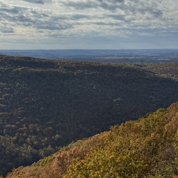


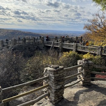


Very nice State Park located near Morgantown. We stopped on Saturday to see the Coopers Rock Overlook (Named after a fugitive Barrel Maker (Cooper) that supposedly hid out here while being pursued by the law). The overlook was easy to reach from the parking lot, and had a fantastic view. The overlook itself is built upon the rock and it surrounded by fencing (Built by the Civilian Conservation Corps during the depression) to keep people from falling off. The rock itself is also slightly angled, so it might be hard for some people to walk down. There is a cool trail that goes under the rock called the "Underlook" and that was not an easy hike because of all the rocks (some that needed traversing), but it was worth seeing in my opinion. Cheers! read more


3 years ago
In June 2023, our family made a road stop here on a drive from Washington DC to Morgantown, WV. This is a must-stop destination for quick views and a chance to stretch your legs. It will add about 30 minutes to your trip. We did not have enough time to check out the Raven Rock Trail. The main Cooper's Rock overlook is easily accessible from the parking lot and provides gorgeous views of the valley below. Second, it's close to I-68 (few minutes drive south of the freeway). Third, you can admire the results of work by the Civilian Conservation Corps (CCC) in the 1930s. read more


2 years ago
This is an amazing state forest for camping and hiking! I've stayed at the Rhododendron camp site and loved it. The bathroom is really clean and well maintained. There's a good amount of space between campsites too. The only downside of being over in this campsite versus the McCollum campsite is you have to drive to McCollum to access showers and a sink to clean your dishes. But in comparing both camp sites, Rhodedendron has more shade and is overall quieter. The park itself is so well maintained too. There's a great playground for kiddos, an awesome gift shop with ice cream and other snacks and goodies and tons of well maintained trails. This spot is awesome!! read more



2 years ago
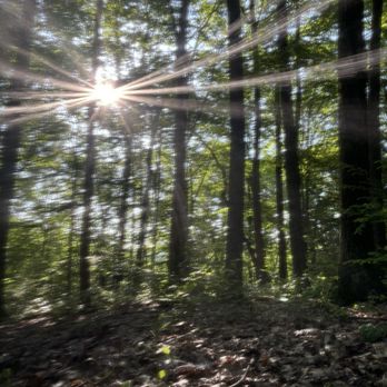
Coopers rock is one of the coolest places I've ever visited got to see the sunset here it's a sight to see for sure read more




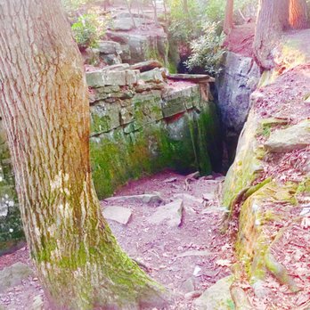


I've visited this spot twice, a few years apart in time. I have never hiked here or stayed longer than 20 minutes. The big scenic overlook of the Cheat River canyon is a very short walk from a parking lot - a perfect rest stop for the weary traveler needing to stretch their legs and re-energize. This time we also pushed our daughter in the toddler swings at the playground near the parking lot. If you live in the Morgantown area you have a gem right next to you - I imagine the camping is peaceful. Love all the rhododendrons growing in this area - just need to stop by when they are in bloom in the late Spring / early Summer. read more


4 years ago
Amazing views, geological sites, and hiking trails. The main overlook and the trails nearby the overlook rock formation are incredible. It was convenient how these main sites were all close together and pretty easily accessible from the parking and gift shop area. The main downside was the bathrooms. I don't expect much from state park restroom facilities, but the stalls at Cooper's Rock were very weird and only came up 4 feet from the ground, so adults could easily look over the top. Very awkward and unpleasant. We also hiked the Ravens Rock trail, which afforded another incredible overlook view at the end - it terminates along a power line path, so the trees are cut away for great views. The trail wasn't steep or challenging, but the surface was very rocky which made for rough walking. Do not attempt if you don't have good boots. read more


1 year ago

5 years ago
What a beautiful forest! We headed up to enjoy the famous Coopers Rock Overlook, which gives a lovely view of the Cheat River Gorge. The rock formations that make up the "deck" are fascinating in their own right, and the bridge, stone steps, and railings that help with access and safety on it were built by the Civilian Conservation Corps in the 1930s/early 1940s. Then, of course, there is the view, which includes the forest and river. There were also a lot of large birds flying overhead that were interesting to see. The walk to the overlook from the parking lot is not far, which also means you are close to other amenities including a playground, a couple of shelterhouses, benches in the shade, and the Trading Post. There are a lot of trail options available, and we also saw several rattlesnake crossing signs. A great view that's worth a stop even just to enjoy the overlook! read more


5 years ago
Cooper's Rock State Forest is a beautiful place for outdoor activities. We came for the hiking and gorgeous views, but you can also camp, fish, etc. There are short trails and extended hikes, and some of the trails are definitely rockier than I expected! We loved the Raven Rocks hike. But overall this park is a great day or weekend trip (or longer!) read more


7 years ago
Nice area to spend a few hours at. They have various spots for picnic and various trails at varied difficulty levels. We visited on a friday morning during labor day weekend and the weather was just perfect. There were very few people as well. We were not in a mood to hike but to just have a relaxing walk. So we took the Roadside trail. It is a out and back trail. Even though at times you could see and hear the cars, it was mostly a very peaceful walk. Not sure if people would have the same experience on busy summer days. They also have a lovely scenic overlook that you can literally drive to. You just have to walk a few steps and you are at the overlook. We were fortunate to have the entire overlook to ourselves for over 10 minutes. Lovely place to spend a few hours of your day. read more


A group of friends and I stayed at Little Bear's Den in Deep Creek Lake Maryland and about 30 minutes from the lake is this state forest, across the state line. The walk to the views is about 1 minute on relatively flat but uneven stone terrain. You don't have to toil or hike to get to them. There was no cost, and the visitors center was under construction. There was plenty of parking during the day on a weekday in mid-July and very few others so it was nice getaway. We hiked one of the shorter trails that went down and around Coopers Rock (it's not paved or cleared out very well, and navigation is a bit difficult) but then got spooked by a woman who stated that she and her two toddler daughters encountered a rattlesnake (we didn't, luckily). If you can find it, there's a small cave under Coopers Rock that is markedly cooler (but expectedly pitch black). I would consider coming back here when it's not so hot and attempt one of the longer trails. read more


2 years ago


Terrific hiking venue. I hiked here with the Pittsburgh HIking Meetup group in October. There are many trails from which to choose. We did about 7 miles on one trail, and then did the Raven Rock Trail which is 3 miles out and back. Beautiful views from the Raven Rock overlook. The trails are moderate in difficulty with some hills to navigate. There's plenty of free parking and restroom facilities plus dogs are allowed on leash. There's even a campsite. Here's a link to the trails: http://www.coopersrockstateforest.com/trails.html. It's less than 2 hours south of Pittsburgh, PA and makes for a lovely day trip. I noticed rhododendrons so definitely would like to return when they're in bloom. read more



This place is great!!! It actually holds a special place in my heart because my fiancé brought me up here to ask me to marry him. Of course I said yes!! The tails are long but bare able! I love that at the end where the Rick is you can actually sit down and have a great pic nic. Not to mention there are several different areas to park so depending on how enthusiastic you are about walking on a given day you can park accordingly. There is also a concession store with goodies!!! Beef jerky, candy, all the cute WVU stuff you may or not want. The actual view is AMAZING. Never thought in a million years that my man would ask me here in WV to marry him. But now it's safe to say a cute smile will always come about when when coopers rock is mentioned because of what happened here. Another thing I like you have to have your dog on a leash. I like that. There are a few trails you can take either. read more





8 years ago
We hiked the the raven rock trail; the trail itself is very rocky and muddy so wear decent shoes and just watch your step because I totally screwed up my ankle. Some people have seen copperhead rattlesnakes on the trail but we didn't. The trail is pretty quick and not difficult; there is a steep climb towards the end but nothing terrible. The overlook is beautiful and definitely worth it even though there are power lines in the view. We also drove up to the Coopers Rock overlook and it was lovely as well; it's pet and children friendly! read more


6 years ago
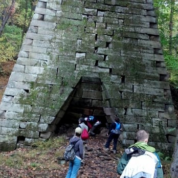
Cooper's Rock State Forest 5/5 stars Cooper's Rock is one of my favorite campgrounds in all of West Virginia. The hill to get there is pretty steep, but the state park road is less than 1/4mi from the interstate exit. You go down a windy, narrow road (Be careful) about 2 miles to the McCollum Campground. The campground is small (only 25 sites). Our experience may have been great bc I booked site 15. It is a HUGE site that butts up to the bathhouse on one side, and the playground on another side. The site is pretty unlevel, but once you get your camper level- it is the best site in the place. The whole campground is wooded, yet open. There is plenty of shade on every site. Other great sites that some family members had were 19, 20, 21, 22. ***Be advised the camp host told us about a 6' black snake (Henrietta) that lives on site 18 and can be seen climbing the tree almost every day. The only negatives I can possibly think of for the campground is the men's bathroom only had one toilet, which was occupied frequently. The hosts did a great job of keeping it spotless in there tho. The playground could use some updates. It's a large area with room for good equipment, but just had a few lame climbing things and one slide. The rest of the park was absolutely beautiful. Cooper's Rock was beautiful, but could be crowded at times due to such easy access (only like 100yds from the parking lot). We hiked 7 different of the hiking trails and were impressed with all of them. They were wide and very well maintained. The Iron Furnace was pretty cool, but if you go here DO NOT skip Raven Rock. It is a long hike, but well worth it. It's actually more beautiful than Cooper's Rock itself. Be advised there are Timber Rattlesnakes everywhere, as well as Copperheads. We saw a rattlesnake on our hike to the iron furnace. read more


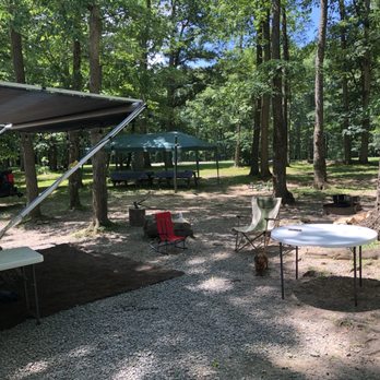


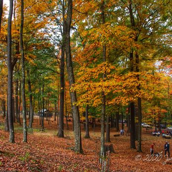
Visited for the fall colors and was not disappointed. Easy day trip from Morgantown with lots of activity options. Short and long hikes are available, along with an excellent overlook that is accessible by virtually anyone (not ADA compliant though). read more




6 years ago
The views are amazing! It's so peaceful and the best part is this state doesn't charge to go to state parks unless you camp. read more


5 years ago

4 years ago


5 years ago

5 years ago

4 years ago

9 years ago
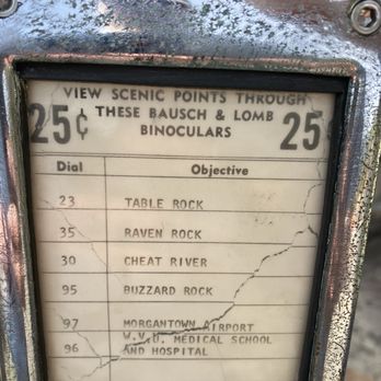
Gorgeous park with great easy walking to the overlook. Nice trading post/gift store. Bathrooms are nearby but not at the trading post. We were really looking forward to seeing the giants in stone... they are sadly gone. Bring a quarter with you to the overlook for the view finders. Pack a picnic lunch or pick up something at the outlook trading post. Decent food and decent prices. Great opportunity to run some energy off little ones! read more


Beautiful area for hiking trails with varying terrain. Highly recommend in the fall when leaves are beautiful but can get crowded this time as well. Very clean and well taken care of. Look forward to coming here every year and I recommend it to anyone who loves the outdoors! Cabins also available for rent. read more


13 years ago

9 years ago
Went on a weekday in the morning, so it wasn't busy at all. Took an easy and beautiful hike to Henry Clay Furnace then drove to Cooper's OverlOok View. We admired the view, took pano shots, shopped at the gift shop (very reasonable prices!) and purchases support the park foundation. Also, please watch your kids closely - it's a gorge peeps! read more




Page 1 of 2
More info about Coopers Rock State Forest
61 County Line Dr
Bruceton Mills, WV 26525
Directions
(304) 594-1561
Call Now
Visit Website
http://www.coopersrockstateforest.com/
Hours
Indoor Amenities
Outdoor Amenities
Ask the Community - Coopers Rock State Forest
Review Highlights - Coopers Rock State Forest













Why does Yelp recommend reviews?
1 review that is not currently recommended
The reviews below are not factored into the business's overall star rating.

5 years ago


