Cancel

    Open app

    Search

    Monongahela National Forest

    4.8 (12 reviews)

    Monongahela National Forest Photos

    Recommended Reviews - Monongahela National Forest

    Your trust is our priority, so businesses can't pay to alter or remove their reviews. Learn more about reviews.
    Yelp app icon
    Browse more easily on the app
    Review Feed Illustration

    Reviews With Photos - Monongahela National Forest

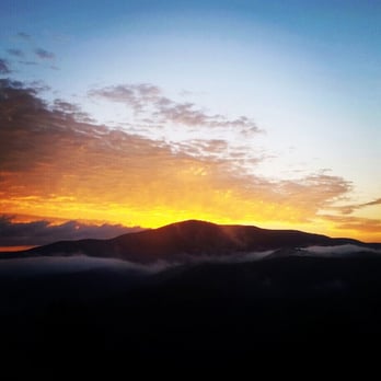
    Night Sky on the edge of Monongahela National Forest

    This forest is one of the best places to camp in the northeast US. Due to WV's historically limited settlements, the overwhelming majority of the natural habitat -- including the forest -- remains untapped by explorers. There are free camping sites nearby such as the Gandy Creek Dispersed Camping Area which you can take on a first come first serve basis. On the other hand, prepare to have little to no cellphone service. If you've got loved ones worrying about you or an employer who may call you in on a moment's notice, let them know in advance that you're headed here. It is by far the best place for stargazing in the east coast. There are no cities nearby, which means no light pollution. I've attached an image to show what the night sky looks like, but the picture is nothing compared to seeing it for yourself: hundreds of thousands of stars visible nowhere else. In summary, this forest is probably the eastern US's most underrated treasure. There are few people who are willing to camp overnight in the middle of nowhere with little cell service and wild animals in the vicinity, but in a place like this, you will never regret it once you muster the courage.

    See all

    Photo of Rob B.
    668
    669
    2844

    2 years ago

    Helpful 7
    Thanks 0
    Love this 7
    Oh no 0

    3 years ago

    Helpful 2
    Thanks 0
    Love this 1
    Oh no 0
    Photo of Sac B.
    43
    248
    115

    3 years ago

    Helpful 0
    Thanks 0
    Love this 0
    Oh no 0

    5 years ago

    Helpful 1
    Thanks 0
    Love this 1
    Oh no 0

    4 years ago

    Wild and wonderful. Great camping, fishing and hiking! Do yourself a favor and get outside!

    Helpful 1
    Thanks 0
    Love this 0
    Oh no 0

    7 years ago

    Helpful 1
    Thanks 0
    Love this 0
    Oh no 0
    Photo of Dub H.
    152
    542
    1677

    13 years ago

    Helpful 8
    Thanks 0
    Love this 0
    Oh no 0
    Photo of Kelly K.
    306
    2354
    1888

    11 years ago

    Helpful 7
    Thanks 0
    Love this 2
    Oh no 0

    12 years ago

    Helpful 3
    Thanks 0
    Love this 3
    Oh no 0

    11 years ago

    Helpful 2
    Thanks 0
    Love this 0
    Oh no 0

    16 years ago

    Helpful 4
    Thanks 0
    Love this 1
    Oh no 0

    12 years ago

    Helpful 1
    Thanks 0
    Love this 0
    Oh no 0

    Ask the Community - Monongahela National Forest

    Review Highlights - Monongahela National Forest

    We camped at Seneca Rocks, which was pretty plush for a campground, with a beautiful view of the rock formations.

    Mentioned in 3 reviews

    Read more highlights

    Verify this business for free

    Get access to customer & competitor insights.

    Verify this business

    Spruce Knob

    Spruce Knob

    4.8(12 reviews)
    22.9 mi

    I stopped by recently for a little adventure :)…read more I've been here more times than I can count and at all times of the day and the night, but I never get tired of this place. The peace and tranquility here is off the charts. It was a beautiful day, the temperature was about 68, and the sky was perfect. Every time I leave here I go a different way out to try and get lost, but after about two hours of exploring and finding some cool new roads and places, I made it back onto US-33 off of Glady Fork Rd by The Lodge in Alpena. What a great place to relax and unwind and learn news roads in and out. I have always loved this whole area and I always will. I'll be seeing you again very soon Spruce Knob :D

    Road was super curving and some was gravel . We stopped at a overlook and even though the light…read morewas going away it was a great view. I def wish we had more time and better light to appreciate it. We saw so many deer which i loved seeing. in the end light was going too fast we made it to the lake but didn't make it to the top because sun was going down. driving those roads in low light was a bit scary. I know my husband really had wanted to be heading home much earlier and not be driving those roads in the dark. But once he realized I was wanting more exploring he went with it. I really would like to return. I wish we had spent more time in WV and skipped skyline drive. I have fell in love with WV. He kept wanting to move on to SKyline drive and down to Gatlinburg. I was wanting all WV.

    Photos
    Spruce Knob
    Spruce Knob
    Spruce Knob

    See all

    North Fork Mountain Inn

    North Fork Mountain Inn

    5.0(2 reviews)
    42.7 mi

    NOTE: Not sure why this listing is called "North Fork Mountain Inn" but this is not the correct…read morename or address (I've requested Yelp moderators to update it so hopefully they will do that soon). The trail is called "North Fork Mountain Trail" and you can navigate to the correct place using Google Maps! For the most part, this hike is all about endurance. From the start to the top (where the overlook is), it's about 3.1 miles and ~2000 feet of elevation. The beginning can be a bit challenging with a lot of loose rocks/pebbles, but then it turns into a smoother path of dead pine leaves/hay (not really sure what it is). The trail is pretty ugly during this time of the year (transition from winter to spring) since leaves have not had the time to grow on trees yet. So lots of dead looking trees and depressing views even if you come on a day where the sky is clear with some clouds and sunlight. The only good part about this is that this means there weren't many bugs! Later on, you'll climb up bigger stones that are more cemented to the ground with lots of branches you can grab onto to hoist yourself up if needed. Also, there are some nasty, green thorn branches that sticks out in the most inconvenient way. If you're not careful, you could get pricked which kinda stings a bit. Overall, pretty uphill and can be pretty tiring - make sure to bring a liter of water to drink here and there to help with any cramping you might feel. Definitely take breaks - there's really no shame in that. I walk a lot on the daily and still had to take many breaks throughout the hike because I'm not used to walking on rocky paths and going uphill. The last 200-300 meters before the overlook is quite challenging as it is an incredibly steep uphill (300-400 feet of elevation?). Right before you enter this last part is a small man-made, stacked rock pyramid. One of my friends and I took several breaks while going up this terror trail because we were so exhausted. When you think you got to the top, you actually have to rock climb a bit before going to the overlook. Take your time to climb up the rocks if you haven't done it before. If you're not an experienced hiker/rock climber, you probably shouldn't go by yourself. Nearly two hours later (and 15 or so breaks), we made it to the overlook, which was incredibly breathtaking and beautiful. I don't know how else to describe the scenes with my simple vocabulary terms, so I attached some photos. It was worth the climb in the end (even if I didn't think so while I was hiking up). We came on a great day where the weather was in the 70s, skies were clear, and the sun wasn't too strong. You can take time to sit for a bit and eat, take lots of pictures, etc. The hike isn't a loop, so the way down is going backwards. Much easier compared to going up (obviously), but be careful going down because it can be pretty slippery. Again, the hike is more about endurance and not much technical skill (except climbing the rocks to get to the overlook). It's a bit challenging, but overall a pretty short one (6.2 miles total) with amazing views! My friends and I thoroughly enjoyed the hike - also doesn't have many people because it's not a tourist trap trail.

    Absolutely beautiful and relaxing! The hostess' are both very kind and welcoming. The breakfast was…read morefabulous and also was able to have dinner at the lodge which was out of this world! Our room was so cozy and comfortable. Very clean. We have a beautiful view out the private balcony. The second night we wanted to switch rooms to have access to the jacuzzi tub in the larger room and they accommodated us so well! Can't recommend this any more. Lots of outdoor activities to take advantage of and a nice relaxing lodge to spend your evenings

    Photos
    North Fork Mountain Inn - Our room: Eagles Nest

    Our room: Eagles Nest

    North Fork Mountain Inn - Mountains

    Mountains

    North Fork Mountain Inn

    See all

    Tolliver Falls Waterfall - Old growth forest near Tolliver Falls

    Tolliver Falls Waterfall

    4.5(2 reviews)
    71.3 mi

    This waterfall is the fourth in the series at Swallow Falls State Park on the Youghiogheny River…read more On the loop walk this is the fourth falls and the slightly longer walk in the groves of the virgin hemlock trees. These lovely groves of Virgin Hemlocks are lovely and remind me of pine trees but super tall. I have to admit, I used my off here because of the dense forest and wet like conditions with all the ferns and trees so thick that its like a dark canopy in there. I still got bit by a mosquito so be careful with any kids, make sure everyone is covered in OFF or some sort of Deet. There is no barriers at the tops of the falls so also take warning and be careful with any pets and kids. Rocks are slippery and you can go over. You are allowed to Wade in the river and the bottom of the falls but the water is strong and swift so be extra careful This park is free to enjoy so ENJOY!!! Be sure to see all four waterfalls in this lovely park!!!

    This is the smallest waterfall in Swallow Falls State Park, accessible via the Swallow Falls Canyon…read moreTrail, but it is so scenic and picturesque! The setting, off the side from the strength and noise of the river, also made it feel very peaceful and relaxing as the water trickled gently into the pond-like area below it. It was also closer to the towering trees of the old growth forest, so the backdrop was wonderful. It seemed to invite a quieter, more contemplative reaction than its larger, noisier cousin waterfalls in the park, and I was glad that we had ended up heading around the loop trail in the direction that ended us here. Beautiful!

    Photos
    Tolliver Falls Waterfall - Tolliver Falls

    Tolliver Falls

    Tolliver Falls Waterfall - Tolliver Falls

    Tolliver Falls

    Tolliver Falls Waterfall

    See all

    Spruce Knob - Seneca Rocks National Recreation Area

    Spruce Knob - Seneca Rocks National Recreation Area

    4.6(33 reviews)
    28.2 mi

    Seneca Rocks Trail. A number of years ago, my husband and I visited the educational Discovery…read moreCenter for the Seneca Rocks National Recreation Area, and got a great view of the Seneca Rocks from the parking lot. But, it was late in the day on a Sunday and we had a long drive ahead of us, so we decided not to attempt to hike up the trail, but we put it as yet another item on our bucket list. We returned to the area in Sept, 2025, specifically to attempt to do the hike. No concerns as to whether my husband would be able to do it, but I have to admit that I was apprehensive as to whether I could! The brochures say that it's 1.5 miles each way (up, and then back down) and you gain almost 850' in elevation. And, did I mention that I'm in my 60s, NOT a regular hiker, and with a medical condition that affects my balance? Nonetheless, my husband and I donned our hiking boots, put on some sunscreen, packed a picnic lunch, snacks, and water, and my hiking stick -- and we were on our way! The trail is wide and well-maintained and, as others have mentioned, has steep sections, especially in the switchbacks towards the top. It's a steady climb up, and my Fitbit registered some intense exercise, but my heart rate never reached its peak category. Given my balance issues, having my walking stick and an occasional hand from my husband, especially on the descent in steep areas with roots or stones, were helpful. I tried not to be discouraged by the two very fit runners who raced by us, recognizing that the majority of hikers and dogs on leash were panting at least to some degree! There are occasional benches, especially towards the bottom, and signs pointing out ecological features. There's an observation deck at the top, with gorgeous views of the valley below, as well as shaded benches to enjoy our picnic lunch. You can't see the rocks from the observation deck. However, some hikers scramble over some additional rocks for more views though signage warns that this can be dangerous. I'm happy to report that my husband and I both completed the hike, and we are now able to cross that item off of our joint bucket list. We celebrated our accomplishment by getting some ice cream at Yokum's, just down the street! Admission to the Seneca Rocks National Recreation Area and parking is free. Staff in the Discovery Center are exceptionally helpful. There are picnic tables and restrooms at the base, and the Seneca Shadows Campground is about a mile down the street.

    Literally a quick trip ( sadly), recommended by a friend, en route from Cass to Elkins…read more Absolutely beautiful and would have loved to have hiked this beauty. Hope to return one day ( Florida resident), preferably again in the fall to see the colors. Nature center sadly closed because of the government shut down.

    Photos
    Spruce Knob - Seneca Rocks National Recreation Area
    Spruce Knob - Seneca Rocks National Recreation Area
    Spruce Knob - Seneca Rocks National Recreation Area

    See all

    Falls at Hills Creek

    Falls at Hills Creek

    4.8(5 reviews)
    40.7 mi

    An amazing set of Falls. See the Lower falls if you can…read more This is one of the best sights along the entire drive. There are 3 different sights to see at this stop. There are upper, middle and lower falls. Let's start at the beginning. There is a parking lot for about 30 cars directly off the road. There is a set of restrooms in the parking lot across from the trailhead. The trailhead has a solid pathway of switchbacks that leads to an observation point to the upper falls viewpoint. For people that want to shortcut the windy path, there is a straighter trail that goes directly down the hill to the first viewpoint. From there, there is a boardwalk with lots of steps that leads down the a bridge that crosses the river. Then more boardwalk and a steel set of stair to two platforms to view the middle falls. More boardwalk along the river and a large wooden stair platform leads to the lower falls. If you get a chance, you should see all three as each is unique and all are beautiful as much as the walk is enjoyable. Just remember, walking down is easy and you have to walk back up to return to the parking lot. Well worth the walk. Enjoy.

    This was an unexpected find on my trip to WV. The trail was nice, if a little strenuous for this…read morefatman, and the water falls (plural) were lovely. It is a well developed trail with lots of stairs, including an actual stairwell to get you to the bottom of the falls. If you are mobile and in the area you should visit, just give yourself some time on the hike back if your a big person like myself.

    Photos
    Falls at Hills Creek - Upper Falls from boardwalk and about .3 miles from parking lot!

    Upper Falls from boardwalk and about .3 miles from parking lot!

    Falls at Hills Creek - Stairs to lower falls

    Stairs to lower falls

    Falls at Hills Creek

    See all

    Monongahela National Forest - hiking - Updated August 2026

    Loading...
    Loading...
    Loading...