Spruce Knob Lake Campground Photos


You might also consider
More like Spruce Knob Lake Campground
Recommended Reviews - Spruce Knob Lake Campground
Start your review...

2 years ago


8 years ago
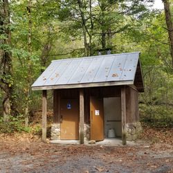
So tidy. So clean. Man, they run a tight ship here. I'm talking this place is like spotless, sterilized, clinically, zestfully clean all up in here. Even the vault toilets. The folks here are friendly and leave you be. Its perfectly isolated up here on the mountain. The road to get here is a pain if you have a city car but if you have anything 4 wheel drive you will love the dirt, the mud splashes, the potholes and the bumps along the *entire stretch of road to get here. read more


7 years ago
4 years ago
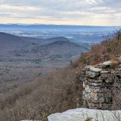
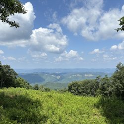
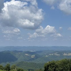
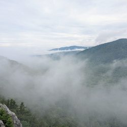
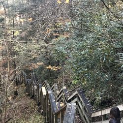
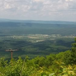
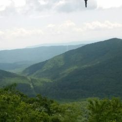
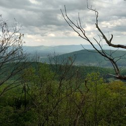
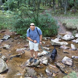
GPS Coordinates: 38.707745, -79.584812 We spent the weekend camping and hiking deep in West Virginia up in the Allegheny Mountains. Spruce Knob Lake Campground located in the Monongahela National Forest, near Seneca Rocks. It is the cleanest campground I've ever been to - the hosts maintain it very well. This place truly is a hidden gem! The campground is less than a mile away from the lake, where there is no swimming access, but are permitted to fish for trout and boat. There is a biking and walking trail around the lake as well. I highly recommend going down to the lake at night to check out the stars. Spruce Knob is the highest point in West Virginia, and has one of the darkest skies in the area. We saw the Perseids a few days after the shower's peak, and it was a perfect setting. We could also see the Milky Way very clearly. It's a bit of a trek to get to the campsite - lots of windy dirt roads makes for a slow climb. It doesn't make a lot of sense to drive out of town to get things (ex. ice), so be smart about packing! They sell firewood at 3 bundles for $20, provide some papers for starting, and deliver the bundles to your campsite - don't bring in your own wood. Our standard non-electric drive-up site was something like $14 a day and had a large fire pit with a grate. I really loved this campsite. It was so quiet and beautiful up in the area. I can't wait to go back and check out more hiking in the area. read more
7 years ago
More info about Spruce Knob Lake Campground
Ask the Community - Spruce Knob Lake Campground


Spruce Knob Lake Campground - hiking - Updated May 2026
Best of Whitmer
People found Spruce Knob Lake Campground by searching for…
Browse Nearby
Browse Brands
Related Cost Guides
Related Searches in Whitmer, WV
Browse Articles
People who viewed Spruce Knob Lake Campground also viewed
Big Bend Campground
11 reviews
East Fork Campground
3 reviews
Sinks Of Gandy
1 review
Pegasus Farm Campground
12 reviews
Dolly Sods Wilderness
11 reviews
Revelle's River Resort
7 reviews
Monongahela National Forest
12 reviews
Seneca Shadows Campground
9 reviews
Nrocks Outdoor Adventures
41 reviews
Yokum's Seneca Rocks Stables
3 reviews