Cancel

    Open app

    Search

    Devil's Fork State Park

    4.5 (41 reviews)
    Open 7:00 am - 9:00 pm

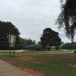
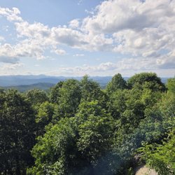
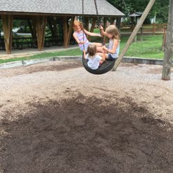
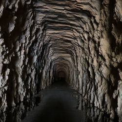
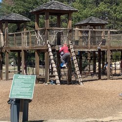
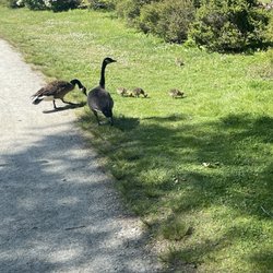
    Devil's Fork State Park Photos

    Devil's Fork State Park Reviews in Other Languages

    Ask the Community - Devil's Fork State Park

    Review Highlights - Devil's Fork State Park

    Lake Jocassee is a beautiful 7,500 acre reservoir created by Duke Energy for their nuclear power plant in 1973.

    Mentioned in 4 reviews

    Read more highlights

    Verify this business for free

    People searched for Parks 208 times last month within 15 miles of this business.

    Verify this business

    Riley Moore Falls

    Riley Moore Falls

    5.0(4 reviews)
    19.7 mi

    This is the best waterfall we got to visit in SC this far. After we left Reedy Branch Falls we…read moredrove here. Well, as close as we could get. I didn't realize that we couldn't drive all the way to the trailhead so we had a long hike in store due to me having to carry my toddler most of the time. I should have re-read the previous reviews before coming. My friend did help me carry her as well and for that I was very thankful. So definitely don't recommend this hike with a little one unless strapped in a carrier. Also, I don't recommend it for the elderly either. It's definitely a wilderness hike deal with roots and elevation change. In fact, it's mostly downhill on the way to the falls, but on the way back it's pretty much all uphill, which was not fun with aforementioned young child. It's about a half mile to the actual trailhead and then another 0.7 mile to the falls. That's about 2.4 miles round trip. The reason of course that my boys absolutely became enamored with this place is the large swimming hole. It is wonderful and has plenty of space. The waterfall itself is beautiful and although it's not as tall as others, its width is quite impressive. I was trying to get as close as I could and even noticed a hidden part of the falls inside of the rock structure. That was so cool!! The sand at the base and shore give it a beachy vibe. We definitely packed it in and out making sure not to leave anything behind as to preserve the area as best as possible. Needless to say we were wiped by the time we made it back to our vehicles, but we're still glad we decided to venture here. Coming back with my hubby and boys in the very near future. Happy yelping!

    I just wanted to update my 3/15/20 review below to add I've now done this hike several times, but…read moreTHIS time I had the chance to hike it with a friend who is directly related to the namesake of the waterfall... Riley Moore. Sandie is a church friend of mine and Riley Moore was her Great Great Uncle (I believe that's right). He once upon a time operated a grist mill here at the top of the falls. She's been trying to get here to see the waterfall, but couldn't find it and wanted to join us (along with her family) since I knew the way. Upon further research I discovered there are actually still remnants of the mill including visible drill holes, spikes and bolts. Thought that was pretty cool info to share! [ [ [ PREVIOUS REVIEW ] ] ] Riley Moore Falls is small in height but HUGE in personality. It's located off State Road S37-748, which is a nicely maintained gravel road where cars and trucks alike can comfortably traverse. ~~~ DIRECTIONS From Westminster, SC - DO NOT turn onto Cobb Bridge Road from Long Creek Hwy (Hwy 76) where you will see the brown & white sign pointing you in the direction of Riley Moore Falls. Our GPS had us go this way, then left onto State Road S37-748, but the road was CLOSED during our visit! INSTEAD, turn onto PU-32 also known as Rocky Fork Road. Turn left onto a gravel road near Rocky Fork Baptist Church and follow that until it dead ends @ State Road S37-748 (also known as Spy Rock Road). Turn right and drive approx. 1.4 miles (4 minutes) to 748c (aka Riley Moore Shoals Road). Park at the intersection of State Road S37-748 and 748c. DO NOT ATTEMPT TO DRIVE 748c in a car or minivan. Low clearance vehicles will find the terrain on this road to be VERY difficult to navigate without bottoming out or getting stuck. I'd also recommend 4x4 capability on wet days! There can be several deep-pocketed muddy areas after heavy rains. ~~~ THE TRAIL Once you reach the intersection of Spy Rock Rd (S37-748) and 748c, park roadside on Spy Rock, secure your vehicle and begin your hike approx. 1/2 mile down the "primitive road." IF you have a high ground clearance SUV or truck, you can drive the primitive road another half mile or so to a second parking area near the trailhead. The primitive road is VERY BUMPY  and can be muddy in spots after heavy rains, so a 4x4 is best. After reaching the second parking area, follow the marked trail on the left!!! The trail is a little over a 1/2 mile to the falls from here. The trail is fairly straightforward and easy to follow. ~~~ THE FALLS Once you reach the Chauga River, you will notice a large sandy area with plenty of room for an entire horde of hikers!!! Riley Moore Falls is not very tall (only about 12 feet), but it is very wide and has a deep base pool. PRO TIP - Bring swimwear, towels and a picnic, but be sure to pack it in and pack it out. ~~~ THINGS TO KNOW Hiking Distance: 2 miles (round trip to falls from S37-748) Difficulty of hiking 748c: All downhill to trailhead (moderate return) Difficulty of hiking trail to falls: EASY Creek Crossings: NO Elevation Gain: 357 feet Waterfall Height: Approx 12 feet Access to top of falls: NO - not without getting wet Access to base of falls: YES Pool of water @ base of Falls: YES Sitting areas @ base: YES + sandy beach RESTROOMS: NO PARKING: YES (along road) + secondary parking area closer to trailhead for trucks and high ground clearance vehicles with room for about 6 cars. ~~~ [ FINAL THOUGHTS ] A lovely waterfall in any season, but also a great spot for a summer swim. While we had the waterfall practically to ourselves during our Mid-March expedition, be advised other trail website reviews say it gets trashy & crowded in summer months. What a shame if that is true because it truly is a treasure. ENJOY! 2022 / 74 #UPDATE 178

    Photos
    Riley Moore Falls
    Riley Moore Falls - CREATED FROM GOOGLE MAPS

    CREATED FROM GOOGLE MAPS

    Riley Moore Falls

    See all

    Station Cove Falls

    Station Cove Falls

    5.0(11 reviews)
    10.2 mi

    These falls are beautiful. I highly recommend checking them out. If you want a longer hike start at…read morethe Oconee Station State Historic Site. There are bathrooms there. If you prefer an easier, shorter hike then drive past the historic site and the trailhead, and parking, are on the left. If you start at the historic site, know that you will eventually just be crossing that same street to get to the trailhead.

    We started our adventure and family hike #8 (sans toddler - insert sad face) at Oconee Station…read moreState Historic Site. We also combined the Interpretive Nature Trail with the Station Cove Trail, which made for a longer, albeit nice hike around 3.1 miles. There's about a 260 ft. elevation gain, but wooden steps help with this ascent and then descent. Usually such a long walk would make my leg muscles ache the next day, but strangely enough I felt no soreness. I guess that means that I'm finally in shape enough to handle longer hikes. Woohoo! The large pond or small lake, depending on your opinion of what a body of 4 acres should be, was beautiful and shimmering in green and blue hues. Didn't see any fish or other creatures in it, but it is supposed to be full with bluegill and largemouth bass. Maybe we'll return for some fishing. Not long after the nature trail joins the falls trail you'll cross over Oconee Station Rd. There is an area for parking cars and from here the trail to the waterfall is about 0.75 mile, so if you prefer a shorter version this is it. I loved seeing the flowers starting to bloom and caught some good pictures of bloodroots and hepaticas. Down by one of the creeks an open area under a rock revealed animal footprints (maybe a raccoon?), which was cool to spot. There were more than a few trees down (probably from Hurricane Helene), but not completely obstructing the trail. As you approach the waterfall you step over some rocks from Station Creek to the other side. I'm glad that we had a good rainfall the day before, because it made for a great rush of water. Truly beautiful and my favorite falls discovered so far. We did run into a few people so it's definitely not an isolated area by any means (and we went on a Monday morning) although we did not meet another soul on the nature trail. Also, between the 3rd and 4th bridge is the Oconee Connector Trail which leads to Oconee State Park in case you want to add another 5.4 miles (I think) round trip to this one, but beware it apparently has an 800 ft. elevation change. Maybe one day I'll brave it. Overall, this was a great hike and our boys really enjoyed the beauty of the waterfall and easily travailed it. Looking forward to come back one day soon! Happy yelping!

    Photos
    Station Cove Falls
    Station Cove Falls
    Station Cove Falls

    See all

    High Falls County Park

    High Falls County Park

    3.0(7 reviews)
    10.9 mi

    Great overnight camping! Fire rings, picnic tables, and roomy, flat campsites for both trailer, RV,…read moreand tent camping. The bath houses are always clean, they have 2 different camp hosts, who are both very helpful and keep the campsites at a clean, topnotch level. There is a boat launch, 2 different playgrounds, basketball courts, tennis courts, pickle ball, horseshoes, volleyball sand area, and kayak rentals with various sizes of life jackets available. They also have a sandy beach area and are dog friendly! There is a camp store and Snack Shack(but they haven't been open since we've been here, April/May). But we played giant checkers on the store porch. It has a wonderful view of the lake with nice rocking chairs to relax in. There are also picnic areas for day use for a small entry fee. Overall, it was a great place to stay with family and friends.

    My husband and I went camping in our RV here years ago. We came back for several nights, as we…read morelove the area. Unfortunately, and to no one's fault it rained the whole time we were there. We did take a local jaunt out on a drier afternoon, but the next day we were leaving. This is a beautiful park with many spacious sites. We did enjoy our stay here, but wished we had better weather. A picnic table and fire pit were available for our use. I forgot if it had a BBQ grill, but we had our own. We had electric and water hook up. We'll be back again.

    Photos
    High Falls County Park
    High Falls County Park - Very nice restrooms, showers, drink machines, volleyball, basketball and tennis courts all beside the swimming area.

    Very nice restrooms, showers, drink machines, volleyball, basketball and tennis courts all beside the swimming area.

    High Falls County Park

    See all

    Jump Off Rock

    Jump Off Rock

    4.6(29 reviews)
    34.4 mi

    10-5-24 The…read morehighlight of my trip to Hendersonville was coming here to Jump Off Rock. It is a free parking with free parking as well. It has a beautiful observation area where on a clear day you can see all the neighboring cities and states. After we tried on of the three trails. They aren't easy but we did it! Felt a sense of accomplishment. It was an enjoyable time where you can enjoy the scenery and nature. Definitely will return on our next trip to Hendersonville.

    This weekend, my family and I decided to explore Jump Off Rock in North Carolina since the weather…read morewas nice. Jump Off Rock--located about 15 minutes from Hendersonville, NC--is a scenic overlook of Western North Carolina with three easy hiking trails, making it a perfect spot to enjoy a sunny day. There is complimentary parking, easy-to-follow trails that are hiker-friendly for all ages, benches to enjoy the scenic outlook, and wheelchair accessibility. Once my family arrived, we enjoyed the magnificent view of the Western North Carolina mountain range, taking photos of the scenery and personal selfies together. There is a drawing of the mountain range that identifies which mountains you are looking at. I found this very helpful since I could finally put names to the mountains in front of my eyes. After admiring the amazing view, we took the three hikes Jump Off Rock offers. The trails are fairly easy, ranging from 0.25 to 1 mile. They are easy to access, located on the left and right sides of the parking lot. The paths are simple to follow and not too dangerous for occasional hikers and their furry friends. While we were there, my family and I saw two deer on the path, which was really cool. Altogether, the three trails took us around 30 minutes at an average pace. Just a quick note--there are no restrooms or portable toilets at Jump Off Rock. I recommend stopping in Hendersonville or at a gas station before making your journey. If it's a nice day or you just want to get out of the house, I highly recommend visiting Jump Off Rock to enjoy the scenic overlook of the Western North Carolina mountain range and reconnect with nature.

    Photos
    Jump Off Rock - One of the treacherous trails

    One of the treacherous trails

    Jump Off Rock - The view from jump off Rock

    The view from jump off Rock

    Jump Off Rock - Rebecca and Bill Lewis of Vero Beach, Florida, visiting Jump Off Rock.

    See all

    Rebecca and Bill Lewis of Vero Beach, Florida, visiting Jump Off Rock.

    Devil's Fork State Park - parks - Updated May 2026

    Loading...
    Loading...
    Loading...